PenningtonUAV1
Site:
PenningtonUAV1
Downloads:
Map
3D Model:
Description:
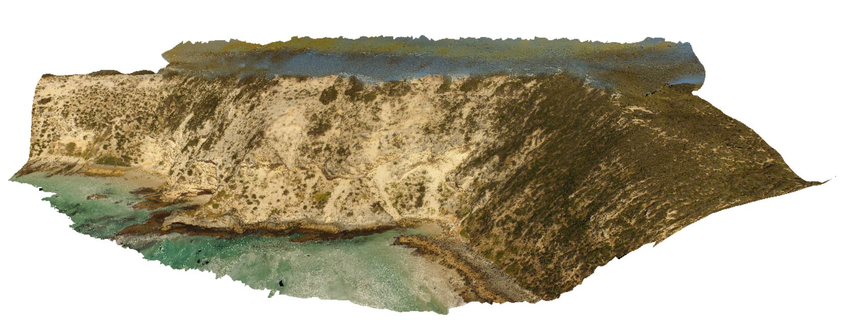
aerial view of calcarenite cliff at Pennington, Kangaroo Island.
| Capture Date: | Oct. 20, 2015, 3:34 p.m. |
| Latitude: | -35.85815100000 degrees |
| Longitude: | 137.73509800000 degrees |
| Elevation: | NA |
| Visualisation Type: | UAV |
| Location Accuracy: | 0 metres |
Keywords:
- calcarenite
- cliff
| calcarenite | |
|---|---|
| Form Type: | bedded |
| Description: | lower member of the Bridgewater Formation: Fine to medium-grained, cream to white, large-scale foreset-bedded calcarenite and calcareous aeolianite, often traversed by red-brown palaeosol horizons. Abundant solution pipes; capped by laminar clay. |
| Min Geological Age: | Late Pleistocene |
| Max Geological Age: | Pleistocene |
| Min Numerical Age: | 0.012 |
| Max Numerical Age: | 69.000 |
| Strat No: | 2543 |
| Supergroup: | |
| Group: | |
| Subgroup: | |
| Formation: | Bridgewater Formation |
| Member: | |
| Province: | Eucla Basin, Murray Basin, St Vincent Basin |