PeronUAV1
Site:
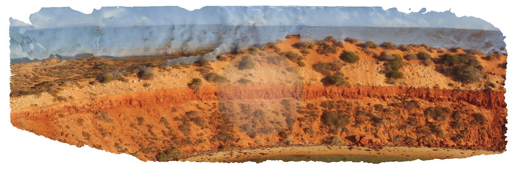
PeronUAV1
Downloads:
Map
3D Model:
Description:
flat lying, bedded sandstone cliff with overlaying aeolian sand containing rhizomes. Cape Peron, Shark Bay, W.A.
| Capture Date: | May 23, 2016, noon |
| Latitude: | -25.51383800000 degrees |
| Longitude: | 113.51588500000 degrees |
| Elevation: | NA |
| Visualisation Type: | UAV |
| Location Accuracy: | 0 metres |
Keywords:
- red sandstone
- root structures
- soil concretions
- unconformity
| sandstone | |
|---|---|
| Form Type: | bedded |
| Description: | Red aeolian quartz sandstone with common soil concretions and root structures |
| Min Geological Age: | Pleistocene |
| Max Geological Age: | Pleistocene |
| Min Numerical Age: | 0.012 |
| Max Numerical Age: | 2.580 |
| Strat No: | 15071 |
| Supergroup: | |
| Group: | |
| Subgroup: | |
| Formation: | Peron Sandstone |
| Member: | |
| Province: |
| sand | |
|---|---|
| Form Type: | bedded |
| Description: | aeolian sands. |
| Min Geological Age: | Holocene |
| Max Geological Age: | Holocene |
| Min Numerical Age: | 0.000 |
| Max Numerical Age: | 0.012 |
| Strat No: | 0 |
| Supergroup: | |
| Group: | |
| Subgroup: | |
| Formation: | |
| Member: | |
| Province: |