PicnicPtFSP3
Site:
PicnicPtFSP3
Downloads:
Map
Description:
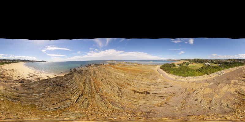
360 degree view of folding and faulting in pelite and psammite beds exposed at Picnic Point, Northern Tas.
| Capture Date: | Undated |
| Latitude: | -41.14010200000 degrees |
| Longitude: | 146.16233400000 degrees |
| Elevation: | 1.000 metres |
| Visualisation Type: | FSP |
| Location Accuracy: | 5 metres |
Keywords:
- kink band
- fault
- fold
- structure
- metasediment
| metasediment | |
|---|---|
| Form Type: | bedded |
| Description: | thinly bedded pelites and psammites. |
| Min Geological Age: | Early Cambrian |
| Max Geological Age: | Neoproterozoic |
| Min Numerical Age: | 514.000 |
| Max Numerical Age: | 1000.000 |
| Strat No: | 18803 |
| Supergroup: | |
| Group: | |
| Subgroup: | |
| Formation: | Ulverstone Metamorphics |
| Member: | |
| Province: | Lachlan Orogen |