PineCreek1
Site:
PineCreek1
Downloads:
Map
3D Model:
Description:
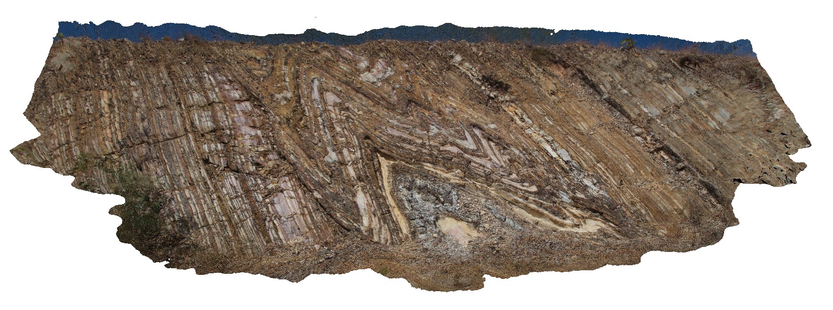
road cutting, showing tight to open folds in thinly layered, white, brown and grey mudstone of the Mount Bonnie Formation. Kakadu Highway, N.T.
| Capture Date: | June 25, 2016, noon |
| Latitude: | -13.65349000000 degrees |
| Longitude: | 132.15392000000 degrees |
| Elevation: | NA |
| Visualisation Type: | 3D |
| Location Accuracy: | 0 metres |
Keywords:
- tight fold
- fold hinge
- fold
- structure
- sheared limb
| mudstone | |
|---|---|
| Form Type: | bedded |
| Description: | Interbedded carbonaceous sericitic and commonly pyritic or chloritic slate, phyllite, mudstone and siltstone; fine to coarse feldspathic metagreywacke; ferruginous phyllite (metasiltstone) with chert bands, lenses and nodules |
| Min Geological Age: | Orosirian |
| Max Geological Age: | Orosirian |
| Min Numerical Age: | 1861.000 |
| Max Numerical Age: | 1863.000 |
| Strat No: | 27066 |
| Supergroup: | Cosmo Supergroup |
| Group: | |
| Subgroup: | |
| Formation: | Mount Bonnie Formation |
| Member: | |
| Province: |