Pingandy2
Site:
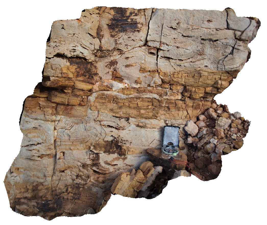
Pingandy2
Downloads:
Map
3D Model:
Description:
detail of clastic dyke from exposed carbonate unite at site Pingandy1. Ashburton Downs - Meekatharra Road, W.A.
| Capture Date: | May 27, 2016, noon |
| Latitude: | -24.00582000000 degrees |
| Longitude: | 117.91148000000 degrees |
| Elevation: | NA |
| Visualisation Type: | 3D |
| Location Accuracy: | 0 metres |
Keywords:
- clastic dyke
- sedimentology
| limestone | |
|---|---|
| Form Type: | bedded |
| Description: | Mostly fine-grained siliciclastic and carbonate sedimentary rocks: siltstone, sandstone, conglomerate, dolostone, stromatolitic dolostone, carbonaceous siltstone, chert; thick dolerite and gabbro sills. |
| Min Geological Age: | Calymmian |
| Max Geological Age: | Statherian |
| Min Numerical Age: | 1462.000 |
| Max Numerical Age: | 1620.000 |
| Strat No: | 34906 |
| Supergroup: | |
| Group: | Edmund Group |
| Subgroup: | |
| Formation: | |
| Member: | |
| Province: | Edmund Basin |