PtEllenUAV1
Site:
PtEllenUAV1
Downloads:
Map
3D Model:
Description:
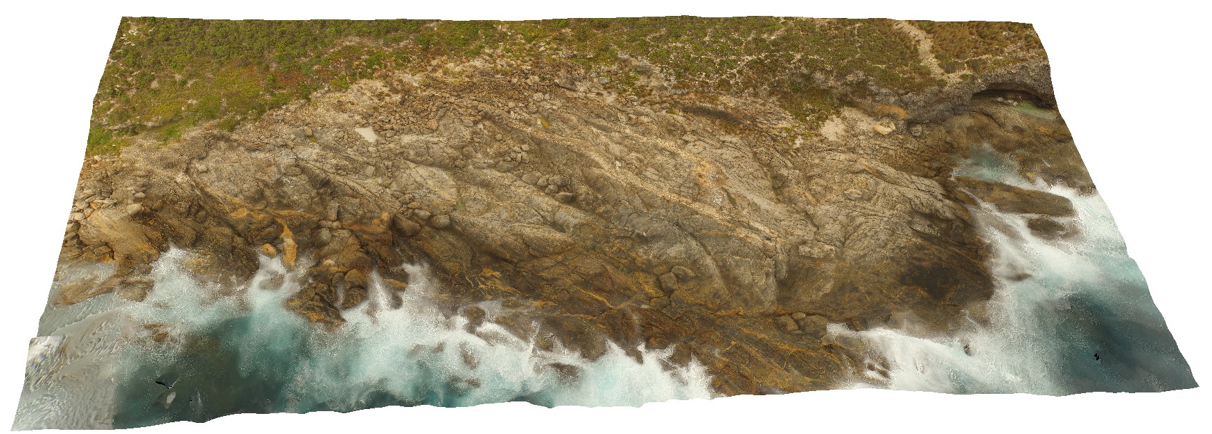
aerial view of deformed Kanmantoo metasediments, with cross cutting dykes. Point Ellen, Kangaroo Island.
| Capture Date: | Oct. 20, 2015, 3:47 p.m. |
| Latitude: | -35.99885900000 degrees |
| Longitude: | 137.18634400000 degrees |
| Elevation: | NA |
| Visualisation Type: | UAV |
| Location Accuracy: | 0 metres |
Keywords:
- metasediments
- dyke
| sediments | |
|---|---|
| Form Type: | bedded |
| Description: | Marine metasandstone, phyllite, schist, gneiss, minor calc-silicate and marble. Sandstone; siltstone, occasionally sulphidic; metamorphosed. |
| Min Geological Age: | Early Cambrian |
| Max Geological Age: | Early Cambrian |
| Min Numerical Age: | 514.000 |
| Max Numerical Age: | 522.000 |
| Strat No: | 28634 |
| Supergroup: | Moralana Supergroup |
| Group: | Kanmantoo Group |
| Subgroup: | |
| Formation: | |
| Member: | |
| Province: | Delamerian Orogen, Stansbury Basin |