PtEllenUAV2
Site:
PtEllenUAV2
Downloads:
Map
3D Model:
Description:
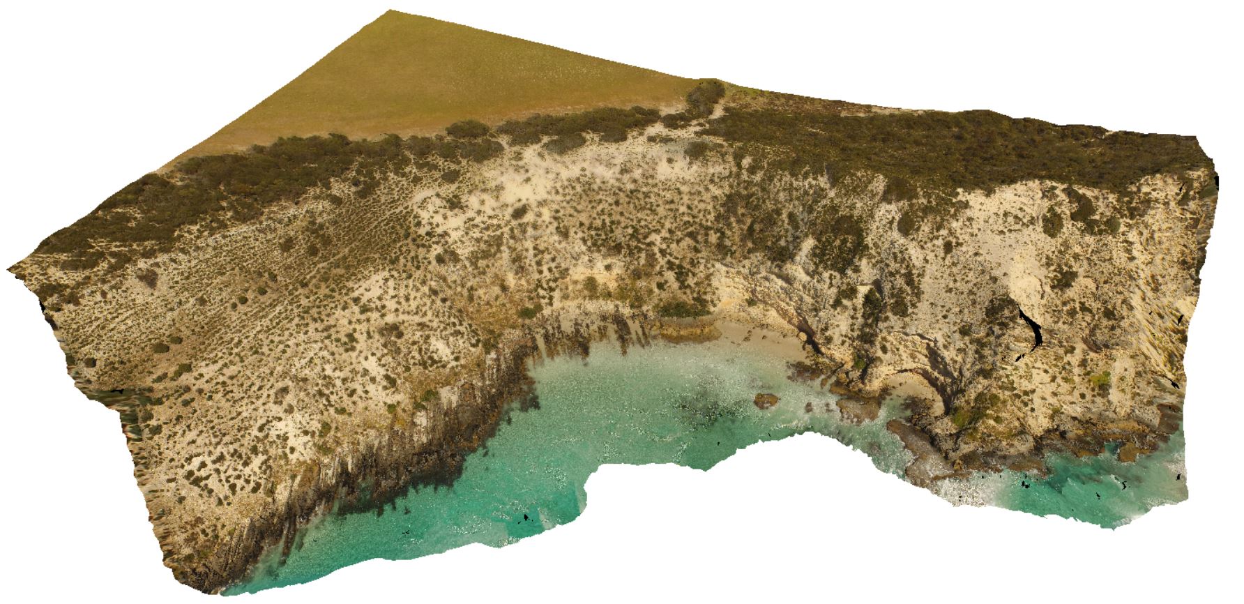
aerial view of the angular unconformity between the underlying Kanmantoo metasediments and the overlying Pleistocene sands. Point Ellen, Kangaroo Island.
| Capture Date: | Oct. 20, 2015, 3:47 p.m. |
| Latitude: | -35.86015600000 degrees |
| Longitude: | 137.73456900000 degrees |
| Elevation: | NA |
| Visualisation Type: | UAV |
| Location Accuracy: | 0 metres |
Keywords:
- angular unconformity
- metasediments
- sandstone
| sediments | |
|---|---|
| Form Type: | bedded |
| Description: | Marine metasandstone, phyllite, schist, gneiss, minor calc-silicate and marble. Sandstone; siltstone, occasionally sulphidic; metamorphosed. |
| Min Geological Age: | Early Cambrian |
| Max Geological Age: | Early Cambrian |
| Min Numerical Age: | 514.000 |
| Max Numerical Age: | 522.000 |
| Strat No: | 28634 |
| Supergroup: | Moralana Supergroup |
| Group: | Kanmantoo Group |
| Subgroup: | |
| Formation: | |
| Member: | |
| Province: | Delamerian Orogen, Stansbury Basin |
| sandstone | |
|---|---|
| Form Type: | bedded |
| Description: | Poorly consolidated yellow pinkish-brown fine to coarse fossiliferous calcareous sand, calcarenite. Locally capped by calcrete. As coastal beach and associated aeolian dune. Forms stranded series of elongated beach ridges, subparallel to present coast |
| Min Geological Age: | Late Pleistocene |
| Max Geological Age: | Pleistocene |
| Min Numerical Age: | 0.012 |
| Max Numerical Age: | 0.690 |
| Strat No: | 2543 |
| Supergroup: | |
| Group: | |
| Subgroup: | |
| Formation: | Bridgewater Formation |
| Member: | |
| Province: | Eucla Basin, Murray Basin, St Vincent Basin |