PtNeill5
Site:
PtNeill5
Downloads:
Map
3D Model:
Description:
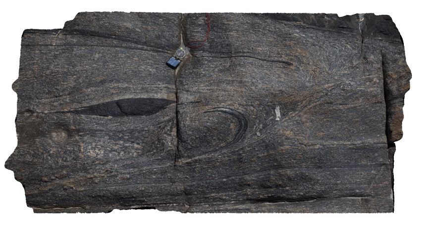
Image showing detail of texture in mylonite, from image PtNeill1. Pioneer Lookout, Point Neill.
| Capture Date: | Oct. 20, 2015, 3:16 p.m. |
| Latitude: | -34.10680000000 degrees |
| Longitude: | 136.35030000000 degrees |
| Elevation: | NA |
| Visualisation Type: | 3D |
| Location Accuracy: | 0 metres |
Keywords:
- mylonite
- boudinage
- tectonic
| mylonite | |
|---|---|
| Form Type: | |
| Description: | mylonite of granite and mafic intrusives, including sheath folds and boudinaged blocks. |
| Min Geological Age: | Paleoproterozoic |
| Max Geological Age: | Paleoproterozoic |
| Min Numerical Age: | 1700.000 |
| Max Numerical Age: | 1730.000 |
| Strat No: | 9128 |
| Supergroup: | |
| Group: | |
| Subgroup: | |
| Formation: | Kalinjala Mylonite |
| Member: | |
| Province: |