Purnululu1
Site:
Purnululu1
Downloads:
Map
3D Model:
Description:
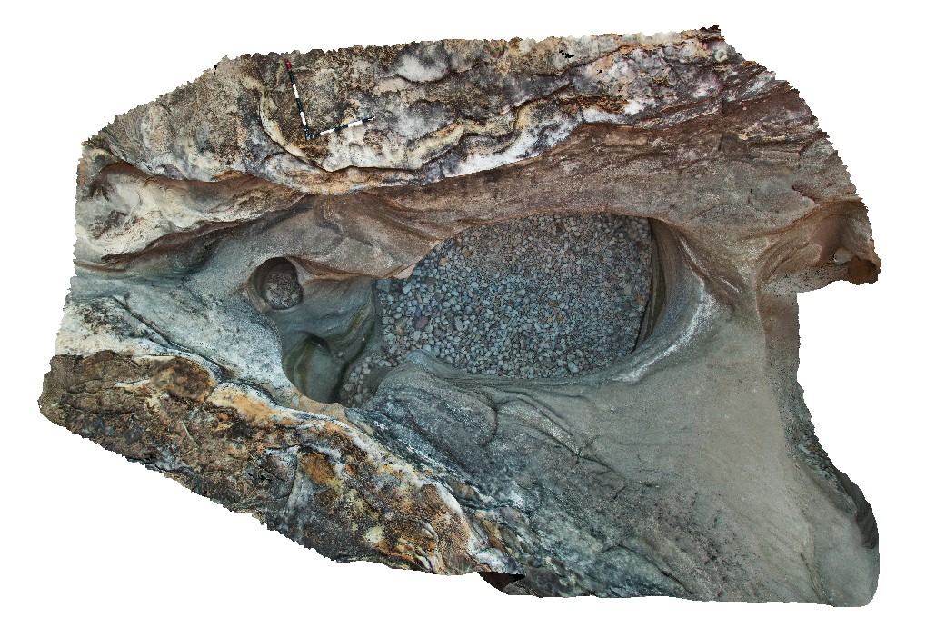
pot holes in cross-bedded dolomitic sandstone with pebbly layers. End of Cathedral Gorge Track. Purnululu National Park, W.A.
| Capture Date: | June 12, 2016, noon |
| Latitude: | -17.48218000000 degrees |
| Longitude: | 128.37589000000 degrees |
| Elevation: | NA |
| Visualisation Type: | 3D |
| Location Accuracy: | 0 metres |
Keywords:
- cross-beds
- dolomitic sandstone
- pot hole
| sandstone | |
|---|---|
| Form Type: | bedded |
| Description: | Medium- to fine-grained quartz arenite; minor pebbly sandstone, conglomerate and siltstone. |
| Min Geological Age: | Frasnian |
| Max Geological Age: | Frasnian |
| Min Numerical Age: | 372.200 |
| Max Numerical Age: | 382.700 |
| Strat No: | 23618 |
| Supergroup: | |
| Group: | Mahony Group |
| Subgroup: | |
| Formation: | Glass Hill Sandstone |
| Member: | |
| Province: |