PurnululuUAV4
Site:
PurnululuUAV4
Downloads:
Map
3D Model:
Description:
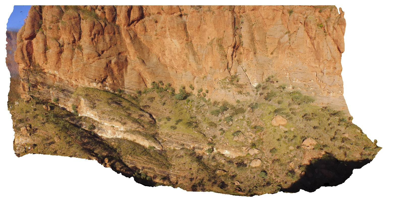
aerial view of the start of the Echidna Chasm trail, showing cliff of Glass Hill Sandstone. Purnululu National Park, W.A.
| Capture Date: | June 12, 2016, noon |
| Latitude: | -17.32394600000 degrees |
| Longitude: | 128.41405700000 degrees |
| Elevation: | NA |
| Visualisation Type: | UAV |
| Location Accuracy: | 0 metres |
Keywords:
- Glass Hill Sandstone
- sandstone
- Bungle Bungles
| sandstone | |
|---|---|
| Form Type: | bedded |
| Description: | Medium- to fine-grained quartz arenite; minor pebbly sandstone, conglomerate and siltstone. |
| Min Geological Age: | Frasnian |
| Max Geological Age: | Frasnian |
| Min Numerical Age: | 372.200 |
| Max Numerical Age: | 382.700 |
| Strat No: | 23618 |
| Supergroup: | |
| Group: | Mahony Group |
| Subgroup: | |
| Formation: | Glass Hill Sandstone |
| Member: | |
| Province: |