Riley10
Site:
Riley10
Downloads:
Map
3D Model:
Description:
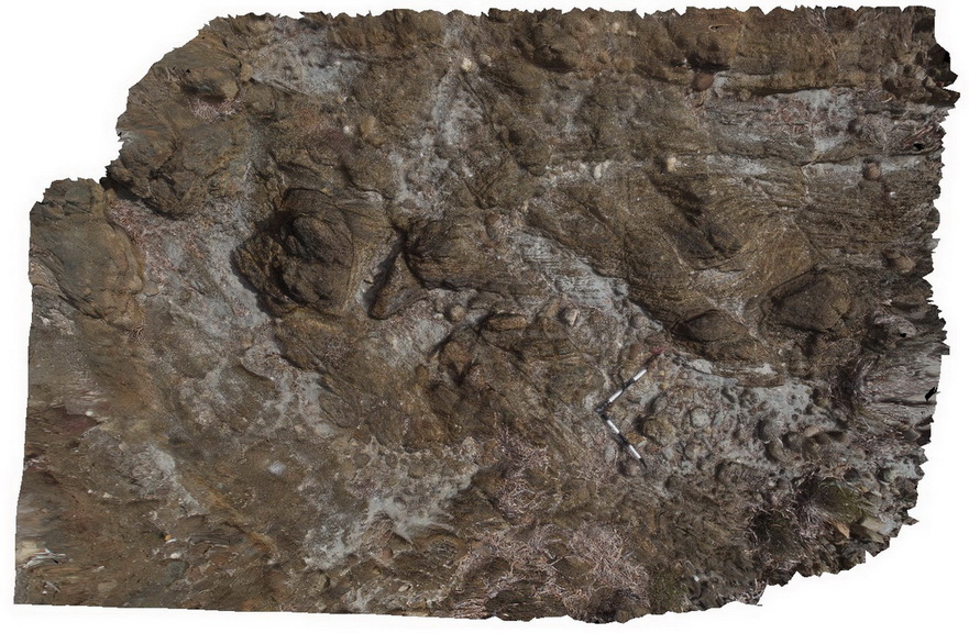
view of folded metasediments in exposed shore platform at Point Riley.
| Capture Date: | Oct. 20, 2015, 4:17 p.m. |
| Latitude: | -33.90408000000 degrees |
| Longitude: | 137.62932000000 degrees |
| Elevation: | NA |
| Visualisation Type: | 3D |
| Location Accuracy: | 0 metres |
Keywords:
- fold
- metasediment
- structure
| sediment | |
|---|---|
| Form Type: | bedded |
| Description: | Biotite schist-dominated unit. Layered, foliated biotite-rich schist of psammitic, argillaceous, calc-silicate, iron rich, graphitic and minor albitic meta-sediments. |
| Min Geological Age: | Paleoproterozoic |
| Max Geological Age: | Paleoproterozoic |
| Min Numerical Age: | 1600.000 |
| Max Numerical Age: | 1741.000 |
| Strat No: | 39166 |
| Supergroup: | |
| Group: | Wallaroo Group |
| Subgroup: | |
| Formation: | |
| Member: | Doora Member |
| Province: | Olympic Domain |