SBay1
Site:
SBay1
Downloads:
Map
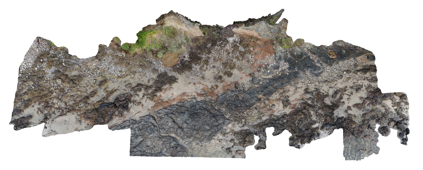
3D Model:
Description:
Pole photography of the Charles Darwin Cliff at Sandy Bay. Tertiary basaltic lava flows and pyroclastic material deposited from a small volcanic vent approximately 200m to the west
| Capture Date: | March 13, 2015, 9:17 a.m. |
| Latitude: | -42.91649600000 degrees |
| Longitude: | 147.36026000000 degrees |
| Elevation: | NA |
| Visualisation Type: | 3D |
| Location Accuracy: | 20 metres |
Keywords:
- basalt
- tuff
- agglomerate
- volcanology
- igneous
| basalt | |
|---|---|
| Form Type: | flow |
| Description: | flows of massive to vesicular basalt up to 2m thick |
| Min Geological Age: | Miocene |
| Max Geological Age: | Miocene |
| Min Numerical Age: | 5.000 |
| Max Numerical Age: | 23.000 |
| Strat No: | 0 |
| Supergroup: | |
| Group: | |
| Subgroup: | |
| Formation: | |
| Member: | |
| Province: |
| tuff | |
|---|---|
| Form Type: | layer |
| Description: | tuff and agglomerate |
| Min Geological Age: | Miocene |
| Max Geological Age: | Miocene |
| Min Numerical Age: | 5.000 |
| Max Numerical Age: | 23.000 |
| Strat No: | 0 |
| Supergroup: | |
| Group: | |
| Subgroup: | |
| Formation: | |
| Member: | |
| Province: |