Scamander10
Site:
Scamander10
Downloads:
Map
3D Model:
Description:
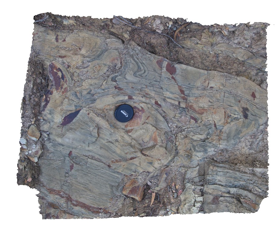
turbidite beds, with soft sediment folding. Upper Scamander Rd, near Scamander River. Eastern Tasmania.
| Capture Date: | March 13, 2015, 9:01 a.m. |
| Latitude: | -41.45949135000 degrees |
| Longitude: | 148.23076806000 degrees |
| Elevation: | NA |
| Visualisation Type: | 3D |
| Location Accuracy: | 5 metres |
Keywords:
- soft sediment deformation
- turbidite
- sedimentology
| turbidite | |
|---|---|
| Form Type: | bedded |
| Description: | thinly layered bands in sandstone with soft sediment folding. |
| Min Geological Age: | Early Devonian |
| Max Geological Age: | Early Devonian |
| Min Numerical Age: | 393.300 |
| Max Numerical Age: | 419.200 |
| Strat No: | 16654 |
| Supergroup: | Mathinna Supergroup |
| Group: | |
| Subgroup: | |
| Formation: | Scamander Formation |
| Member: | |
| Province: |