Scamander7
Site:
Scamander7
Downloads:
Map
3D Model:
Description:
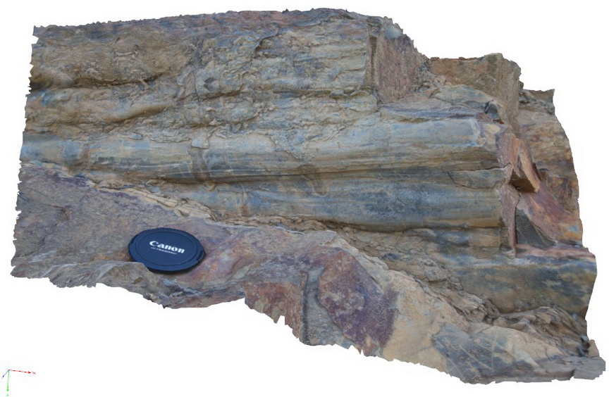
load casts on lower sandstone contact with finer silty mudstone layer below. Upper Scamander Rd, near Scamander River. Eastern Tasmania.
| Capture Date: | March 13, 2015, 9 a.m. |
| Latitude: | -41.45837554000 degrees |
| Longitude: | 148.23018277000 degrees |
| Elevation: | NA |
| Visualisation Type: | 3D |
| Location Accuracy: | 5 metres |
Keywords:
- load casts
- sedimentology
- turbidite
| turbidite | |
|---|---|
| Form Type: | bedded |
| Description: | turbidite package, with load casts on lowermost contact of a bouma sequence |
| Min Geological Age: | Early Devonian |
| Max Geological Age: | Early Devonian |
| Min Numerical Age: | 393.300 |
| Max Numerical Age: | 419.200 |
| Strat No: | 16654 |
| Supergroup: | Mathinna Supergroup |
| Group: | |
| Subgroup: | |
| Formation: | Scamander Formation |
| Member: | |
| Province: |