Splitpoint14
Site:
Splitpoint14
Downloads:
Map
3D Model:
Description:
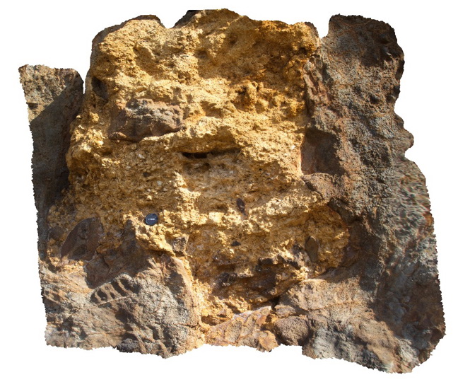
detailed view of bioclastic limestone of the Torquay Group infilling fissures in the underlying basalt of the Oligocene Angahook Formation. Split Point, Vic.
| Capture Date: | June 17, 2015, 10:48 a.m. |
| Latitude: | -38.46855000000 degrees |
| Longitude: | 144.10698000000 degrees |
| Elevation: | 2.000 metres |
| Visualisation Type: | 3D |
| Location Accuracy: | 5 metres |
Keywords:
- volcanology
- fissure infill
| limestone | |
|---|---|
| Form Type: | |
| Description: | sandy bioclastic limestone |
| Min Geological Age: | Miocene |
| Max Geological Age: | Oligocene |
| Min Numerical Age: | 5.300 |
| Max Numerical Age: | 28.000 |
| Strat No: | 18441 |
| Supergroup: | |
| Group: | Torquay Group |
| Subgroup: | |
| Formation: | |
| Member: | |
| Province: | Torquay Sub Basin |
| basalt | |
|---|---|
| Form Type: | |
| Description: | basalt |
| Min Geological Age: | Oligocene |
| Max Geological Age: | Oligocene |
| Min Numerical Age: | 28.500 |
| Max Numerical Age: | 28.900 |
| Strat No: | 432 |
| Supergroup: | |
| Group: | Demons Bluff Group |
| Subgroup: | |
| Formation: | Angahook Formation |
| Member: | |
| Province: |