SplitpointFSP2
Site:
SplitpointFSP2
Downloads:
Map
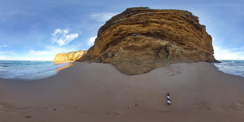
Description:
Flat lying, thinly bedded, sandy limestone of the Oligocene-Miocene Torquay Group disconformably overlying poorly sorted pyroclastic rocks of the Oligocene Angahook Formation. Split Point, Vic.
| Capture Date: | June 17, 2015, 11:08 a.m. |
| Latitude: | -38.46316000000 degrees |
| Longitude: | 144.10841000000 degrees |
| Elevation: | 1.000 metres |
| Visualisation Type: | FSP |
| Location Accuracy: | 5 metres |
Keywords:
- disconformity
- pyroclastic
- sedimentology
- volcanology
| limestone | |
|---|---|
| Form Type: | bedded |
| Description: | thinly bedded sandy limestone |
| Min Geological Age: | Miocene |
| Max Geological Age: | Oligocene |
| Min Numerical Age: | 5.300 |
| Max Numerical Age: | 2.800 |
| Strat No: | 18441 |
| Supergroup: | |
| Group: | Torquay Group |
| Subgroup: | |
| Formation: | |
| Member: | |
| Province: | Torquay Sub Basin |
| tuff | |
|---|---|
| Form Type: | |
| Description: | poorly sorted pyroclastic deposits including large basalt 'bombs'? to 1m |
| Min Geological Age: | Oligocene |
| Max Geological Age: | Oligocene |
| Min Numerical Age: | 28.500 |
| Max Numerical Age: | 28.900 |
| Strat No: | 432 |
| Supergroup: | |
| Group: | Demons Bluff Group |
| Subgroup: | |
| Formation: | Angahook Formation |
| Member: | |
| Province: |