StyxRd1
Site:
StyxRd1
Downloads:
Map
3D Model:
Description:
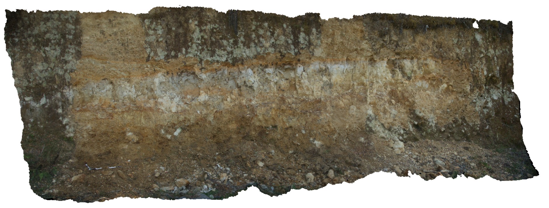
regolith profile, showing fine colluvial scree overlying silty-clay (aeolian), overlying coarser colluvial sediments. Styx road, Tasmania.
| Capture Date: | Feb. 23, 2016, 9:29 a.m. |
| Latitude: | -42.80639000000 degrees |
| Longitude: | 146.59326000000 degrees |
| Elevation: | NA |
| Visualisation Type: | 3D |
| Location Accuracy: | 0 metres |
Keywords:
- colluvium
- scree
| scree | |
|---|---|
| Form Type: | |
| Description: | unconsolidated recent colluvial sediments. |
| Min Geological Age: | Quaternary |
| Max Geological Age: | Quaternary |
| Min Numerical Age: | 0.000 |
| Max Numerical Age: | 2.580 |
| Strat No: | 0 |
| Supergroup: | |
| Group: | |
| Subgroup: | |
| Formation: | |
| Member: | |
| Province: |