SulphurCreek5
Site:
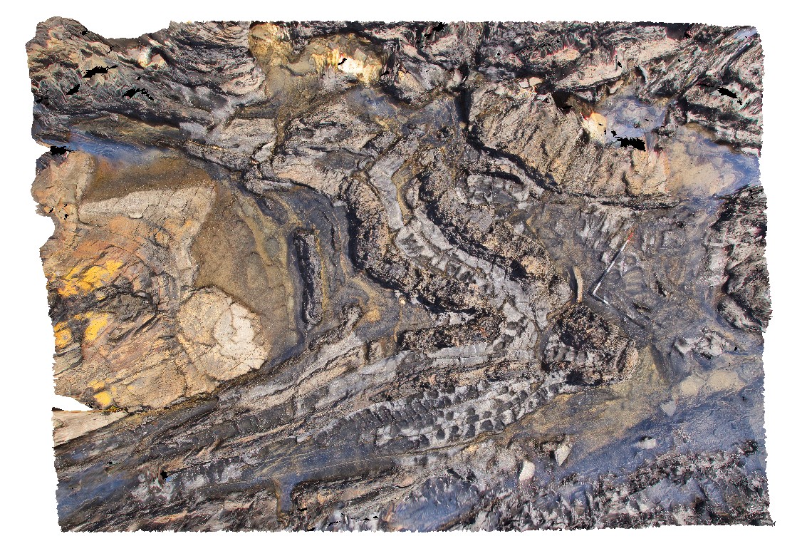
SulphurCreek5
Downloads:
Map
3D Model:
Description:
steeply plunging fold hinge in mudstone with axial planar cleavage. Sulphur Creek, north Tas.
| Capture Date: | Undated |
| Latitude: | -41.09159000000 degrees |
| Longitude: | 146.02060000000 degrees |
| Elevation: | 1.000 metres |
| Visualisation Type: | 3D |
| Location Accuracy: | 5 metres |
Keywords:
- fold hinge
- fold plunge
- axial planar cleavage
- cleavage
- structure
- fold
| mudstone | |
|---|---|
| Form Type: | bedded |
| Description: | fine-grained mudstone with thin laminations |
| Min Geological Age: | Cryogenian |
| Max Geological Age: | Tonian |
| Min Numerical Age: | 750.000 |
| Max Numerical Age: | 1000.000 |
| Strat No: | 27555 |
| Supergroup: | |
| Group: | Rocky Cape Group |
| Subgroup: | |
| Formation: | |
| Member: | |
| Province: |