SulphurCreekUAV1
Site:
SulphurCreekUAV1
Downloads:
Map
3D Model:
Description:
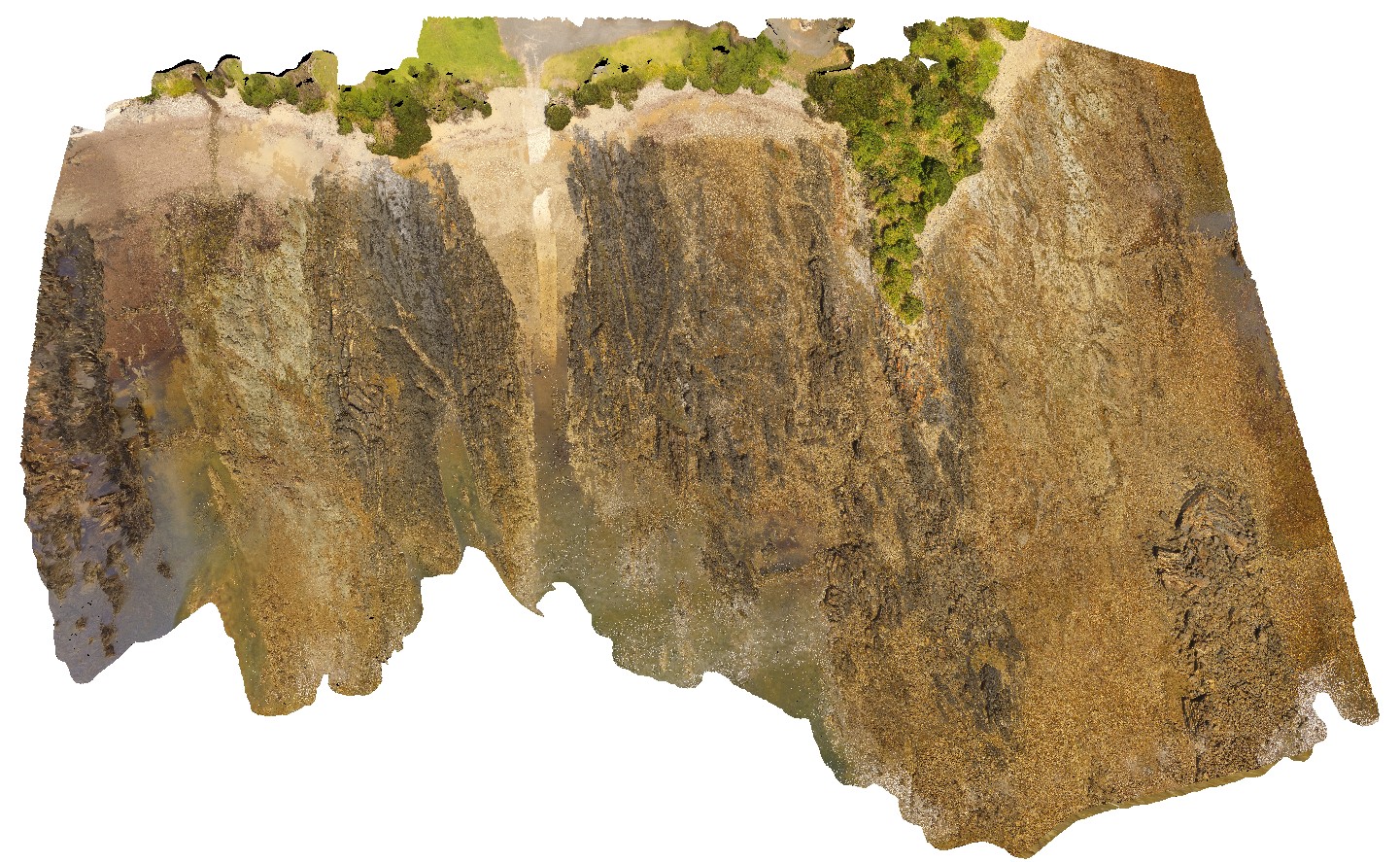
aerial view of shore outcrop, showing region of folded metasediments in contact with altered basalts. Sulphur Creek, north Tas.
| Capture Date: | Undated |
| Latitude: | -41.09104300000 degrees |
| Longitude: | 146.02016600000 degrees |
| Elevation: | 108.600 metres |
| Visualisation Type: | UAV |
| Location Accuracy: | 20 metres |
Keywords:
- metasediments
- basalt
- fold
- fault
| metasediments | |
|---|---|
| Form Type: | bedded |
| Description: | interbedded mudstone and sandstone package |
| Min Geological Age: | Cryogenian |
| Max Geological Age: | Tonian |
| Min Numerical Age: | 750.000 |
| Max Numerical Age: | 1000.000 |
| Strat No: | 27555 |
| Supergroup: | |
| Group: | Rocky Cape Group |
| Subgroup: | |
| Formation: | |
| Member: | |
| Province: |
| basalt | |
|---|---|
| Form Type: | flow |
| Description: | blocky, weathered basalt. |
| Min Geological Age: | Cenozoic |
| Max Geological Age: | Cenozoic |
| Min Numerical Age: | 0.012 |
| Max Numerical Age: | 66.000 |
| Strat No: | 38495 |
| Supergroup: | |
| Group: | |
| Subgroup: | |
| Formation: | mafic volcanic rocks 38495 |
| Member: | |
| Province: |