TaliaUAV2
Site:
TaliaUAV2
Downloads:
Map
3D Model:
Description:
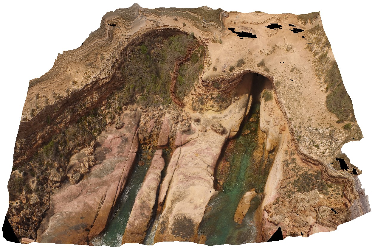
aerial view, showing access and shore entrance to the Woolshed Cave at Talia. Images shows geological unconformity between the Blue Range Beds and the overlying Bridgewater Formation. Talia.
| Capture Date: | Oct. 20, 2015, 4:52 p.m. |
| Latitude: | -33.32420000000 degrees |
| Longitude: | 134.78483000000 degrees |
| Elevation: | NA |
| Visualisation Type: | UAV |
| Location Accuracy: | 0 metres |
Keywords:
- unconformity
- cave
| sandstone | |
|---|---|
| Form Type: | bedded |
| Description: | Sandstone, minor grit and pebble beds, white, massive to cross bedded, rare haematite veins |
| Min Geological Age: | Mesoproterozoic |
| Max Geological Age: | Paleoproterozoic |
| Min Numerical Age: | 1000.000 |
| Max Numerical Age: | 2500.000 |
| Strat No: | 24737 |
| Supergroup: | |
| Group: | |
| Subgroup: | |
| Formation: | Blue Range beds |
| Member: | |
| Province: |
| sandstone | |
|---|---|
| Form Type: | bedded |
| Description: | Poorly consolidated yellow pinkish-brown fine to coarse fossiliferous calcareous sand, calcarenite. Locally capped by calcrete. As coastal beach and associated aeolian dune. Forms stranded series of elongated beach ridges, subparallel to present coast |
| Min Geological Age: | Late Pleistocene |
| Max Geological Age: | Pleistocene |
| Min Numerical Age: | 0.012 |
| Max Numerical Age: | 0.690 |
| Strat No: | 2543 |
| Supergroup: | |
| Group: | |
| Subgroup: | |
| Formation: | Bridgewater Formation |
| Member: | |
| Province: | Eucla Basin, Murray Basin, St Vincent Basin |