Thomson2
Site:
Thomson2
Downloads:
Map
3D Model:
Description:
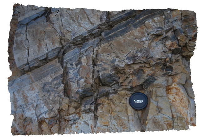
Detail of mudstone rip up clasts in sandstone matrix - same exposure as Thomson1. Thomson Dam, Walhalla, Vic.
| Capture Date: | May 18, 2015, 2:17 p.m. |
| Latitude: | -37.84397000000 degrees |
| Longitude: | 146.39761000000 degrees |
| Elevation: | NA |
| Visualisation Type: | 3D |
| Location Accuracy: | 5 metres |
Keywords:
- sandstone
- siltstone
- turbidite
- rip-up clasts
- sedimentology
| sandstone | |
|---|---|
| Form Type: | bedded |
| Description: | medium sandstone bed containing mudstone rip-up clasts |
| Min Geological Age: | Devonian |
| Max Geological Age: | Devonian |
| Min Numerical Age: | 394.000 |
| Max Numerical Age: | 407.000 |
| Strat No: | 14304 |
| Supergroup: | Murrindindi Supergroup |
| Group: | Walhalla Group |
| Subgroup: | |
| Formation: | Norton Gully Sandstone |
| Member: | |
| Province: | Lachlan Orogen |