Thomson7
Site:
Thomson7
Downloads:
Map
3D Model:
Description:
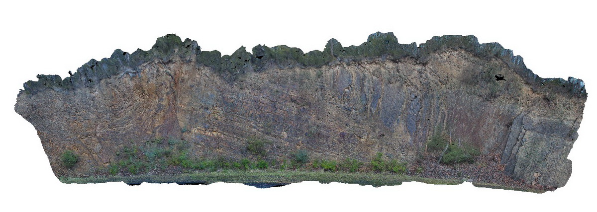
Folds and associated faults cutting turbiditic metasediments of the Devonian Norton Gully Sandstone. Thomson Dam, Walhalla, Vic.
| Capture Date: | May 18, 2015, 2:20 p.m. |
| Latitude: | -37.85506000000 degrees |
| Longitude: | 146.39720000000 degrees |
| Elevation: | 530.000 metres |
| Visualisation Type: | 3D |
| Location Accuracy: | 5 metres |
Keywords:
- turbidite
- fault
- fold
- structure
| turbidite | |
|---|---|
| Form Type: | bedded |
| Description: | medium to thinly bedded fine sandy turbidite layers |
| Min Geological Age: | Devonian |
| Max Geological Age: | Devonian |
| Min Numerical Age: | 394.000 |
| Max Numerical Age: | 407.000 |
| Strat No: | 14304 |
| Supergroup: | Murrindindi Supergroup |
| Group: | Walhalla Group |
| Subgroup: | |
| Formation: | Norton Gully Sandstone |
| Member: | |
| Province: | Lachlan Orogen |