TomPrice2
Site:
TomPrice2
Downloads:
Map
3D Model:
Description:
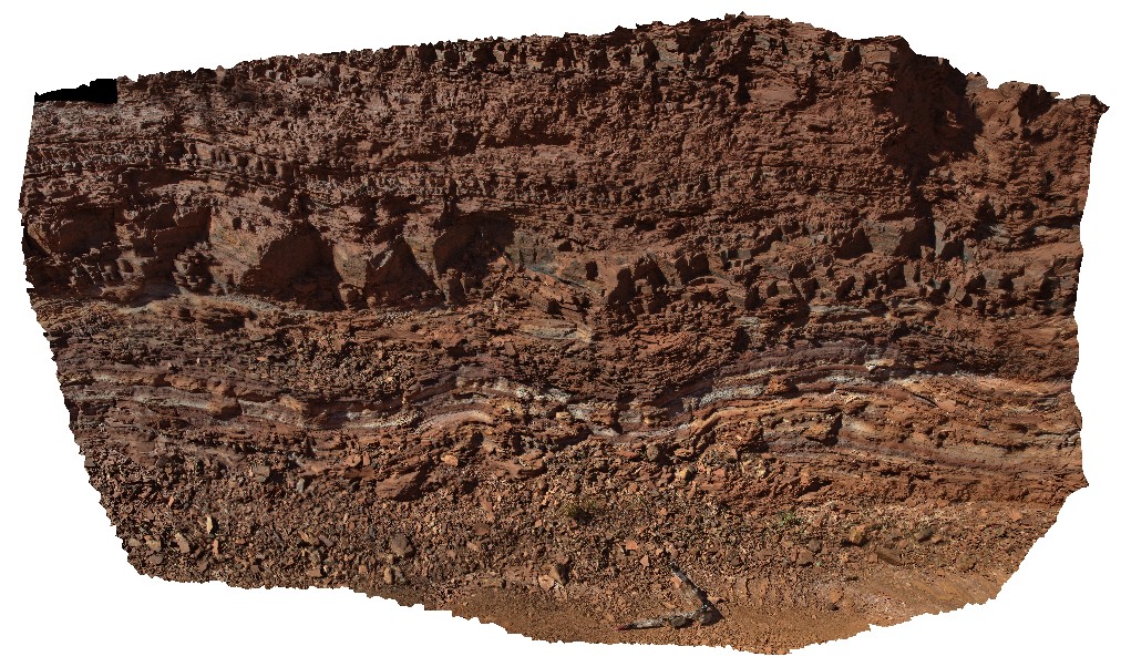
view of open folds in interbedded Shale and banded Iron on the western side of Mount Nameless, Tom Price. W.A.
| Capture Date: | May 29, 2016, noon |
| Latitude: | -22.72650000000 degrees |
| Longitude: | 117.74983000000 degrees |
| Elevation: | NA |
| Visualisation Type: | 3D |
| Location Accuracy: | 0 metres |
Keywords:
- shale
- open folds
- structure
- folding
- Hamersley Group
| shale | |
|---|---|
| Form Type: | bedded |
| Description: | Mudstone, siltstone, chert, iron-formation, and dolomite. Thin bands of shard-bearing volcanic ash in upper parts. |
| Min Geological Age: | Paleoproterozoic |
| Max Geological Age: | Neoarchean |
| Min Numerical Age: | 2494.000 |
| Max Numerical Age: | 2505.000 |
| Strat No: | 12926 |
| Supergroup: | Mount Bruce Supergroup |
| Group: | |
| Subgroup: | |
| Formation: | Mount McRae Shale |
| Member: | |
| Province: | Hamersley Basin |