Ulverstone8
Site:
Ulverstone8
Downloads:
Map
3D Model:
Description:
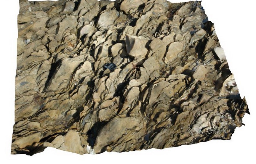
moderately dipping, stretched cobble conglomerate. Picnic Point, Ulverstone, northern Tasmania.
| Capture Date: | March 16, 2015, 2:40 p.m. |
| Latitude: | -41.14084150000 degrees |
| Longitude: | 146.16139565000 degrees |
| Elevation: | 1.000 metres |
| Visualisation Type: | 3D |
| Location Accuracy: | 5 metres |
Keywords:
- stretching
- metamorphics
- structure
| conglomerate | |
|---|---|
| Form Type: | bedded |
| Description: | stretched and flattened quartz cobbles in conglomerate. |
| Min Geological Age: | Early Cambrian |
| Max Geological Age: | Neoproterozoic |
| Min Numerical Age: | 514.000 |
| Max Numerical Age: | 1000.000 |
| Strat No: | 18803 |
| Supergroup: | |
| Group: | |
| Subgroup: | |
| Formation: | Ulverstone Metamorphics |
| Member: | |
| Province: | Lachlan Orogen |