WTasFSP1
Site:
WTasFSP1
Downloads:
Map
Description:
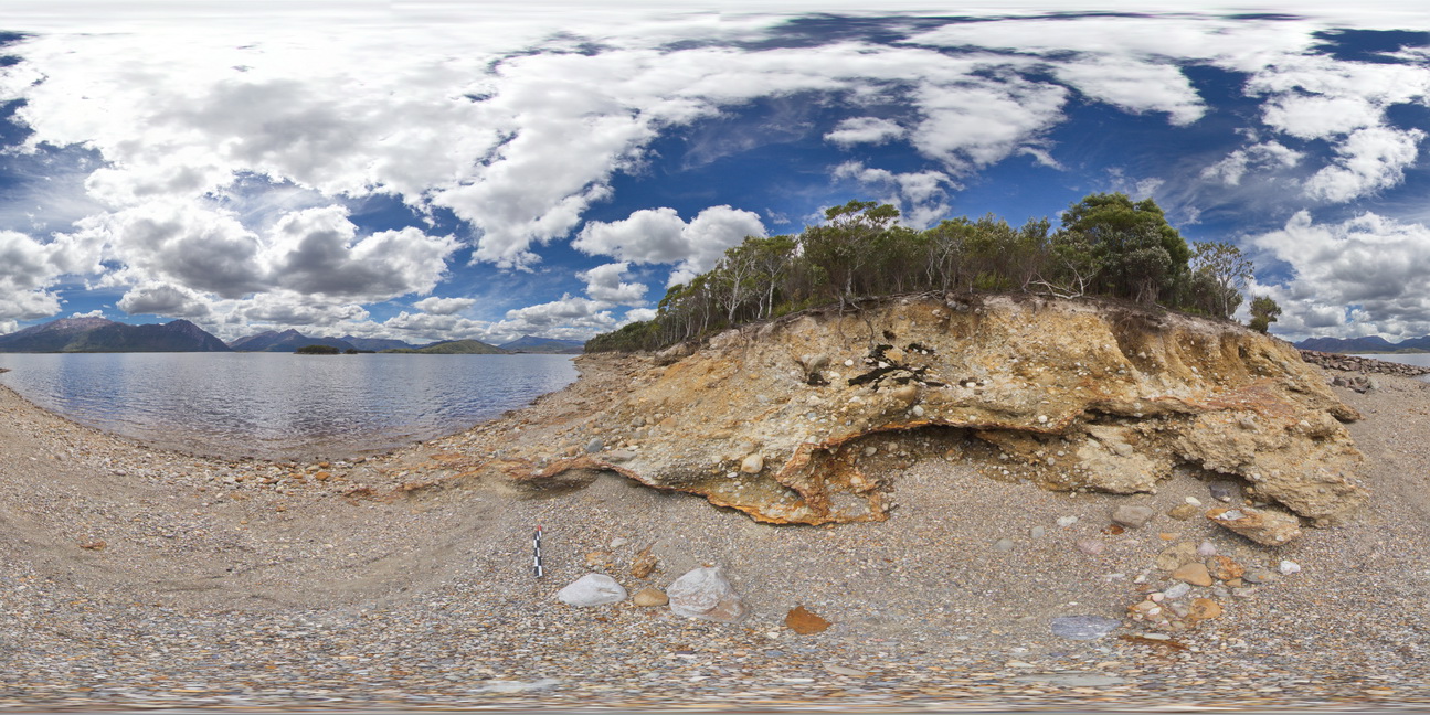
view of shore of Lake Burbury, showing the vista and (Pleistocene) tillite. Lake Burbury, West Tasmania.
| Capture Date: | Undated |
| Latitude: | -42.09616000000 degrees |
| Longitude: | 145.67336000000 degrees |
| Elevation: | NA |
| Visualisation Type: | FSP |
| Location Accuracy: | 5 metres |
Keywords:
- tillite
- Pleistocene sediments
| tillite | |
|---|---|
| Form Type: | bedded |
| Description: | glacial tillite, with cobbles of quartzite in clay and gritty matrix. |
| Min Geological Age: | Pleistocene |
| Max Geological Age: | Pleistocene |
| Min Numerical Age: | 0.012 |
| Max Numerical Age: | 2.580 |
| Strat No: | 0 |
| Supergroup: | |
| Group: | |
| Subgroup: | |
| Formation: | |
| Member: | |
| Province: |