WTasFSP20
Site:
WTasFSP20
Downloads:
Map
Description:
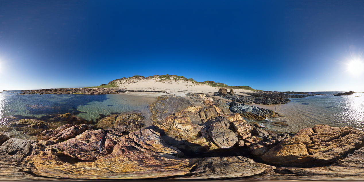
outcropping folded sediments of the Oonah Formation with cross cutting felsic dyke. Granville Harbour, West Tasmania.
| Capture Date: | Undated |
| Latitude: | -41.77933000000 degrees |
| Longitude: | 145.00633000000 degrees |
| Elevation: | NA |
| Visualisation Type: | FSP |
| Location Accuracy: | 5 metres |
Keywords:
- fold
- structure
- dyke
| metasediments | |
|---|---|
| Form Type: | bedded |
| Description: | finely bedded sandstones and siltstones |
| Min Geological Age: | Cryogenian |
| Max Geological Age: | Cryogenian |
| Min Numerical Age: | 690.000 |
| Max Numerical Age: | 708.000 |
| Strat No: | 14603 |
| Supergroup: | |
| Group: | Arthur Metamorphic Complex |
| Subgroup: | |
| Formation: | Oonah Formation |
| Member: | |
| Province: |