WTasFSP26
Site:
WTasFSP26
Downloads:
Map
Description:
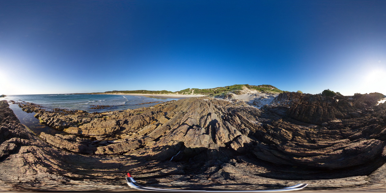
steeply dipping sandstone and siltstone beds exposed along the beach at Granville Harbour, West Tasmania.
| Capture Date: | Undated |
| Latitude: | -41.77359000000 degrees |
| Longitude: | 145.00658000000 degrees |
| Elevation: | NA |
| Visualisation Type: | FSP |
| Location Accuracy: | 5 metres |
Keywords:
- dip
- bedding
- sedimentology
- structure
| sandstone | |
|---|---|
| Form Type: | bedded |
| Description: | moderately dipping, pale grey to white, fine-grained quartz sandstone |
| Min Geological Age: | Early Devonian |
| Max Geological Age: | Late Silurian |
| Min Numerical Age: | 393.300 |
| Max Numerical Age: | 427.400 |
| Strat No: | 27768 |
| Supergroup: | Wurawina Supergroup |
| Group: | Eldon Group |
| Subgroup: | |
| Formation: | |
| Member: | |
| Province: | Lachlan Orogen |