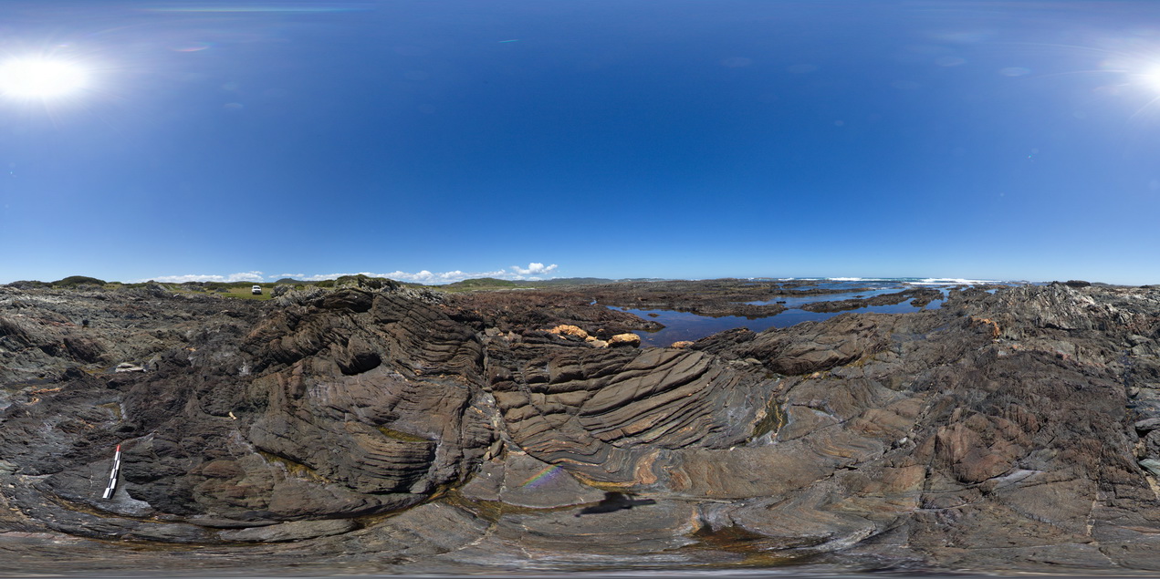
WTasFSP40
Site:
WTasFSP40
Downloads:
Map
Description:
folded and faulted sedimentary rocks of the Oonah Formation. North of Duck Creek, west coast, Tasmania.
| Capture Date: | Undated |
| Latitude: | -41.76544000000 degrees |
| Longitude: | 145.00070000000 degrees |
| Elevation: | NA |
| Visualisation Type: | FSP |
| Location Accuracy: | 5 metres |
Keywords:
- fault
- fold
- cleavage
- structure
| sandstone | |
|---|---|
| Form Type: | bedded |
| Description: | fine to medium-grained, finely bedded sandstones with interbedded siltstones. |
| Min Geological Age: | Cryogenian |
| Max Geological Age: | Cryogenian |
| Min Numerical Age: | 690.000 |
| Max Numerical Age: | 708.000 |
| Strat No: | 14603 |
| Supergroup: | |
| Group: | Arthur Metamorphic Complex |
| Subgroup: | |
| Formation: | Oonah Formation |
| Member: | |
| Province: |