WTasUAV1
Site:
WTasUAV1
Downloads:
Map
3D Model:
Description:
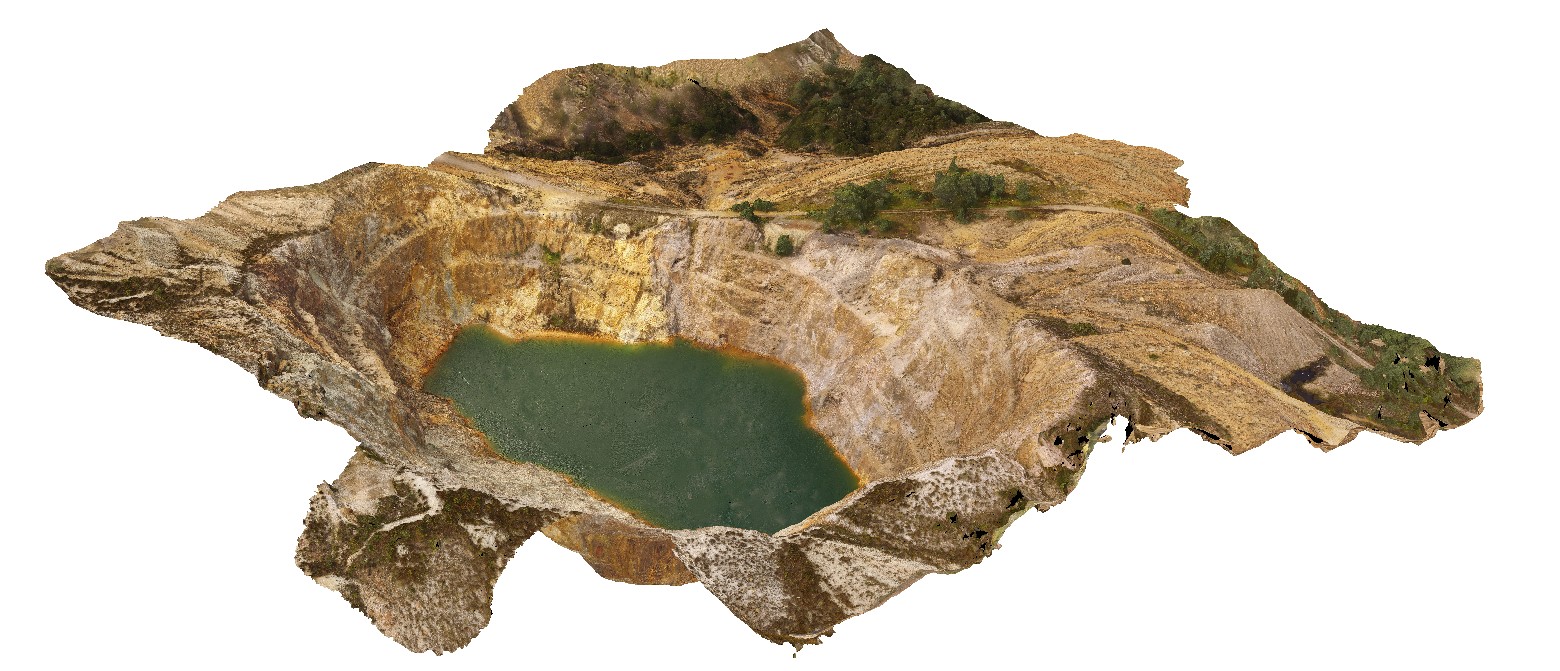
aerial view of the Iron Blow open pit at My Lyell with view of the Lyell Schist and Owen Group. Gormanston, West Tasmania.
| Capture Date: | Undated |
| Latitude: | -42.06835300000 degrees |
| Longitude: | 145.59241300000 degrees |
| Elevation: | NA |
| Visualisation Type: | UAV |
| Location Accuracy: | 20 metres |
Keywords:
- fault
- contact
- structure
- Mount Lyell
- Lyell Schist
- Owen Group
- conglomerate
- Iron Blow Copper Mine
| schist | |
|---|---|
| Form Type: | |
| Description: | quartz-sericite-pyrite altered schist of the Mount Reed Volcanics? |
| Min Geological Age: | |
| Max Geological Age: | |
| Min Numerical Age: | 0.000 |
| Max Numerical Age: | 0.000 |
| Strat No: | 10877 |
| Supergroup: | |
| Group: | |
| Subgroup: | |
| Formation: | Lyell Schist |
| Member: | |
| Province: |
| conglomerate | |
|---|---|
| Form Type: | bedded |
| Description: | Thick sequence of siliciclastic conglomerate and sandstone. |
| Min Geological Age: | |
| Max Geological Age: | |
| Min Numerical Age: | 0.000 |
| Max Numerical Age: | 0.000 |
| Strat No: | 34165 |
| Supergroup: | Wurawina Supergroup |
| Group: | Owen Group |
| Subgroup: | |
| Formation: | |
| Member: | |
| Province: | Lachlan Orogen |