WTasUAV4
Site:
WTasUAV4
Downloads:
Map
3D Model:
Description:
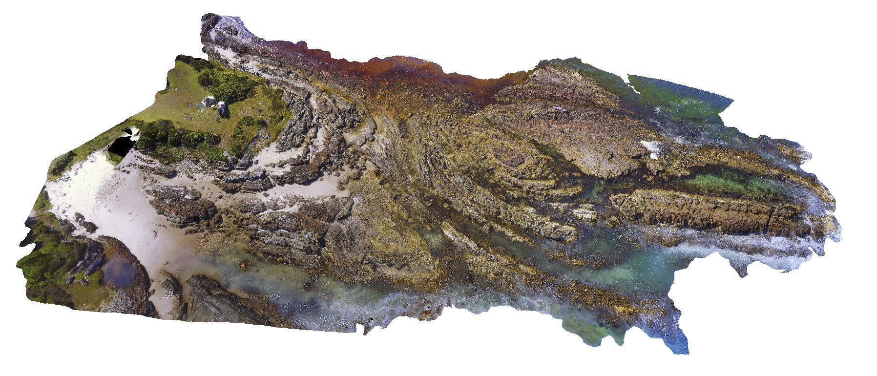
aerial view of folds in sandstone and siltstone Silurian aged rocks. Duck Creek, west coast, Tasmania.
| Capture Date: | Undated |
| Latitude: | -41.76811000000 degrees |
| Longitude: | 145.00443100000 degrees |
| Elevation: | NA |
| Visualisation Type: | UAV |
| Location Accuracy: | 5 metres |
Keywords:
- fold
- structure
| sandstone | |
|---|---|
| Form Type: | bedded |
| Description: | shallowly to moderately dipping, pale grey, fine-grained quartz sandstone with subordinate interbedded greenish-grey siltstone. Abundantly fossiliferous in parts. |
| Min Geological Age: | Early Devonian |
| Max Geological Age: | Late Silurian |
| Min Numerical Age: | 393.300 |
| Max Numerical Age: | 427.400 |
| Strat No: | 27768 |
| Supergroup: | Wurawina Supergroup Wurawina Supergroup |
| Group: | Eldon Group |
| Subgroup: | |
| Formation: | |
| Member: | |
| Province: | Lachlan Orogen |