Walkerville1
Site:
Walkerville1
Downloads:
Map
3D Model:
Description:
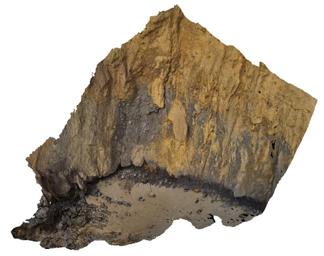
Contact between the Liptrap Formation sandstone and limestone. Contact is a fault melange. Walkerville South, Vic.
| Capture Date: | May 18, 2015, 2:23 p.m. |
| Latitude: | -38.85546000000 degrees |
| Longitude: | 145.99707000000 degrees |
| Elevation: | NA |
| Visualisation Type: | 3D |
| Location Accuracy: | 5 metres |
Keywords:
- fault
- structure
- melange
| melange | |
|---|---|
| Form Type: | |
| Description: | a fault melange containing blocks up to 0.5m in a fine-grained matrix. Blocks derived from Liptrap Sandstone |
| Min Geological Age: | Devonian |
| Max Geological Age: | Devonian |
| Min Numerical Age: | 372.000 |
| Max Numerical Age: | 419.000 |
| Strat No: | 26691 |
| Supergroup: | Murrindindi Supergroup |
| Group: | Walhalla Group |
| Subgroup: | |
| Formation: | Liptrap Formation |
| Member: | |
| Province: | Lachlan Orogen |