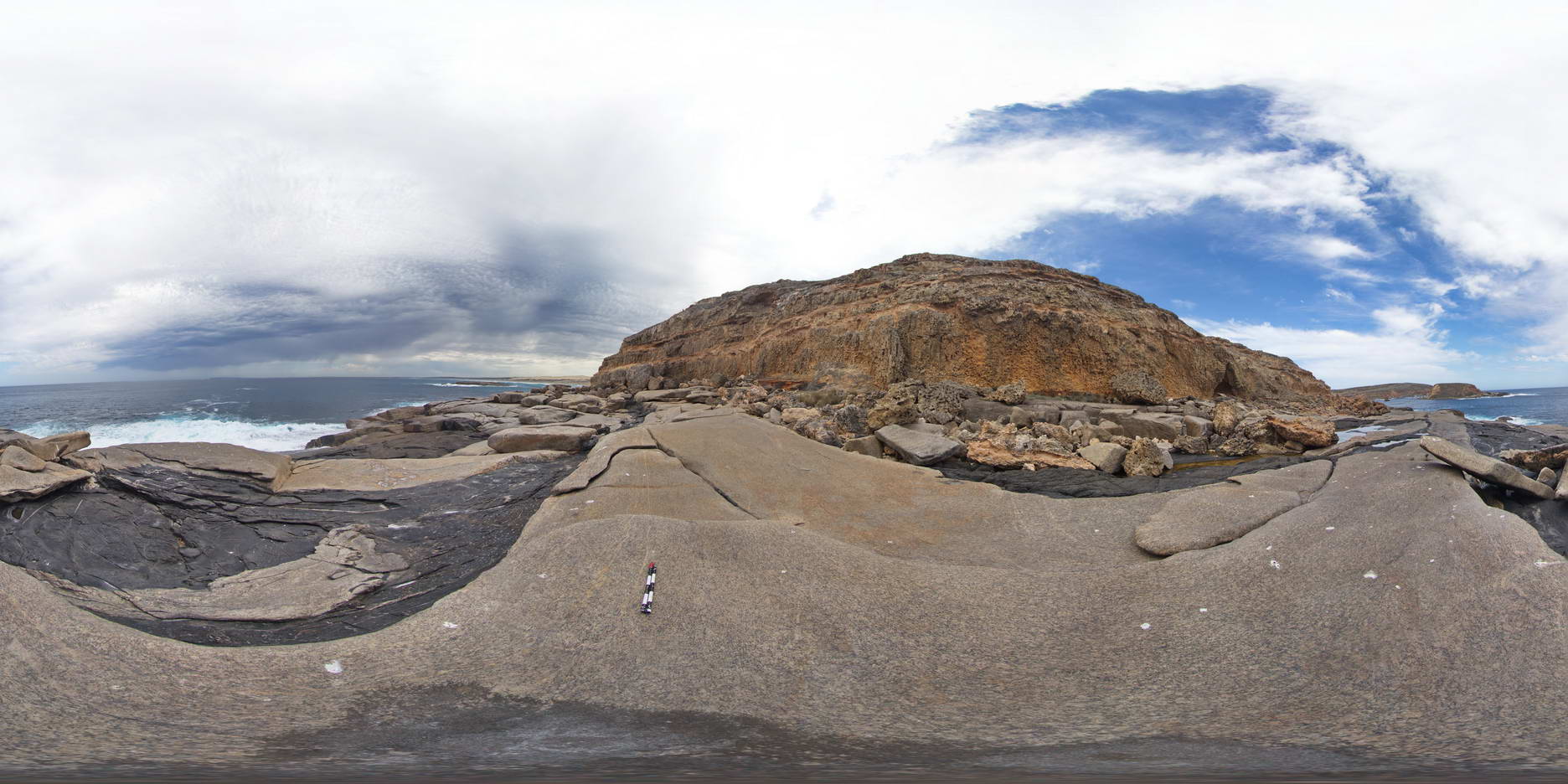
WannaFSP2
Site:
WannaFSP2

Downloads:
Map
Description:
shore platform exposure, showing intruded meta-dolerite dykes into granite gneiss, overlain by recent Holocene coastal sediments. Wanna, Port Lincoln.
| Capture Date: | Oct. 20, 2015, 4:57 p.m. |
| Latitude: | -34.89268000000 degrees |
| Longitude: | 135.85359000000 degrees |
| Elevation: | NA |
| Visualisation Type: | FSP |
| Location Accuracy: | 0 metres |
Keywords:
- intrusive contact
- unconformity
- meta dolerite
- granite gneiss
| granite gneiss | |
|---|---|
| Form Type: | |
| Description: | Weakly to strongly foliated, coarse-grained megacrystic granite-granodiorite to augen gneiss. Characteristic ovoid zoned plagioclase and K-feldspar megacrysts up to 40mm wide. |
| Min Geological Age: | Paleoproterozoic |
| Max Geological Age: | Paleoproterozoic |
| Min Numerical Age: | 1600.000 |
| Max Numerical Age: | 2800.000 |
| Strat No: | 33834 |
| Supergroup: | |
| Group: | Donington Suite |
| Subgroup: | |
| Formation: | Wanna Megacrystic Granite Gneiss |
| Member: | |
| Province: |
| meta dolerite | |
|---|---|
| Form Type: | dyke |
| Description: | Composed of hornblende, plagioclase, sphene and minor quartz. Foliated. Occurs as discrete dykes to mafic enclaves in other Donintion Suite granitoids. |
| Min Geological Age: | Paleoproterozoic |
| Max Geological Age: | Paleoproterozoic |
| Min Numerical Age: | 1600.000 |
| Max Numerical Age: | 2800.000 |
| Strat No: | 68744 |
| Supergroup: | |
| Group: | Donington Suite |
| Subgroup: | |
| Formation: | Jussieu Metadolerite |
| Member: | |
| Province: |
| sand | |
|---|---|
| Form Type: | bedded |
| Description: | Unconsolidated, white bioclastic quartz-carbonate sand of modern beaches and transgressive dune fields. Foredune and dune sand. |
| Min Geological Age: | Holocene |
| Max Geological Age: | Holocene |
| Min Numerical Age: | 0.000 |
| Max Numerical Age: | 0.012 |
| Strat No: | 33996 |
| Supergroup: | |
| Group: | |
| Subgroup: | |
| Formation: | Saint Kilda Formation |
| Member: | Semaphore Sand Member |
| Province: |