WaterfallbayUAV1
Site:
WaterfallbayUAV1
Downloads:
Map
3D Model:
Description:
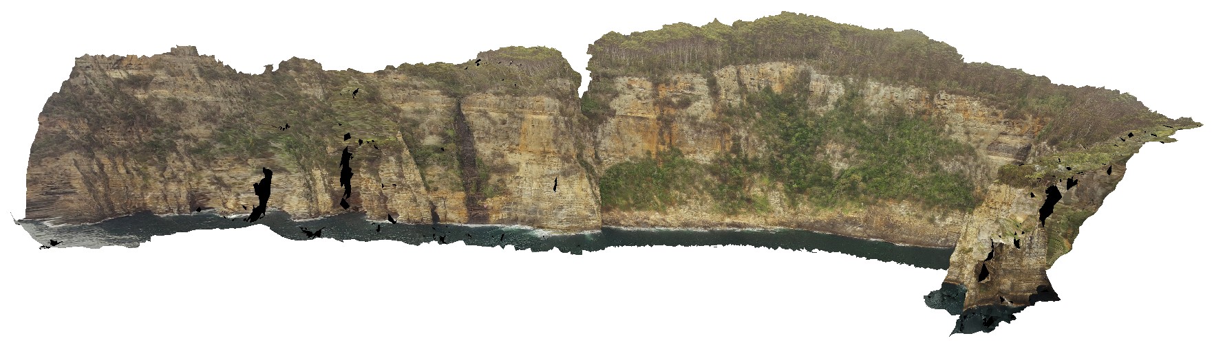
extensive aerial view of 'clean' Permian sediment cliffs. Waterfall Bay, Tasmania.
| Capture Date: | Undated |
| Latitude: | -43.05168000000 degrees |
| Longitude: | 147.94986900000 degrees |
| Elevation: | 170.448 metres |
| Visualisation Type: | UAV |
| Location Accuracy: | 20 metres |
Keywords:
- Permian sediments
- dolerite dyke
- faults
- sedimentology
| sediments | |
|---|---|
| Form Type: | bedded |
| Description: | Undivided sedimentary rocks, including clastic sediments with interbedded coal and alkali basalt; glaciomarine sequences of mudstone, sandstone, minor limestone, coal measures, Tasmanite oil shale and basal tillite. |
| Min Geological Age: | Late Triassic |
| Max Geological Age: | Late Carboniferous |
| Min Numerical Age: | 208.500 |
| Max Numerical Age: | 323.200 |
| Strat No: | 14900 |
| Supergroup: | Parmeener Supergroup |
| Group: | |
| Subgroup: | |
| Formation: | |
| Member: | |
| Province: | Melbourne-Mathinna Zone |