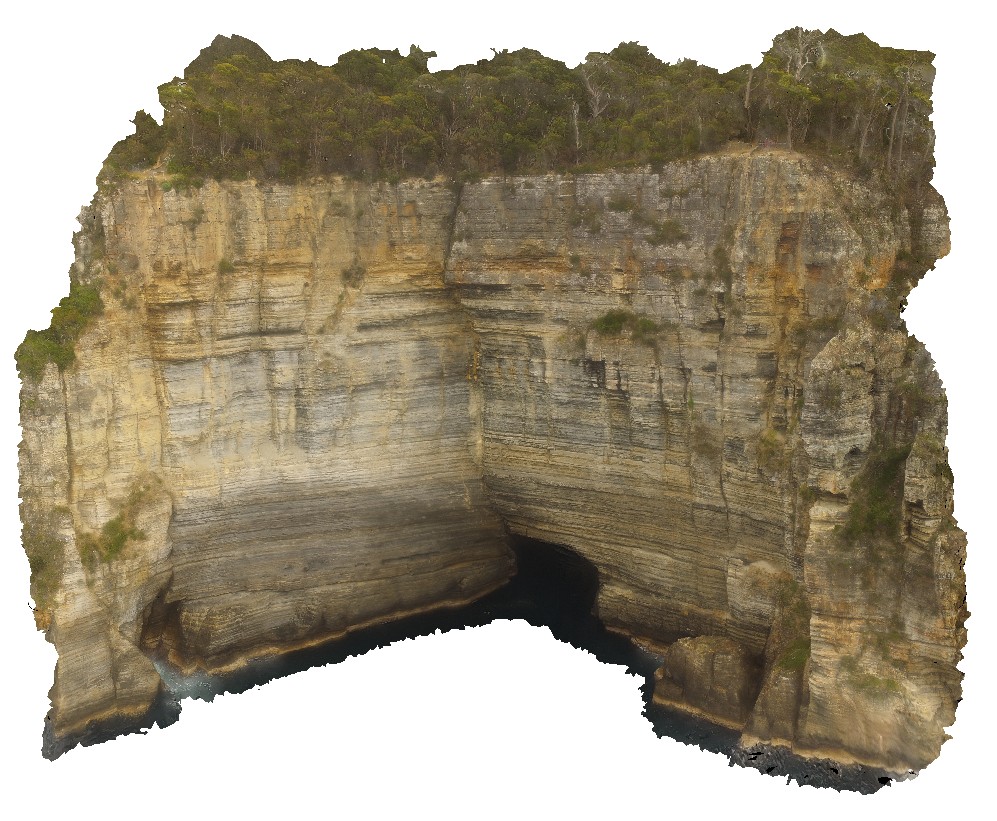
WaterfallbayUAV2
Site:
WaterfallbayUAV2
Downloads:
Map
3D Model:
Description:
extensive aerial view of 'clean' Permian sediment cliffs with sea cave. Waterfall Bay, Tasmania.
| Capture Date: | Undated |
| Latitude: | -43.05807400000 degrees |
| Longitude: | 147.94901500000 degrees |
| Elevation: | 112.000 metres |
| Visualisation Type: | UAV |
| Location Accuracy: | 20 metres |
Keywords:
- sea cave
- Permian sediment
- Parmeener Supergroup
| sediment | |
|---|---|
| Form Type: | bedded |
| Description: | large section through Permian aged sediments, showing bedding. |
| Min Geological Age: | Late Triassic |
| Max Geological Age: | Late Carboniferous |
| Min Numerical Age: | 201.300 |
| Max Numerical Age: | 323.200 |
| Strat No: | 14900 |
| Supergroup: | Parmeener Supergroup |
| Group: | |
| Subgroup: | |
| Formation: | |
| Member: | |
| Province: | Melbourne-Mathinna Zone |