WestBeach6
Site:
WestBeach6
Downloads:
Map
3D Model:
Description:
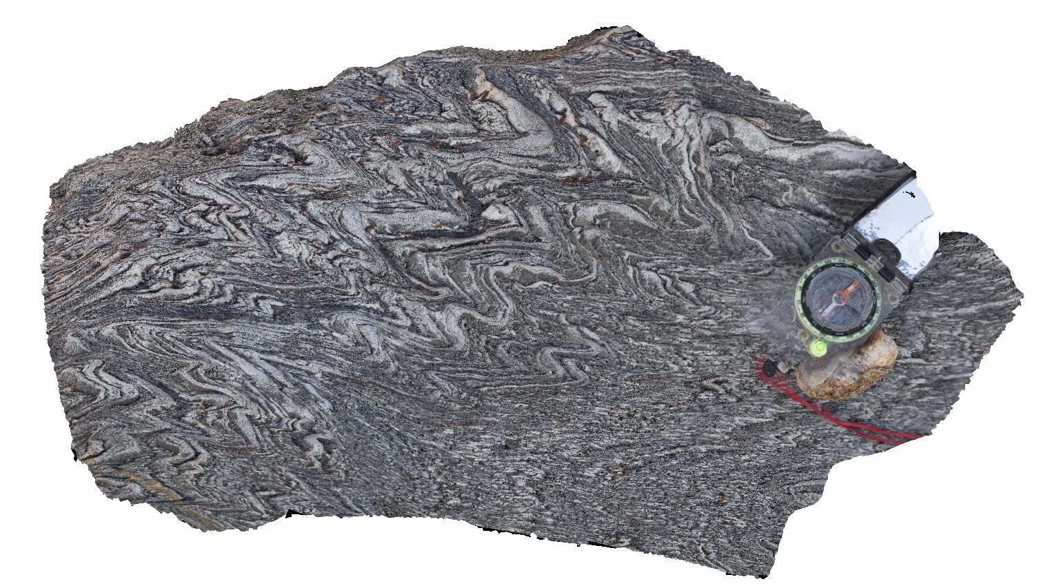
steeply plunging, tight to open folds in finely laminated schist. West Beach, W.A.
| Capture Date: | June 5, 2016, 10:42 a.m. |
| Latitude: | -33.95350000000 degrees |
| Longitude: | 119.97487000000 degrees |
| Elevation: | NA |
| Visualisation Type: | 3D |
| Location Accuracy: | 0 metres |
Keywords:
- folding
- schist
- structure
| schist | |
|---|---|
| Form Type: | bedded |
| Description: | Quartzite, sandstone, dolostone, conglomerate, phyllite, pelitic and psammitic schist |
| Min Geological Age: | Mesoproterozoic |
| Max Geological Age: | Paleoproterozoic |
| Min Numerical Age: | 1000.000 |
| Max Numerical Age: | 1693.000 |
| Strat No: | 27840 |
| Supergroup: | |
| Group: | Mount Barren Group |
| Subgroup: | |
| Formation: | |
| Member: | |
| Province: | Albany-Fraser Orogen |