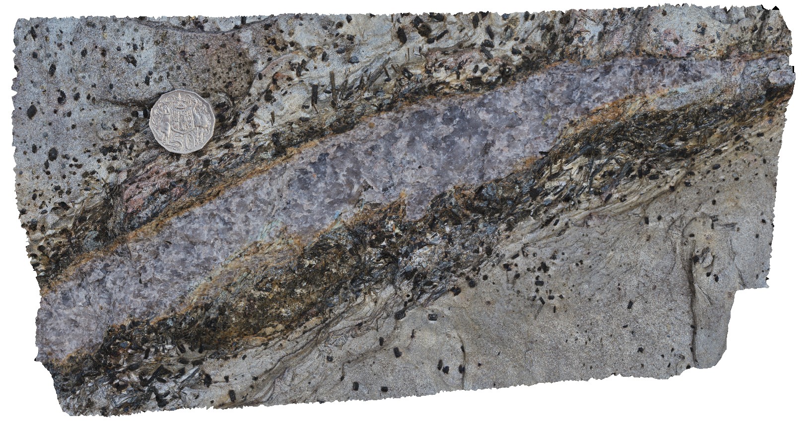
TowerHill12 Map
 |
10 |
06/05/2016 10:44 a.m. |
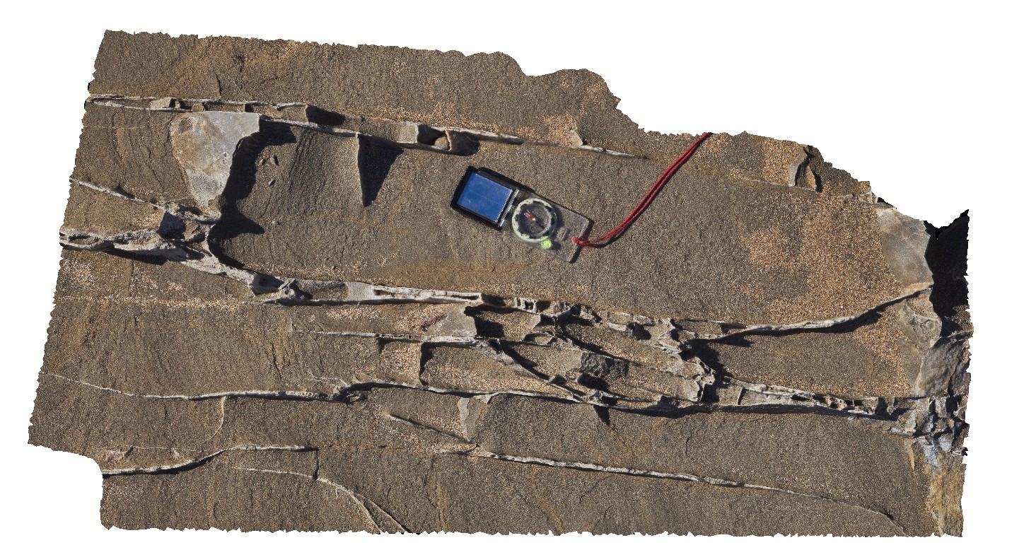
3D |
detail of cross bedding in thinly layered, fine-grained tuffaceous deposits. Tower Hill, Vic. |
3.20 |
-38.32697000000 |
142.36827000000 |
-9999.000 |
tuff, cross bedding |
tuff |
TowerHill13 Map
 |
10 |
06/05/2016 10:44 a.m. |
3D |
detailed view of wavy pebble layer in tuff deposits. Tower Hill, Vic. |
0.50 |
-38.32708000000 |
142.36807000000 |
-9999.000 |
tuff, volcanics |
tuff |
TowerHill14 Map
 |
10 |
06/05/2016 10:44 a.m. |
3D |
overview of layered tuff deposits, Tower Hill, Vic. |
10.00 |
-38.32714000000 |
142.36807000000 |
-9999.000 |
tuff, bedding |
tuff |
TowerHill2 Map
 |
10 |
06/05/2016 10:42 a.m. |
3D |
medium scale view of tuffaceous outcrop, showing finely layered beds. Tower Hill, Vic. |
4.00 |
-38.32485000000 |
142.37242000000 |
-9999.000 |
tuffaceous, volcanic, sedimentology |
tuff |
TowerHill3 Map
 |
10 |
06/05/2016 10:42 a.m. |
3D |
detailed view of tuffaceous layers, showing coarse-grained and fine-grained layers. Tower Hill, Vic. |
1.20 |
-38.32485000000 |
142.37242000000 |
-9999.000 |
tuffaceous, volcanics, sedimentology |
tuff |
TowerHill4 Map
 |
10 |
06/05/2016 10:42 a.m. |
3D |
truncated layering in tuff deposits, showing fine layering. Tower Hill, Vic. |
2.00 |
-38.32484000000 |
142.37291000000 |
-9999.000 |
tuffaceous, truncated bedding |
tuff |
TowerHill5 Map
 |
10 |
06/05/2016 10:43 a.m. |
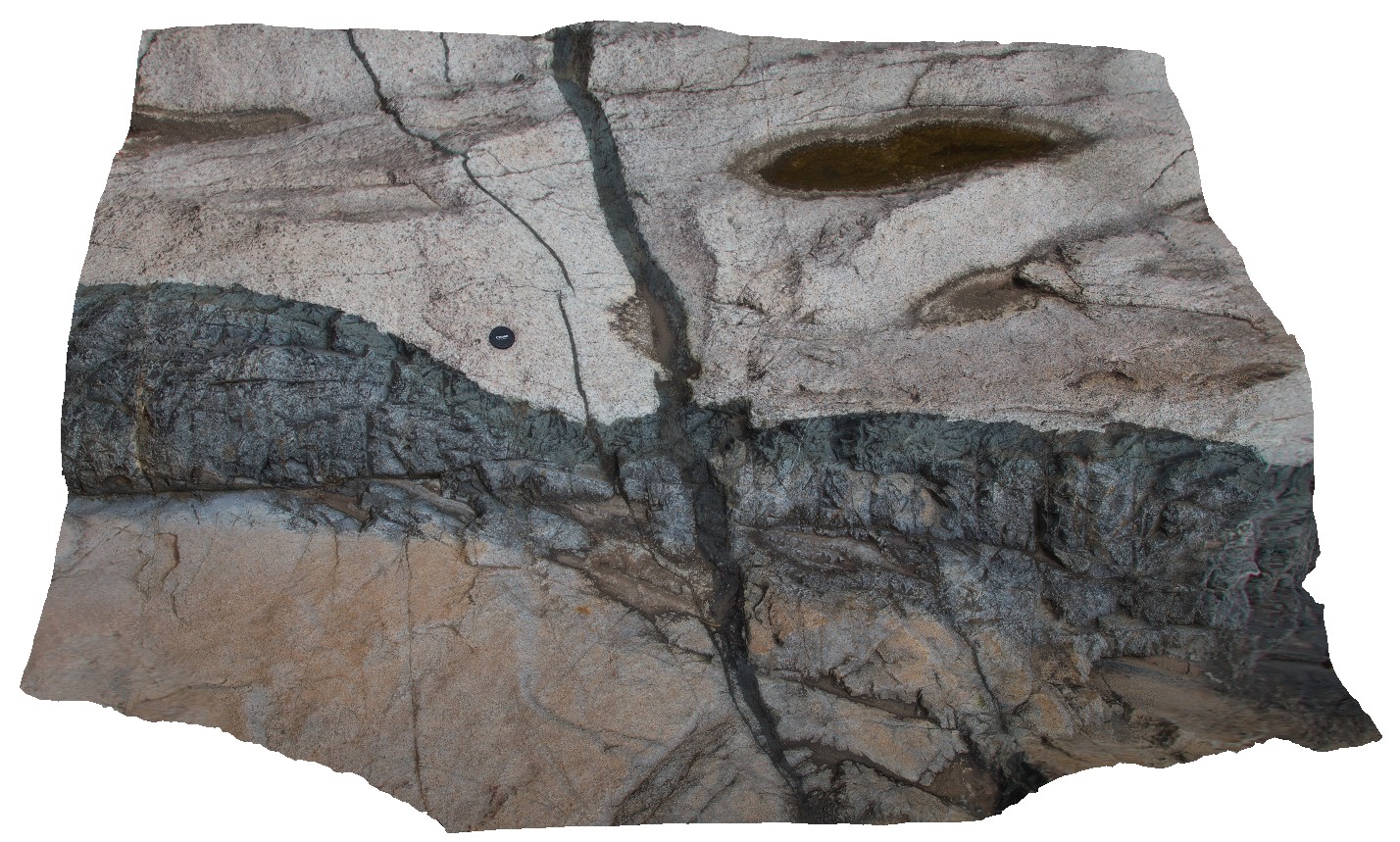
3D |
view of cross-section through a scoria rich layer in tuffaceous sediment package, Tower Hill, Vic. |
6.00 |
-38.32721000000 |
142.36809000000 |
-9999.000 |
tuff, scoria |
tuff |
TowerHill6 Map
 |
10 |
06/05/2016 10:43 a.m. |
3D |
detail from site TowerHill5 of cross-bedding around an altered volcanic bomb. Tower Hill, Vic. |
0.45 |
-38.32721000000 |
142.36809000000 |
-9999.000 |
cross-bedding, tuffaceous, volcanic bomb |
tuff |
TowerHill7 Map
 |
10 |
06/05/2016 10:43 a.m. |
3D |
convoluted bedding in tuffaceous layers, Tower Hill, Vic. |
4.00 |
-38.32701000000 |
142.36813000000 |
-9999.000 |
tuffaceous, convoluted bedding |
tuff |
TowerHill8 Map
 |
10 |
06/05/2016 10:43 a.m. |
3D |
detail of pebble-sized tuff layers in tuffaceous deposits. Tower Hill, Vic. |
2.00 |
-38.32703000000 |
142.36818000000 |
-9999.000 |
tuffaceous, bedding |
tuff |
TowerHill9 Map
 |
10 |
06/05/2016 10:43 a.m. |
3D |
detail of small-scale cross beds in tuffaceous deposits. Tower Hill, Vic. |
1.40 |
-38.32702000000 |
142.36830000000 |
-9999.000 |
cross bedding, tuff |
tuff |
Trigelow1 Map
 |
0 |
06/05/2016 10:47 a.m. |
3D |
gently plunging, open folds in psammite / quartzite, Point Ann, W.A. |
1.50 |
-34.19865000000 |
119.55386000000 |
-9999.000 |
gently plunging fold, open fold, metasediments, structure |
quartzite |
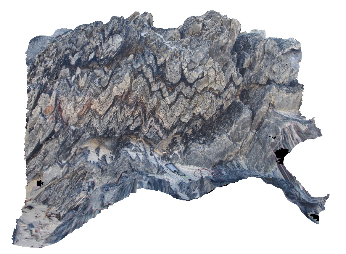
Trigelow2 Map
 |
0 |
06/05/2016 10:47 a.m. |
3D |
gently plunging, open to tight folds in psammite / quartzite. Point Ann, W.A. |
0.60 |
-34.19875000000 |
119.55394000000 |
-9999.000 |
fold plunge, fold, quartzite |
quartzite |
WestBeach1 Map
 |
0 |
06/05/2016 10:47 a.m. |
3D |
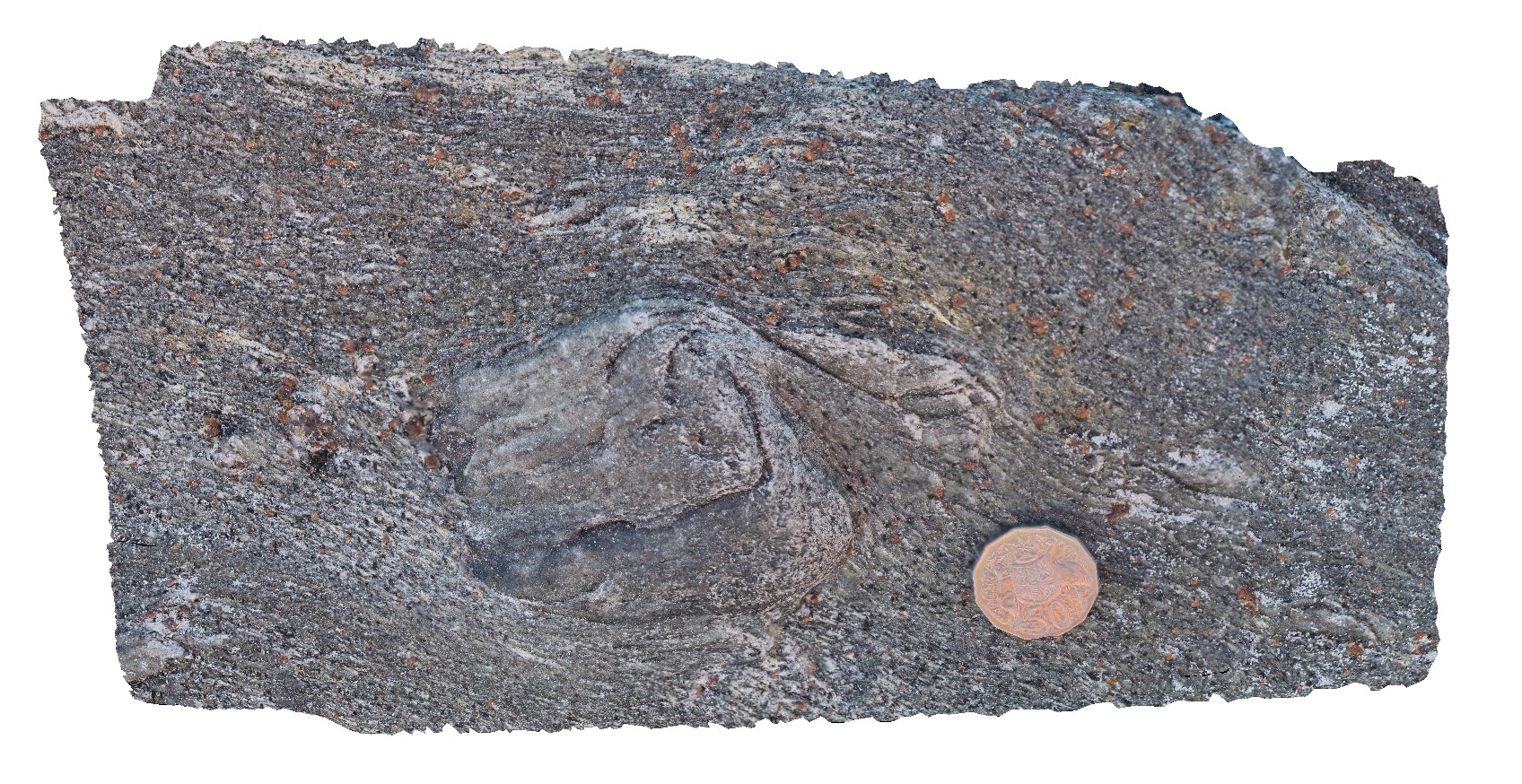
M geometry folds with penetrative cleavage in garnet schist. West Beach, W.A. |
1.00 |
-33.95337000000 |
119.97512000000 |
-9999.000 |
penetrative cleavage, M folding, garnet schist |
garnet schist |
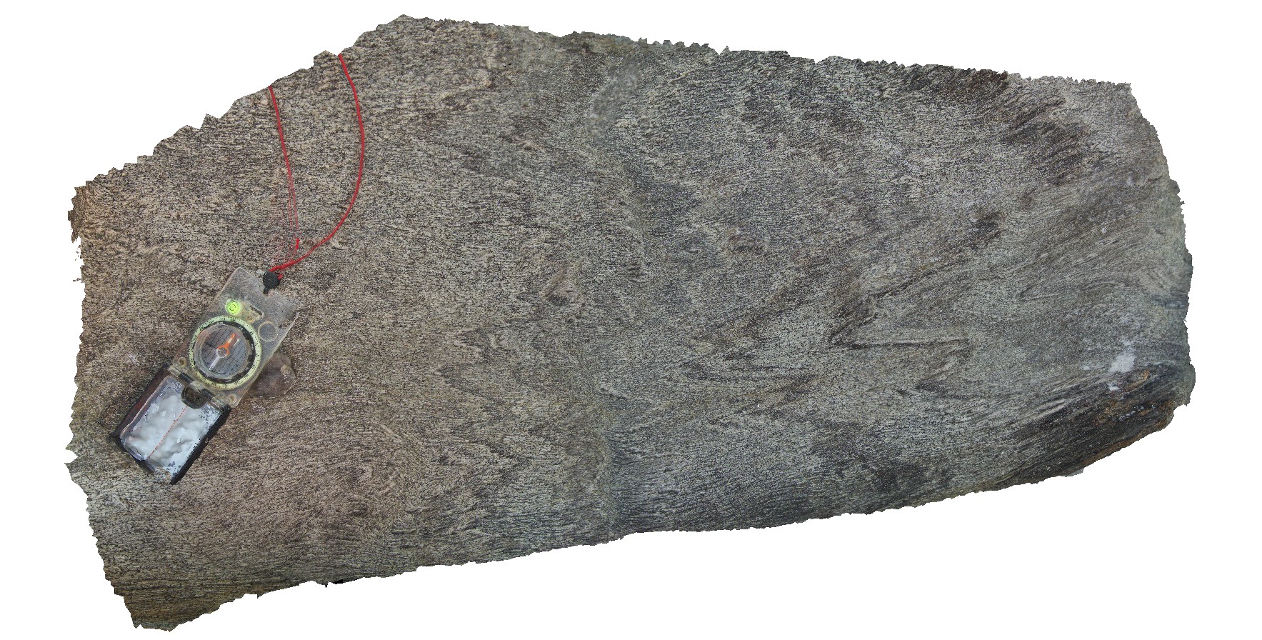
WestBeach10 Map
 |
0 |
06/05/2016 10:35 a.m. |
3D |
Biotite and kyanite crystals growing on quartz vein selvage. West Beach, W.A. |
0.35 |
-33.95360000000 |
119.97449000000 |
-9999.000 |
biotite vein selvage, kyanite vein selvage |
schist |
WestBeach2 Map
 |
0 |
06/05/2016 10:34 a.m. |
3D |
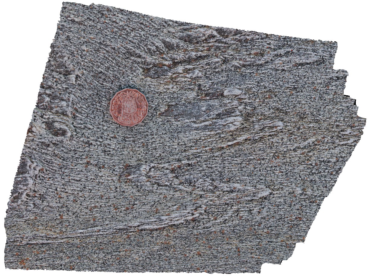
folded layering, showing fold vergence in schist. West Beach, W.A. |
0.80 |
-33.95340000000 |
119.97511000000 |
-9999.000 |
fold vergence, structure |
schist |
WestBeach3 Map
 |
0 |
06/05/2016 10:50 a.m. |
3D |
detailed view of 'M' folding in garnet schist from site WestBeach1. West Beach, W.A. |
0.30 |
-33.95340000000 |
119.97511000000 |
-9999.000 |
M fold geometry, folding, structure |
garnet schist |
WestBeach4 Map
 |
0 |
06/05/2016 10:34 a.m. |
3D |
close-up view of fold in garnet-bearing schist, West Beach. W.A. |
0.30 |
-33.95349000000 |
119.97489000000 |
-9999.000 |
fold, structure |
garnet schist |
WestBeach5 Map
 |
0 |
06/05/2016 10:50 a.m. |
3D |
'M' folding in garnet schist, West Beach, W.A. |
0.00 |
-33.95352000000 |
119.97489000000 |
-9999.000 |
M folds, structure, garnet schist |
garnet schist |
WestBeach6 Map
 |
0 |
06/05/2016 10:42 a.m. |
3D |
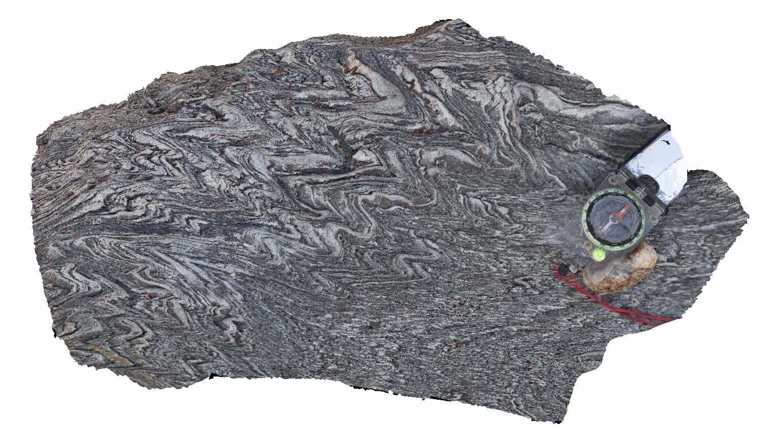
steeply plunging, tight to open folds in finely laminated schist. West Beach, W.A. |
0.50 |
-33.95350000000 |
119.97487000000 |
-9999.000 |
folding, schist, structure |
schist |
WestBeach7 Map
 |
0 |
06/05/2016 10:49 a.m. |
3D |
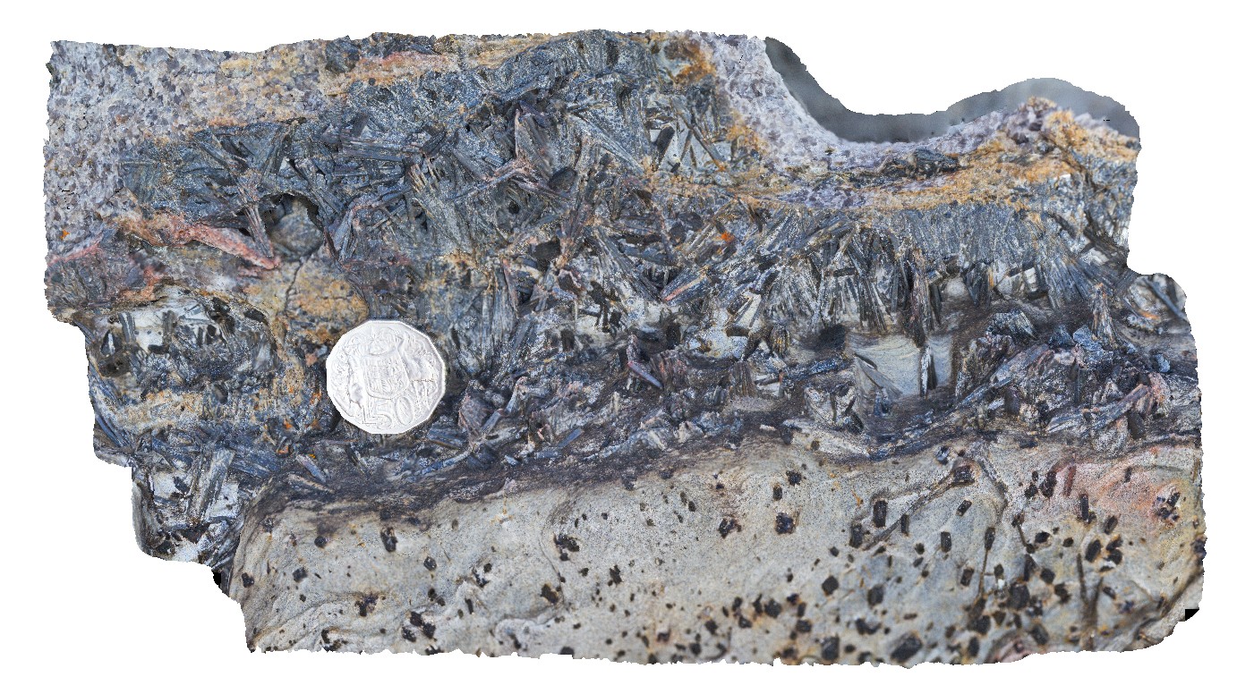
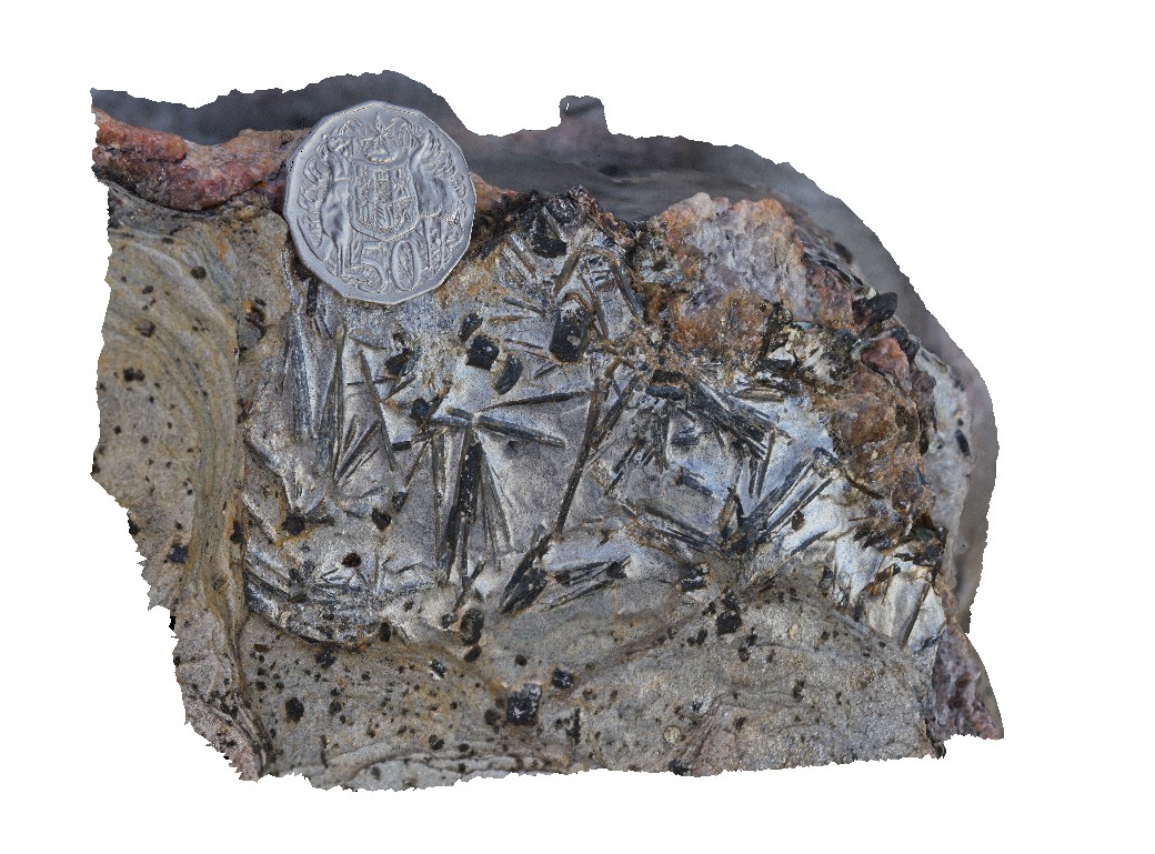
aggregates of black kyanite crystals in band of schist. West Beach, W.A. |
0.20 |
-33.95360000000 |
119.97449000000 |
-9999.000 |
kyanite, schist, metamorphic |
schist |
WestBeach8 Map
 |
0 |
06/05/2016 10:35 a.m. |
3D |
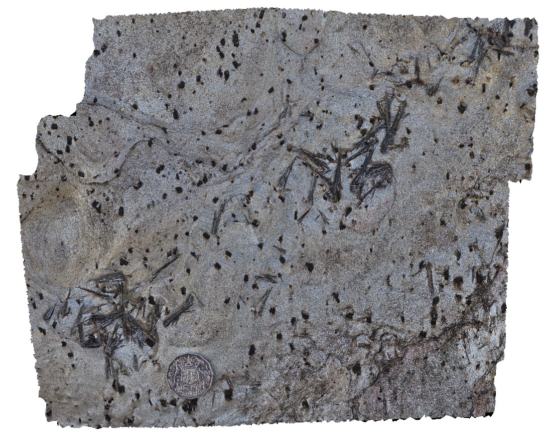
radiating needles of kyanite in schist. West Beach, W.A. |
0.10 |
-33.95360000000 |
119.97449000000 |
-9999.000 |
kyanite, schist, metamorphic |
kyanite schist |
WestBeach9 Map
 |
0 |
06/05/2016 10:51 a.m. |
3D |
radiating kyanite aggregates on schistosity surface. West Beach, W.A. |
0.30 |
-33.95360000000 |
119.97449000000 |
-9999.000 |
kyanite aggregates, schist |
kyanite schist |
WreckBeach1 Map
 |
0 |
06/14/2016 2:13 p.m. |
3D |
shore platform exposure of multiple carbonate veins in well sorted sandstone. Wreck Beach, Vic. |
1.20 |
-38.75579000000 |
143.21394000000 |
-9999.000 |
sandstone, carbonate vein |
sandstone |
Jourama1 Map
 |
20 |
04/28/2016 2:59 p.m. |
3D |
dolerite dykes intruding granite. Clear examples of small scale intrusive structures. Jourama Falls, QLD. |
4.00 |
-18.86587200000 |
146.12700700000 |
125.000 |
Granite, dolerite dyke swarm, cross cutting relationships, igneous |
granite, dolerite |