CityofMelbourneBay6 Map
 |
5 |
04/25/2015 11:38 a.m. |
3D |
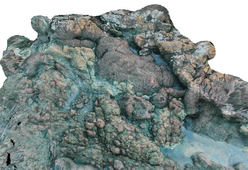
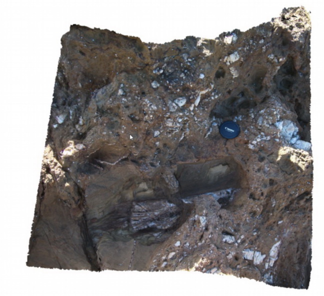
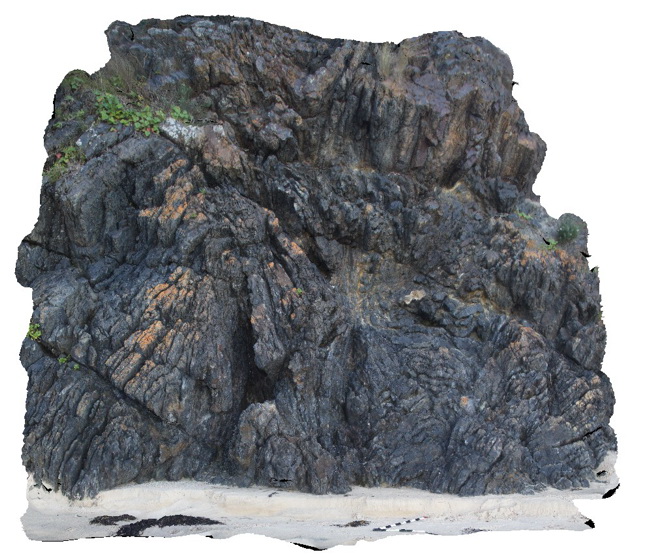
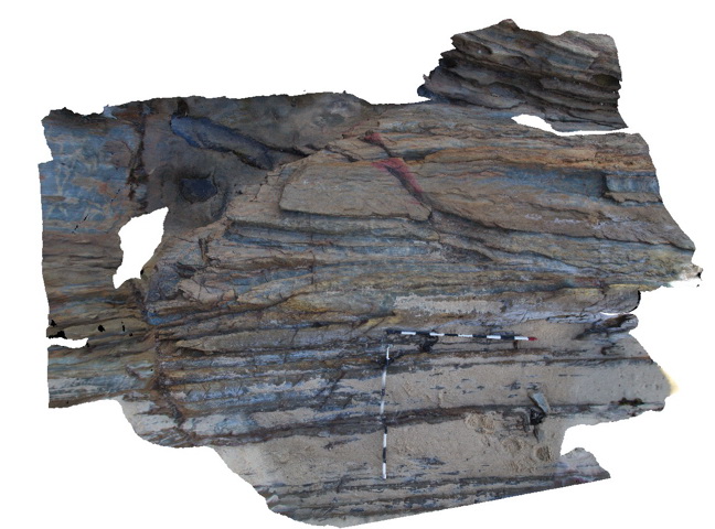
basaltic volcanic package, showing flows and pillows, inter pillow / flow sediments and possible breccia flow? City of Melbourne Bay, King Island. Tasmania. |
3.00 |
-40.01292543000 |
144.11667927000 |
1.000 |
lava flow, sediments, volcanology |
basalt |
CapeWickham9 Map
 |
5 |
04/25/2015 11:52 a.m. |
3D |
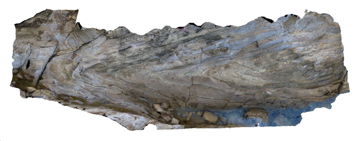
steeply plunging fold hinge in quartzite and pelites. Cape Wickham, King Island. Tasmania. |
0.00 |
-39.59211212000 |
143.92782848000 |
2.000 |
fold hinge, fold, structure, metamorphic |
quartzite |
Maria11 Map
 |
20 |
04/27/2015 11:54 a.m. |
3D |
contact between granite basement and overlying basal Permian conglomerate. Maria Island, Tas. |
3.00 |
-42.65806526000 |
148.11054913000 |
5.000 |
contact |
granite, tillite |
Bermagui2 Map
 |
5 |
05/18/2015 12:57 p.m. |
3D |
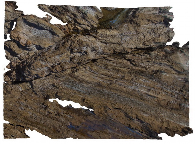
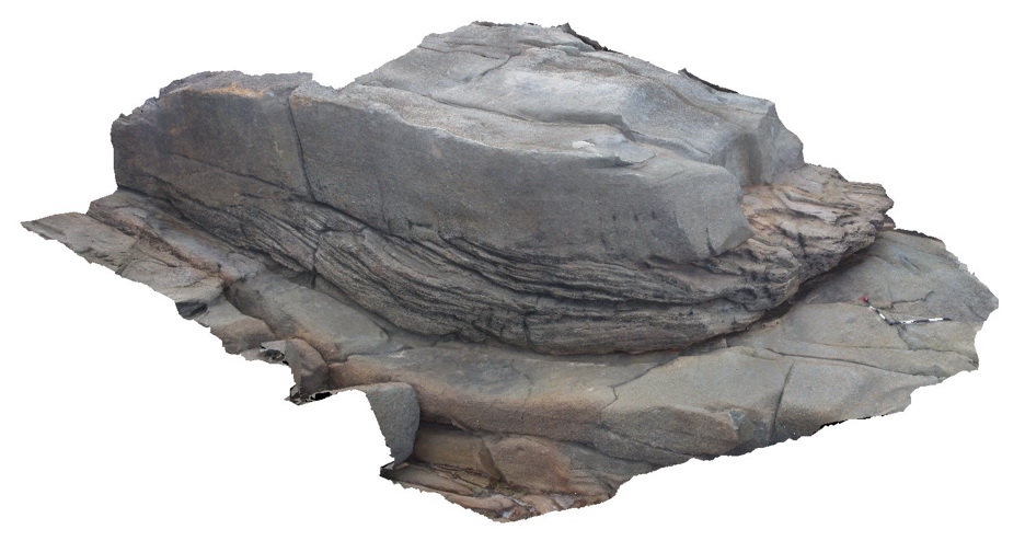
plunging anticline in Ordovician sandstones of the Abercrombie Formation. N.S.W. |
12.00 |
-36.42352000000 |
150.08267000000 |
2.000 |
sandstone, fold, anticline, structure |
sandstone |
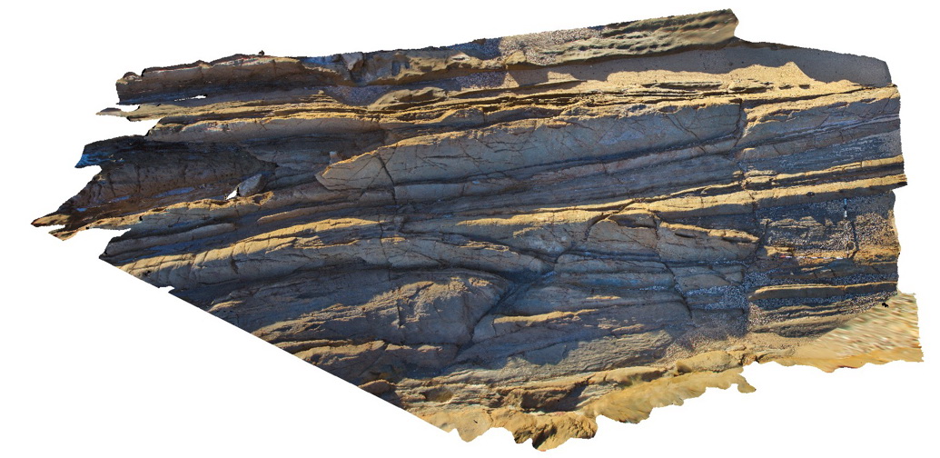
Bermagui3 Map
 |
5 |
05/18/2015 12:58 p.m. |
3D |
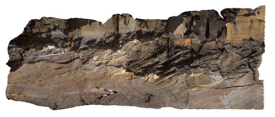
Fault zone cross-cutting steeply dipping sandstone beds of the Ordovician Abercrombie Formation. Visualisation is approximately 8-10m across. Bermagui, N.S.W. |
9.00 |
-36.42400000000 |
150.08278000000 |
-9999.000 |
fault zone, sandstone, structure |
sandstone |
Bermagui4 Map
 |
5 |
05/18/2015 12:59 p.m. |
3D |
Detail of fault breccia within Ordovician Abercrombie Formation. Bermagui, N.S.W. |
1.00 |
-36.42400000000 |
150.08278000000 |
2.000 |
fault, breccia, structure |
breccia |
Bermagui5 Map
 |
5 |
05/18/2015 12:59 p.m. |
3D |
Quartz vein networks cutting sandstone of the Ordovician Abercrombie Formation. Bermagui, N.S.W. |
8.00 |
-36.42444000000 |
150.08282000000 |
1.000 |
sandstone, quartz vein, structure |
sandstone, quartz |
BermaguiPole1 Map
 |
5 |
05/18/2015 1:01 p.m. |
3D |
pole photography of a large, tight plunging anticline in Adaminaby Group low grade turbiditic metasediments. Bermagui, N.S.W. |
20.00 |
-36.42342000000 |
150.08270000000 |
2.000 |
fold, anticline, structure |
turbidite |
Merimbula1 Map
 |
5 |
05/18/2015 1:21 p.m. |
3D |
en-echelon quartz veins in cross bedded sandstone. Merimbula, N.S.W. |
5.00 |
-36.88414000000 |
149.93306000000 |
2.000 |
cross beds, quartz vein, en-echelon, structure |
sandstone |
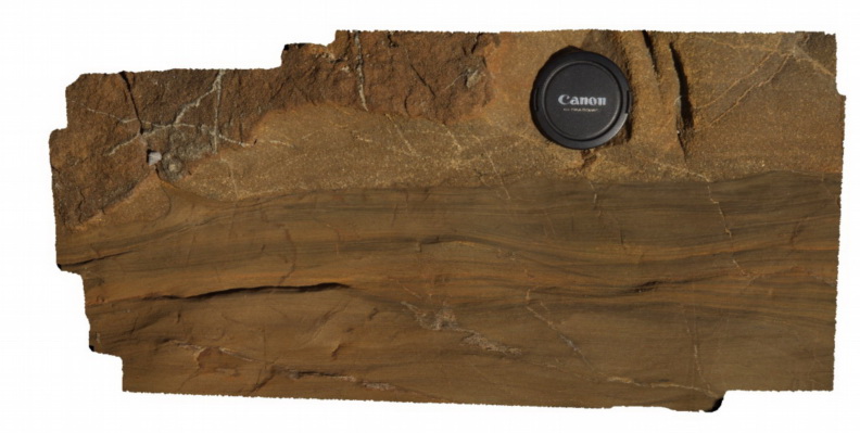
Merimbula10 Map
 |
5 |
05/18/2015 1:21 p.m. |
3D |
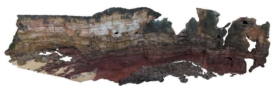
very irregular contact between yellow cross bedded sandstone and red sandstone. Merimbula, N.S.W. |
10.00 |
-36.89641000000 |
149.93002000000 |
2.000 |
bedding, erosional contact, cross bedding, sedimentology |
sandstone |
Merimbula2 Map
 |
5 |
05/18/2015 1:22 p.m. |
3D |
en echelon quartz veins in medium-coarse grained cross-bedded sandstones. Merimbula, N.S.W. |
5.00 |
-36.88403000000 |
149.93391000000 |
2.000 |
quartz veins, en-echelon, structure |
sandstone |
Merimbula3 Map
 |
5 |
05/18/2015 1:22 p.m. |
3D |
en-echelon quartz veins in medium to coarse cross bedded sandstones. Merimbula, N.S.W. |
5.00 |
-36.88396000000 |
149.93465000000 |
2.000 |
quartz veins, en-echelon, structure |
sandstone |
Merimbula4 Map
 |
5 |
05/18/2015 1:23 p.m. |
3D |
cross beds in medium grained sandstone. Merimbula, N.S.W. |
5.00 |
-36.88585000000 |
149.93343000000 |
2.000 |
cross bedding, sedimentology |
sandstone |
Merimbula5 Map
 |
5 |
05/18/2015 1:24 p.m. |
3D |
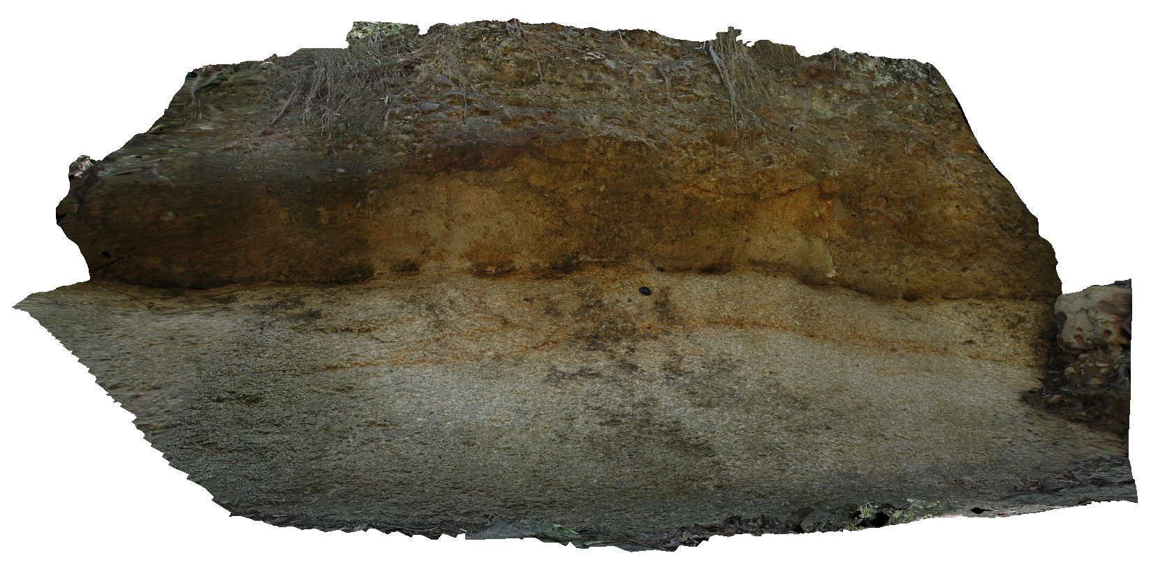
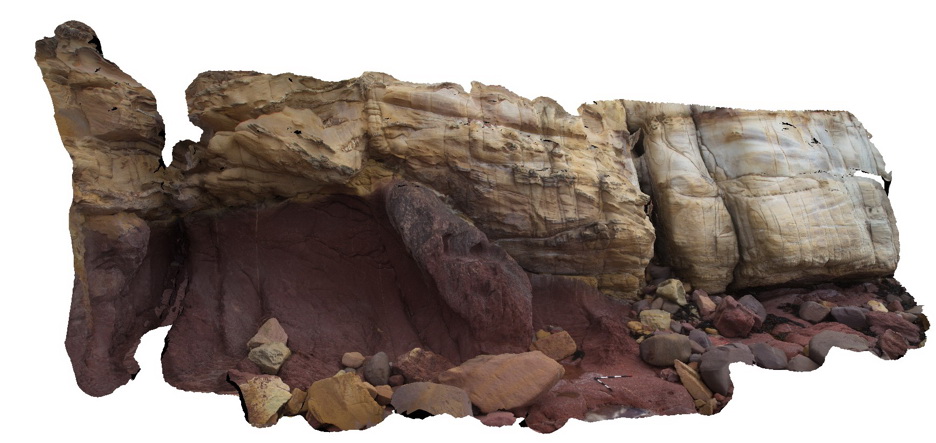
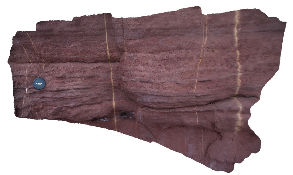
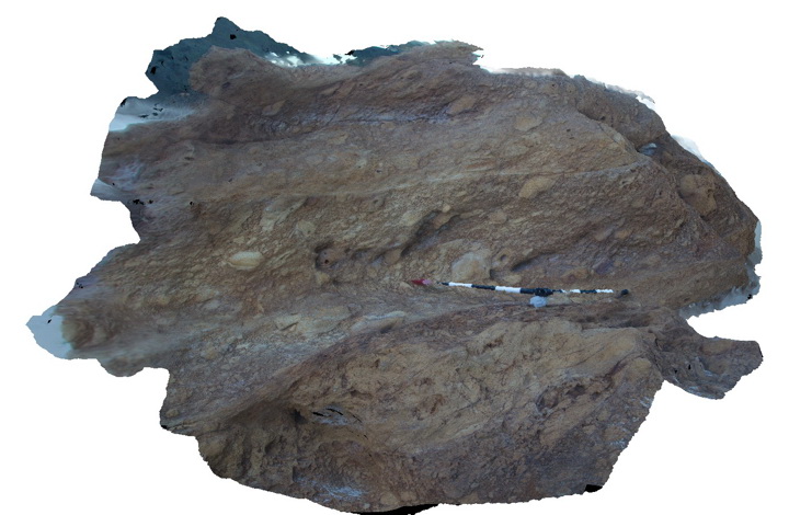
large coastal outcrop with red sandstone (red bed) overlain by yellow cross bedded sandstone. The contact between the two units is erosional. Merimbula, N.S.W. |
30.00 |
-36.88851000000 |
149.93022000000 |
2.000 |
cross bedding, erosional contact, sedimentology, stratigraphy |
sandstone |
Merimbula6 Map
 |
5 |
05/18/2015 1:25 p.m. |
3D |
detailed view of the medium to coarse grained redbed sandstone depicted in Merimbula5. Merimbula, N.S.W. |
1.00 |
-36.88815600000 |
149.93033000000 |
2.000 |
sedimentology |
sandstone |
Merimbula7 Map
 |
5 |
05/18/2015 1:25 p.m. |
3D |
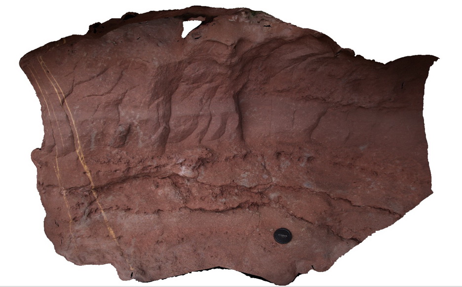
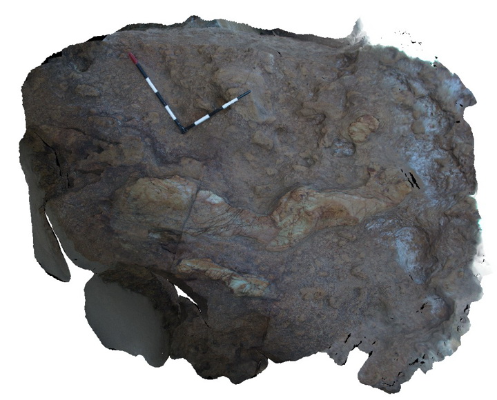
Detail of bedding in medium to fine-grained red sandstone. Mottled zones of light coloured leaching are also apparent. Merimbula, N.S.W. |
1.00 |
-36.88820000000 |
149.93033000000 |
2.000 |
sedimentology, bedding |
sandstone |
Merimbula8 Map
 |
5 |
05/18/2015 1:26 p.m. |
3D |
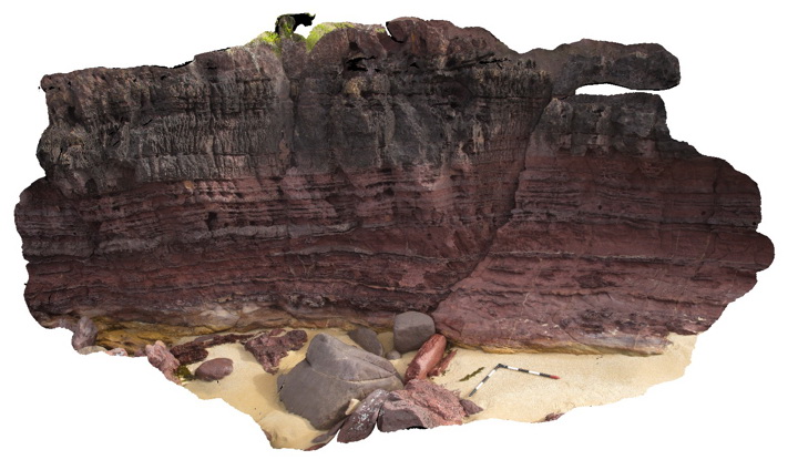
Devonian red bed sandstone cliff displaying alternations between fine and medium grainsize. Rock unit is thin to thickly bedded. Merimbula, N.S.W. |
6.00 |
-36.89697000000 |
149.93036000000 |
2.000 |
bedding, sedimentology |
sandstone |
Merimbula9 Map
 |
5 |
05/18/2015 1:26 p.m. |
3D |
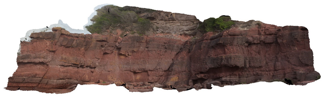
Thickly bedded red sandstone. Coarse grained units have irregular erosional lower contacts and planar upper contacts. Merimbula, N.S.W. |
15.00 |
-36.89839000000 |
149.93224000000 |
2.000 |
bedding, erosional contact, sedimentology |
sandstone |
Narooma1 Map
 |
5 |
05/18/2015 1:27 p.m. |
3D |
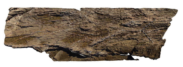
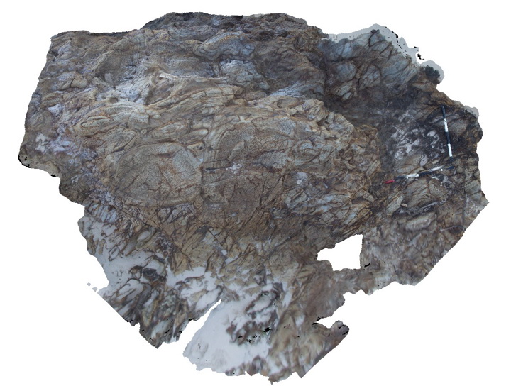
intensely folded layered chert. Narooma, N.S.W. |
4.00 |
-36.22038000000 |
150.14062000000 |
0.000 |
folds, structure |
chert |
Narooma2 Map
 |
5 |
05/18/2015 1:27 p.m. |
3D |
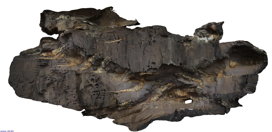
imbricated clasts in Volcanic breccia. Narooma, N.S.W. |
3.00 |
-36.22093000000 |
150.14082000000 |
0.000 |
imbricated, breccia, volcanology |
breccia |
Narooma3 Map
 |
5 |
05/18/2015 1:27 p.m. |
3D |
elongate small pillows of altered basalt in volcanic breccia. Narooma, N.S.W. |
3.00 |
-36.22104000000 |
150.14082000000 |
0.000 |
pillow basalt, volcanology, igneous |
breccia, basalt |
Narooma4 Map
 |
5 |
05/18/2015 1:28 p.m. |
3D |
altered pillow basalts with clearly defined chilled margins. Narooma, N.S.W. |
3.00 |
-36.22147000000 |
150.14070000000 |
0.000 |
pillow basalt, volcanology, igneous |
basalt |
PotatoPt1 Map
 |
5 |
05/18/2015 1:29 p.m. |
3D |
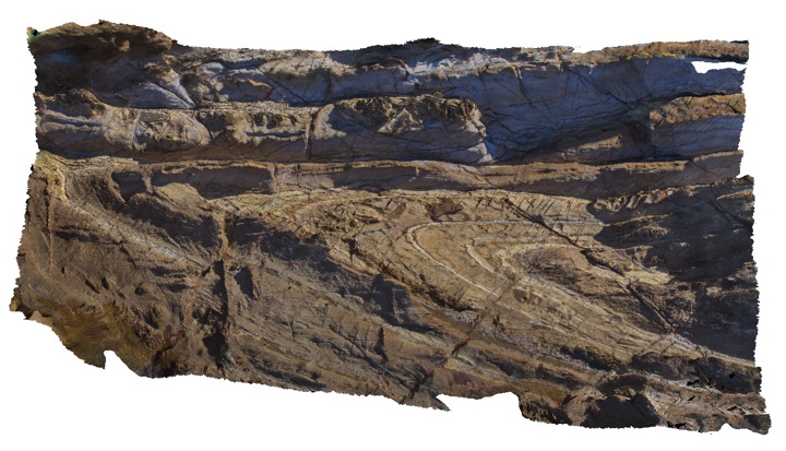
small antiform and open synform in Ordovician turbidites. Potato Point, N.S.W |
5.00 |
-36.09296000000 |
150.13853000000 |
0.000 |
folds, synform, antiform, structure |
turbidite |
PotatoPt2 Map
 |
5 |
05/18/2015 1:29 p.m. |
3D |
gently plunging antiform/synform in Ordovician turbidites. Potato Point, N.S.W |
6.00 |
-36.09311000000 |
150.13795000000 |
0.000 |
folds, anticline, syncline, structure |
turbidite |
PotatoPt3 Map
 |
5 |
05/18/2015 1:31 p.m. |
3D |
detail of cross laminations in the top of a fine sandy turbidite layer. Potato Point, N.S.W |
0.40 |
-36.09311000000 |
150.13788000000 |
0.000 |
cross bedding, sedimentology |
turbidite |