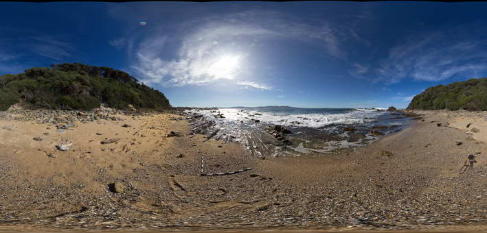
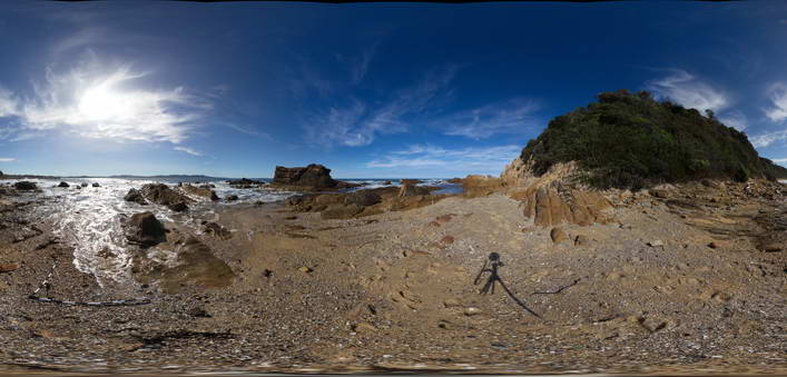
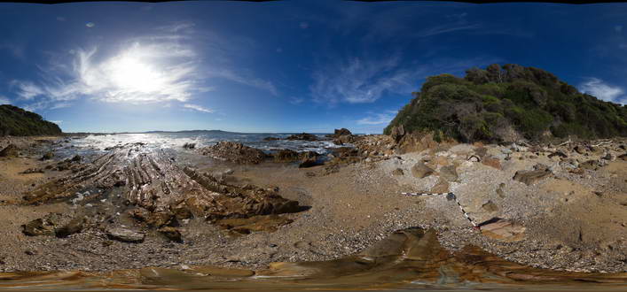
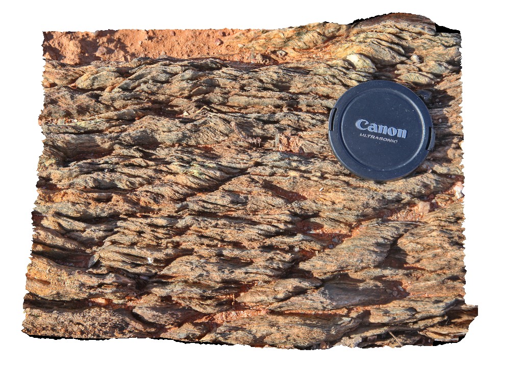
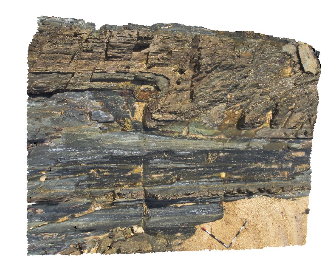
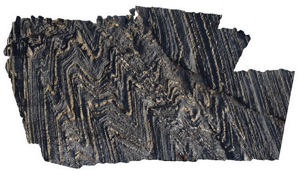
MallacootaFSP2 Map
 |
5 |
05/18/2015 2 p.m. |
FSP |
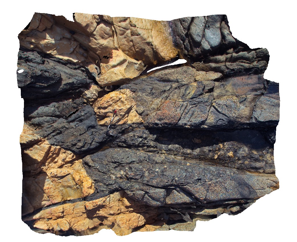
Well bedded turbidites of the Ordovician Adaminaby Group. Mallacoota, Vic. |
50.00 |
-37.57255000000 |
149.76489000000 |
1.000 |
turbidite, structure |
turbidite |
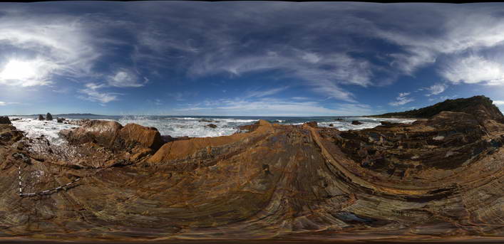
MallacootaFSP6 Map
 |
5 |
05/18/2015 2:01 p.m. |
FSP |
Well bedded turbidites of the Ordovician Adaminaby Group. Mallacoota, Vic. |
50.00 |
-37.57352000000 |
149.76544000000 |
1.000 |
turbidite, structure, sedimentology |
turbidite |
MallacootaFSP5 Map
 |
5 |
05/18/2015 2 p.m. |
FSP |
Well bedded turbidites of the Ordovician Adaminaby Group. Mallacoota, Vic. |
50.00 |
-37.57331000000 |
149.76561000000 |
1.000 |
turbidite, structure, sedimentology |
turbidite |
MallacootaFSP4 Map
 |
5 |
05/18/2015 2 p.m. |
FSP |
Well bedded turbidites of the Ordovician Adaminaby Group. Mallacoota, Vic. |
50.00 |
-37.57314000000 |
149.76550000000 |
1.000 |
turbidite |
turbidite |
MallacootaFSP3 Map
 |
5 |
05/18/2015 2 p.m. |
FSP |
Well bedded turbidites of the Ordovician Adaminaby Group. Mallacoota, Vic. |
50.00 |
-37.57290000000 |
149.76523000000 |
1.000 |
turbidite, structure |
turbidite |
MallacootaFSP7 Map
 |
5 |
05/18/2015 2:01 p.m. |
FSP |
Well bedded turbidites of the Ordovician Adaminaby Group. Mallacoota, Vic. |
50.00 |
-37.57370000000 |
149.76555000000 |
1.000 |
turbidite, structure, sedimentology |
turbidite |
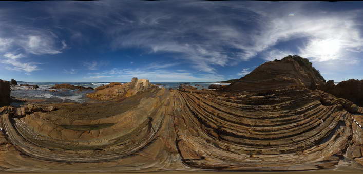
Piccaninny23 Map
 |
20 |
03/13/2015 9:06 a.m. |
3D |
well defined conjugate faults within Long Point Granodiorite and semi assimilated xenolith of Mathinna Supergroup. Piccaninny Point, eastern Tasmania. |
8.00 |
-41.69552000000 |
148.29365700000 |
3.000 |
igneous, structure, conjugate fault, assimilated |
Turbidite, Granodiorite |
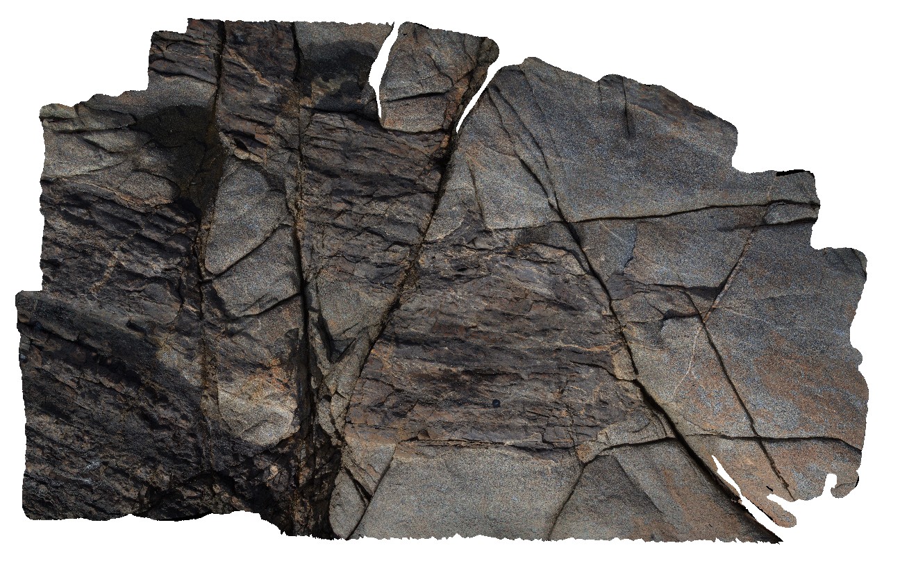
BH2014n7 Map
 |
20 |
03/17/2015 2:10 p.m. |
3D |
well developed S-C fabric in metasediment. Broken Hill, N.S.W. |
0.15 |
-31.61297855000 |
141.53056219000 |
-9999.000 |
S-C fabric, structure, metasediment |
psammite |
BH2014n6 Map
 |
20 |
03/17/2015 1:35 p.m. |
3D |
well developed S-C fabric in metasediment. Broken Hill, N.S.W. |
0.20 |
-31.61295228000 |
141.53052256000 |
-9999.000 |
S-C fabric, metasediment, structure |
metasediment |
BH2014n1 Map
 |
20 |
03/16/2015 3:03 p.m. |
3D |
well preserved small cross beds in sandstone. Broken Hill, N.S.W. |
1.00 |
-31.61947252000 |
141.56534702000 |
-9999.000 |
cross bedding, sedimentology |
sandstone |
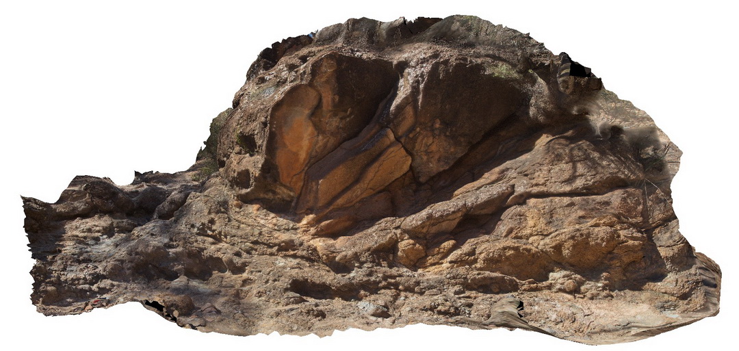
Blinman8 Map
 |
0 |
11/13/2015 8:55 p.m. |
3D |
Xenoclast (~3.4m) within carbonate breccia. Clast is layered dolomite carbonate. Parachilna Gorge Road. Blinman, S.A. |
7.00 |
-31.11336000000 |
138.65308000000 |
-9999.000 |
structure, xenoclast |
diapir |
GibbRiver13 Map
 |
0 |
06/06/2016 noon |
3D |
xenolith / boudin of porphyritic granite in foliated gabbro. Gibb River Road, near Mount Amy. W.A. |
0.80 |
-17.20688000000 |
124.91716000000 |
-9999.000 |
xenolith, gabbro |
gabbro |
Bingi7 Map
 |
5 |
06/21/2016 11:46 a.m. |
3D |
Xenolith crowded mafic dyke cross cutting granodiorite and aplite. Xenoliths include igneous and lower crustal rocks. Bingi, N.S.W. |
6.00 |
-36.01253000000 |
150.16399000000 |
1.000 |
granodiorite, aplite, xenolith, dyke, igneous |
granodiorite, Aplite, dolerite |
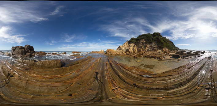
Piccaninny31 Map
 |
20 |
03/13/2015 9:07 a.m. |
3D |
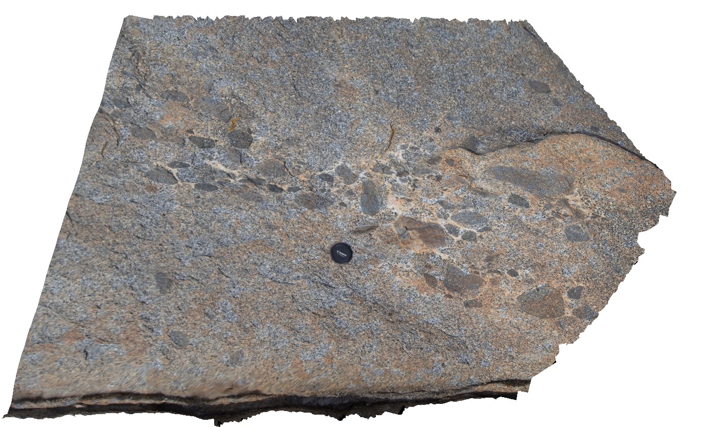
xenoliths of dark, fine grained, mafic rock in Long Point Granodiorite. Late stage more aplitic or k feldspar material around xenoliths - late melt. Pervasive bt-defined foliation within granodiorite - evidence it is a syn-orogenic granite. Tas. |
2.00 |
-41.69430300000 |
148.29438700000 |
4.000 |
xenoliths, Long Point Granodiorite, syn-orogenic |
Turbidite, Granodiorite |
Remarkable5 Map
 |
0 |
10/20/2015 3:53 p.m. |
3D |
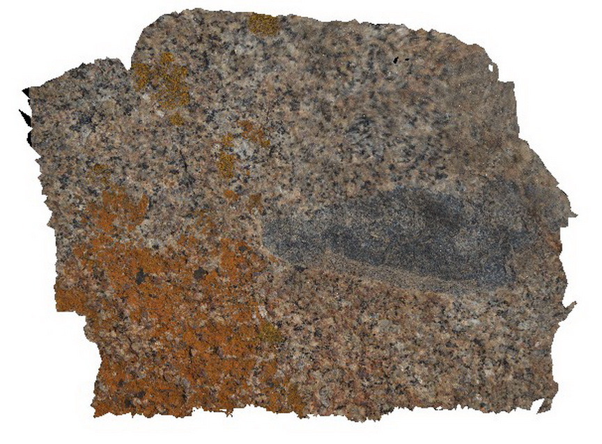
xenolith with folds in Remarkable Granite, Remarkable Rocks, Kangaroo Island. |
0.50 |
-36.04814000000 |
136.75725000000 |
-9999.000 |
xenolith, granite, folds |
granite |
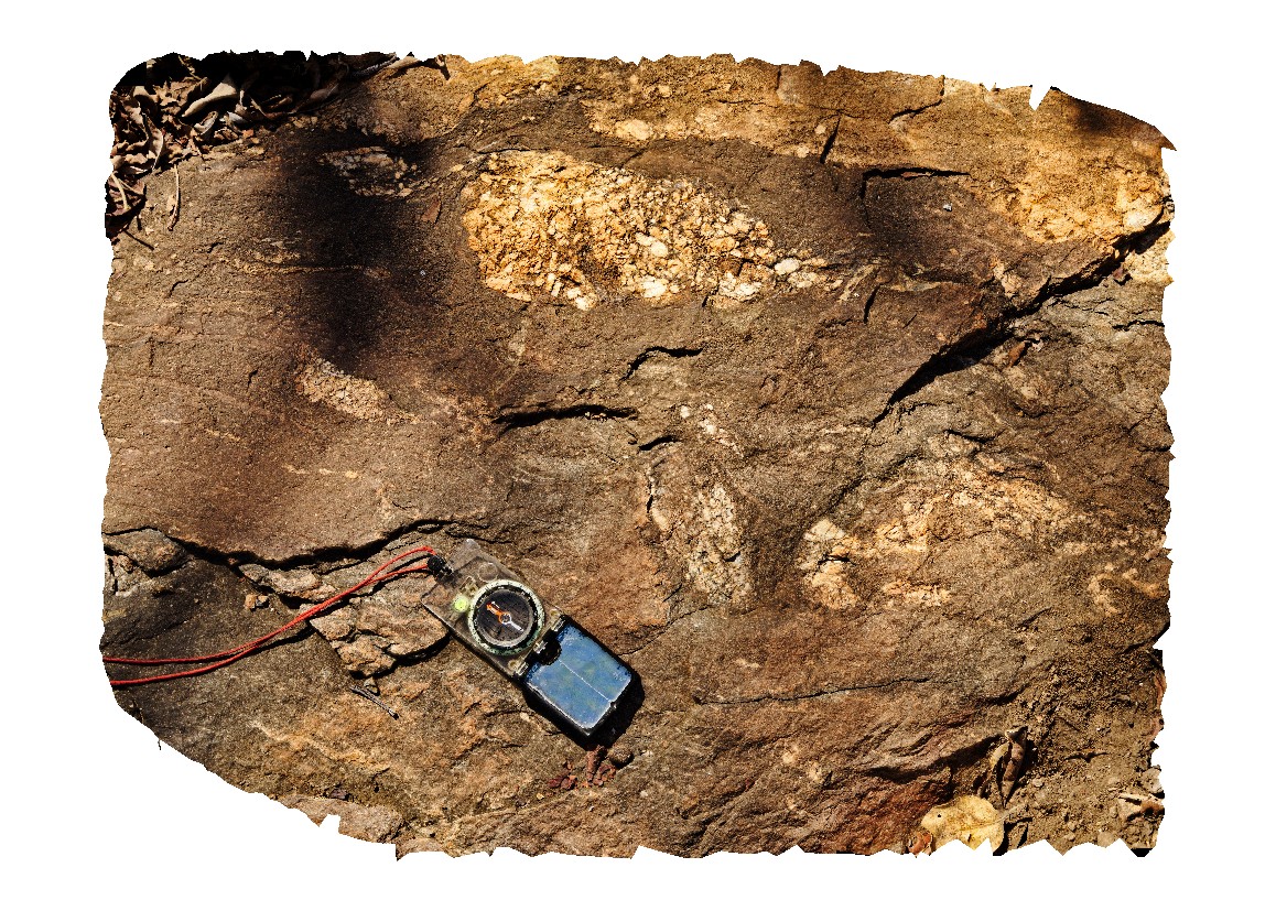
Yarrowyck1 Map
 |
5 |
06/16/2015 5:50 p.m. |
3D |
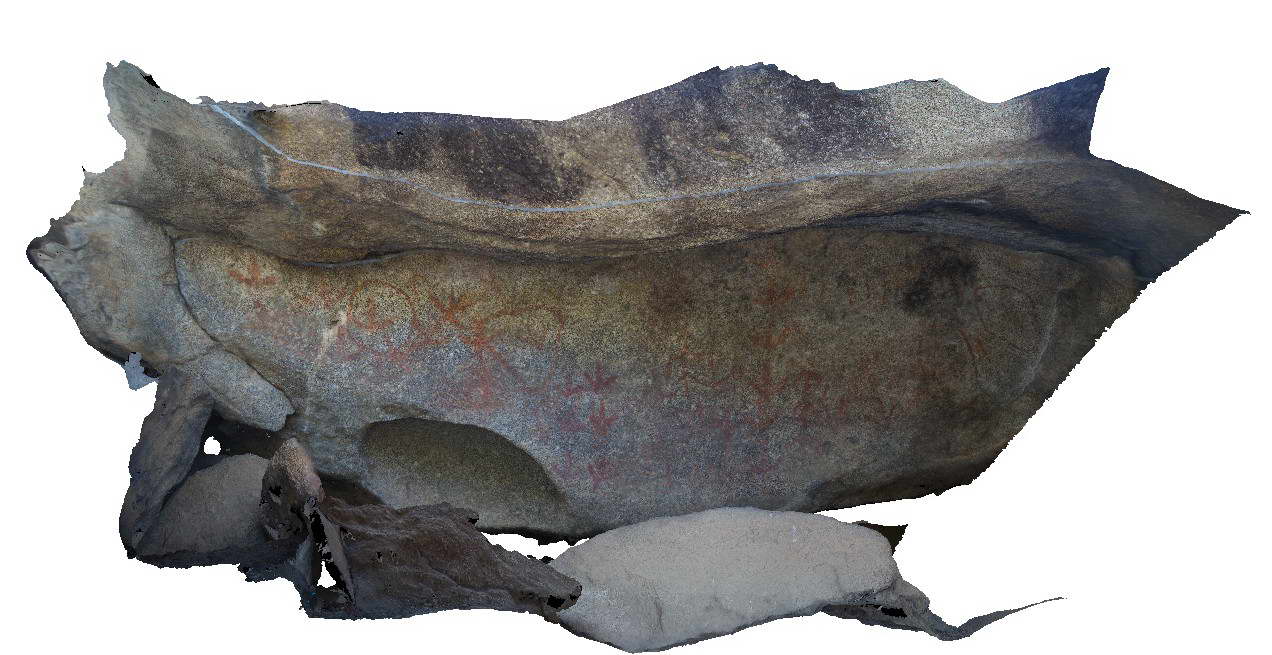
Yarrowick rock art site in granite of the Permo-Triassic Gwydir River Monzogranite. Mount Yarrowick, N.S.W. |
3.00 |
-30.45472000000 |
151.37651000000 |
900.000 |
rock art |
granite |
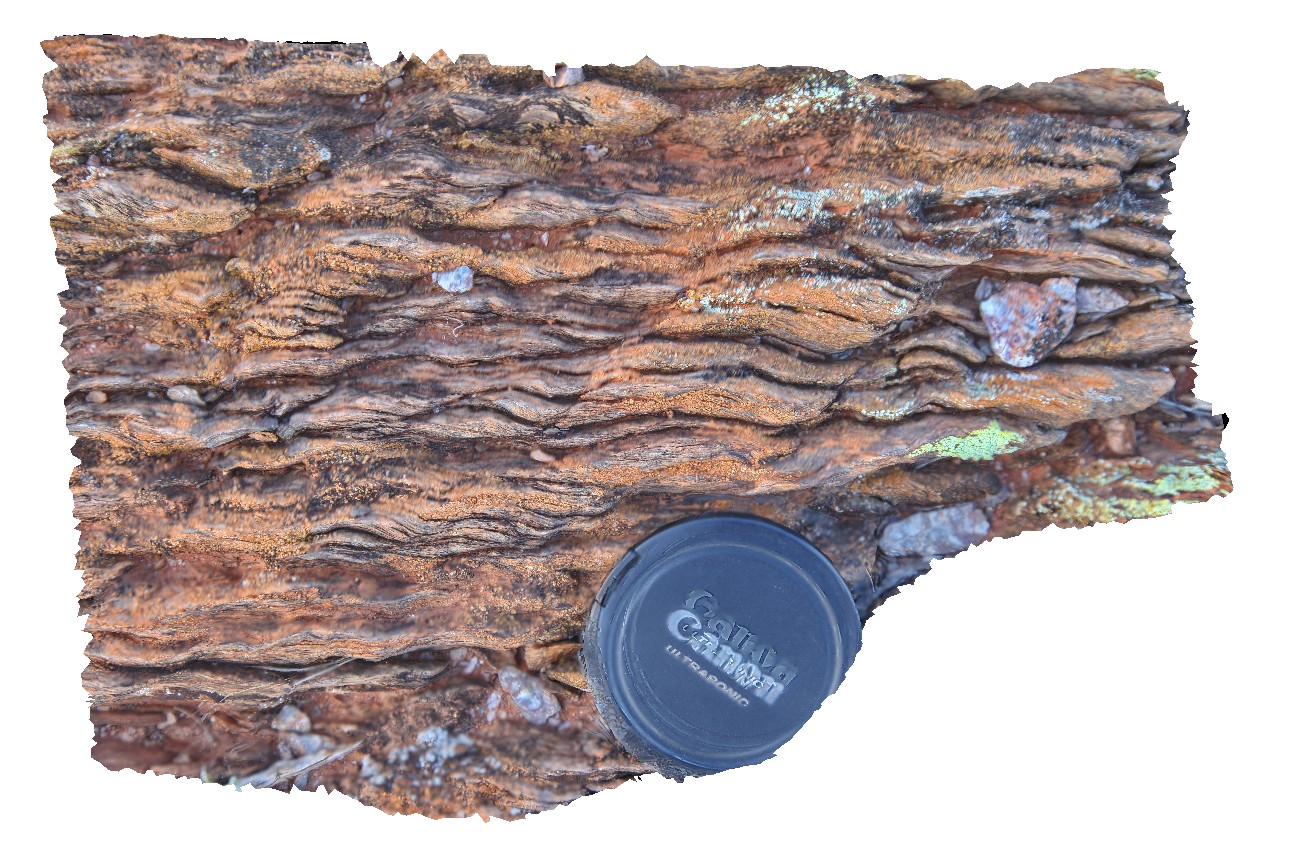
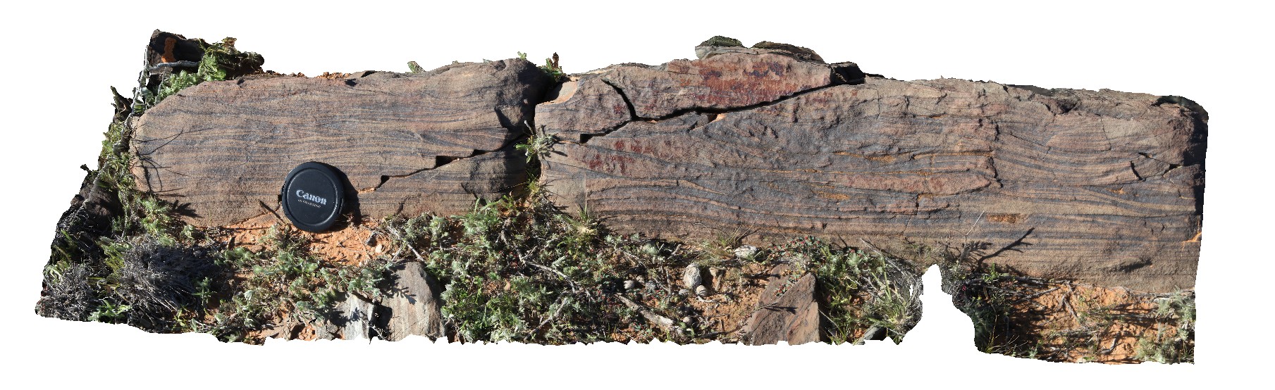
Bellingham28 Map
 |
5 |
01/01/9999 midnight |
3D |
'Z' fold in sandstone and mudstone layers of turbidites. Bellingham, NE Tasmania. |
4.00 |
-41.00823000000 |
147.16118000000 |
-9999.000 |
'Z' fold, fold, structure, turbidite, sedimentology |
turbidite |
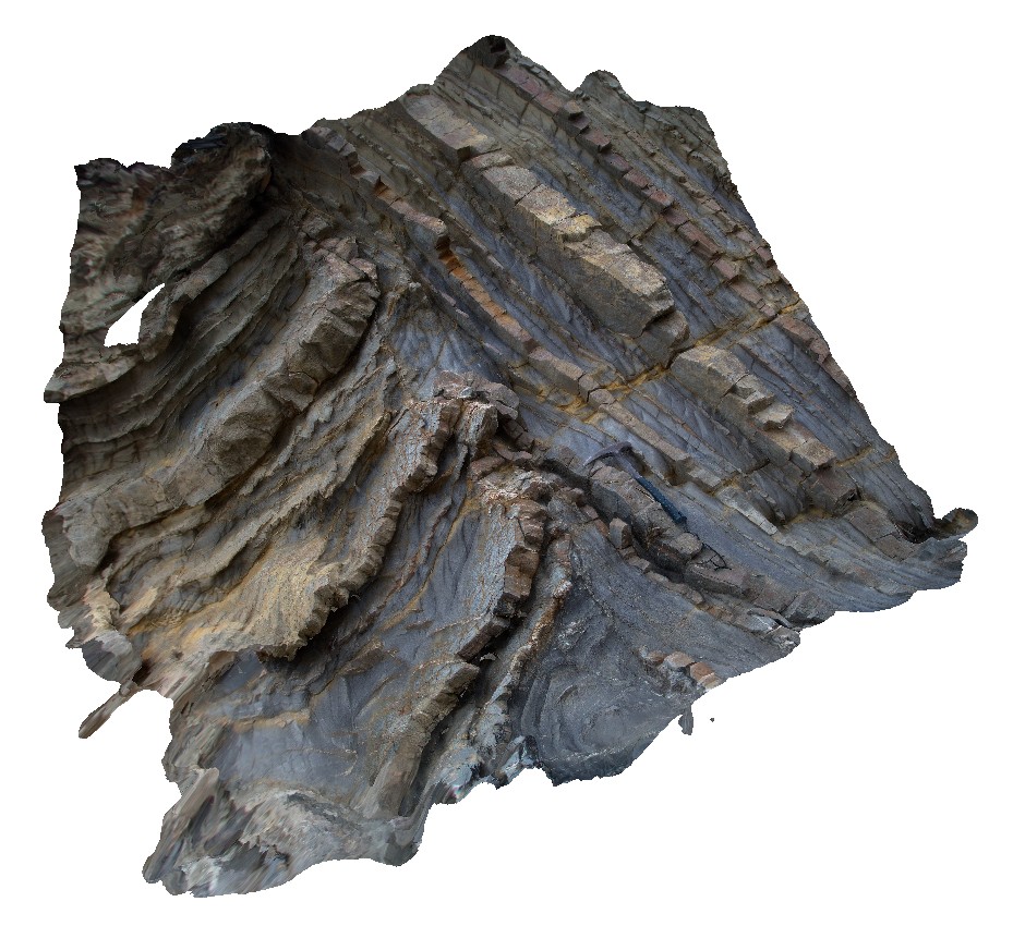
Liptrap16 Map
 |
20 |
03/13/2015 9:19 a.m. |
3D |
zone of asymmetric folding within distal turbidites. Cape Liptrap, Vic. |
2.00 |
-38.90319180000 |
145.91613787000 |
0.000 |
structure, sedimentology, fold, turbidite |
turbidite |
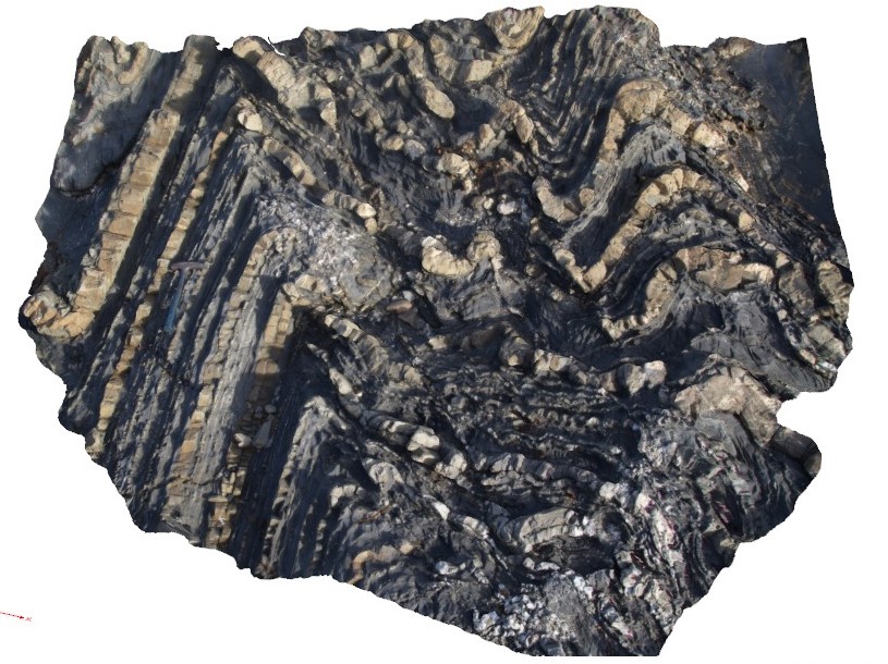
Liptrap8 Map
 |
20 |
03/13/2015 9:24 a.m. |
3D |
zone of deformation, quartz veining and folding, showing asymmetrical folding in finely bedded distal turbidites. Cape Liptrap, Vic. |
3.00 |
-38.90412340000 |
145.91723000000 |
0.000 |
fold, turbidite, sedimentology |
turbidite |
Liptrap15 Map
 |
20 |
03/13/2015 9:19 a.m. |
3D |
zone of intense folding within distal turbidites. Cape Liptrap, Vic. |
6.00 |
-38.90319550000 |
145.91621653000 |
0.000 |
turbidite, sedimentology, structure, fold |
turbidite |
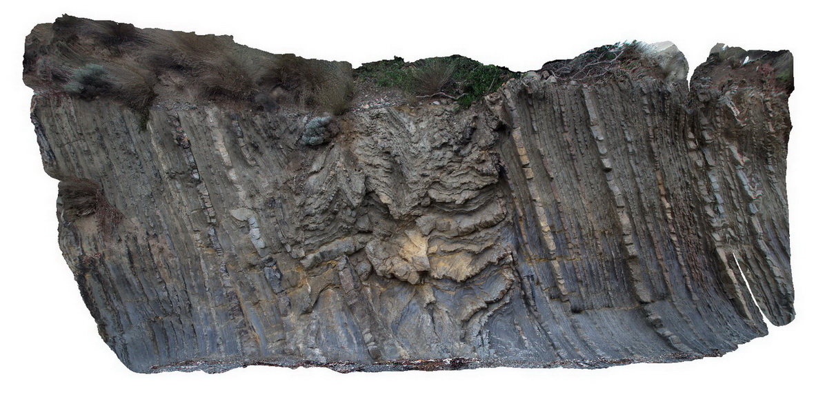
Liptrap5 Map
 |
20 |
03/13/2015 9:22 a.m. |
3D |
zone of structural deformation, showing faulting of finely bedded distal turbidites. Cape Liptrap, Vic. |
10.00 |
-38.90400517000 |
145.91716871000 |
0.000 |
structure, fold, turbidite, sedimentology |
turbidite |