Pedder10 Map
 |
5 |
05/04/2016 11:11 a.m. |
3D |
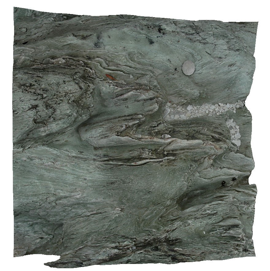
moderately plunging, asymmetric parasitic folds. Lake Pedder, south west Tasmania. |
0.45 |
-42.84908871000 |
146.10443679000 |
-9999.000 |
asymmetric fold, fold, fold hinge, plunging fold, structure |
phyllite |
Pedder11 Map
 |
5 |
05/04/2016 12:04 p.m. |
3D |
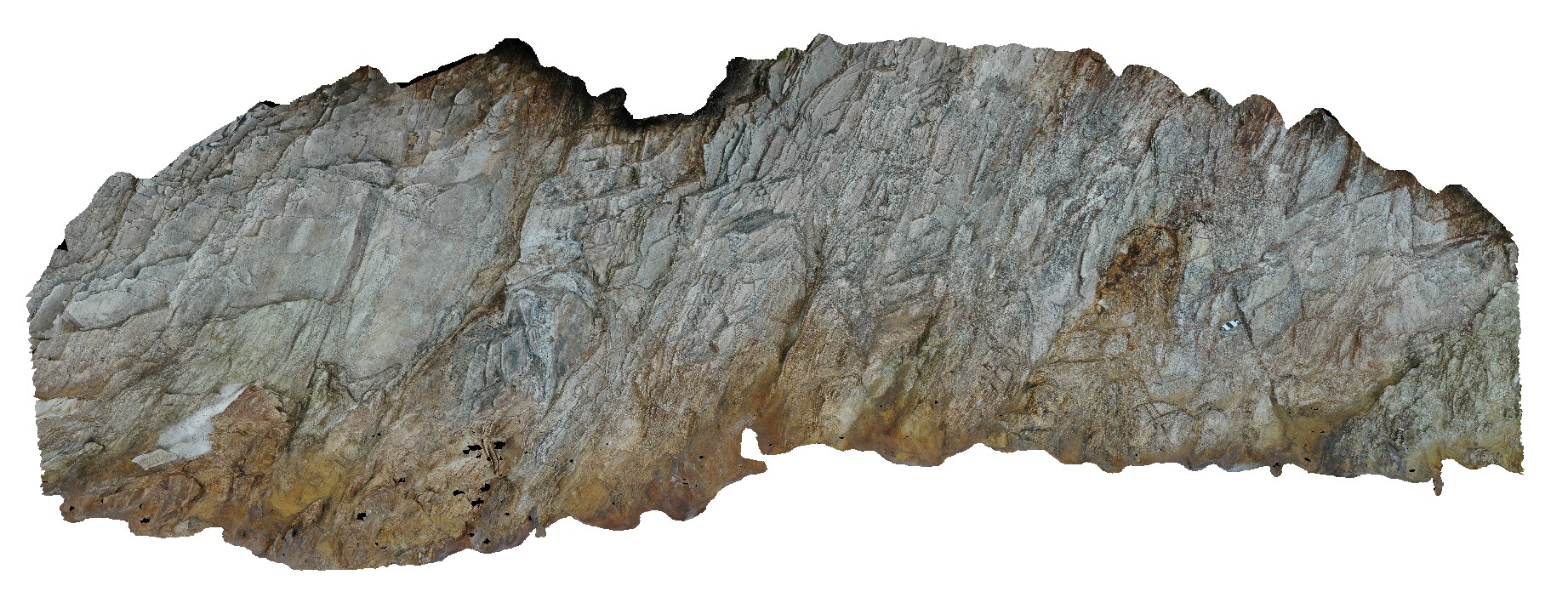
moderately plunging, inclined, asymmetric parasitic folds in quartzite. Lake Pedder, south west Tasmania. |
2.50 |
-42.84902711000 |
146.10461774000 |
-9999.000 |
asymmetric folds, parasitic fold, fold plunge, overturned fold, structure |
quartzite |
Pedder7 Map
 |
5 |
04/07/2016 1:16 p.m. |
3D |
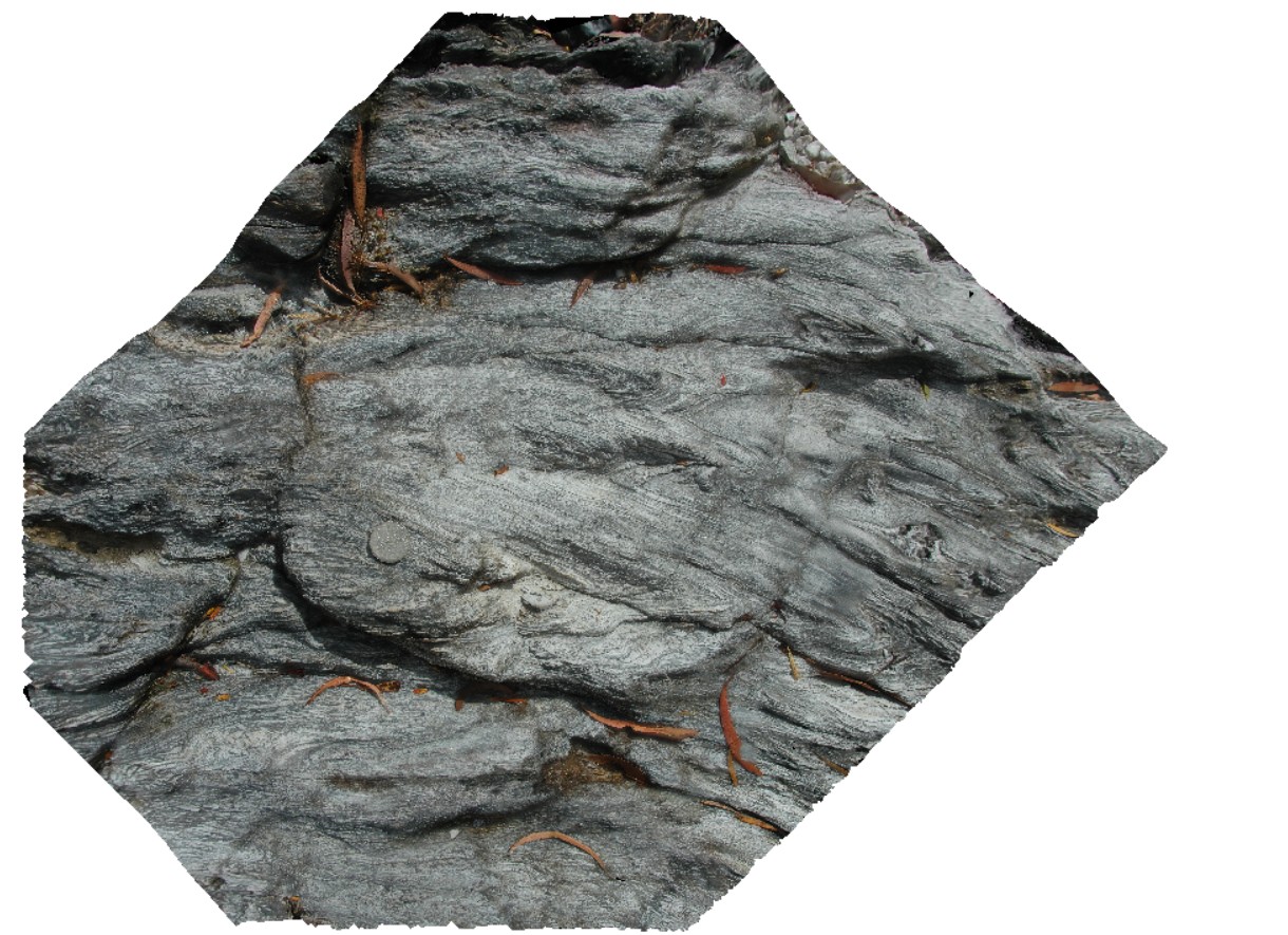
small-scale chevron folding in thinly laminated quartzite. Lake Pedder, south west Tasmania. |
0.70 |
-42.84900708000 |
146.11393893000 |
-9999.000 |
chevron folding, fold, structure |
quartzite |
Pedder15 Map
 |
5 |
05/05/2016 1:01 p.m. |
3D |
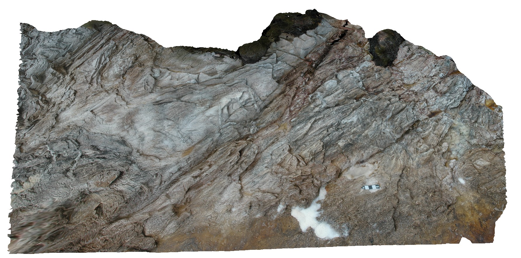
open parasitic folds in quartzite. Lake Pedder, south west Tasmania. |
1.20 |
-42.84895071000 |
146.10478655000 |
-9999.000 |
open fold, fold, structure, quartzite |
quartzite |
Pedder1 Map
 |
5 |
04/29/2016 11:45 a.m. |
3D |
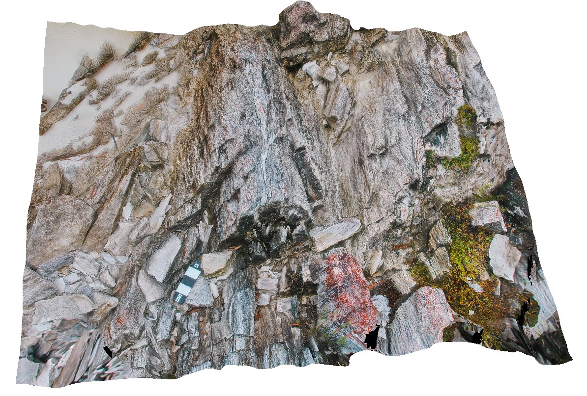
gently plunging fold hinge in Precambrian quartzite, with quartz veins. Lake Pedder, south west Tasmania. |
0.45 |
-42.84893657000 |
146.11540272000 |
-9999.000 |
fold plunge, fold, open fold, structure, quartzite |
quartzite |
Pedder14 Map
 |
5 |
03/16/2015 2:27 p.m. |
3D |
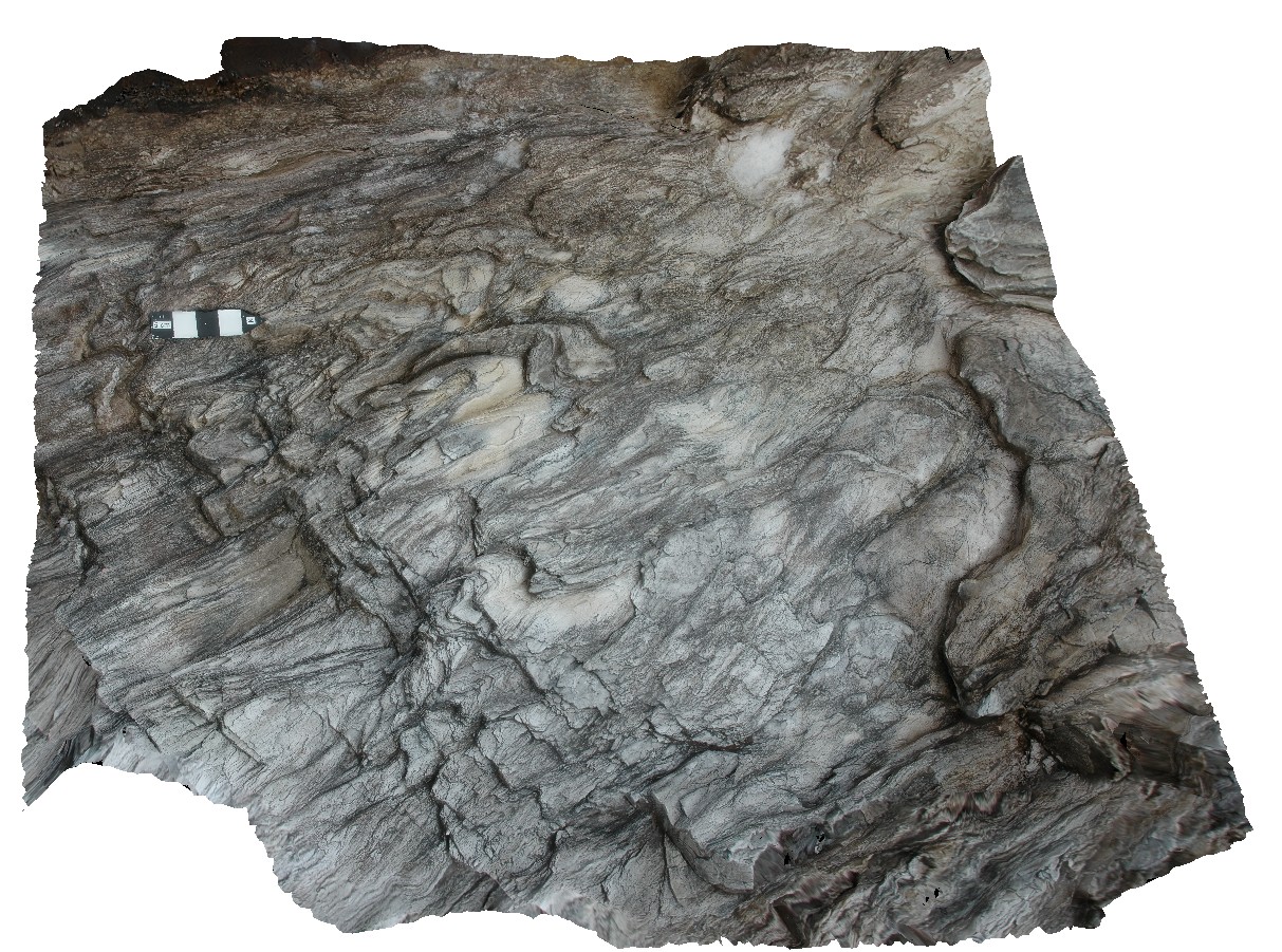
gently plunging, parasitic folds in phyllite. Lake Pedder, south west Tasmania. |
0.25 |
-42.84891061000 |
146.10477646000 |
-9999.000 |
parasitic fold, gently plunging, fold plunge, fold, structure, phyllite |
phyllite |
Pedder13 Map
 |
5 |
03/16/2015 2:26 p.m. |
3D |
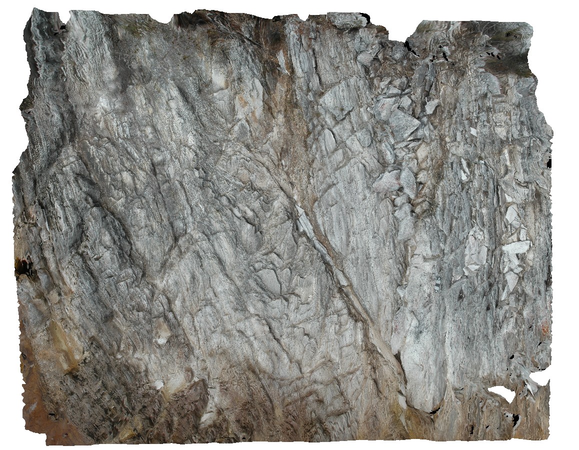
fault cutting folded quartzite. Lake Pedder, south west Tasmania. |
0.00 |
-42.84890616000 |
146.10493121000 |
-9999.000 |
fault, fold, structure, quartzite |
quartzite |
Pedder12 Map
 |
5 |
05/04/2016 12:38 p.m. |
3D |
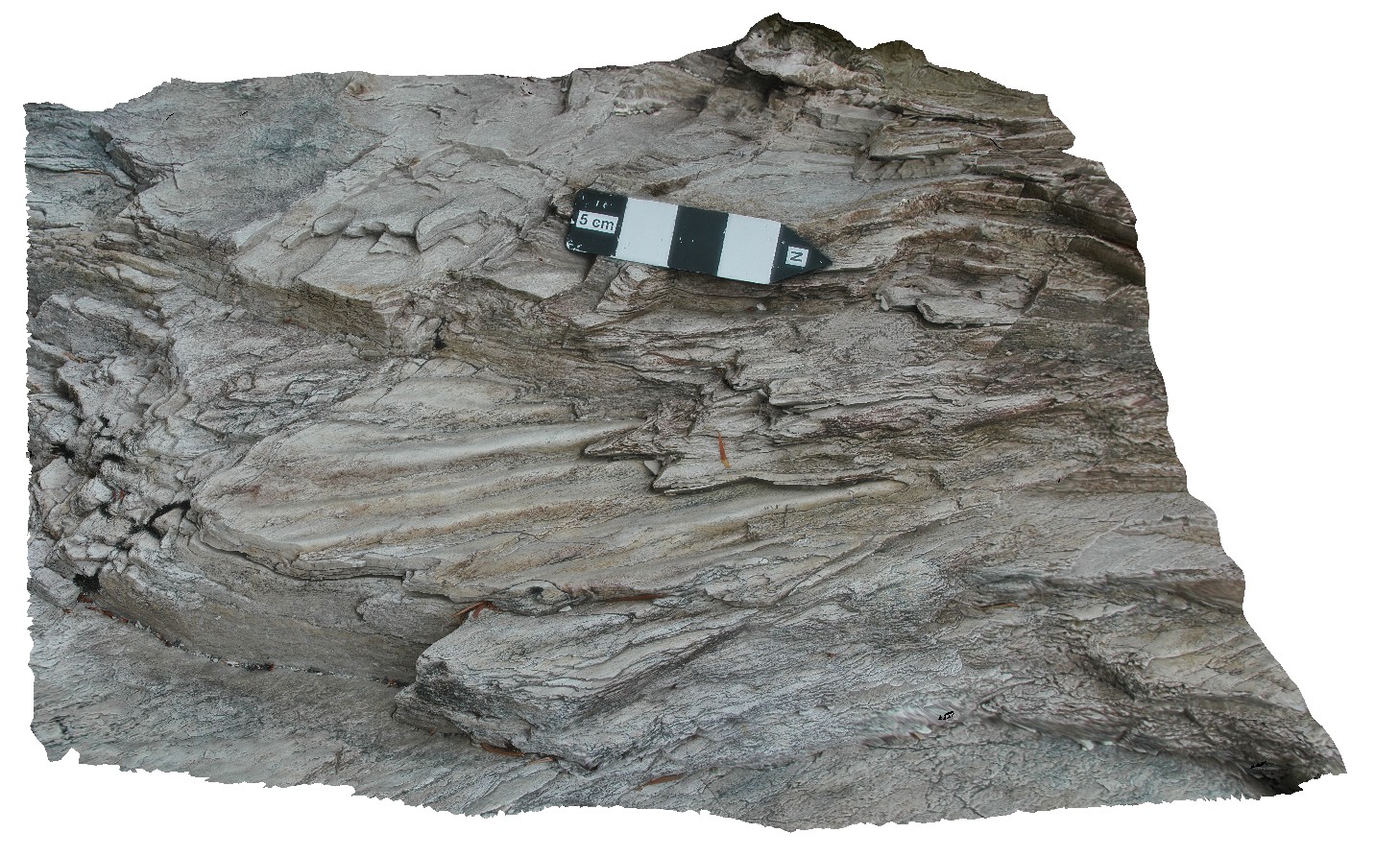
preserved ripple marks in bedded, folded quartzite. Lake Pedder, south west Tasmania. |
7.75 |
-42.84887512000 |
146.10483247000 |
-9999.000 |
ripple mark, fold, structure, quartzite |
quartzite |
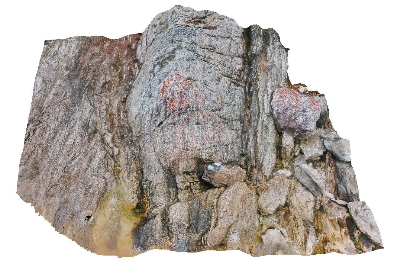
Pedder2 Map
 |
5 |
04/29/2016 11:49 a.m. |
3D |
gently plunging open fold in Precambrian quartzite. Lake Pedder, south west Tasmania. |
0.55 |
-42.84874629000 |
146.11562709000 |
-9999.000 |
Precambrian, fold, open fold, structure |
quartzite |
Pedder3 Map
 |
0 |
04/29/2016 11:50 a.m. |
3D |
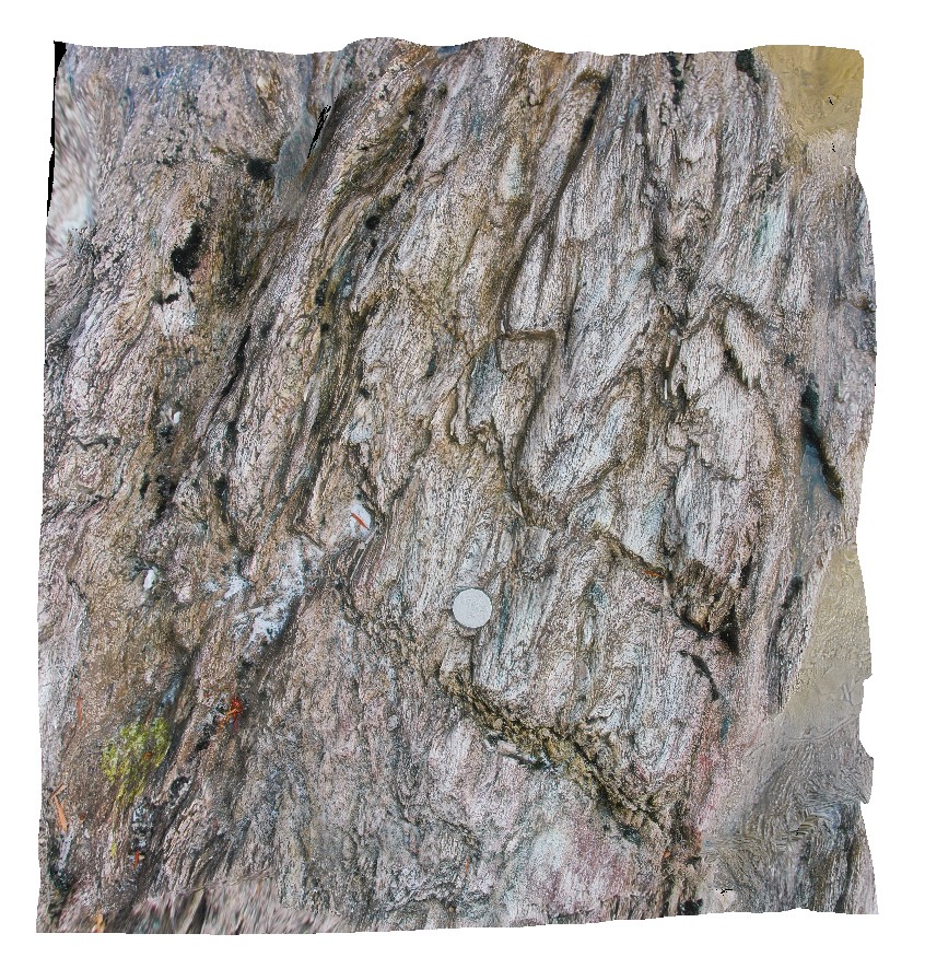
gently plunging, multiple parasitic fold hinges. Lake Pedder, south west Tasmania. |
0.70 |
-42.84856842000 |
146.11586429000 |
-9999.000 |
parasitic fold hinge, fold plunge, fold, structure |
quartzite |
Pedder4 Map
 |
5 |
05/04/2016 10:29 a.m. |
3D |
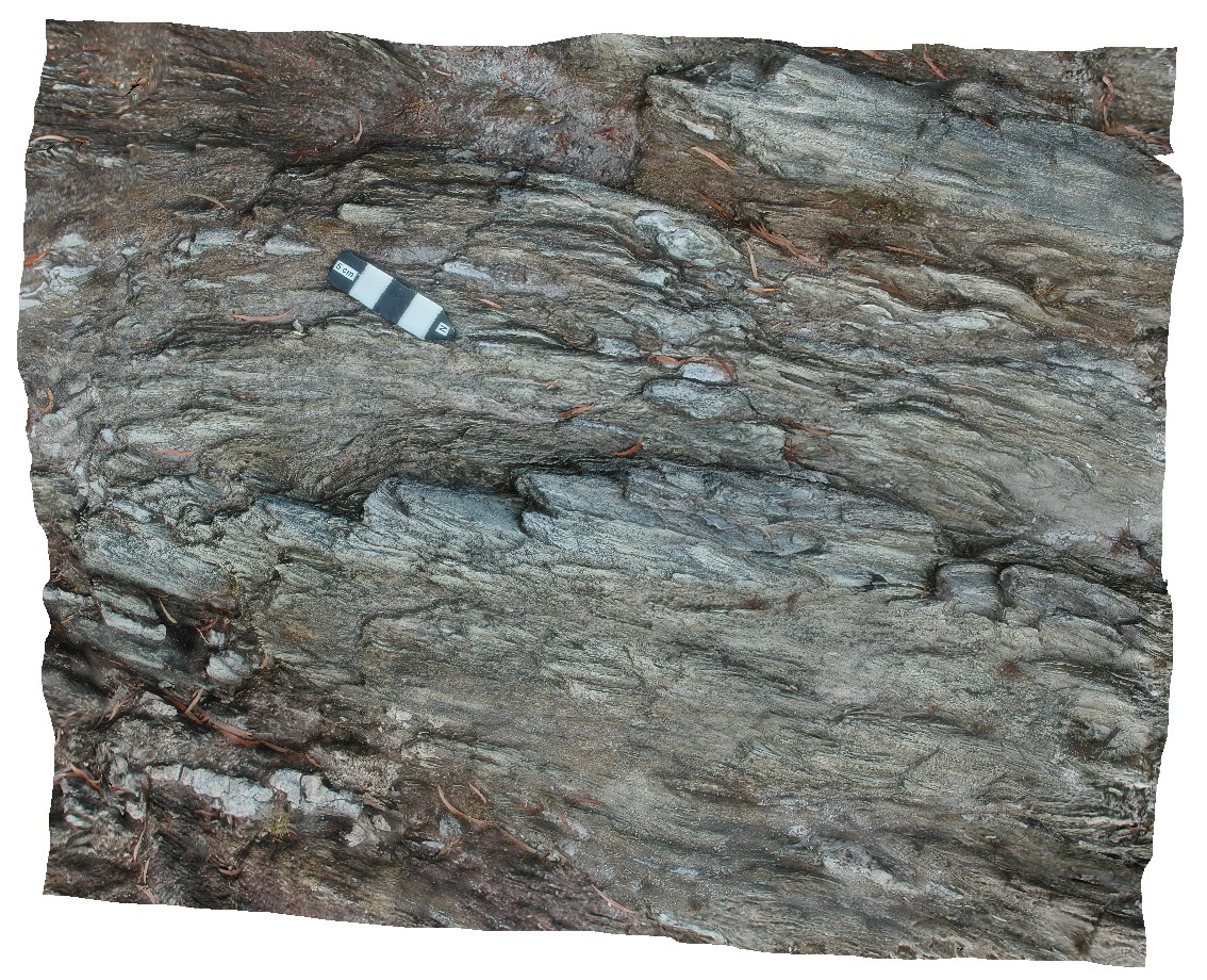
gently plunging, upright to overturned parasitic folds in quartzite with stretched and deformed quartz vein. Lake Pedder, south west Tasmania. |
0.25 |
-42.84854550000 |
146.11601940000 |
-9999.000 |
parasitic fold, fold, structure |
quartzite |
Pedder29 Map
 |
5 |
05/04/2016 10:14 a.m. |
3D |
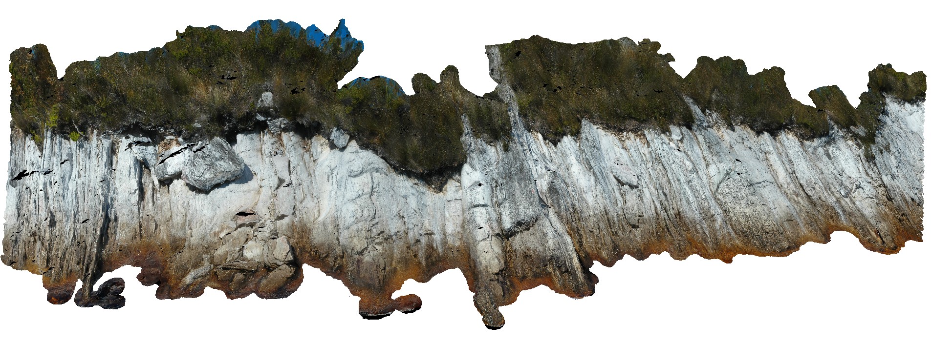
view of shore exposure of quartzite sediments along Lake Pedder, showing plunging, upright folds. Lake Pedder, south west Tasmania. |
22.00 |
-42.84673300000 |
146.09027980000 |
-9999.000 |
folding, upright fold, structure, quartzite |
quartzite |
Pedder28 Map
 |
5 |
03/16/2015 2:29 p.m. |
3D |
upright to slightly inclined, open to tight folds in layered quartzite. Lake Pedder, south west Tasmania. |
5.00 |
-42.84637281000 |
146.08904307000 |
-9999.000 |
fold geometry, upright fold, inclined fold, open fold, tight fold, structure |
quartzite |
GordonRdUAV1 Map
 |
20 |
02/23/2016 9:18 a.m. |
UAV |
view of polyharmonic folding quartzite and phyllite beds, Gordon Dam Road, Tasmania. |
6.00 |
-42.81057000000 |
146.09669000000 |
-9999.000 |
polyharmonic folding, quartzite, deformation |
phyllite |
GordonRd10 Map
 |
0 |
02/29/2016 1:41 p.m. |
3D |
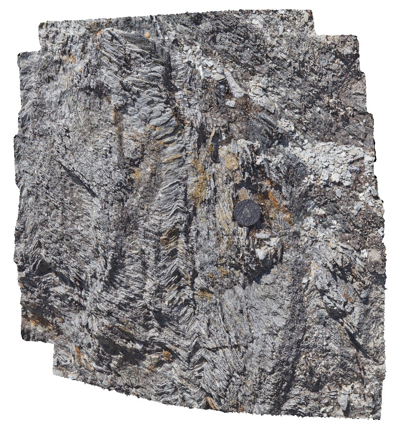
detail of small-scale kinks and associated crenulation cleavage in phyllites. Gordon Dam road. Tasmania. |
0.50 |
-42.81057000000 |
146.09669000000 |
-9999.000 |
crenulation cleavage, chevron folds, phyllite, structure |
phyllite |
GordonRd9 Map
 |
0 |
02/29/2016 1:41 p.m. |
3D |
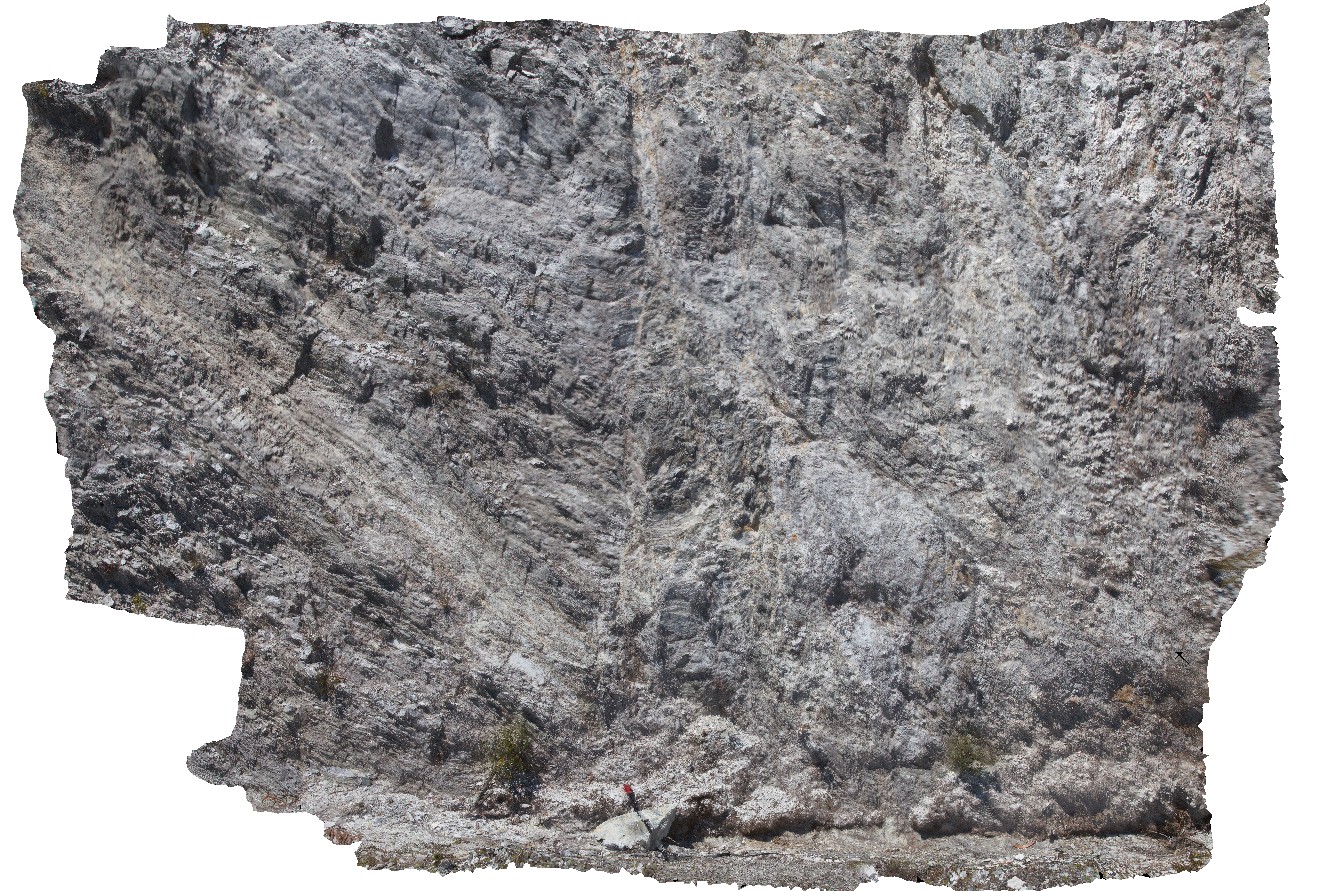
folded and faulted phyllite with crenulation of cleavage. Gordon Dam. Tasmania. |
4.00 |
-42.81057000000 |
146.09669000000 |
-9999.000 |
crenulation cleavage, folding, phyllite, fault, structure |
phyllite |
StyxRd4 Map
 |
0 |
02/23/2016 9:30 a.m. |
3D |
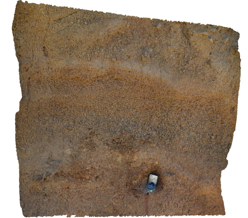
view of fine talus with clear rhythmic layering and graded bedding. Talus is monomict and derived from Permian siltstone. Styx road, Tasmania. |
0.60 |
-42.80716000000 |
146.59270000000 |
-9999.000 |
talus, graded bedding, rhythmic bedding |
talus |
StyxRd3 Map
 |
0 |
02/23/2016 9:30 a.m. |
3D |
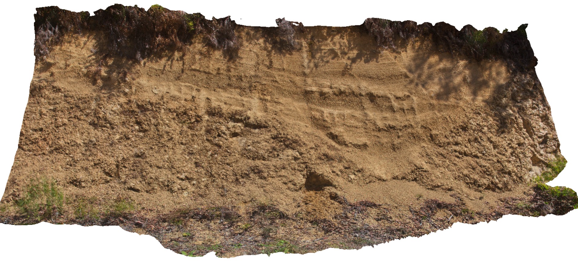
View of infilled paleogully. Fine scree, derived from Permian sandstone over Permian sandstone outcrop. Styx Road, Tasmania. |
0.00 |
-42.80680000000 |
146.59299000000 |
-9999.000 |
paleo horizons, paleo gully |
scree |
StyxRd1 Map
 |
0 |
02/23/2016 9:29 a.m. |
3D |
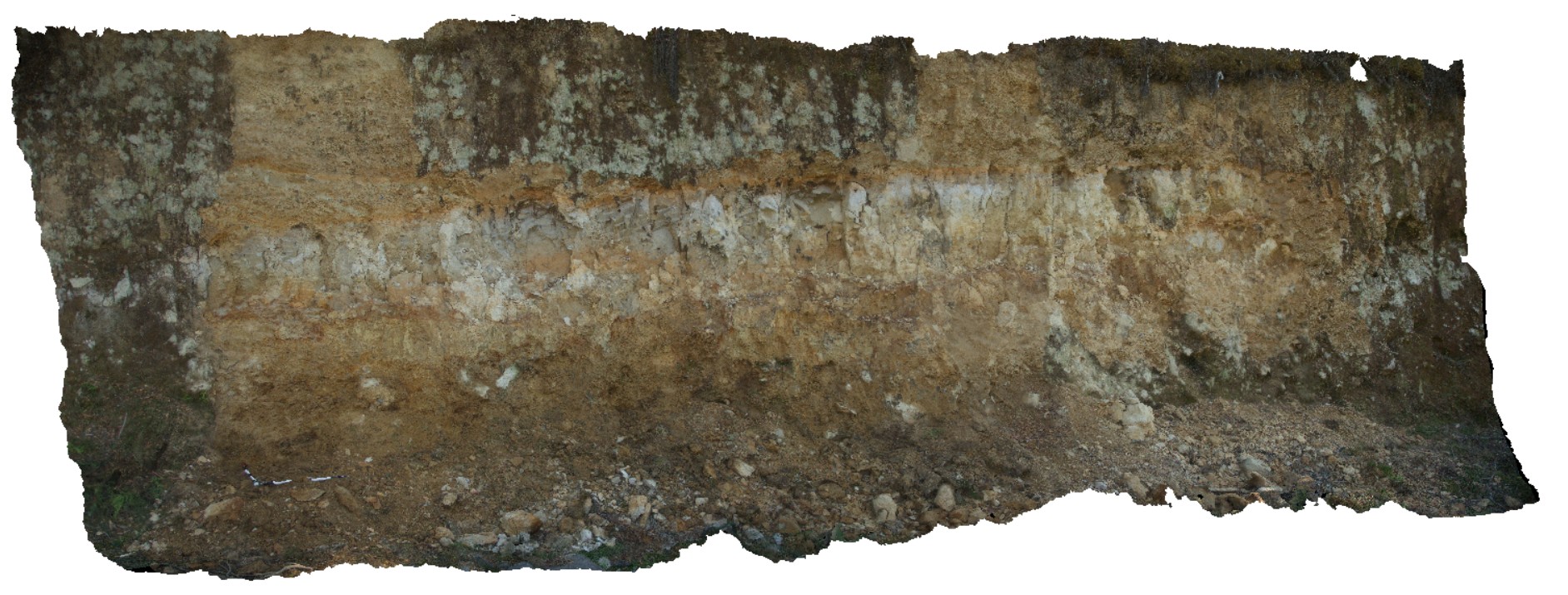
regolith profile, showing fine colluvial scree overlying silty-clay (aeolian), overlying coarser colluvial sediments. Styx road, Tasmania. |
7.00 |
-42.80639000000 |
146.59326000000 |
-9999.000 |
colluvium, scree |
scree |
StyxRd2 Map
 |
0 |
02/23/2016 9:29 a.m. |
3D |
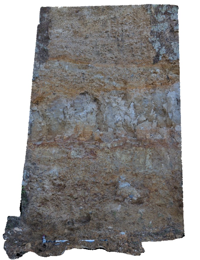
detail of location StyxRd1, showing regolith profile; fine colluvial scree overlying silty-clay (aeolian), overlying coarser colluvial sediments. Styx road, Tasmania. |
2.50 |
-42.80639000000 |
146.59326000000 |
-9999.000 |
colluvium |
scree |
GordonRd12 Map
 |
0 |
02/29/2016 1:42 p.m. |
3D |
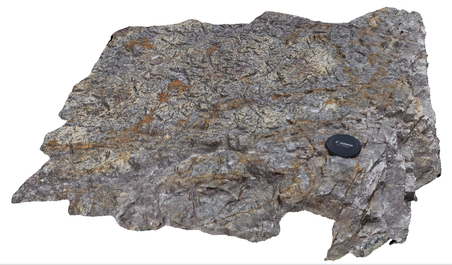
detail of psuedomorphs on bedding plane from image GordonRd11. Tasmania. |
0.60 |
-42.79335000000 |
146.39572000000 |
-9999.000 |
psuedomorphs, bedding plane |
sandstone |
GordonRd13 Map
 |
0 |
02/29/2016 11:20 a.m. |
3D |
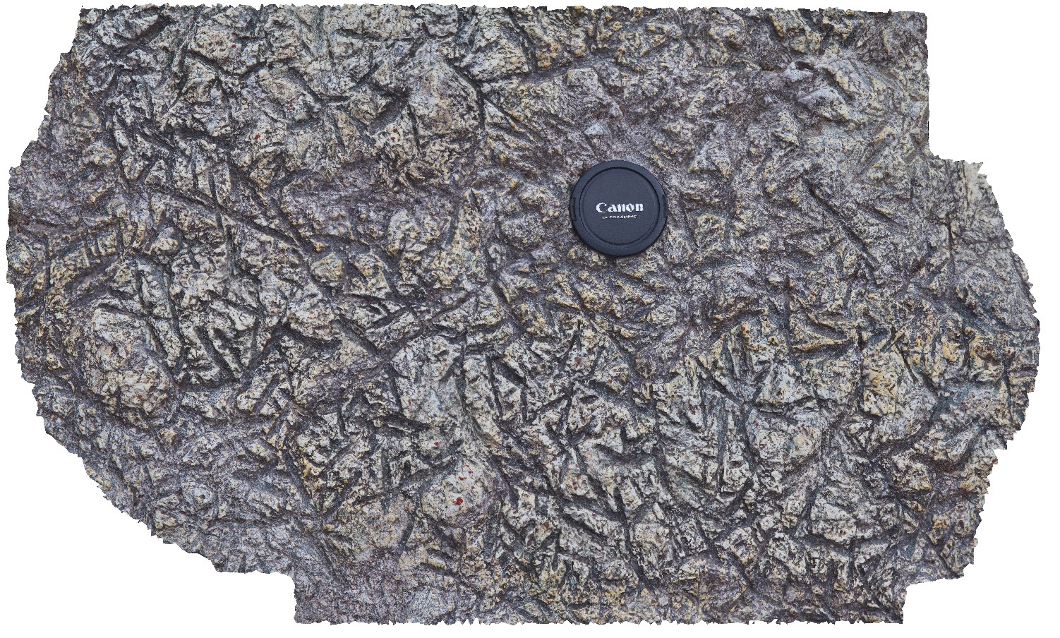
detail of psuedomorphs on bedding plane from image GordonRd11. Gordon Dam, Tasmania. |
0.30 |
-42.79327000000 |
146.39574000000 |
-9999.000 |
psuedomorphs, bedding plane |
sandstone |
MaynesJct3 Map
 |
5 |
02/23/2016 9:25 a.m. |
3D |
detail of location MaynesJct1, showing banded regolith. Styx road, Tasmania. |
3.00 |
-42.77855000000 |
146.59097000000 |
-9999.000 |
regolith |
regolith |
MaynesJct2 Map
 |
0 |
02/23/2016 9:25 a.m. |
3D |
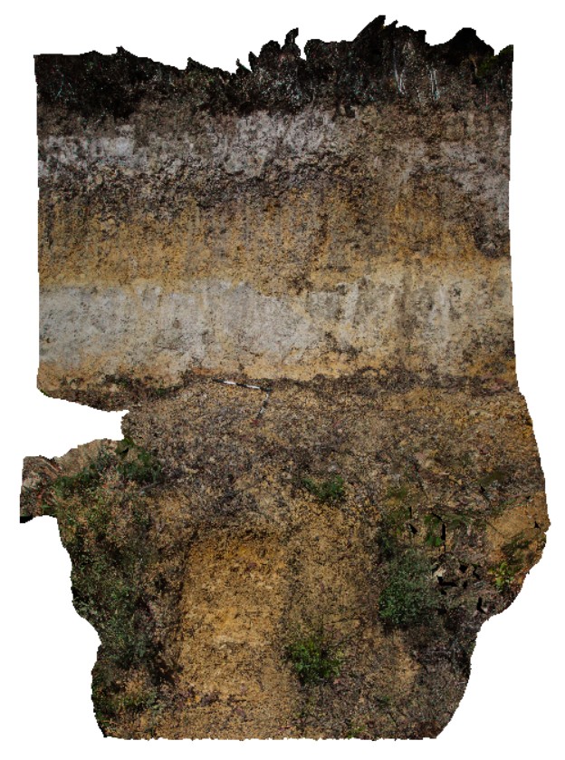
detail of location MaynesJct1, showing middle of image of banded regolith profile. Styx road, Tasmania. |
4.00 |
-42.77855000000 |
146.59097000000 |
-9999.000 |
regolith |
silt |
MaynesJct1 Map
 |
0 |
02/23/2016 9:24 a.m. |
3D |
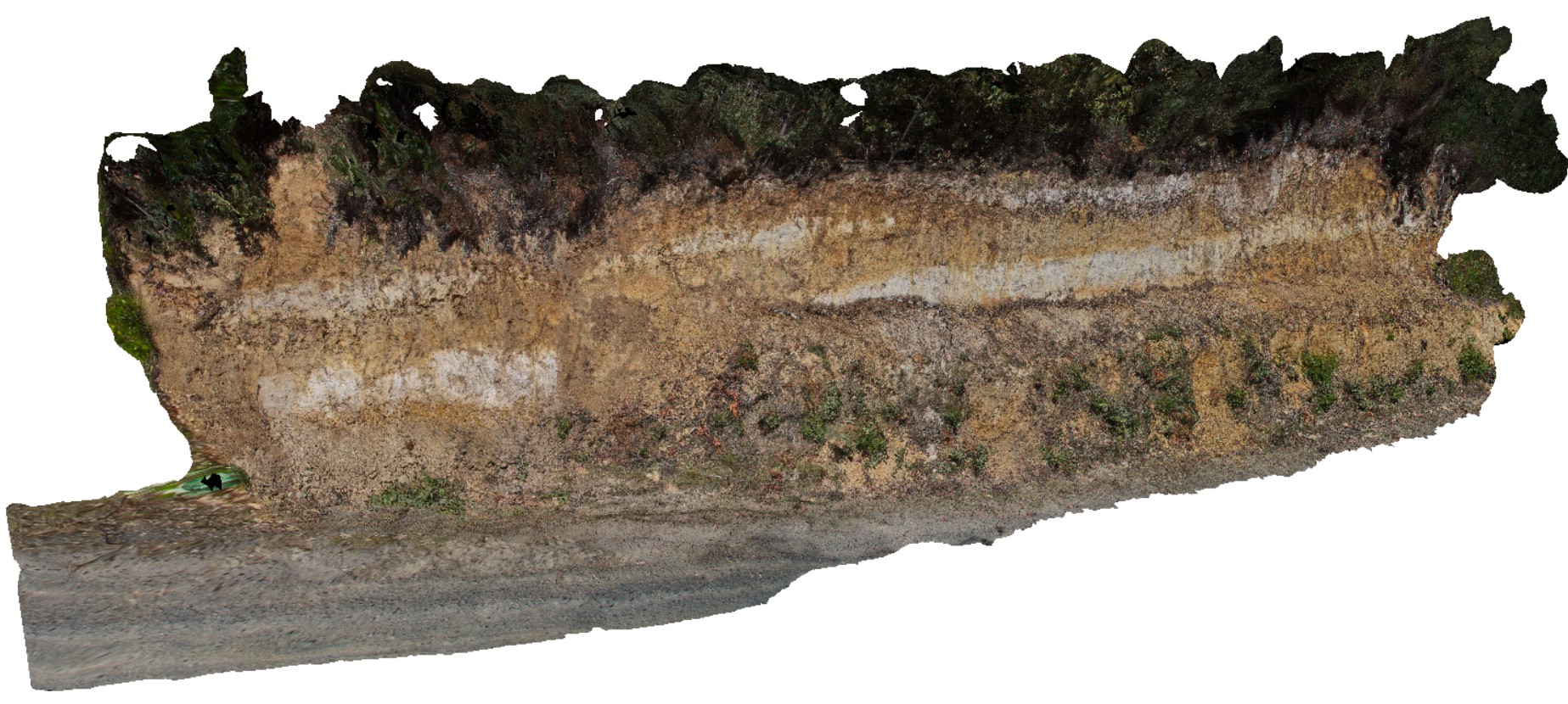
road cutting showing regolith profile with alternating white and brown layers. Styx road, Tasmania. |
10.00 |
-42.77855000000 |
146.59097000000 |
-9999.000 |
regolith profile, weathering |
silt |


