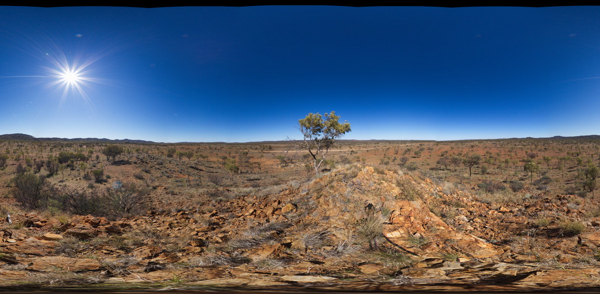
LimebayUAV2 Map
 |
20 |
01/01/9999 midnight |
UAV |
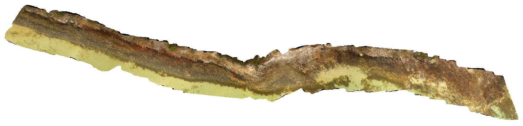
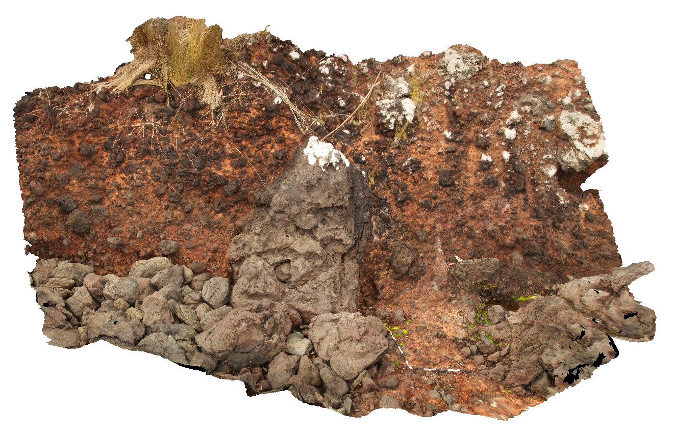
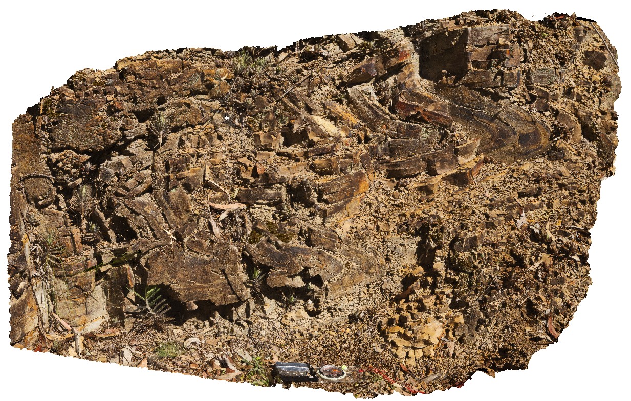
overview of basaltic dyke and volcanic breccia. Lime Bay, Tas. |
36.00 |
-42.94087600000 |
147.69450600000 |
10.000 |
dyke, volcanic breccia, Tertiary Basalt |
basalt |
IronstonePtUAV1 Map
 |
20 |
01/01/9999 midnight |
UAV |
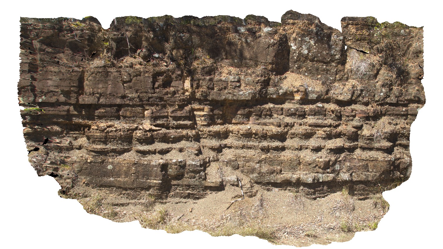
aerial view around Ironstone Point and basaltic flows and associated volcanics. Ironstone Point. Tasmania. |
200.00 |
-42.97061200000 |
147.73363000000 |
35.300 |
basalt flow, basalt, volcanics |
basalt |
Ironstone1 Map
 |
5 |
01/01/9999 midnight |
3D |
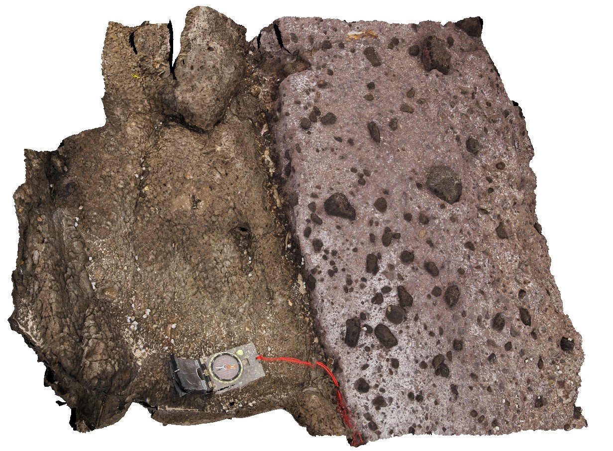
contact between basalt and overlying pyroclastic with bombs up to 0.3m across. Ironstone Point, Tas. |
0.00 |
-42.97108000000 |
147.73396000000 |
-9999.000 |
basalt, pyroclastics, volcanics |
basalt |
Ironstone2 Map
 |
5 |
01/01/9999 midnight |
3D |
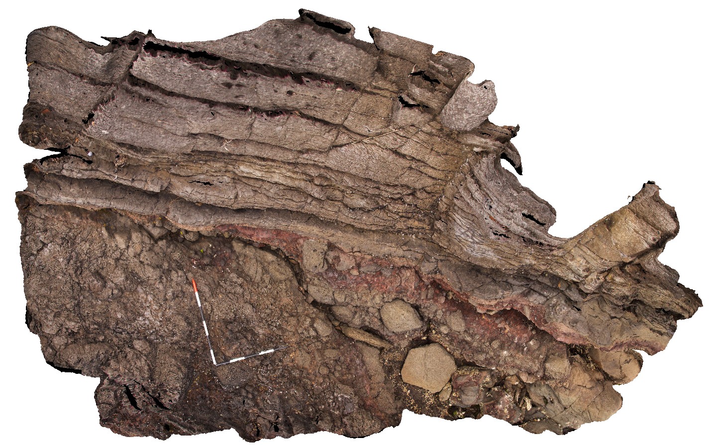
detail of basalt contact from site IronstonePt1, with overlying pyroclastics. Ironstone Point, Tas. |
0.00 |
-42.97108000000 |
147.73396000000 |
-9999.000 |
basalt, pyroclastic, volcanics |
basalt |
Ironstone3 Map
 |
5 |
01/01/9999 midnight |
3D |
contact between basalt and underlying volcanic breccia. Ironstone Point, Tas. |
0.00 |
-42.97063000000 |
147.73338000000 |
-9999.000 |
basalt lava, volcanic breccia, volcanics |
basalt |
Ironstone4 Map
 |
5 |
01/01/9999 midnight |
3D |
detail of contact between basalt and underlying volcanic breccia from site IronstonePt3. Ironstone Point, Tas. |
0.00 |
-42.97063000000 |
147.73338000000 |
-9999.000 |
basalt, lava, volcanics, Tertiary basalt, geological contact |
basalt |
Ironstone5 Map
 |
5 |
01/01/9999 midnight |
3D |
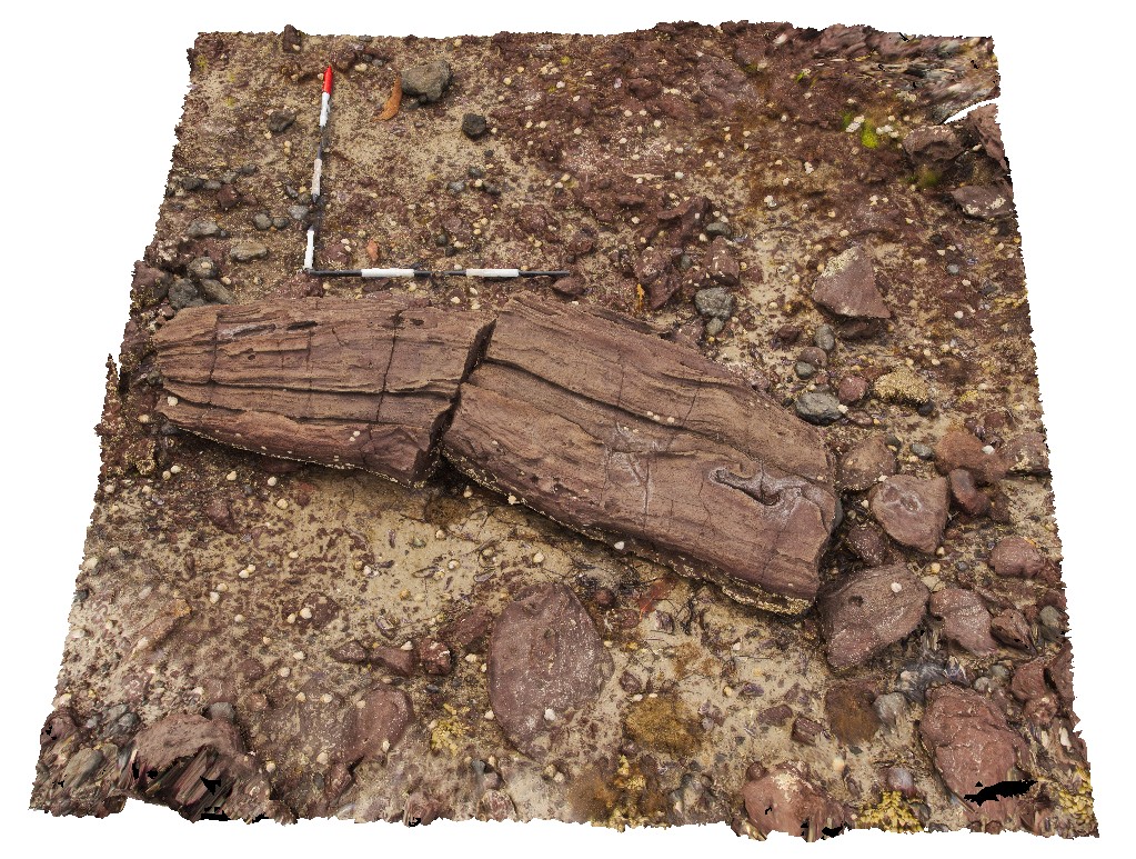
giant bomb in pyroclastic deposits. Ironstone Point, Tas. |
0.00 |
-42.97054000000 |
147.73294000000 |
-9999.000 |
pyroclastic, basalt, volcanics, bomb, Tertiary basalt |
basalt |
Ironstone6 Map
 |
5 |
01/01/9999 midnight |
3D |
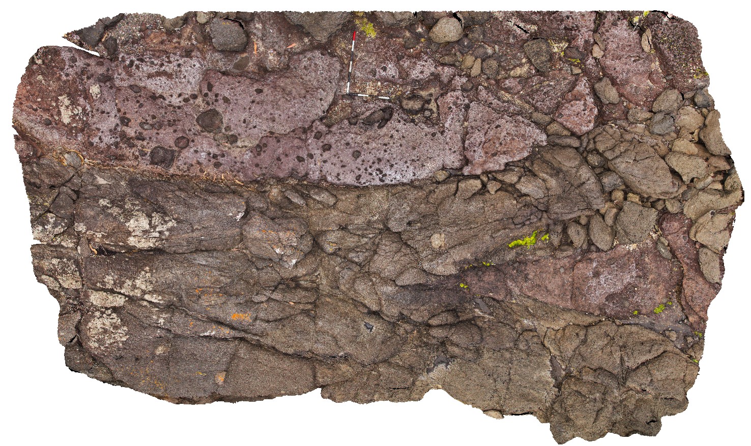
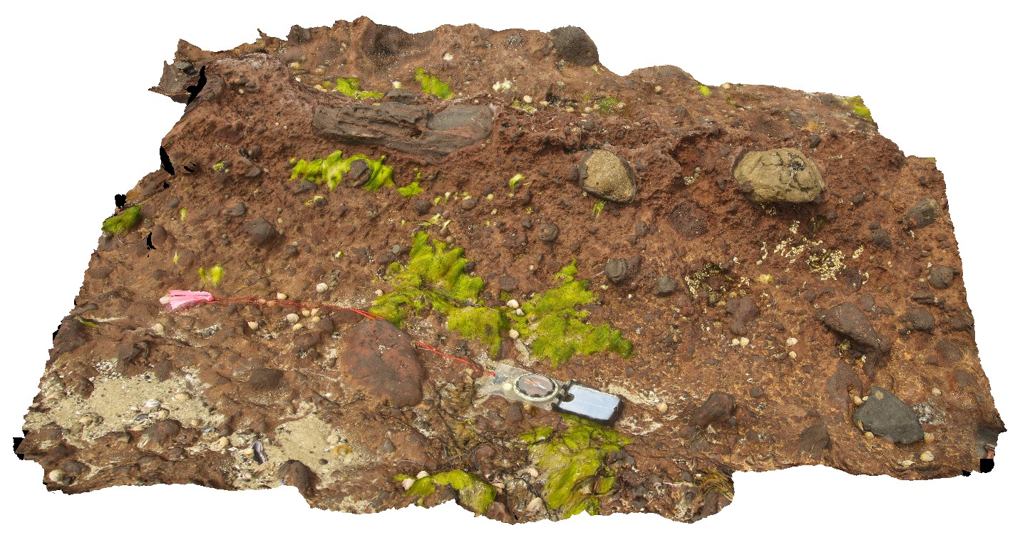
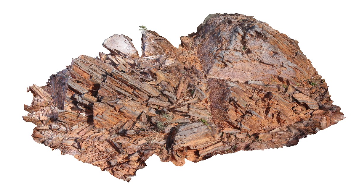
breccia with coated clasts of dolerite and Triassic sandstone. Ironstone Point, Tas. |
0.00 |
-42.97052000000 |
147.73407000000 |
-9999.000 |
breccia, country rock, xenoliths |
basalt |
Ironstone7 Map
 |
5 |
01/01/9999 midnight |
3D |
large, flow-banded bombs in pyroclastics. Ironstone Point, Tas. |
0.00 |
-42.97071000000 |
147.73529000000 |
-9999.000 |
flow-banded, bomb, pyroclastics, basalt, volcanic |
basalt |
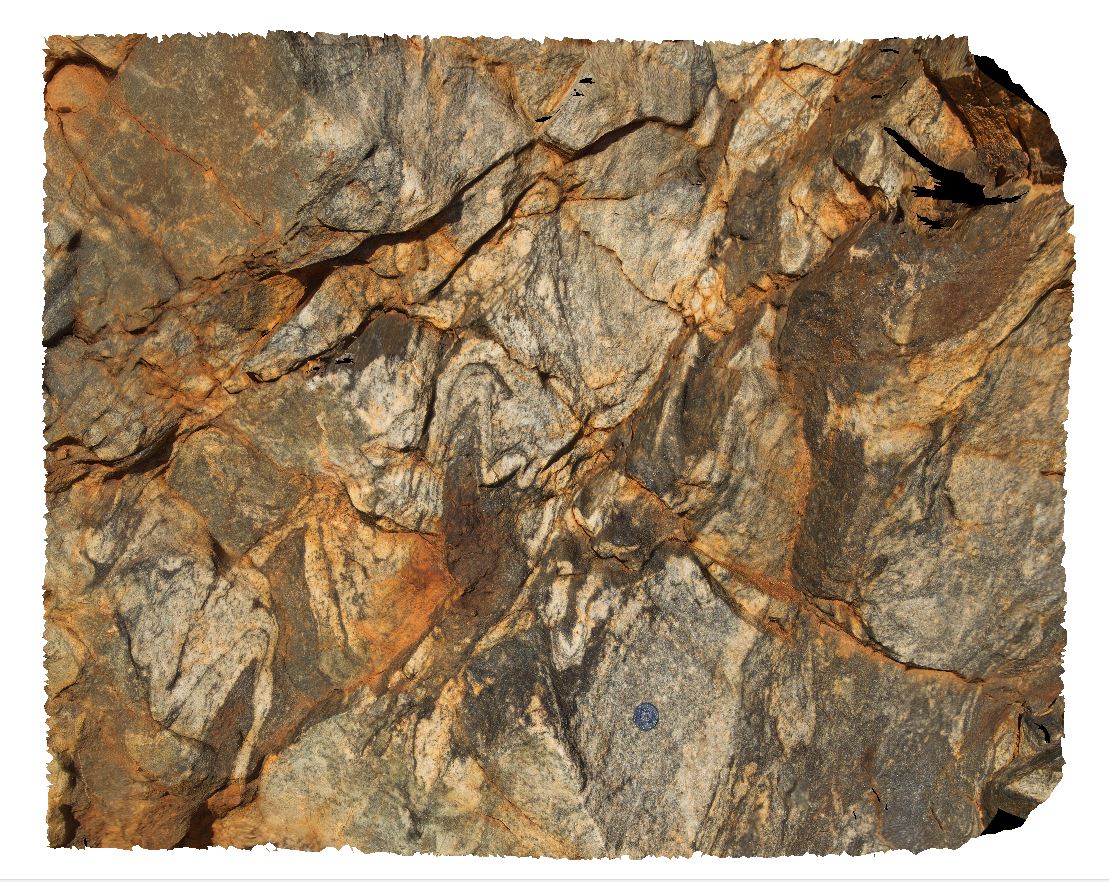
Ailer1 Map
 |
5 |
01/01/9999 midnight |
3D |
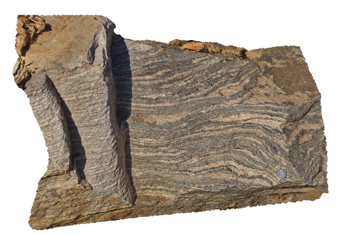
proto gneiss layers in road cutting along Stuart Highway, north of Alice Springs, N.T. |
0.60 |
-23.59699000000 |
133.87950000000 |
-9999.000 |
proto gneiss, banded gneiss |
gneiss |
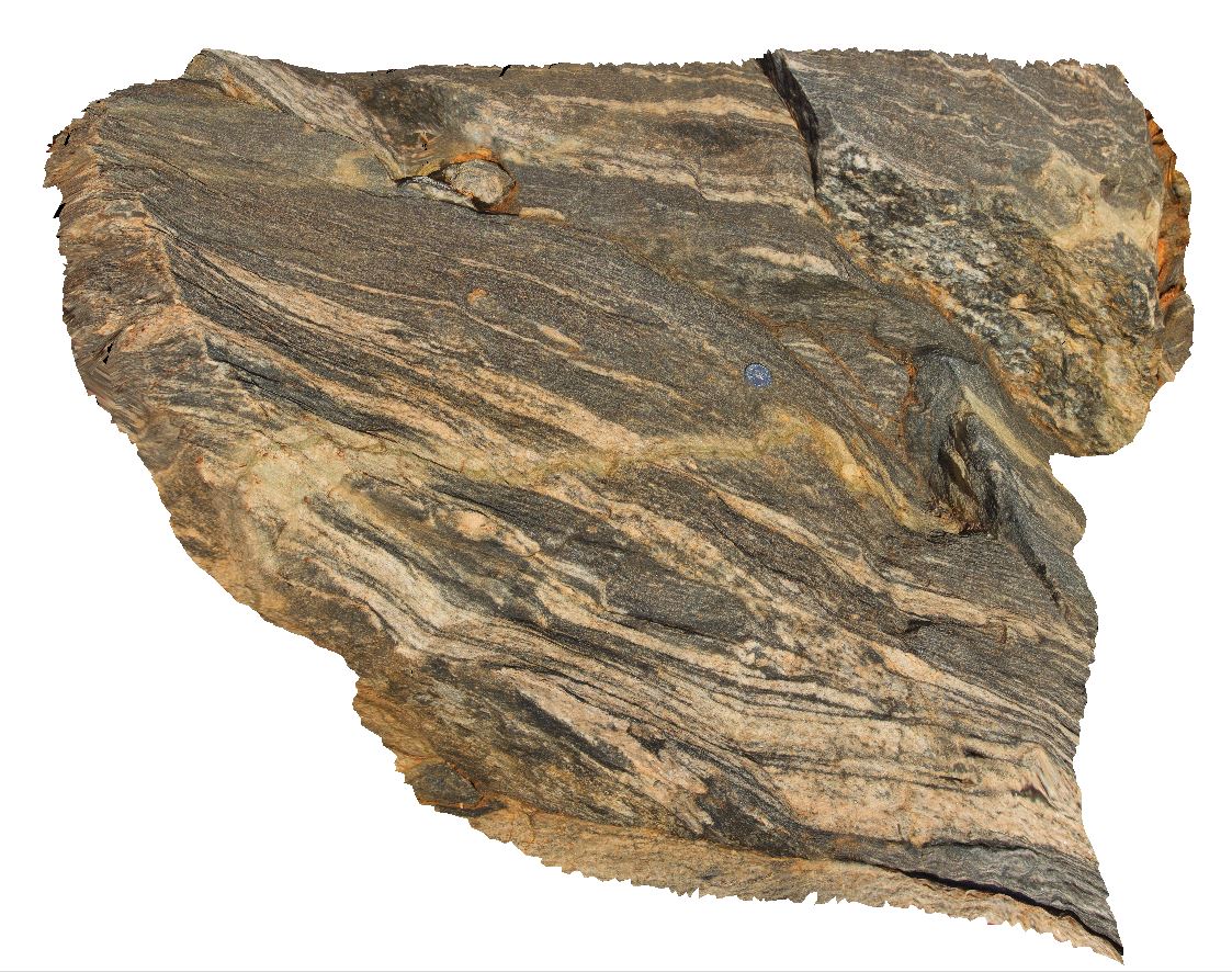
Ailer2 Map
 |
5 |
01/01/9999 midnight |
3D |
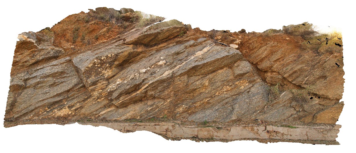
folded felsic and mafic migmatitic gneiss in road cutting North of Alice Springs, N.T. |
1.20 |
-23.61359000000 |
133.87965000000 |
-9999.000 |
gneiss, fold, structure, metamorphic |
gneiss |
Ailer3 Map
 |
5 |
01/01/9999 midnight |
3D |
epidote vein with light-coloured halo cutting orthogneiss. Same outcrop as site AILER2. North of Alice Springs, N.T. |
1.20 |
-23.61389000000 |
133.87952000000 |
-9999.000 |
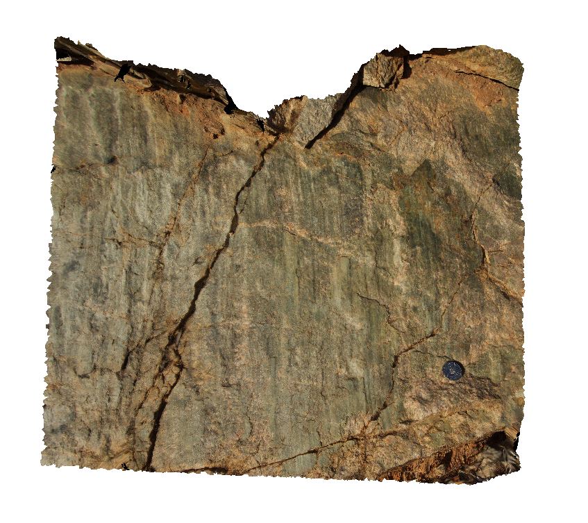
epidote, orthogneiss |
orthogneiss |
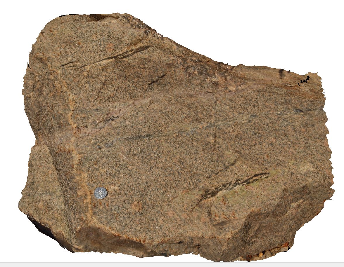
Ailer4 Map
 |
5 |
01/01/9999 midnight |
3D |
pink granite cut by aplite dyke (red-white) and thin epidote (green) veins. Stuart Highway North of Alice Springs. N.T. |
0.70 |
-23.64877000000 |
133.86237000000 |
-9999.000 |
granite, aplite, epidote |
granite |
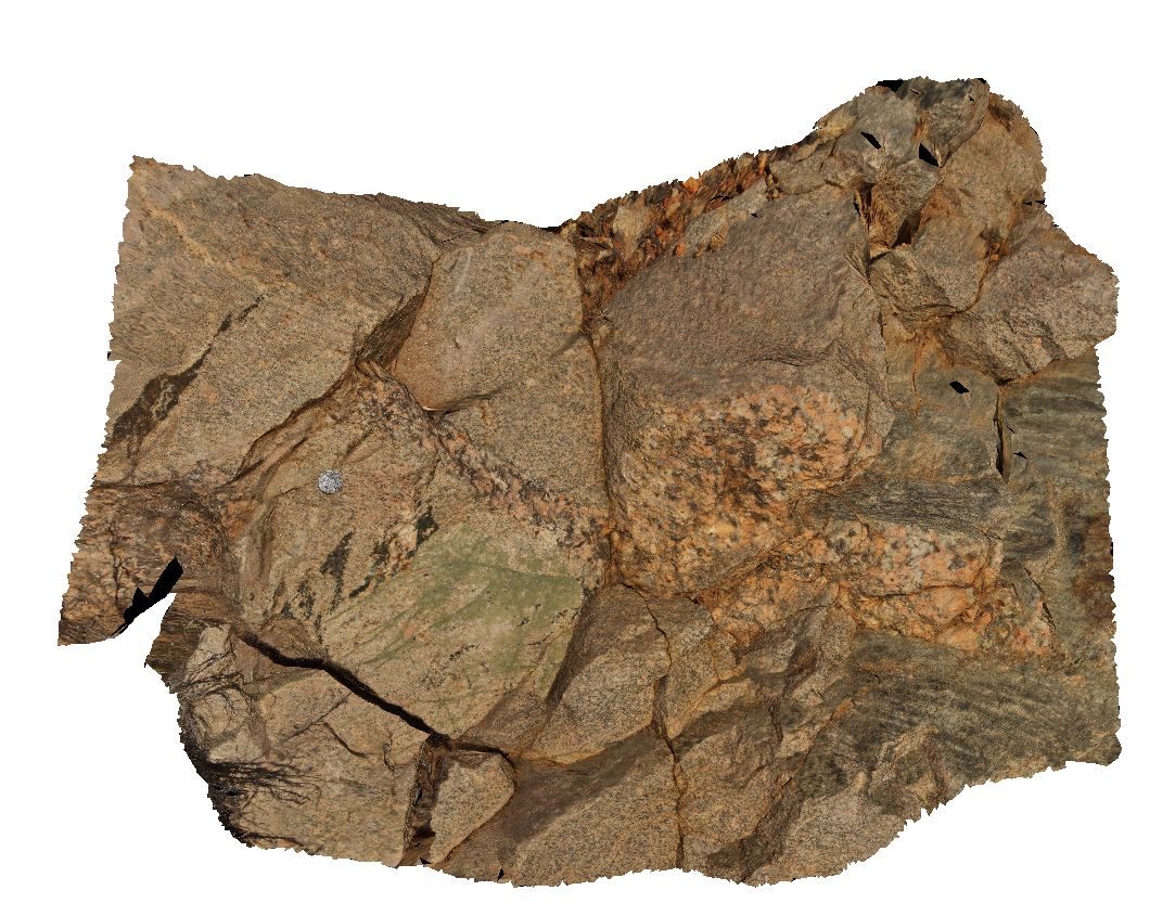
Ailer5 Map
 |
5 |
01/01/9999 midnight |
3D |
pegmatite and epidote vein network cutting pink granite. Stuart Highway North of Alice Springs. N.T. |
1.20 |
-23.64877000000 |
133.86237000000 |
-9999.000 |
pegmatite, granite, epidote, vein network |
granite |
Ailer6 Map
 |
5 |
01/01/9999 midnight |
3D |
slickenlines of chl-ser vein with movement sense of hanging wall up, cutting pink granite. Stuart Highway North of Alice Springs. N.T. |
1.00 |
-23.64877000000 |
133.86237000000 |
-9999.000 |
fault, structure, slickenside, slickenlines |
granite |
Ailer7 Map
 |
5 |
08/04/2016 9:25 a.m. |
3D |
outcrop of augen, biotite gneiss cut by pegmatite dykes. Anzac Hill, Alice Springs. N.T. |
5.00 |
-23.69593200000 |
133.88206700000 |
579.401 |
gneiss, pegmatite, dyke, metamorphic, igneous |
gneiss |
Ailer8 Map
 |
5 |
08/04/2016 10:30 a.m. |
3D |
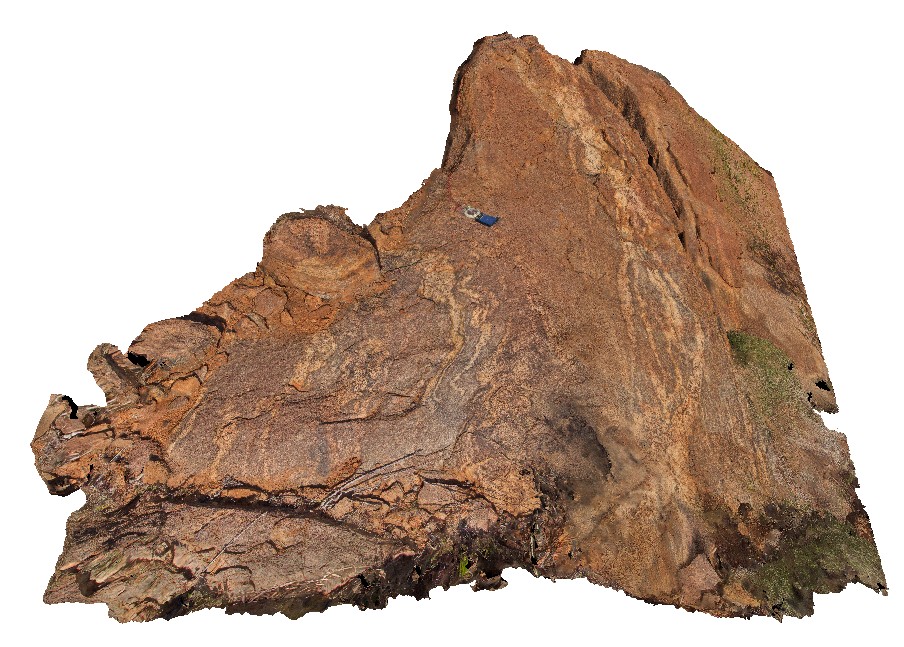
migmatitic biotite-gneiss cut by deformed felsic dyke. The Garden Road, North of Alice Springs. N.T. |
3.00 |
-23.25841100000 |
133.96238400000 |
774.021 |
gneiss, felsic dyke, metamorphics, structure |
biotite gneiss |
Ailer9 Map
 |
5 |
01/01/9999 midnight |
3D |
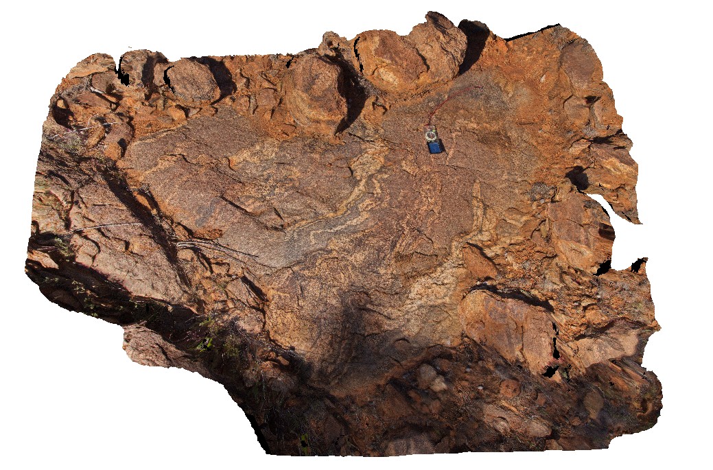
migmatitic biotite-gneiss cut by deformed felsic dyke. The Garden Road, North of Alice Springs. N.T. |
3.00 |
-23.25841100000 |
133.96238400000 |
774.021 |
biotite gneiss, gneiss, metamorphic, dyke, structure |
biotite gneiss |
AilerFSP1 Map
 |
0 |
08/04/2016 10:54 a.m. |
FSP |
panoramic view from small hill of gneisses forming the Western and Hartz Ranges. The Garden Road, North of Alice Springs. N.T. |
5000.00 |
-23.23560700000 |
134.03837800000 |
809.222 |
gneiss, metamorphic |
gneiss |
Ninghan1 Map
 |
5 |
01/01/9999 midnight |
3D |
Folded Archean banded-iron formation composed of alternating hematitic/chert laminae. Weakly magnetic. Exposed in isolated hinge of anticline in the Ningham Foldbelt. Near Great Northern Highway, W.A. |
4.00 |
-29.37333320000 |
117.27916670000 |
320.000 |
banded Iron Formation, anticline, fold, structure, BIF, sedimentology |
BIF |
Seaham1 Map
 |
5 |
01/01/9999 midnight |
3D |
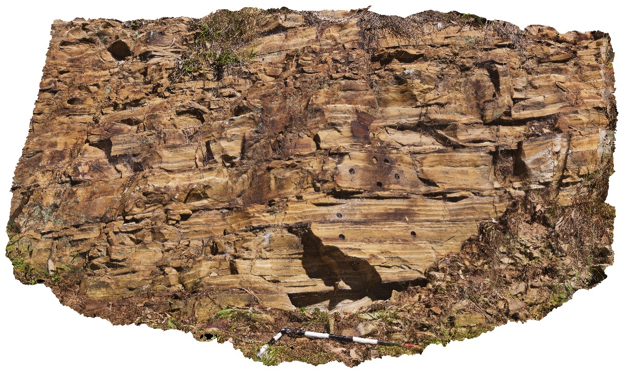
varved shales of the Seaham Formation with paleomag holes. Seaham, N.S.W. |
0.00 |
-32.66433000000 |
151.72768000000 |
-9999.000 |
varved, annual sediments, sedimentology, paleomagnetic dating |
shale |
Seaham2 Map
 |
5 |
01/01/9999 midnight |
3D |
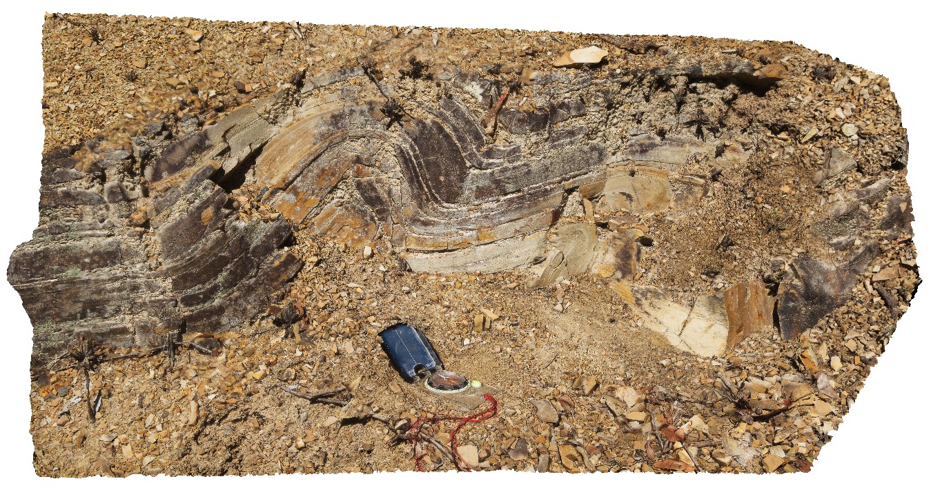
convoluted bedding in varved shales of the Seaham Formation. Seaham, N.S.W. |
0.00 |
-32.66301000000 |
151.72682000000 |
-9999.000 |
convoluted bedding, varved sediments, varved, annual, sedimentology |
shale |
Seaham3 Map
 |
5 |
01/01/9999 midnight |
3D |
convoluted bedding in varved shales of the Seaham Formation. Seaham, N.S.W. |
0.00 |
-32.66299000000 |
151.72681000000 |
-9999.000 |
convoluted bedding, varved sediments, annual sediments, sedimentology |
shale |
Dungog1 Map
 |
5 |
01/01/9999 midnight |
3D |
flat-lying Carboniferous sandstone and shale, Chichester Dam Rd, near Mulconda. N.S.W. |
0.00 |
-32.28273000000 |
151.71133000000 |
-9999.000 |
Carboniferous, sediments, sedimentology |
sandstone |
Dungog2 Map
 |
5 |
01/01/9999 midnight |
3D |
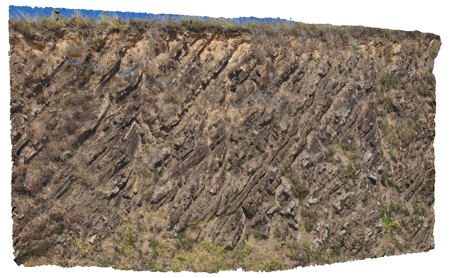
moderately dipping, planar, Carboniferous sediments on Sailsbury Rd. Near Mulconda. N.S.W. |
0.00 |
-32.23988000000 |
151.58795000000 |
-9999.000 |
Carboniferous, sedimentology, planar sediments, dip |
sediments |