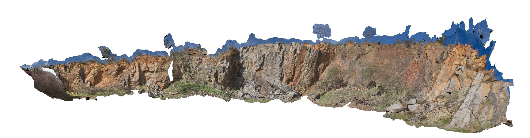
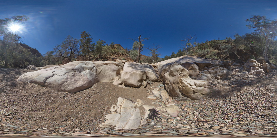
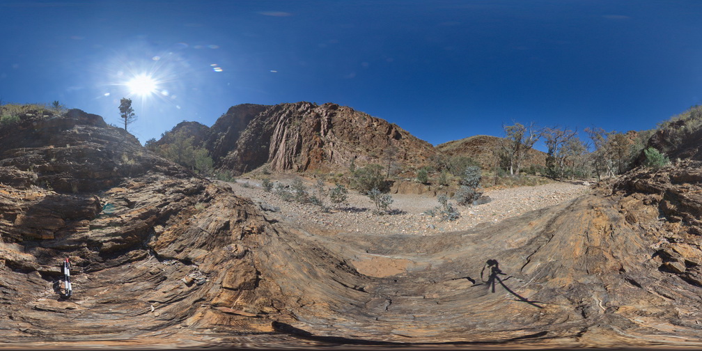
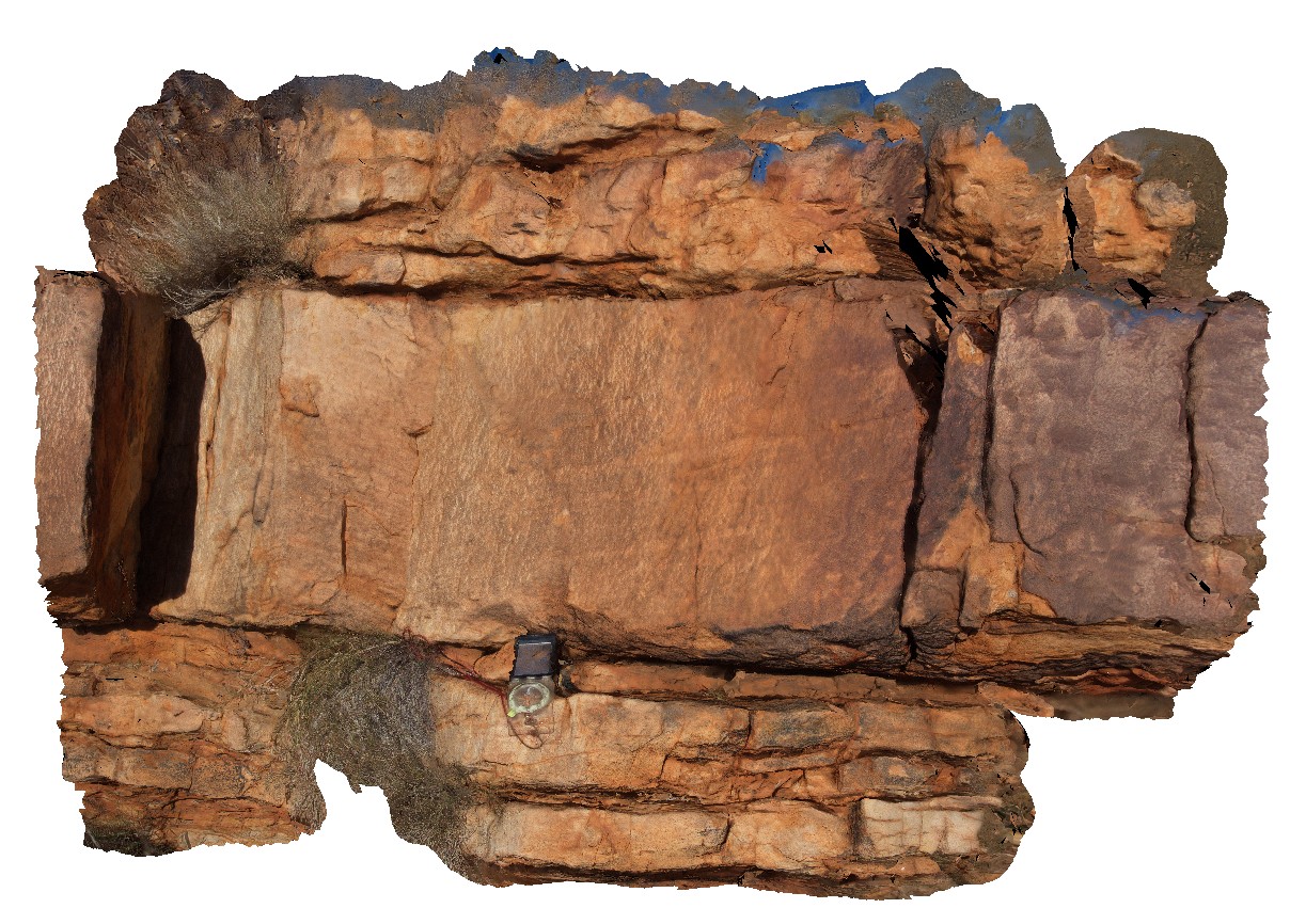
Boya5 Map
 |
0 |
03/13/2015 9:26 a.m. |
PANO |
Boya quarry, Boya, Western Australia. |
0.00 |
-31.91484580000 |
116.06239402000 |
-9999.000 |
|
|
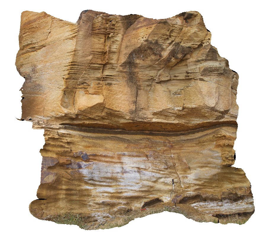
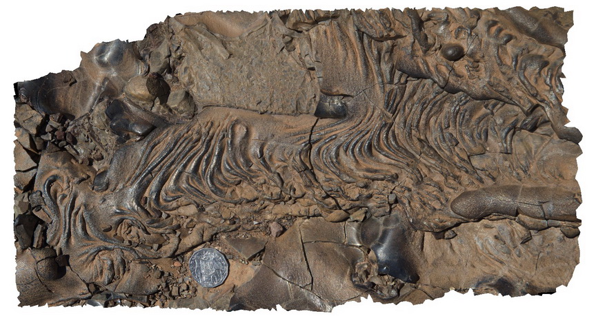
Parkers5 Map
 |
5 |
01/01/9999 midnight |
3D |
in-situ cross beds in Triassic sandstone. Parkers Beach, Nubeena Tasmania. |
0.00 |
-43.04884000000 |
147.79445000000 |
-9999.000 |
cross bedding, sandstone, sedimentology |
sandstone |
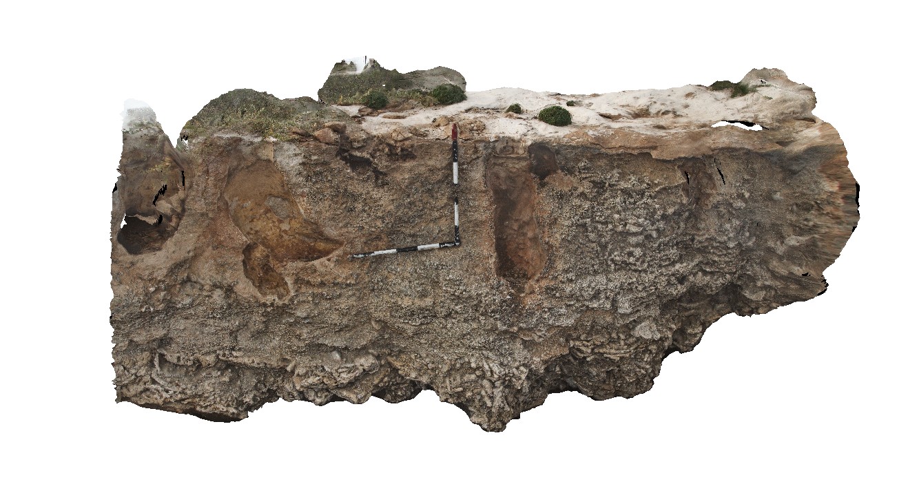
Dongara2 Map
 |
0 |
05/18/2016 noon |
3D |
reef facies in Tamala Limestone, Dongra, W.A. |
0.00 |
-29.27918000000 |
114.91579000000 |
-9999.000 |
reef facies, limestone, stratigraphy, fossil, palaeontology |
limestone |
WeetootlaFSP6 Map
 |
0 |
09/27/2015 4:38 p.m. |
FSP |
outcrop of massive homogeneous carbonate. Weetootla gorge. |
0.00 |
-30.47952000000 |
139.22774000000 |
-9999.000 |
sedimentology |
carbonate |
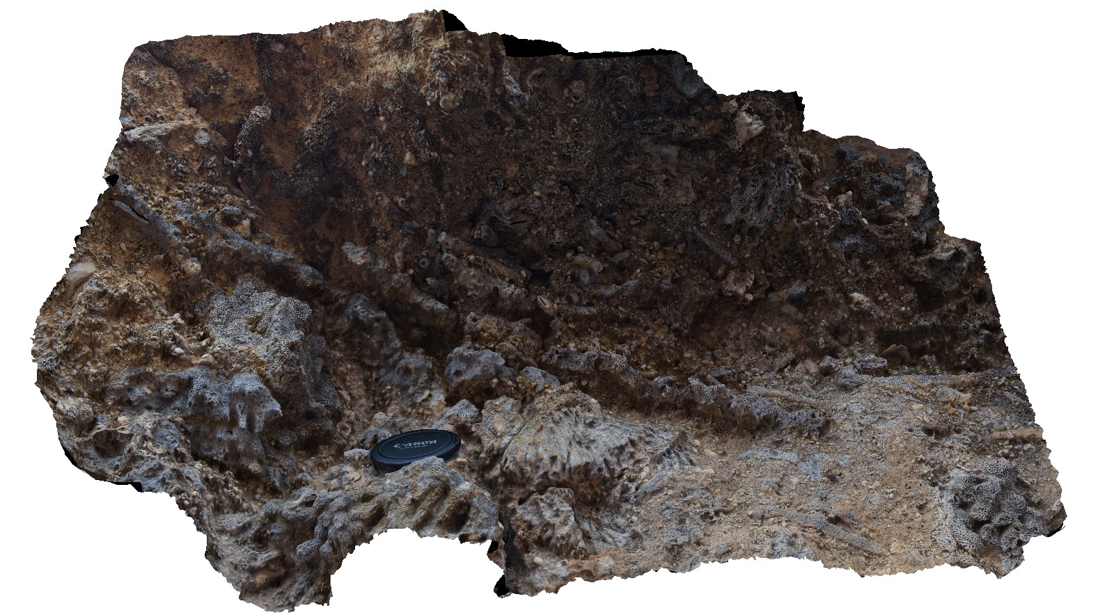
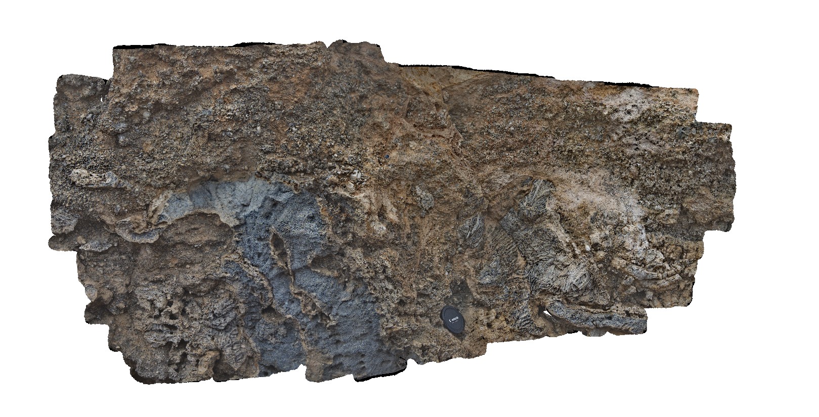
Dongara3 Map
 |
0 |
05/18/2016 noon |
3D |
reef facies and karstic features in Tamala Limestone, Dongra, W.A. |
0.00 |
-29.27914000000 |
114.91576000000 |
-9999.000 |
limestone, reef facies, palaeontology, fossil |
limestone |
Dongara4 Map
 |
0 |
05/18/2016 noon |
3D |
detail of reef and shelly facies features in Tamala Limestone, Dongra, W.A. |
0.00 |
-29.27913000000 |
114.91570000000 |
-9999.000 |
limestone, reef facies, sedimentology, fossil, palaeontology |
limestone |
NambuccaGiga1 Map
 |
0 |
01/01/9999 midnight |
GIGA |
Nambucca, N.S.W. |
0.00 |
-30.64660000000 |
153.01932000000 |
-9999.000 |
|
|
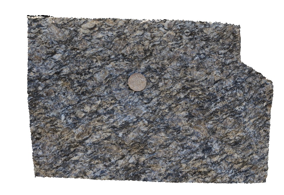
GibbRiver15 Map
 |
0 |
06/06/2016 noon |
3D |
shear fabric in coarse-grained granodiorite in large block at quarry. Gibb River Road, near Mount Amy. W.A. |
0.00 |
-17.22854000000 |
124.90450000000 |
-9999.000 |
shear fabric, shear, granodiorite |
granodiorite |
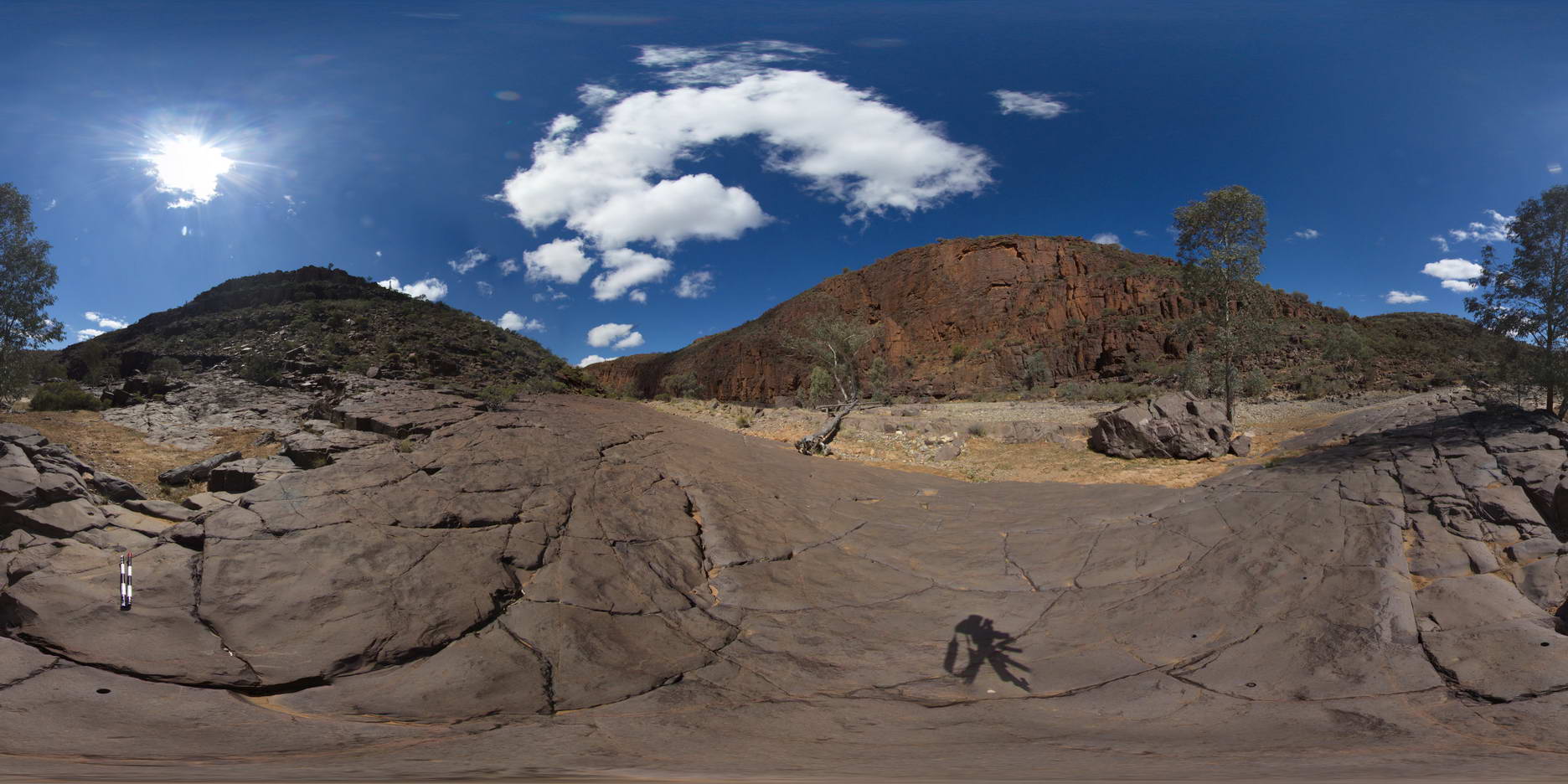
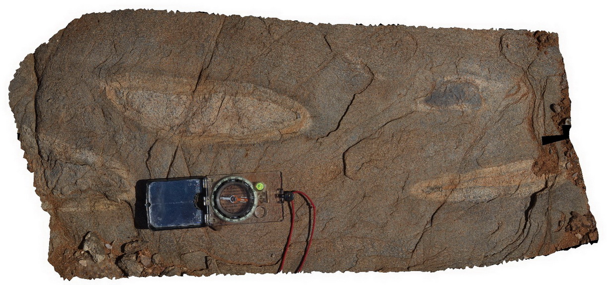
ArkaroolaFSP15 Map
 |
5 |
11/26/2015 3:15 p.m. |
FSP |
Paleo magnetic sampling site, taken from a large sandstone bed within the diamictite, Tillite Gorge, Arkaroola. Northern Flinders Ranges, S.A. |
0.00 |
-30.33022000000 |
139.40932000000 |
-9999.000 |
diamictite |
diamictite |
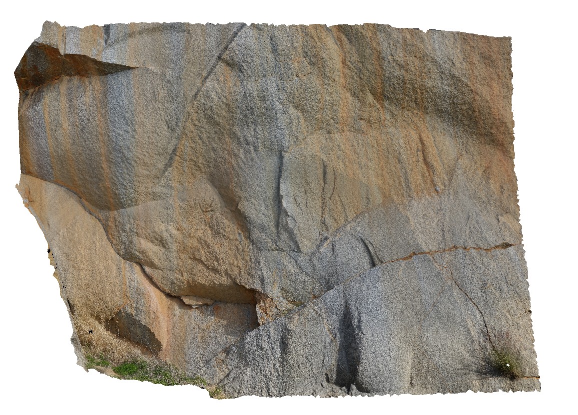
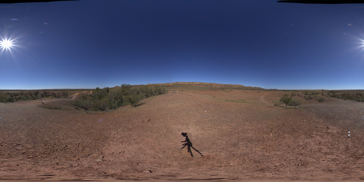
BoyaPole1 Map
 |
0 |
03/13/2015 9:27 a.m. |
3D |
Boya quarry, Boya, Western Australia. |
0.00 |
-31.91484580000 |
116.06239402000 |
-9999.000 |
|
|
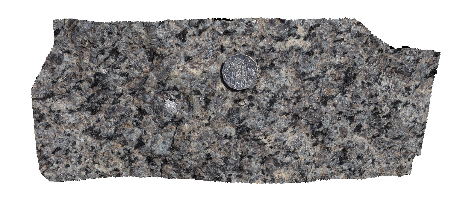
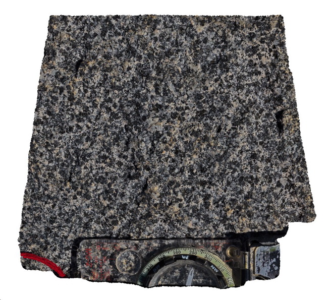
GibbRiver14 Map
 |
0 |
06/06/2016 noon |
3D |
close-up view of coarse-grained granodiorite in quarry. Gibb River Road, near Mount Amy. W.A. |
0.00 |
-17.22889000000 |
124.90460000000 |
-9999.000 |
granodiorite |
granodiorite |
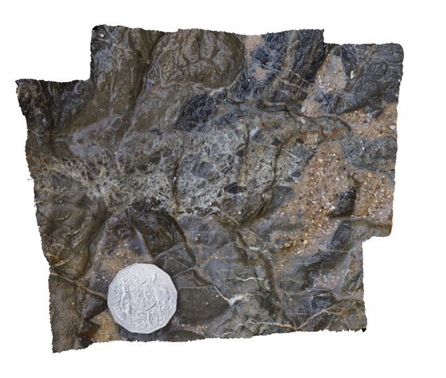
ArkaroolaFSP10 Map
 |
5 |
11/26/2015 3:14 p.m. |
FSP |
haematitic and granitic brecciated boulders and outcrop exposed in creek bed. Quartz veins cross-cut and also host breccia clasts. Arkaroola. Northern Flinders Ranges, S.A. |
0.00 |
-30.22888000000 |
139.34531000000 |
-9999.000 |
breccia, quartz veining |
breccia |
Limebay5 Map
 |
5 |
01/01/9999 midnight |
3D |
laminated tuff and bomb beds , including sandstone lithic bombs in Tertiary Basalt units. Lime Bay, Tas. |
0.00 |
-42.94318000000 |
147.69609000000 |
-9999.000 |
bomb, tuff, laminated, volcaniclastic, volcanic |
basalt |
WeetootlaFSP5 Map
 |
0 |
09/27/2015 4:38 p.m. |
FSP |
outcrop of massive carbonate. Weetootla gorge. |
0.00 |
-30.47945000000 |
139.22777000000 |
-9999.000 |
sedimentology |
carbonate |
Blinman6 Map
 |
0 |
11/12/2015 10:13 a.m. |
3D |
Detail of ropy, flow textures in slag. Blinman Mine. Blinman, S.A. |
0.00 |
-31.08684000000 |
138.67450000000 |
-9999.000 |
slag, ropy flow banking |
Slag |
MitchellGIGa1 Map
 |
0 |
06/08/2016 noon |
GIGA |
Port Warrender Road, Kimberley. W.A. |
0.00 |
-14.56782000000 |
125.84389000000 |
-9999.000 |
|
|
WeetootlaFSP4 Map
 |
0 |
09/27/2015 4:38 p.m. |
FSP |
view of steeply dipping stratigraphy, Weetootla Gorge. |
0.00 |
-30.48114000000 |
139.22690000000 |
-9999.000 |
structure |
mudstone |
GibbRiverGIG1 Map
 |
0 |
06/06/2016 noon |
GIGA |
— |
0.00 |
-15.91240000000 |
128.17818000000 |
-9999.000 |
|
|
HENB1 Map
 |
0 |
07/29/2016 12:14 p.m. |
3D |
disrupted bedding between impact craters. Henbury Meteorites Conservation Reserve. N.T. |
0.00 |
-24.57255600000 |
133.14790100000 |
464.641 |
Meteorite, impact craters, disrupted bedding |
sediments |
HENBFSP1 Map
 |
0 |
07/29/2016 12:23 p.m. |
FSP |
view of impact craters from lip of second main crater. 2 smaller craters to the SW in front of ridge. Henbury Meteorites Conservation Reserve. N.T. |
0.00 |
-24.57256800000 |
133.14765900000 |
467.793 |
impact craters, Meteorite, Henbury |
sediments |
Olary71 Map
 |
0 |
09/27/2015 6:39 p.m. |
3D |
detailed view of calc-silicate ellipsoids at site Olary70. Olary, S.A. |
0.00 |
-32.11449000000 |
140.30037000000 |
-9999.000 |
calc-silicate, fold, structure |
psammite |
HENB2 Map
 |
0 |
07/29/2016 12:56 p.m. |
3D |
laminated sandstone on ridge immediately south of Henbury impact sight. Henbury Meteorites Conservation Reserve. N.T. |
0.00 |
-24.57323400000 |
133.12315300000 |
464.466 |
Henbury, Meteorite, impact crater |
sandstone |
Karijini15 Map
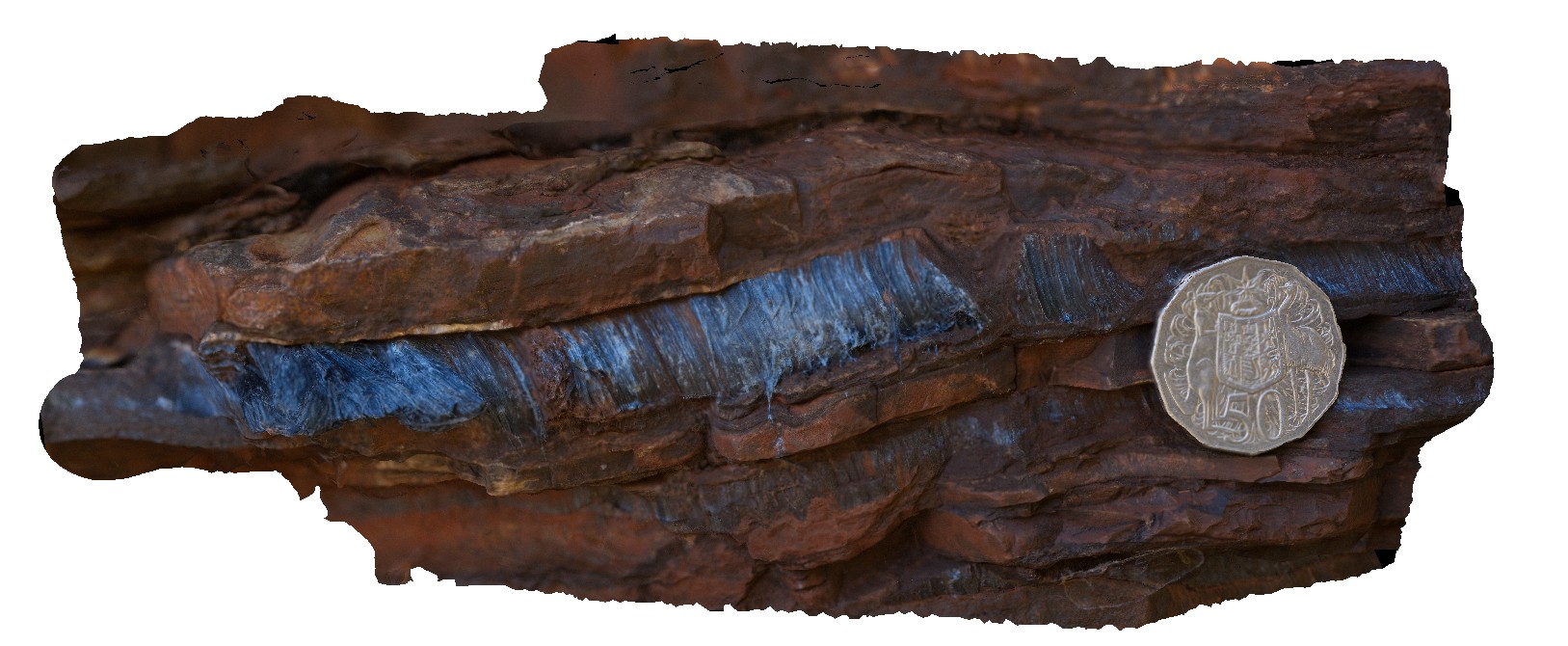 |
0 |
05/29/2016 noon |
3D |
macro view of 1cm wide seam of radiating crocidolite in Brockman Iron Formation. Dales Gorge, Karijini National Park. W.A. |
0.10 |
-22.47611000000 |
118.56268000000 |
-9999.000 |
crocidolite, banded iron formation, mineral |
BIF |
Blackhead7 Map
 |
5 |
07/08/2015 9:32 a.m. |
3D |
Detail of fault breccia in very fine sandstone. Black Head, N.S.W. |
0.10 |
-32.07087000000 |
152.54707000000 |
0.000 |
sandstone, fault breccia, structure |
sandstone, breccia |
Bingi16 Map
 |
5 |
06/21/2016 12:37 p.m. |
3D |
detailed texture of hornblende-biotite diorite/gabbro. Bingi, N.S.W. |
0.10 |
-36.01301000000 |
150.16377000000 |
3.000 |
diorite, hornblende, igneous |
diorite |