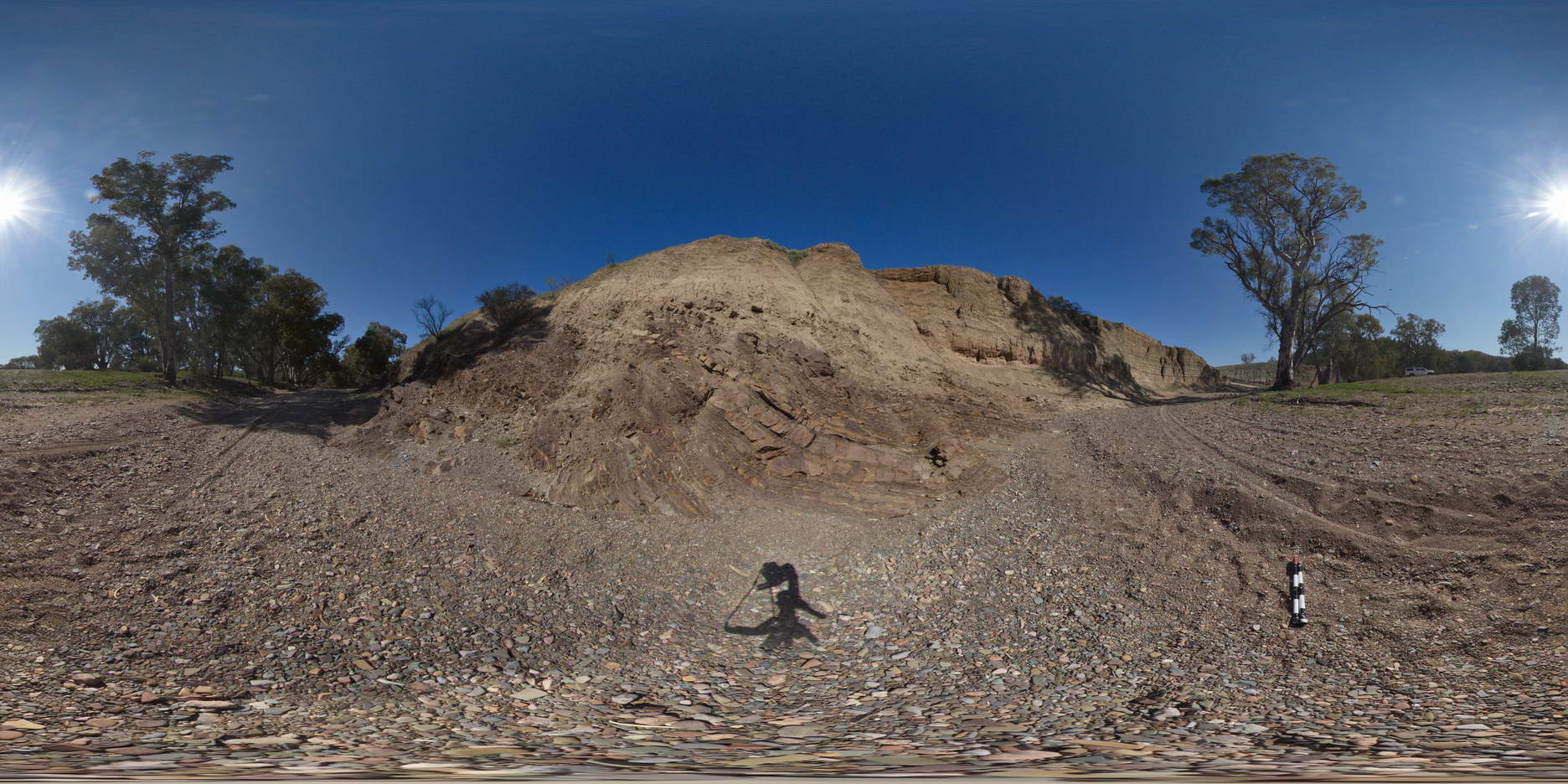
BoyaPole2 Map
 |
0 |
03/13/2015 9:27 a.m. |
3D |
Boya quarry, Boya, Western Australia. |
0.00 |
-31.91484580000 |
116.06239402000 |
-9999.000 |
|
|
TowerHillGIGA1 Map
 |
10 |
01/01/9999 midnight |
GIGA |
— |
0.00 |
-38.32723000000 |
142.36790000000 |
-9999.000 |
|
tuff |
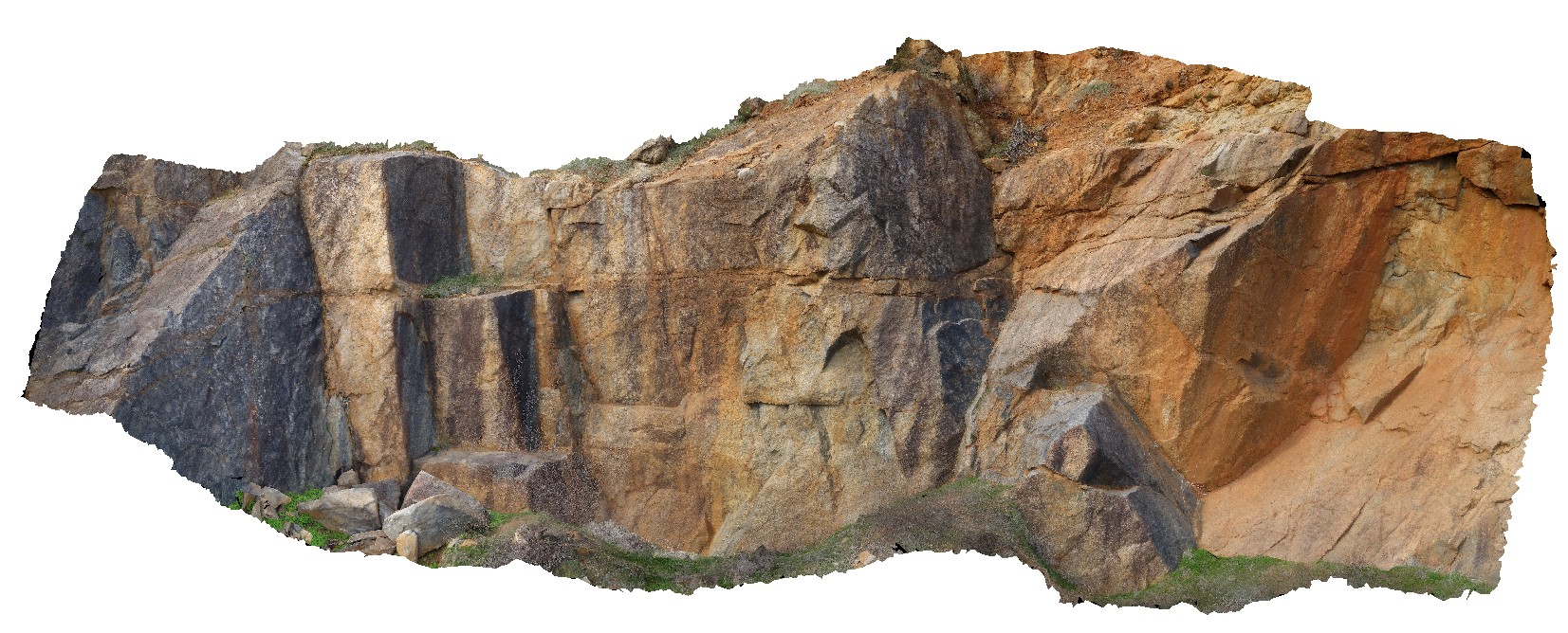
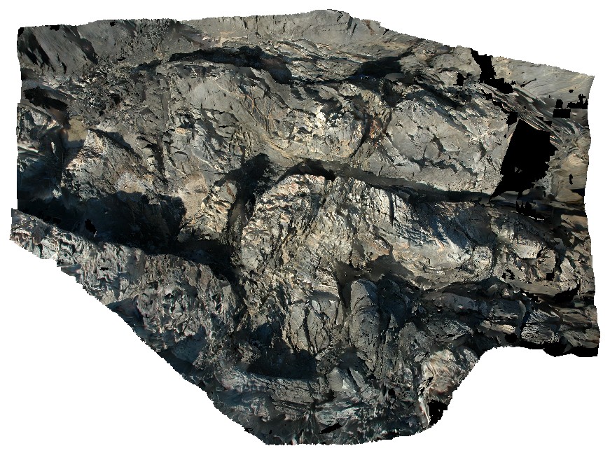
BoyaPole1 Map
 |
0 |
03/13/2015 9:27 a.m. |
3D |
Boya quarry, Boya, Western Australia. |
0.00 |
-31.91484580000 |
116.06239402000 |
-9999.000 |
|
|
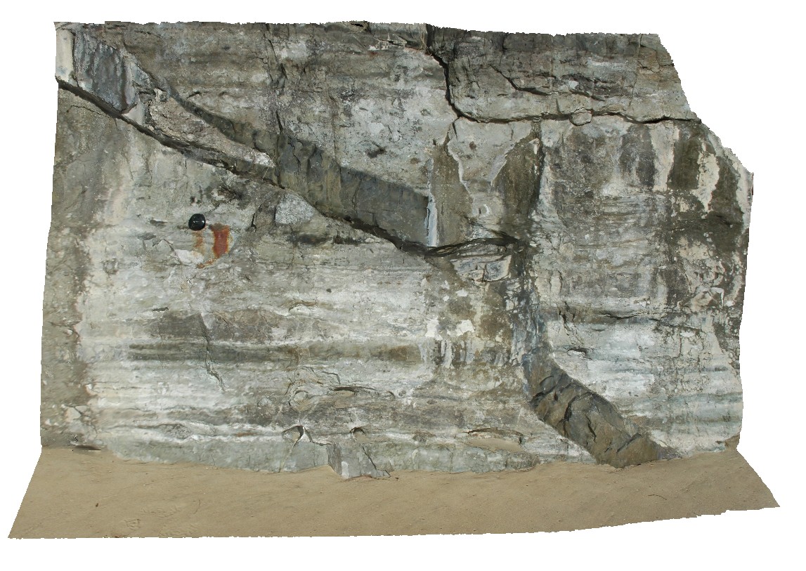
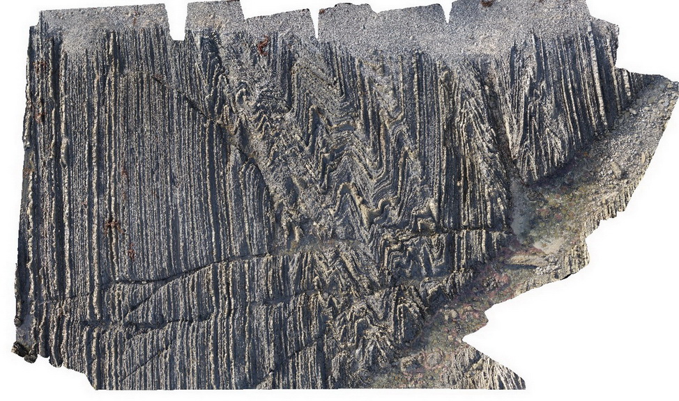
LiptrapPole2 Map
 |
20 |
03/13/2015 9:25 a.m. |
3D |
wave cut platform showing steeply plunging chevron folding in finely bedded turbiditic sequence. Cape Liptrap, Vic. |
0.00 |
-38.90414711000 |
145.91743374000 |
0.000 |
structure, chevron folds |
turbidite |
OlaryUAV2 Map
 |
0 |
09/27/2015 6:50 p.m. |
UAV |
aerial view of Old Boolcoomata Conglomerate Member, showing interbedded conglomerate with pebbly sandstone and siltstone. Old Boolcoomata Station. Olary. S.A. |
0.00 |
-32.09433000000 |
140.27747000000 |
-9999.000 |
conglomerate, sedimentology |
conglomerate |
CanberraGiga3 Map
 |
1 |
06/17/2015 10:30 a.m. |
GIGA |
— |
0.00 |
-35.30408000000 |
149.12651000000 |
-9999.000 |
|
|
Roches5 Map
 |
5 |
03/16/2015 2:21 p.m. |
3D |
view of bifurcating dolerite dyke intruding Permian siltstone. Roches Beach, Tasmania. |
0.00 |
-42.88362383000 |
147.50543178000 |
5.000 |
dyke, intrusive contact, igneous |
siltstone, dolerite |
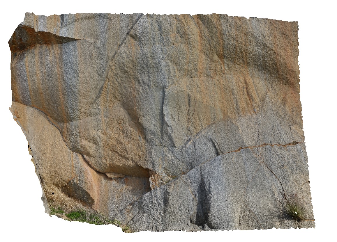
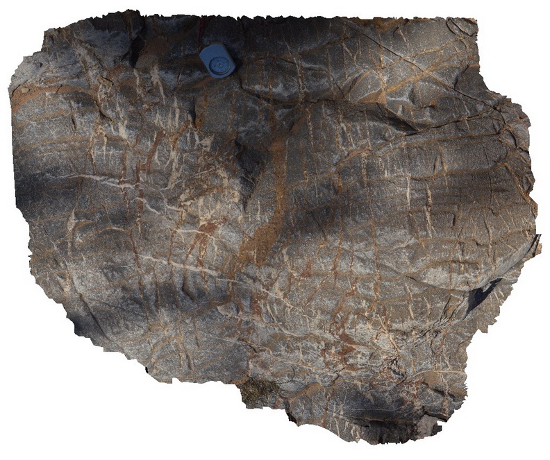
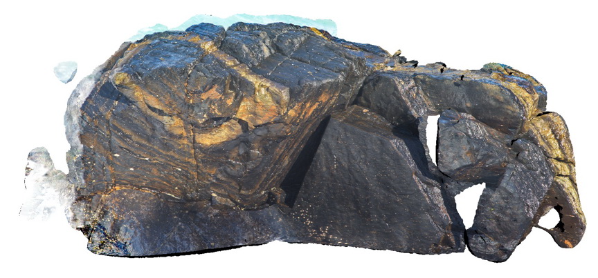
Olary71 Map
 |
0 |
09/27/2015 6:39 p.m. |
3D |
detailed view of calc-silicate ellipsoids at site Olary70. Olary, S.A. |
0.00 |
-32.11449000000 |
140.30037000000 |
-9999.000 |
calc-silicate, fold, structure |
psammite |
Blinman15 Map
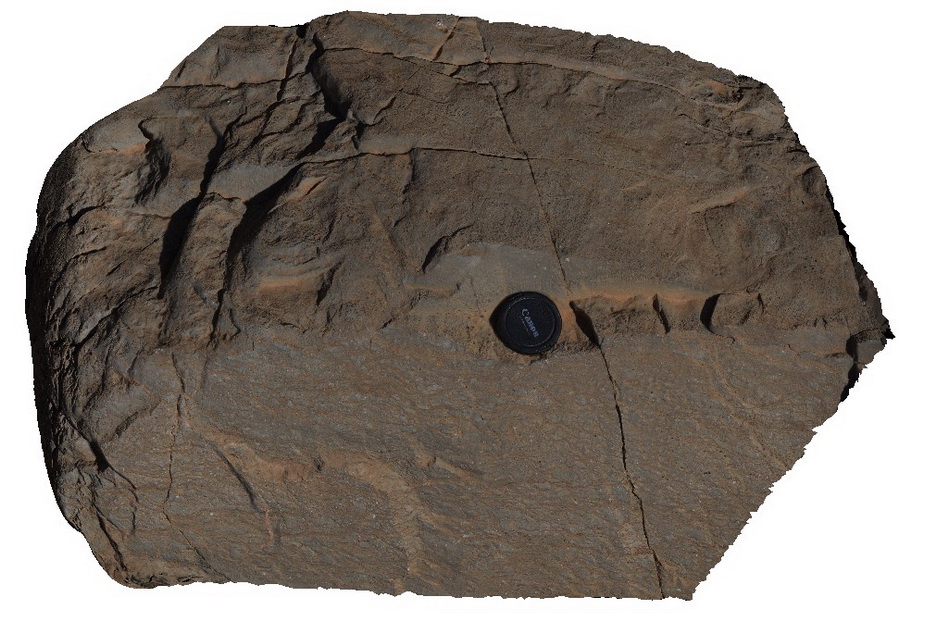 |
0 |
11/12/2015 10:16 a.m. |
3D |
stromatolites in 3D view. Blinman pools walking trail. Blinman, S.A. |
0.00 |
-31.12900000000 |
138.57234000000 |
-9999.000 |
stromatolite, palaeontology |
carbonate |
CanberraGiga2 Map
 |
0 |
06/17/2015 10:29 a.m. |
GIGA |
— |
0.00 |
-35.30408000000 |
149.12651000000 |
-9999.000 |
|
|
Blinman16 Map
 |
0 |
11/12/2015 10:17 a.m. |
3D |
detail of cross-section and 3D view of stromatolites. Blinman pools walking trail. Blinman, S.A. |
0.00 |
-31.12896000000 |
138.57230000000 |
-9999.000 |
stromatolite, palaeontology |
carbonate |
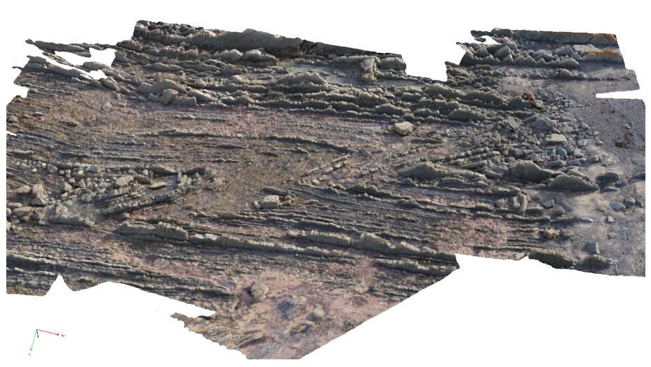
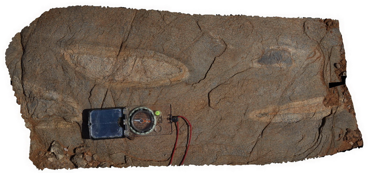
ESCape14 Map
 |
20 |
03/16/2015 2:33 p.m. |
3D |
steeply plunging, folded turbiditic sandstone and siltstone beds of the Mathinna Supergroup. Sandy Point, Tas. |
0.00 |
-40.95007594000 |
147.35335474000 |
0.000 |
fold, turbidite, structure |
turbidite |
MyrtleBch2 Map
 |
1 |
06/17/2015 9:23 a.m. |
3D |
Large (~6m) megaclast of folded Wagonga Group rocks within cliff of Permian Snapper Point Formation. Poor image due to limited vantage points. No scale. Myrtle Beach, N.S.W. |
0.00 |
-35.68269000000 |
150.30045800000 |
-9999.000 |
megaclast, sedimentology |
sandstone |
WestBeach5 Map
 |
0 |
06/05/2016 10:50 a.m. |
3D |
'M' folding in garnet schist, West Beach, W.A. |
0.00 |
-33.95352000000 |
119.97489000000 |
-9999.000 |
M folds, structure, garnet schist |
garnet schist |
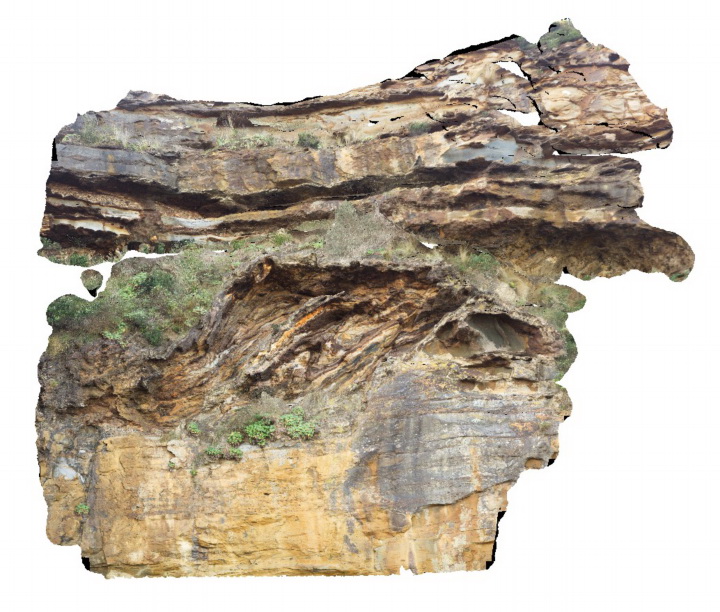
CapeWickham8 Map
 |
5 |
04/22/2016 12:22 p.m. |
3D |
view of bedded, quartzite dominant metasediments. Cape Wickham, King Island. Tasmania. |
0.00 |
-39.59224515000 |
143.92791342000 |
0.500 |
metasediments |
|
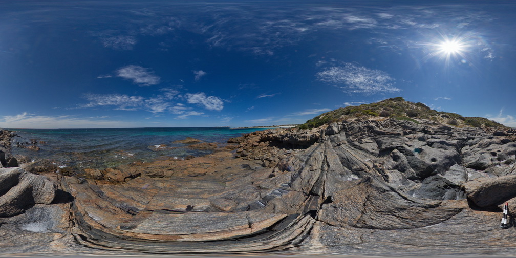
LiptrapPole1 Map
 |
20 |
03/13/2015 9:25 a.m. |
3D |
wave cut platform showing chevron folding and cross cutting faults in finely bedded turbidites. Cape Liptrap, Vic. |
0.00 |
-38.90406232000 |
145.91729772000 |
0.000 |
turbidite, chevron folds, structure |
turbidite |
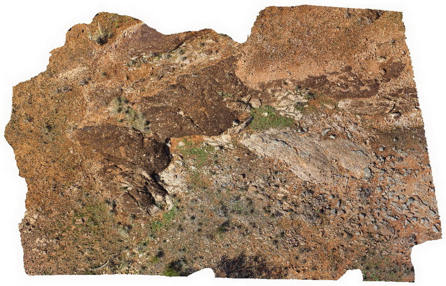
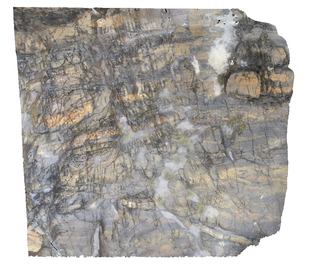
BrachinaFSP12 Map
 |
5 |
11/27/2015 11:52 a.m. |
FSP |
exposure of angular unconformity between the moderately dipping and openly folded Brachina Formation and overlying Quaternary sediments. Brachina Gorge. S.A. |
0.00 |
-31.33824000000 |
138.60666000000 |
-9999.000 |
angular unconformity |
siltstone, siltstone |
CanberraGiga1 Map
 |
1 |
06/17/2015 10:27 a.m. |
GIGA |
— |
0.00 |
-35.30408000000 |
149.12651000000 |
-9999.000 |
|
|
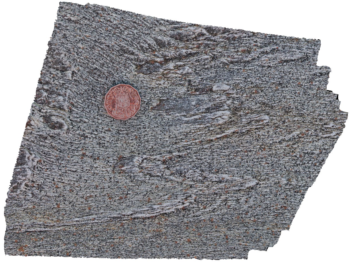
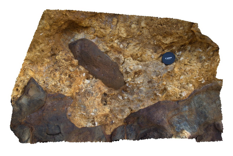
PtNeillFSP7 Map
 |
0 |
10/20/2015 3:21 p.m. |
FSP |
shore platform exposure showing granitic and mafic differentiated bands in mylonite. |
0.00 |
-34.10677000000 |
136.35036000000 |
-9999.000 |
mylonite |
mylonite |
Splitpoint16 Map
 |
5 |
06/17/2015 10:49 a.m. |
3D |
Detailed view of the disconformable contact between basalt of the Oligocene Angahook Formation and bioclastic limestone of the Oligocene-Miocene Torquay Group. Split Point, Vic. |
0.00 |
-38.46855000000 |
144.10698000000 |
-9999.000 |
palaeontology, disconformity, volcanology, sedimentology |
basalt, limestone |
NambuccaGiga2 Map
 |
0 |
01/01/9999 midnight |
GIGA |
Nambucca, N.S.W. |
0.00 |
-30.64857000000 |
153.01886000000 |
-9999.000 |
|
|
HastingsPt2 Map
 |
1 |
07/09/2015 4:27 p.m. |
3D |
fold in metasediments in offshore rock - approximately 2.5m across. Devonian - Carboniferous Neranleigh-Fernvale Beds. Hastings Point, QLD. |
0.00 |
-28.33676000000 |
153.57729000000 |
-9999.000 |
fold, structure |
sandstone |
NambuccaGiga1 Map
 |
0 |
01/01/9999 midnight |
GIGA |
Nambucca, N.S.W. |
0.00 |
-30.64660000000 |
153.01932000000 |
-9999.000 |
|
|
NambuccaGiga3 Map
 |
0 |
01/01/9999 midnight |
GIGA |
Nambucca, N.S.W. |
0.00 |
-30.64876000000 |
153.01909000000 |
-9999.000 |
|
|
DevmFSP1 Map
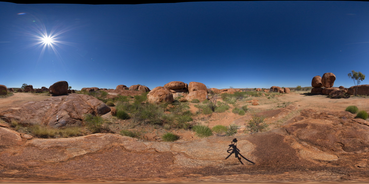 |
5 |
07/22/2016 12:52 p.m. |
FSP |
view of Devils Marbles granite outcrop. Karlu Karlu / Devils Marbles Conservation Reserve. N.T. |
0.00 |
-20.55961100000 |
134.26470100000 |
412.342 |
Devils Marbles, granite, weathering |
granite |