Piccaninny30 Map
 |
20 |
03/13/2015 9:07 a.m. |
3D |
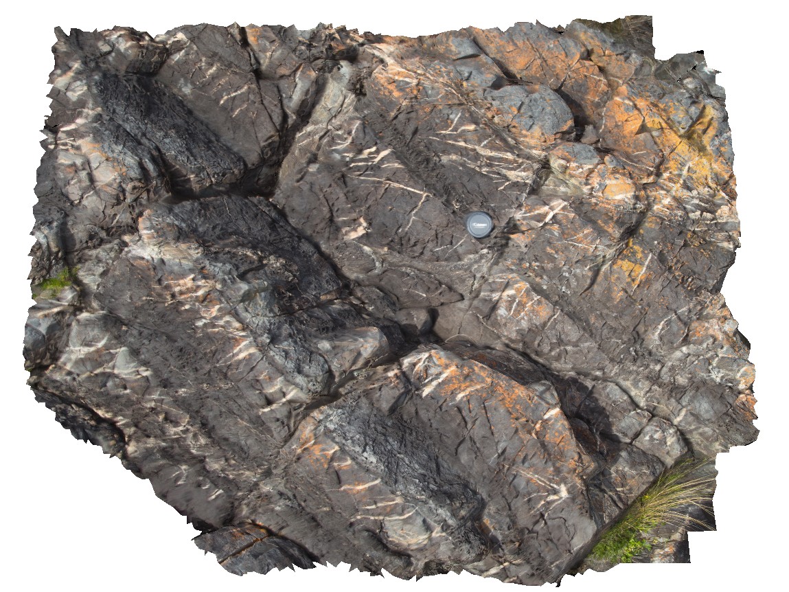
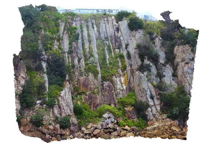
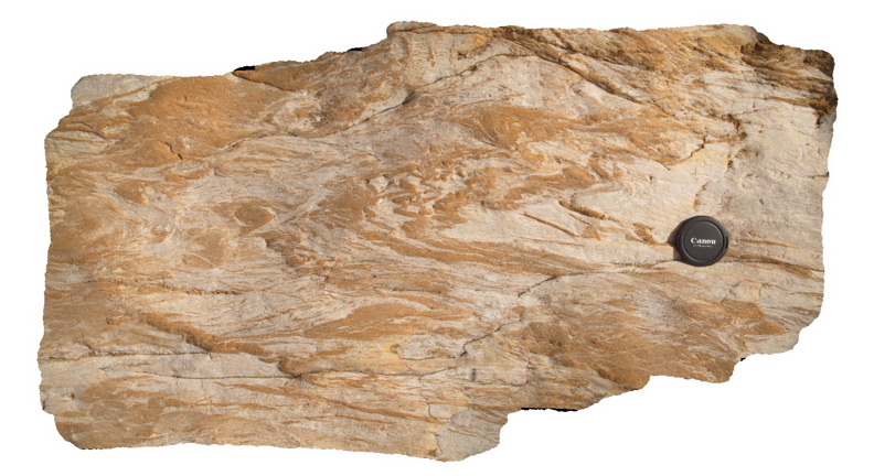
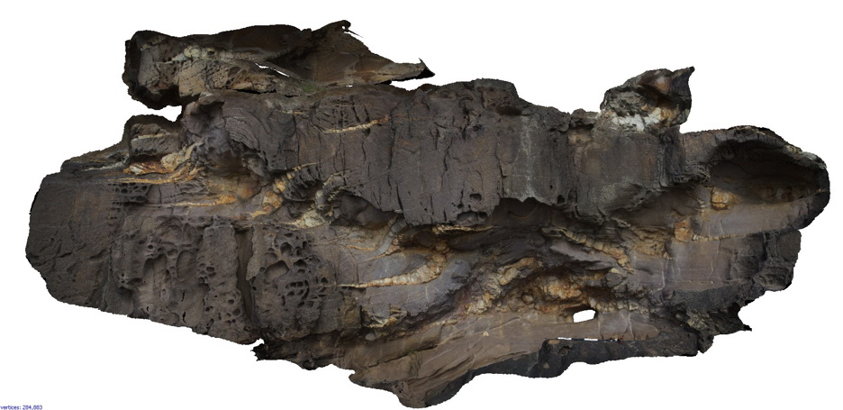
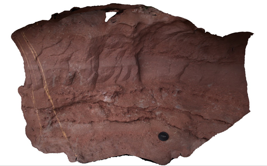
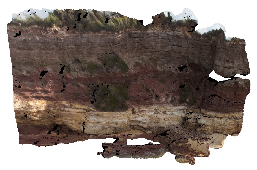
well bedded hornfelsed Mathinna Supergroup, displaying competency control on development of qz veins. Piccaninny Point, eastern Tasmania. |
1.00 |
-41.69424200000 |
148.29408500000 |
6.000 |
structure, hornfels, competency controlled veins, bedding |
Turbidite, Granodiorite |
Piccaninny31 Map
 |
20 |
03/13/2015 9:07 a.m. |
3D |
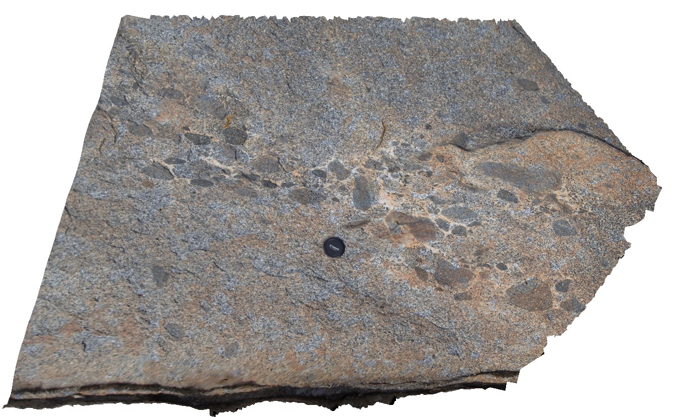
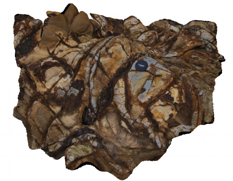
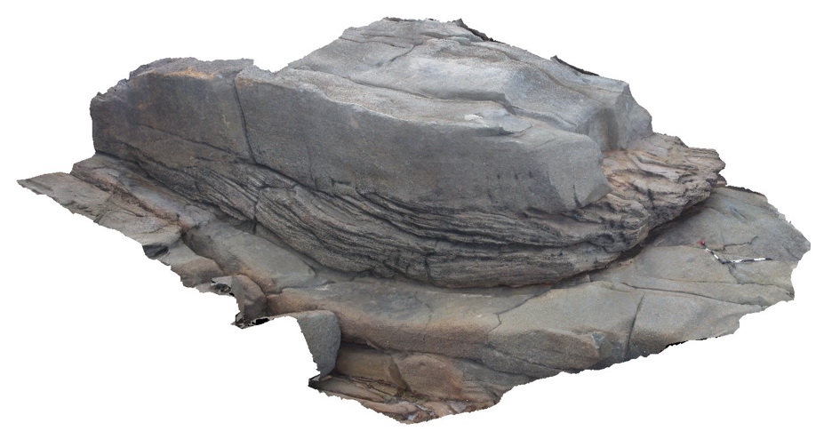
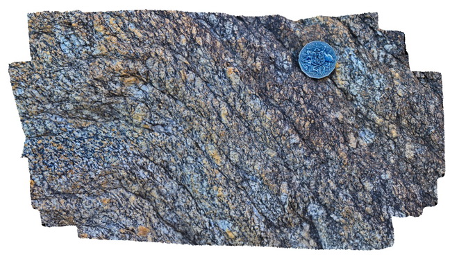
xenoliths of dark, fine grained, mafic rock in Long Point Granodiorite. Late stage more aplitic or k feldspar material around xenoliths - late melt. Pervasive bt-defined foliation within granodiorite - evidence it is a syn-orogenic granite. Tas. |
2.00 |
-41.69430300000 |
148.29438700000 |
4.000 |
xenoliths, Long Point Granodiorite, syn-orogenic |
Turbidite, Granodiorite |
Prices1 Map
 |
20 |
03/13/2015 9:12 a.m. |
3D |
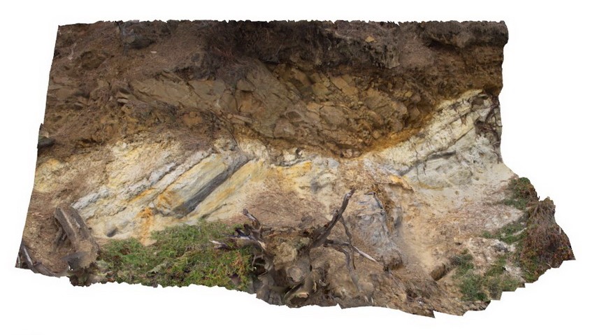
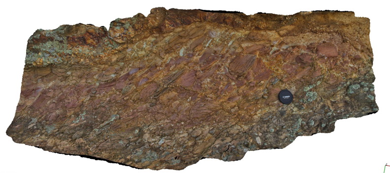
low angle thrust fault? Contact between Triassic fluvial sediments and overlying Jurassic dolerite. Prices Point, Tasman Peninsula, Tasmania. |
10.00 |
-43.03506500000 |
147.74806700000 |
0.500 |
thrust fault, fluvial sediments, structure |
dolerite, sandstone |
Prices2 Map
 |
20 |
03/13/2015 9:12 a.m. |
3D |
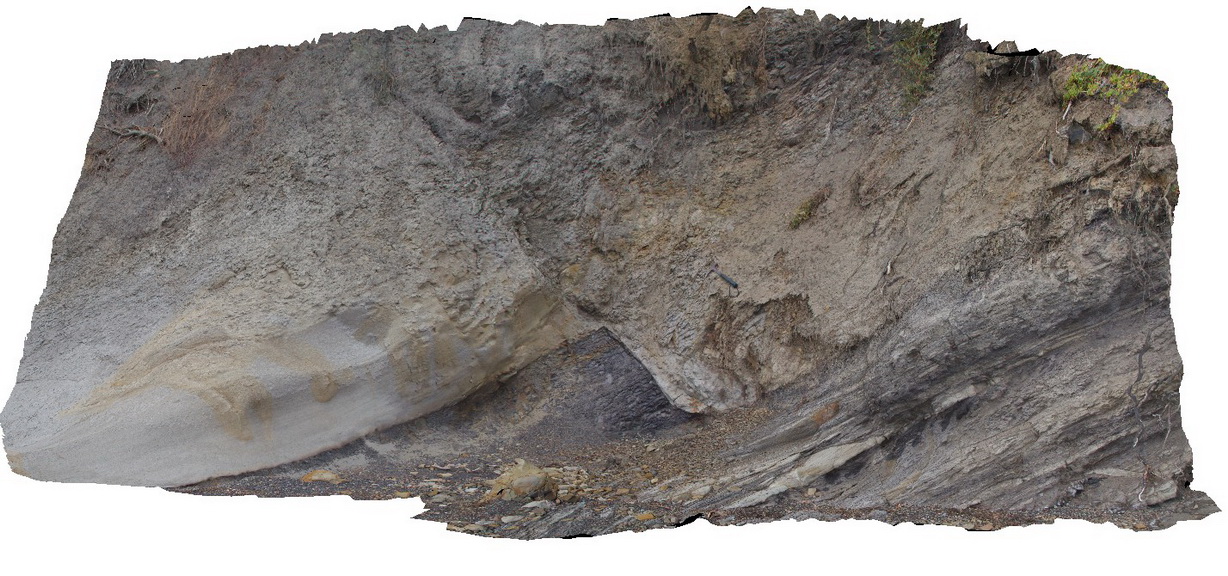
normal fault offsetting a contact between Triassic sandstone and siltstone. Prices Point, Tasman Peninsula, Tasmania. |
10.00 |
-43.03500200000 |
147.74783500000 |
0.500 |
normal fault, sandstone, siltstone, structure, sedimentology |
sandstone, siltstone |
Eden3 Map
 |
20 |
07/09/2015 9:04 a.m. |
3D |
Cooling columns at the base of B.R. volcanics. Eden, N.S.W. |
25.00 |
-37.07526500000 |
149.91372100000 |
0.000 |
rhyolite, columnar joints, igneous, volcanology |
rhyolite |
Eden4 Map
 |
5 |
07/09/2015 9:04 a.m. |
3D |
Iron oxide coated joints in felsic lava of the Devonian Boyd Volcanic Complex. Eden, N.S.W. |
1.50 |
-37.07536000000 |
149.91341000000 |
1.000 |
rhyolite, jointing, iron oxide, igneous, weathering |
rhyolite |
Eden5 Map
 |
5 |
07/09/2015 9:05 a.m. |
3D |
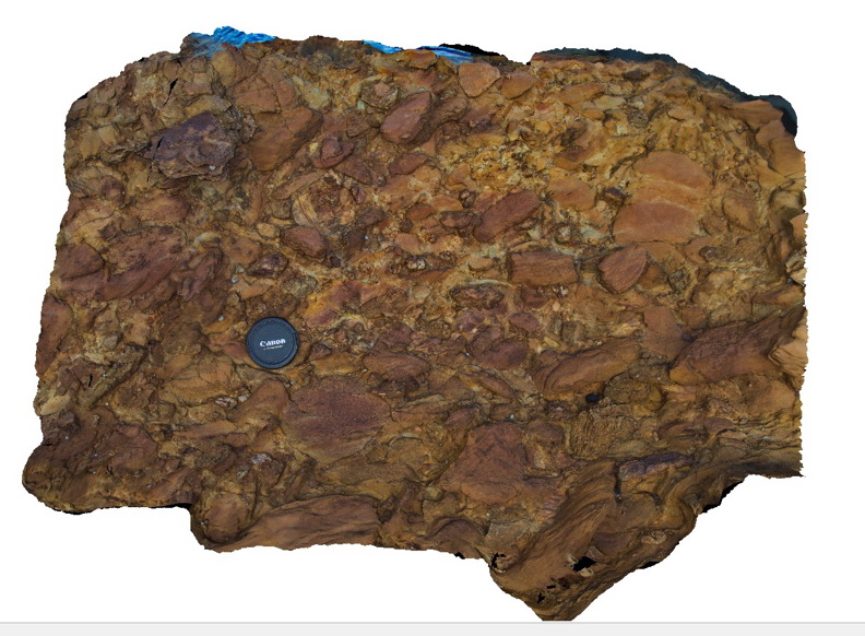
conglomerate with cobble sized angular clasts at the base of the Boyd Volcanic Complex. Eden, N.S.W. |
2.00 |
-37.07808000000 |
149.88478000000 |
2.000 |
conglomerate, sedimentology |
conglomerate |
Eden6 Map
 |
5 |
07/09/2015 9:06 a.m. |
3D |
conglomerate at the base of the Boyd River volcanics. Eden, N.S.W. |
1.50 |
-37.07814000000 |
149.88484000000 |
1.000 |
conglomerate, sedimentology |
conglomerate |
Eden7 Map
 |
5 |
07/09/2015 9:07 a.m. |
3D |
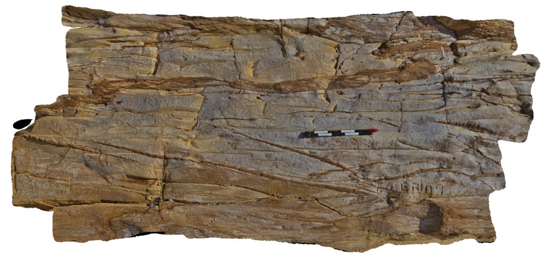
complex structures in sandstone unit of the Ordovician Pinnak Sandstone. Eden, N.S.W. |
0.50 |
-37.07926000000 |
149.87650000000 |
2.000 |
sandstone, folds, faults, structure |
sandstone |
Eden8 Map
 |
5 |
07/09/2015 9:07 a.m. |
3D |
Tight folds in Ordovician Pinnak Sandstone. Eden, N.S.W. |
1.00 |
-37.07936000000 |
149.87646000000 |
2.000 |
sandstone, folds, faults, structure |
sandstone |
Eden9 Map
 |
5 |
07/09/2015 9:08 a.m. |
3D |
Cleavage - cross cutting disrupted coarser grained lithological units in sandstone of the Ordovician Pinnak Sandstone. Eden, N.S.W. |
3.00 |
-37.07940000000 |
149.87651000000 |
2.000 |
sandstone, cleavage, structure |
sandstone |
Eden10 Map
 |
5 |
07/09/2015 9:08 a.m. |
3D |
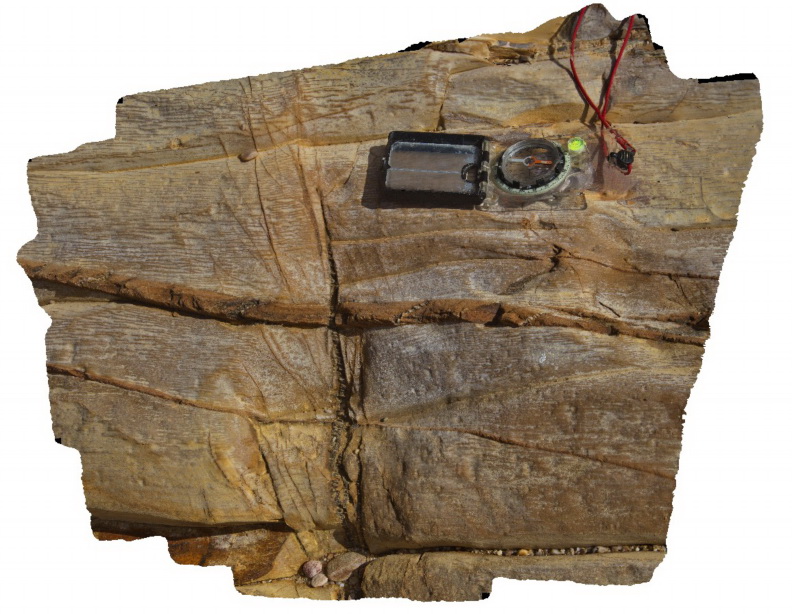
Bedding, cleavage and quartz veins in fine grained sandstone of the Ordovician Pinnak Sandstone. Eden, N.S.W. |
0.50 |
-37.07940000000 |
149.87651000000 |
2.000 |
sandstone, cleavage, structure |
sandstone |
Merimbula1 Map
 |
5 |
05/18/2015 1:21 p.m. |
3D |
en-echelon quartz veins in cross bedded sandstone. Merimbula, N.S.W. |
5.00 |
-36.88414000000 |
149.93306000000 |
2.000 |
cross beds, quartz vein, en-echelon, structure |
sandstone |
Merimbula2 Map
 |
5 |
05/18/2015 1:22 p.m. |
3D |
en echelon quartz veins in medium-coarse grained cross-bedded sandstones. Merimbula, N.S.W. |
5.00 |
-36.88403000000 |
149.93391000000 |
2.000 |
quartz veins, en-echelon, structure |
sandstone |
Merimbula3 Map
 |
5 |
05/18/2015 1:22 p.m. |
3D |
en-echelon quartz veins in medium to coarse cross bedded sandstones. Merimbula, N.S.W. |
5.00 |
-36.88396000000 |
149.93465000000 |
2.000 |
quartz veins, en-echelon, structure |
sandstone |
Merimbula4 Map
 |
5 |
05/18/2015 1:23 p.m. |
3D |
cross beds in medium grained sandstone. Merimbula, N.S.W. |
5.00 |
-36.88585000000 |
149.93343000000 |
2.000 |
cross bedding, sedimentology |
sandstone |
Merimbula5 Map
 |
5 |
05/18/2015 1:24 p.m. |
3D |
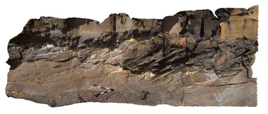
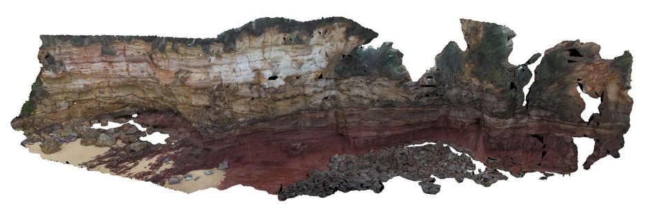
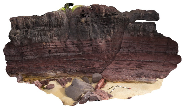
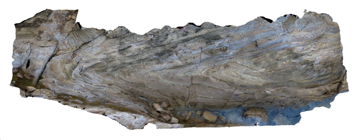
large coastal outcrop with red sandstone (red bed) overlain by yellow cross bedded sandstone. The contact between the two units is erosional. Merimbula, N.S.W. |
30.00 |
-36.88851000000 |
149.93022000000 |
2.000 |
cross bedding, erosional contact, sedimentology, stratigraphy |
sandstone |
Merimbula6 Map
 |
5 |
05/18/2015 1:25 p.m. |
3D |
detailed view of the medium to coarse grained redbed sandstone depicted in Merimbula5. Merimbula, N.S.W. |
1.00 |
-36.88815600000 |
149.93033000000 |
2.000 |
sedimentology |
sandstone |
Merimbula7 Map
 |
5 |
05/18/2015 1:25 p.m. |
3D |
Detail of bedding in medium to fine-grained red sandstone. Mottled zones of light coloured leaching are also apparent. Merimbula, N.S.W. |
1.00 |
-36.88820000000 |
149.93033000000 |
2.000 |
sedimentology, bedding |
sandstone |
Merimbula8 Map
 |
5 |
05/18/2015 1:26 p.m. |
3D |
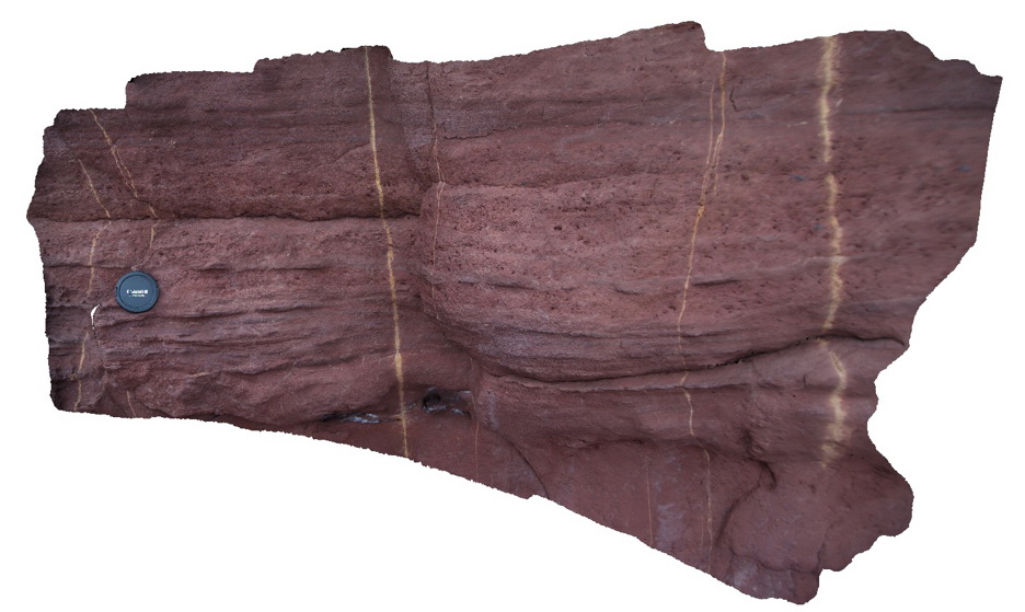
Devonian red bed sandstone cliff displaying alternations between fine and medium grainsize. Rock unit is thin to thickly bedded. Merimbula, N.S.W. |
6.00 |
-36.89697000000 |
149.93036000000 |
2.000 |
bedding, sedimentology |
sandstone |
Merimbula9 Map
 |
5 |
05/18/2015 1:26 p.m. |
3D |
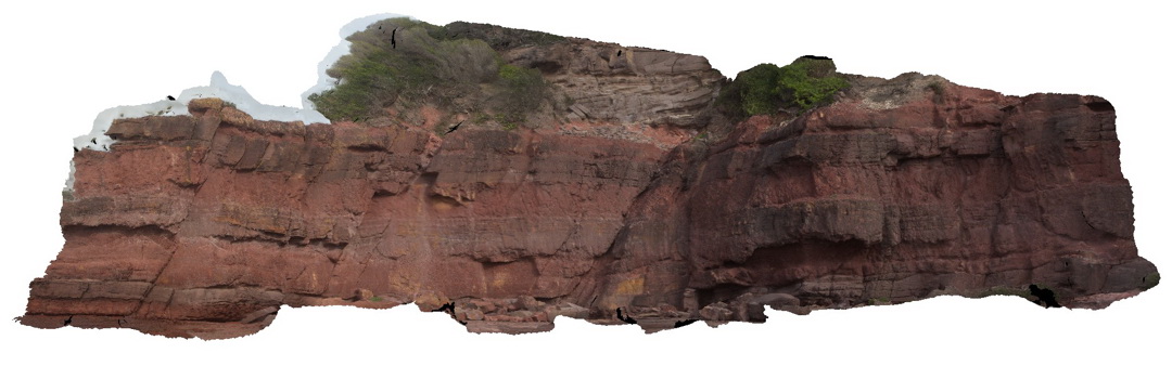
Thickly bedded red sandstone. Coarse grained units have irregular erosional lower contacts and planar upper contacts. Merimbula, N.S.W. |
15.00 |
-36.89839000000 |
149.93224000000 |
2.000 |
bedding, erosional contact, sedimentology |
sandstone |
Merimbula10 Map
 |
5 |
05/18/2015 1:21 p.m. |
3D |
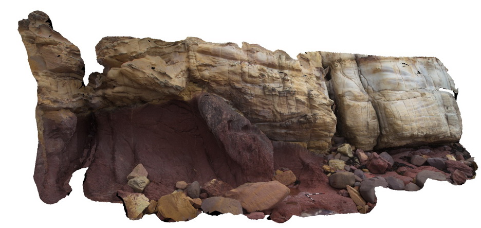
very irregular contact between yellow cross bedded sandstone and red sandstone. Merimbula, N.S.W. |
10.00 |
-36.89641000000 |
149.93002000000 |
2.000 |
bedding, erosional contact, cross bedding, sedimentology |
sandstone |
Merimbula11 Map
 |
20 |
01/01/9999 midnight |
3D |
overview of large cliff face, showing layered sandstone beds. Merimbula, N.S.W. |
10.00 |
-36.89641000000 |
149.93002000000 |
2.000 |
sandstone, sedimentology, bedding |
sandstone |
Conran16b Map
 |
5 |
07/18/2015 3:23 p.m. |
3D |
Shear textures (s-c fabric) in Cape Conran Granite. Shear fabric appears to have been folded? Cape Conran, Vic. |
0.30 |
-37.80819000000 |
148.73337000000 |
1.000 |
granite, shear, s-c fabric, structure |
granite |
BermaguiPole1 Map
 |
5 |
05/18/2015 1:01 p.m. |
3D |
pole photography of a large, tight plunging anticline in Adaminaby Group low grade turbiditic metasediments. Bermagui, N.S.W. |
20.00 |
-36.42342000000 |
150.08270000000 |
2.000 |
fold, anticline, structure |
turbidite |