Pingandy8 Map
 |
0 |
05/28/2016 noon |
3D |
possible stromatolite in dolomite. Ashburton Downs - Meekatharra Road, W.A. |
0.20 |
-24.00592000000 |
117.91161000000 |
-9999.000 |
stromatolite, fossil, palaeontology |
dolostone |
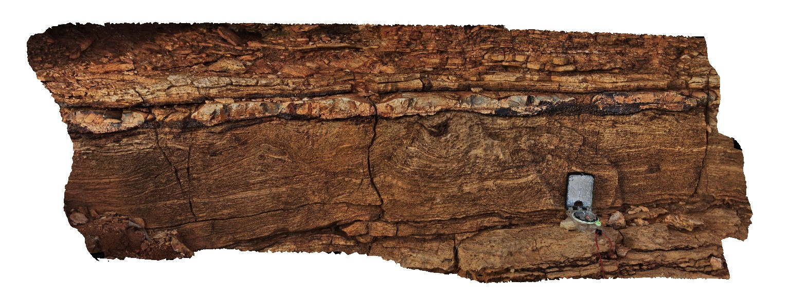
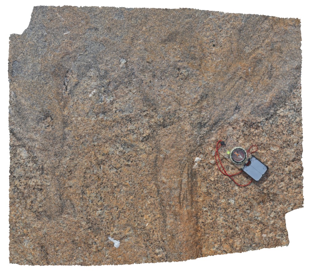
Pingandy7 Map
 |
5 |
05/27/2016 noon |
3D |
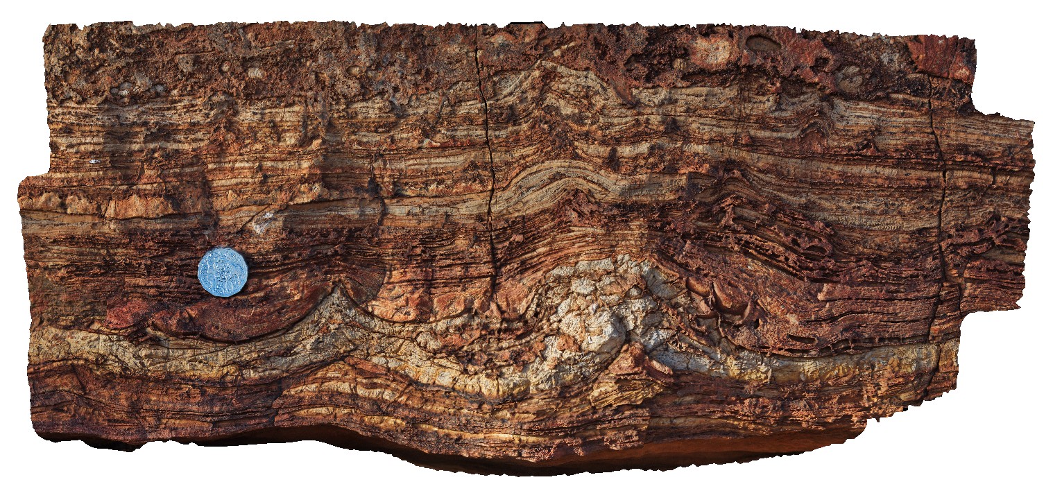
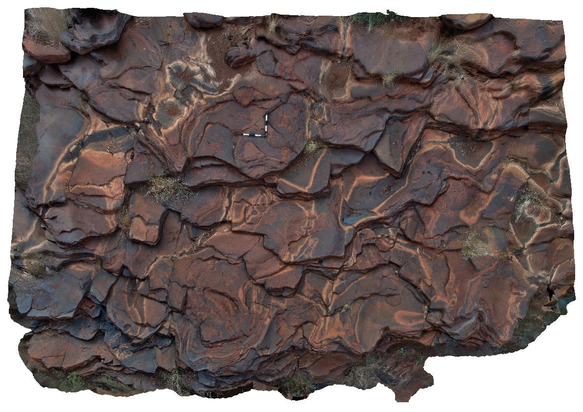
thickly bedded dololutite and dolomite. Ashburton Downs - Meekatharra Road, W.A. |
6.00 |
-24.00592000000 |
117.91161000000 |
-9999.000 |
sedimentology, dolostone |
dolostone |
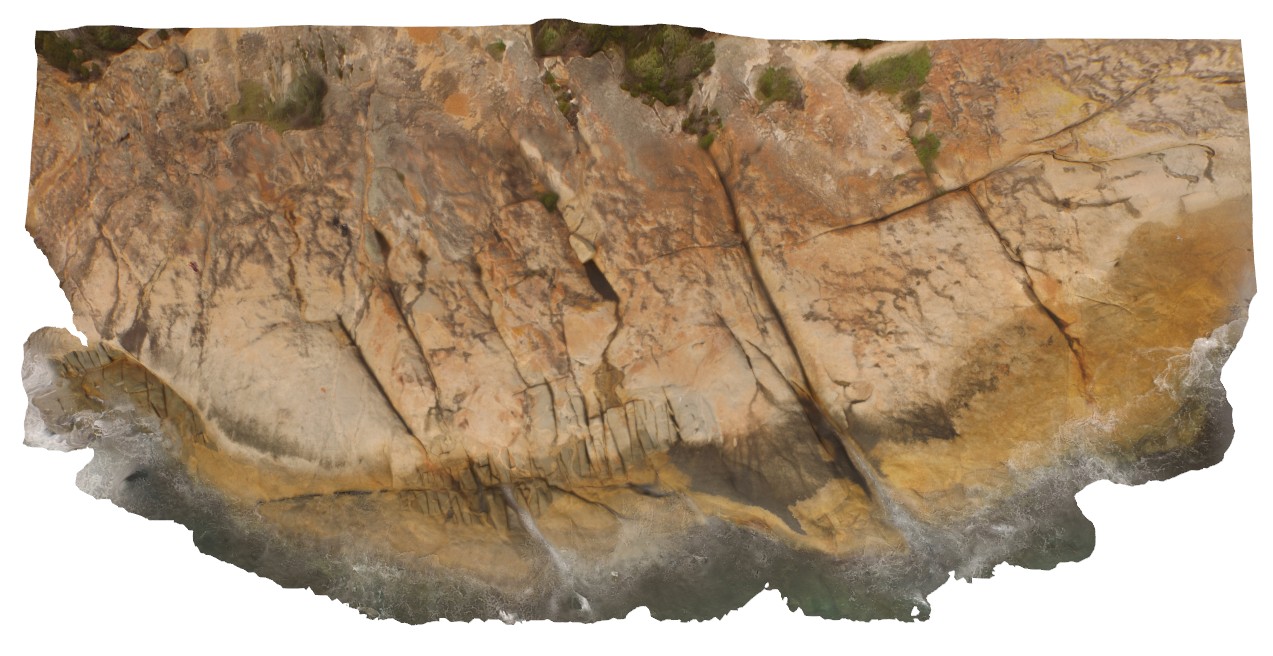
Pingandy10 Map
 |
0 |
05/28/2016 noon |
3D |
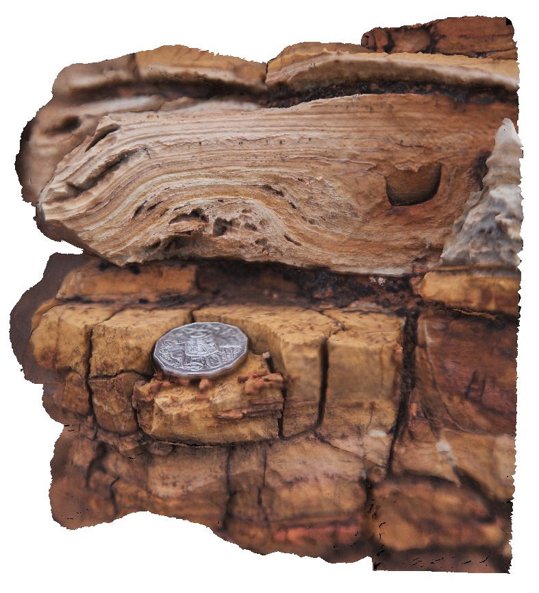
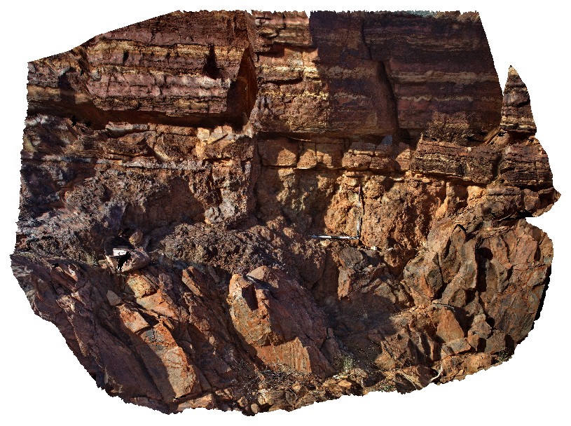
detail of chert nodule and enclosing bed of finely laminated carbonate. Pingandy, Ashburton Downs - Meekatharra Road, W.A. |
0.40 |
-23.98612000000 |
117.92156000000 |
-9999.000 |
chert nodule, carbonate, sedimentology |
carbonate |
Pingandy9 Map
 |
0 |
05/28/2016 noon |
3D |
Tee-Pee structures in finely banded carbonate and chert in the Edmund Group. Ashburton Downs - Meekatharra Road, W.A. |
1.20 |
-23.98612000000 |
117.92156000000 |
-9999.000 |
tee-pee structure, sedimentology, carbonate, chert |
carbonate |
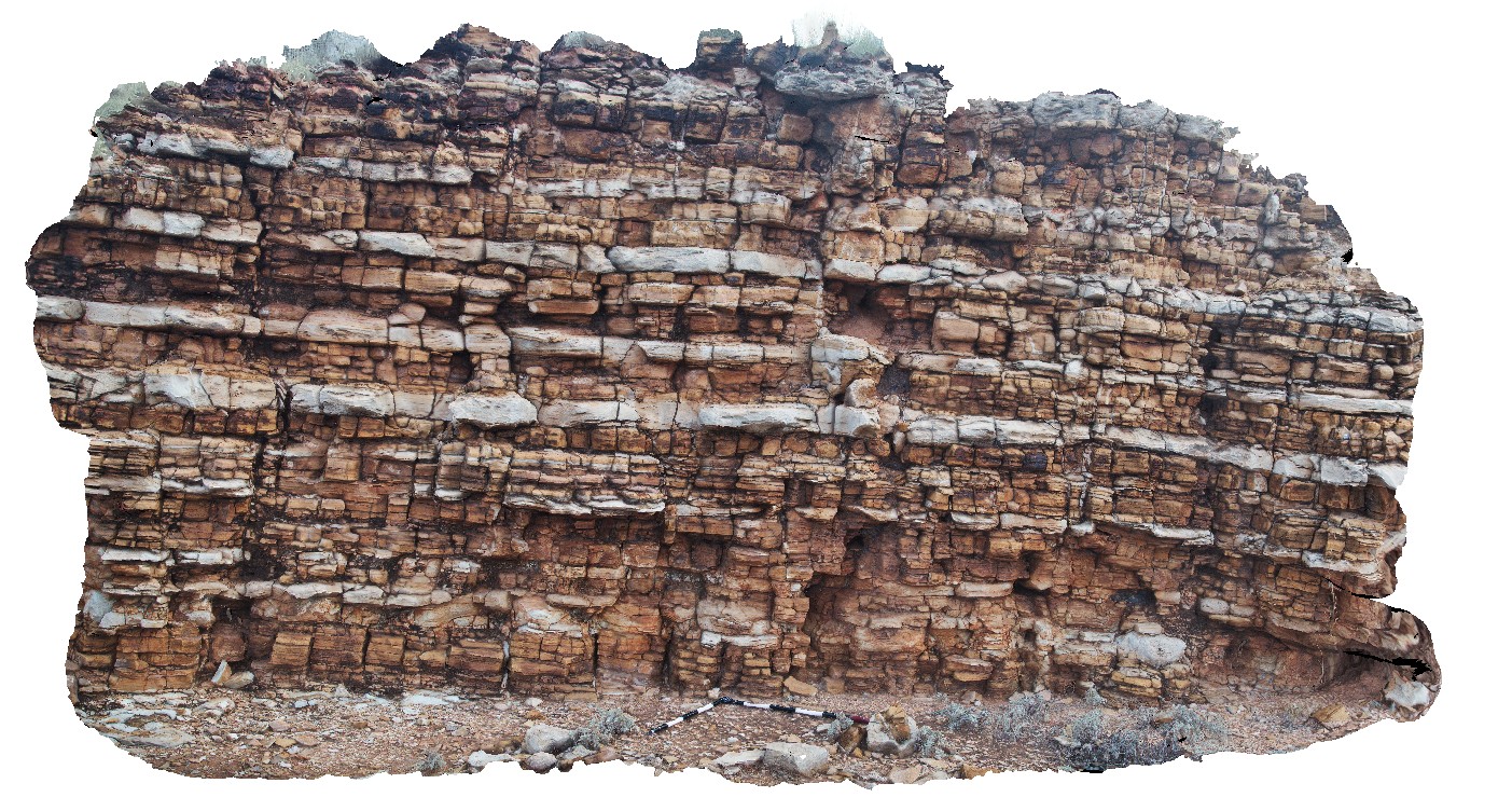
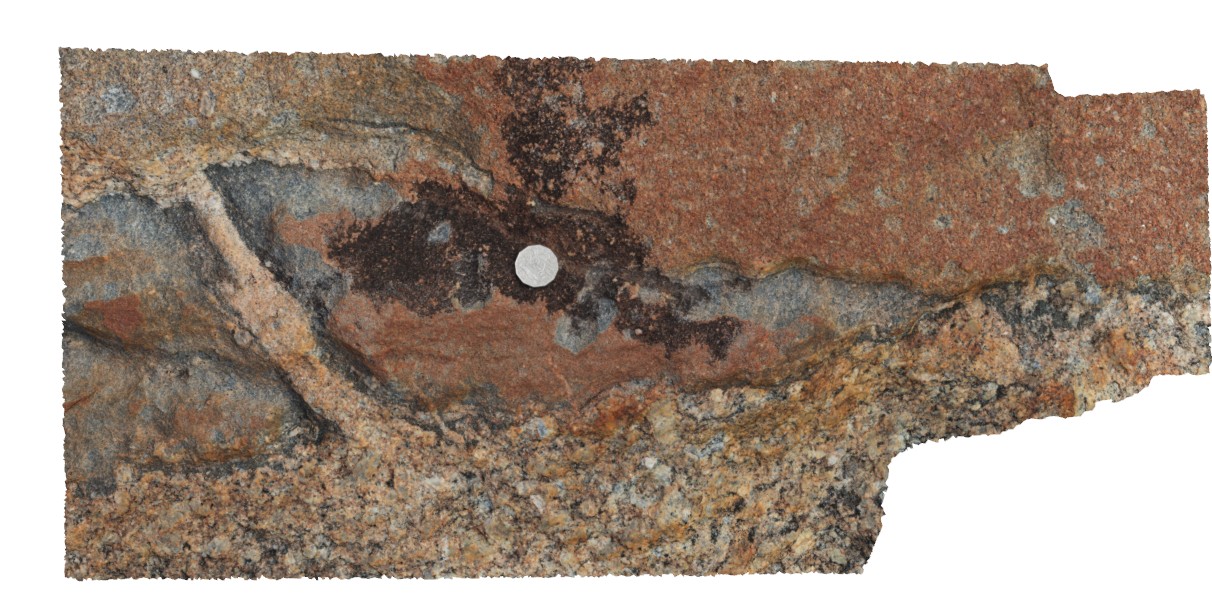
Pingandy13 Map
 |
0 |
05/28/2016 noon |
3D |
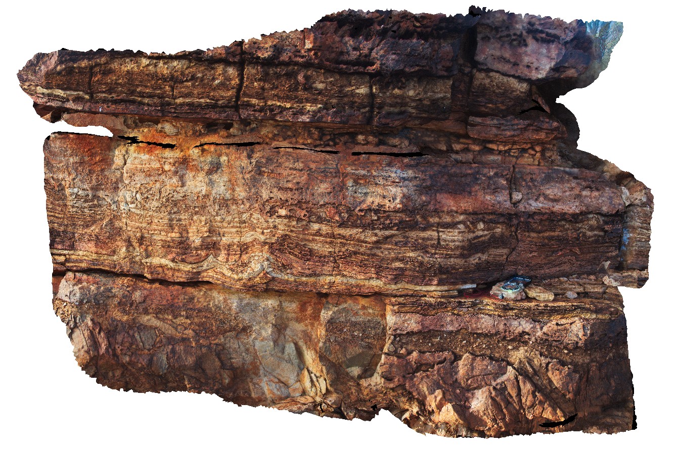
detail of unconformity with carbonate and underlying breccia layer. Pingandy, Ashburton Downs - Meekatharra Road, W.A. |
5.00 |
-23.98595000000 |
117.92158000000 |
-9999.000 |
unconformity, carbonate, sedimentary breccia |
carbonate, breccia |
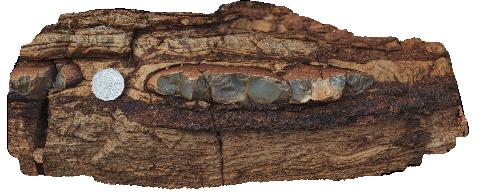
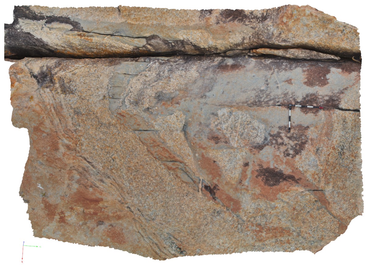
Pingandy12 Map
 |
0 |
05/28/2016 noon |
3D |
detail of stromatolite and tepee textures in thinly bedded carbonate. Pingandy, Ashburton Downs - Meekatharra Road, W.A. |
0.60 |
-23.98593000000 |
117.92158000000 |
-9999.000 |
tepee, stromatolite, carbonate, sedimentology |
carbonate |
Pingandy11 Map
 |
0 |
05/28/2016 noon |
3D |
unconformity. Sharp contact between thin pebbly layer and overlying thinly layered carbonates. Pingandy, Ashburton Downs - Meekatharra Road, W.A. |
1.00 |
-23.98593000000 |
117.92158000000 |
-9999.000 |
unconformity, pebble sandstone, carbonate, sedimentology |
carbonate |
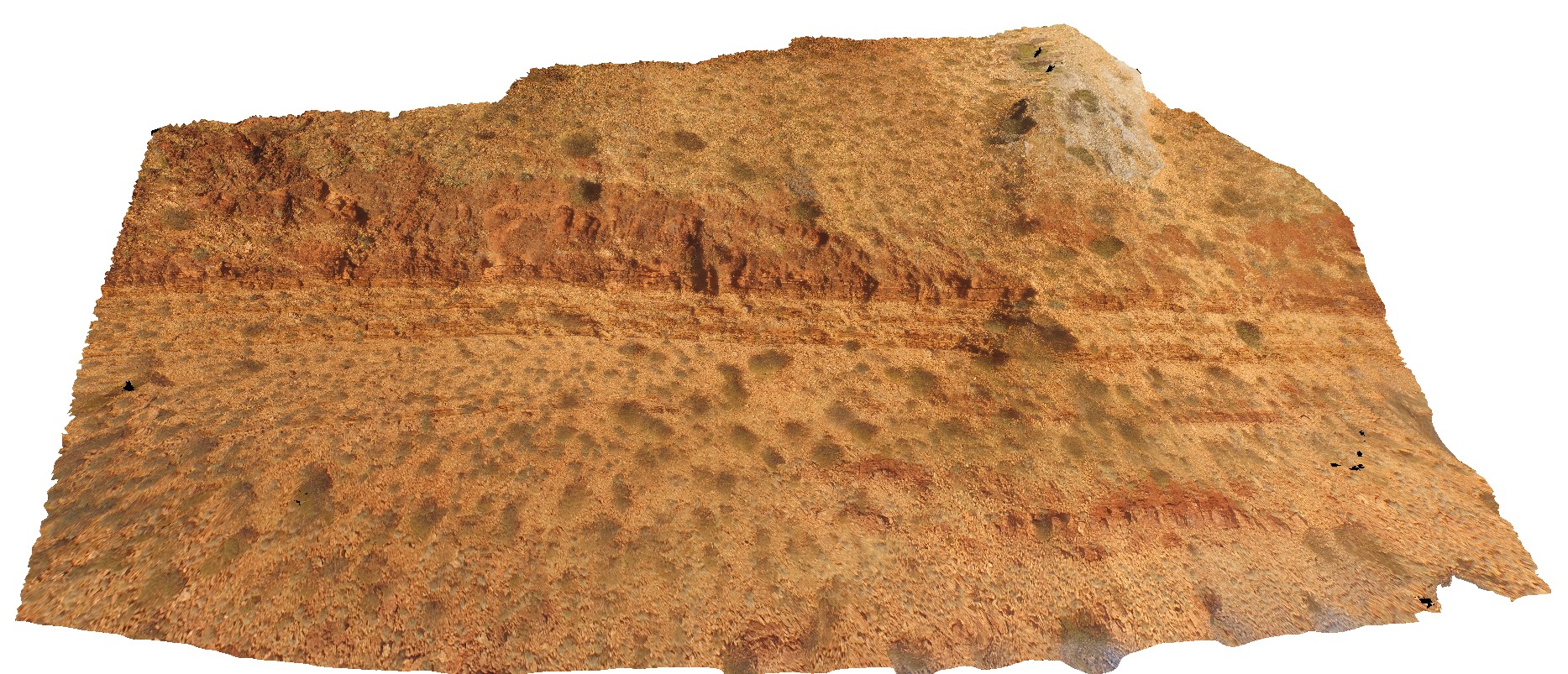
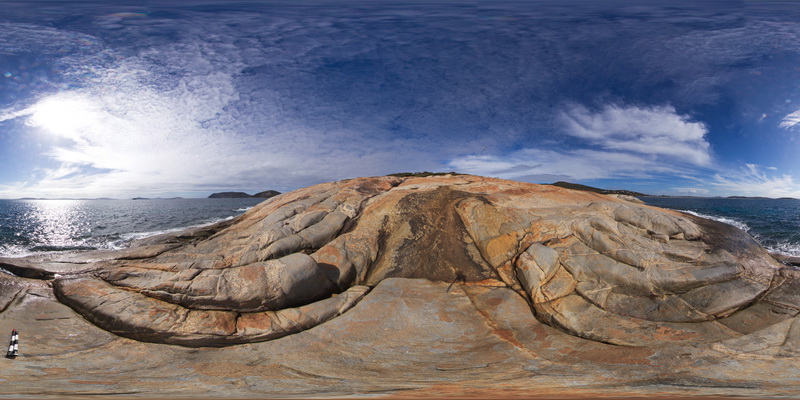
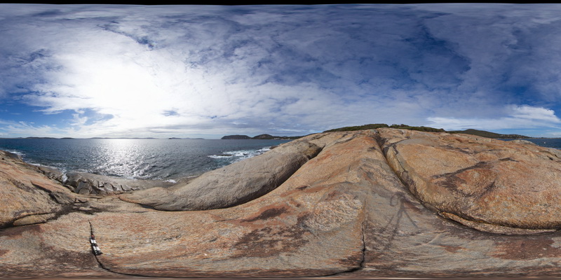
PingandyUAV1 Map
 |
0 |
05/28/2016 noon |
UAV |
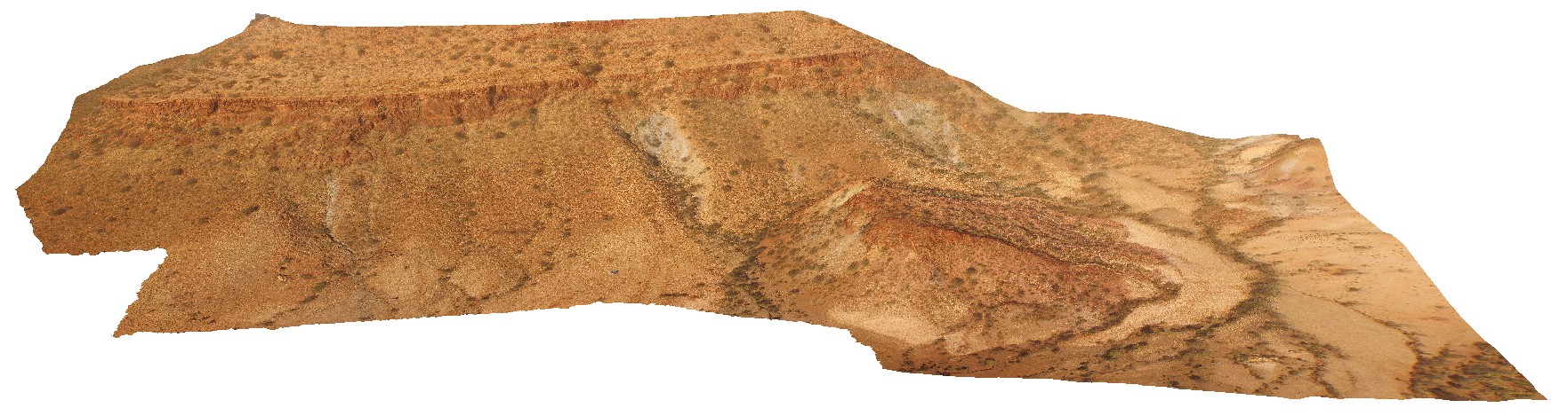
aerial view of outcrop unconformity between the Edmund Basin and the Ashburton Formation. 'Tchintaby Ridge'. Ashburton Downs - Meekatharra Road, W.A. |
100.00 |
-23.98458850000 |
117.92190660000 |
-9999.000 |
unconformity |
sandstone, sandstone |
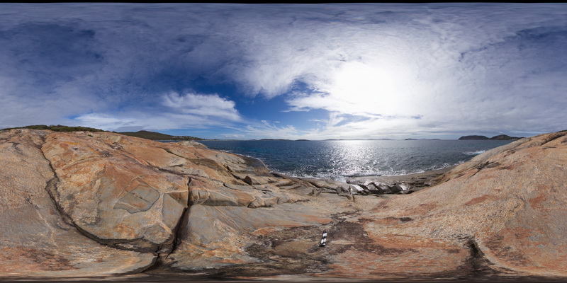
PingandyUAV2 Map
 |
0 |
05/28/2016 noon |
UAV |
detailed aerial view of outcrop unconformity between the Edmund Basin and the Ashburton Formation. 'Tchintaby Ridge'. Ashburton Downs - Meekatharra Road, W.A. |
50.00 |
-23.98536700000 |
117.92202800000 |
-9999.000 |
Tchintaby Ridge unconformity, Ashburton Formation, Edmund Basin |
sandstone, sandstone |
Albany2 Map
 |
0 |
06/05/2016 10:34 a.m. |
3D |
complex intrusive relationships showing porphyry granite with xenoliths and intruded by grey granodiorite. Albany, W.A. |
6.00 |
-35.08972000000 |
117.95035000000 |
-9999.000 |
xenolith, igneous contact |
granite, granodiorite |
AlbanyFSP4 Map
 |
0 |
06/05/2016 10:40 a.m. |
FSP |
shoreline outcrop, showing complex intrusive relationships between porphyry granite, intruded by grey granodiorite and cross cut by porphyry dykes. Albany, W.A. |
100.00 |
-35.08969000000 |
117.95036000000 |
-9999.000 |
porphyry granite, granodiorite, porphyry dyke |
granite, granodiorite, porphyry |
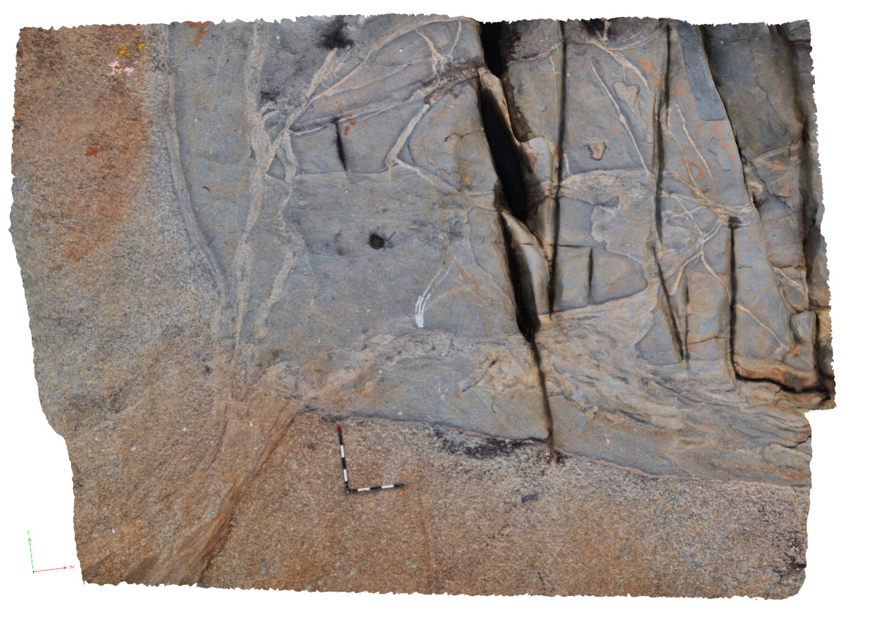
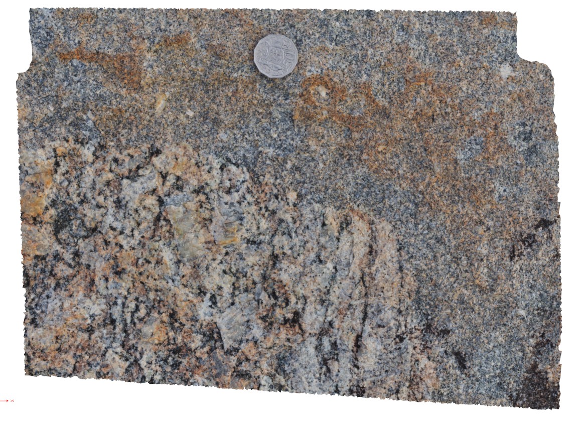
Albany5 Map
 |
0 |
06/05/2016 10:36 a.m. |
3D |
detail of grey granodiorite intruding 'quartzite' xenolith with pegmatitic segregations. Albany, W.A. |
0.80 |
-35.08971000000 |
117.95038000000 |
-9999.000 |
granodiorite, xenolith, igneous intrusion, intrusive contact |
granodiorite |
AlbanyFSP3 Map
 |
0 |
06/05/2016 10:39 a.m. |
FSP |
shoreline outcrop, showing complex intrusive relationships between porphyry granite, intruded by grey granodiorite and cross cut by porphyry dykes. Albany, W.A. |
100.00 |
-35.08969000000 |
117.95044000000 |
-9999.000 |
granodiorite, granite, porphyry dyke |
granite, granodiorite, porphyry |
AlbanyFSP2 Map
 |
0 |
06/05/2016 10:39 a.m. |
FSP |
shoreline outcrop, showing complex intrusive relationships between porphyry granite, intruded by grey granodiorite and cross cut by porphyry dykes. Albany, W.A. |
100.00 |
-35.08977000000 |
117.95050000000 |
-9999.000 |
igneous contact, intrusive contact, xenolith |
granite, granodiorite, porphyry |
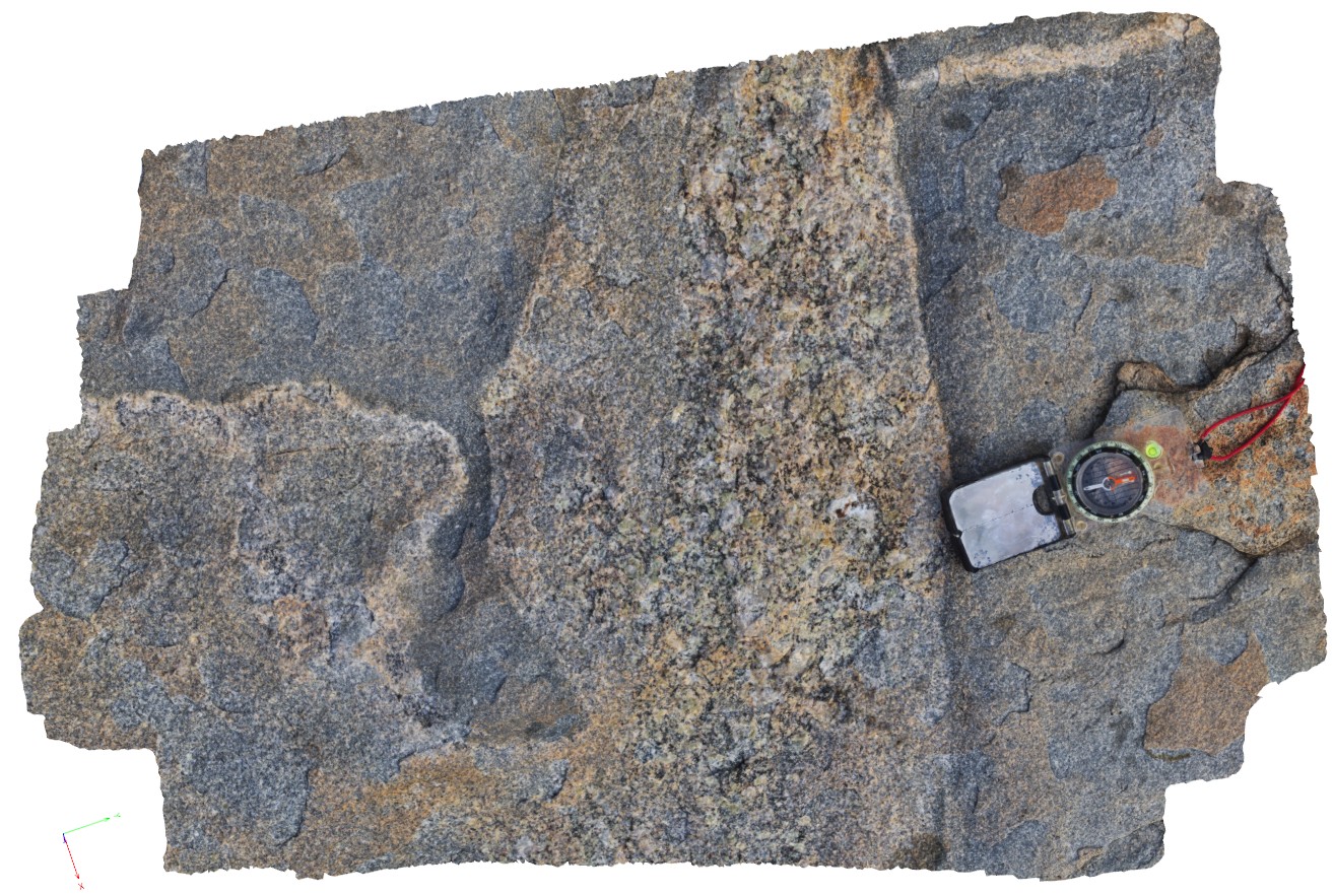
Albany3 Map
 |
0 |
06/05/2016 10:35 a.m. |
3D |
macro view of contact between porphyritic granite and grey granodiorite, Albany, W.A. |
0.40 |
-35.08981000000 |
117.95055000000 |
-9999.000 |
granodiorite, porphyritic granite, igneous contact, intrusive contact |
granite, granodiorite |
AlbanyUAV1 Map
 |
0 |
01/01/9999 midnight |
UAV |
aerial view, showing complex relationships in granite. Porphyritic granite with 'quartzite' xenoliths intruded by grey 'granodiorite' all cut by thin pegmatite dykes. Albany, W.A. |
50.00 |
-35.08986000000 |
117.95056000000 |
-9999.000 |
granite, intrusive contact, xenolith |
granite, granodiorite, porphyry |
Albany1 Map
 |
0 |
06/05/2016 10:34 a.m. |
3D |
porphyritic granite with quartzite rafts, xenoliths and cut by grey granodiorite bodies |
5.00 |
-35.08986000000 |
117.95056000000 |
1.000 |
granite, xenolith |
granite |
Albany4 Map
 |
0 |
06/05/2016 10:35 a.m. |
3D |
complex intrusive relationships showing porphyry granite with xenoliths and intruded by grey granodiorite. Albany, W.A. |
0.80 |
-35.08982000000 |
117.95057000000 |
-9999.000 |
porphyritic granite, granodiorite, porphyry dyke, igneous contact |
granite, granodiorite |
AlbanyFSP1 Map
 |
0 |
06/05/2016 10:39 a.m. |
FSP |
shore outcrop of intrusive contact between porphyritic granite and grey finer-grained granodiorite. Albany, W.A. |
100.00 |
-35.08979000000 |
117.95058000000 |
-9999.000 |
igneous contact, porphyritic granite, granodiorite |
granite, granodiorite |
Albany6 Map
 |
0 |
06/05/2016 10:36 a.m. |
3D |
detail of 'wispy' contact between porphyritic granite and grey granodiorite, Albany, W.A. |
0.70 |
-35.08973000000 |
117.95635000000 |
-9999.000 |
igneous contact, granodiorite |
granite, granodiorite |
MtBruce2 Map
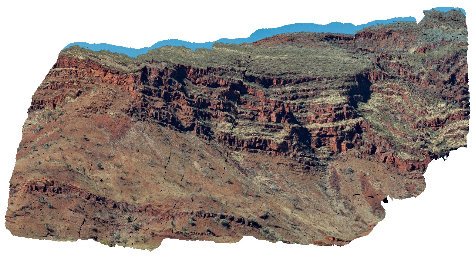 |
0 |
05/29/2016 noon |
3D |
view of the stratigraphy of Mount Bruce. Exposed core of synform with the Brockman Iron Formation and Mount McRae Shale and Mount Sylvia Formations. Openly folded, gently dipping stratigraphy. Mount Bruce, Pilbara, W.A. |
1000.00 |
-22.57421700000 |
118.13826800000 |
-9999.000 |
Mount Bruce, open folds, monocline, structure, stratigraphy |
BIF, shale |
MtBruce1 Map
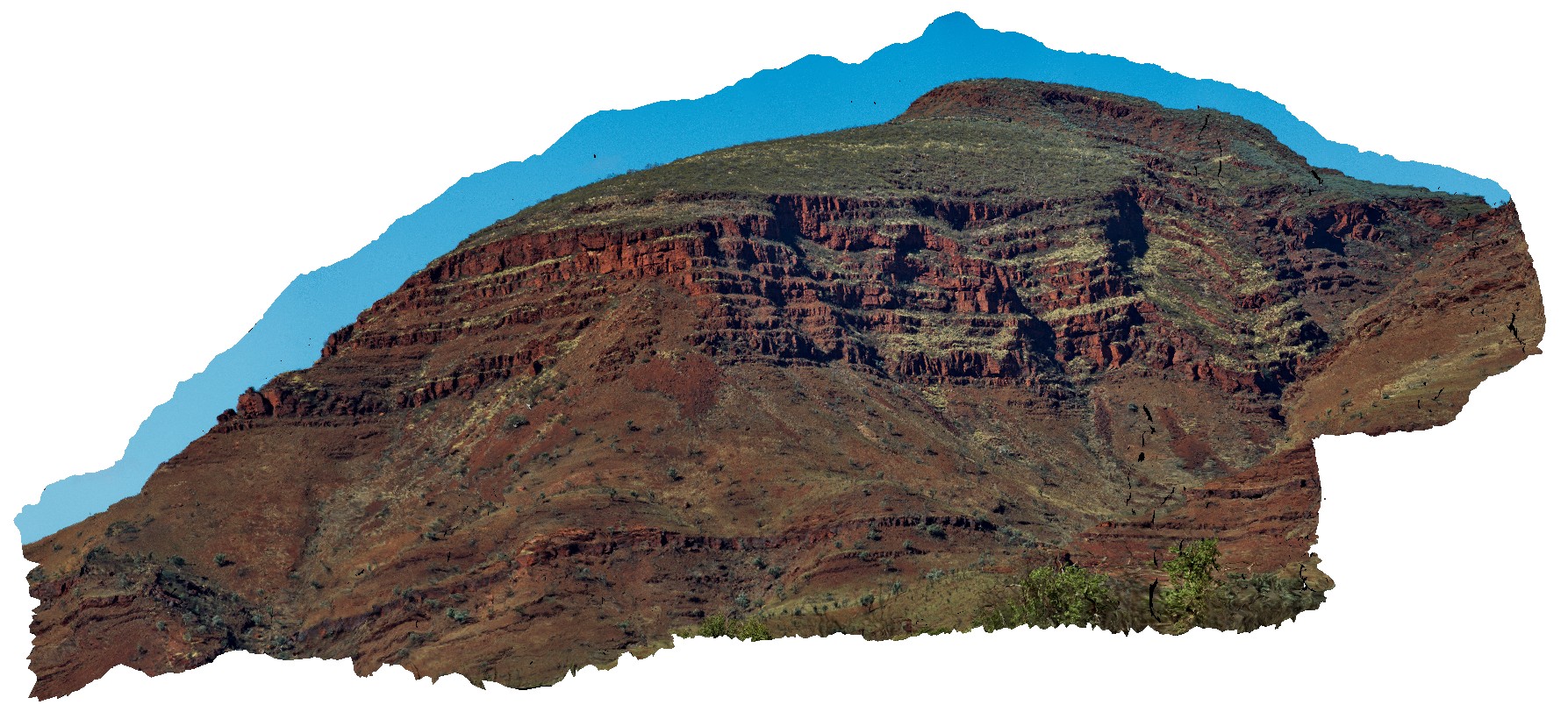 |
0 |
05/29/2016 noon |
3D |
view of the stratigraphy of Mount Bruce. Exposed core of synform with the Brockman Iron Formation and Mount McRae Shale and Mount Sylvia Formations. Openly folded, gently dipping stratigraphy. Mount Bruce, Pilbara, W.A. |
1000.00 |
-22.57421700000 |
118.13826800000 |
-9999.000 |
Mount Bruce, Pilbara, fold, open fold |
BIF, shale |
Joffre1 Map
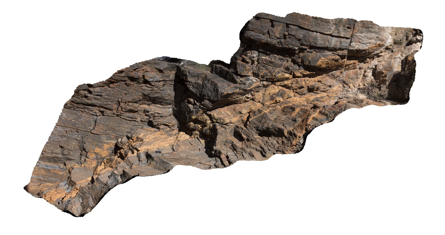 |
5 |
08/02/2016 noon |
3D |
Fault filled with fibrous carbonate minerals in BIF formation near entrance to Joffre Gorge. Karijini National Park, W.A. |
4.00 |
-22.39036100000 |
118.26834600000 |
-9999.000 |
banded Iron Formation, fault, carbonate, structure |
BIF |
Karijini1 Map
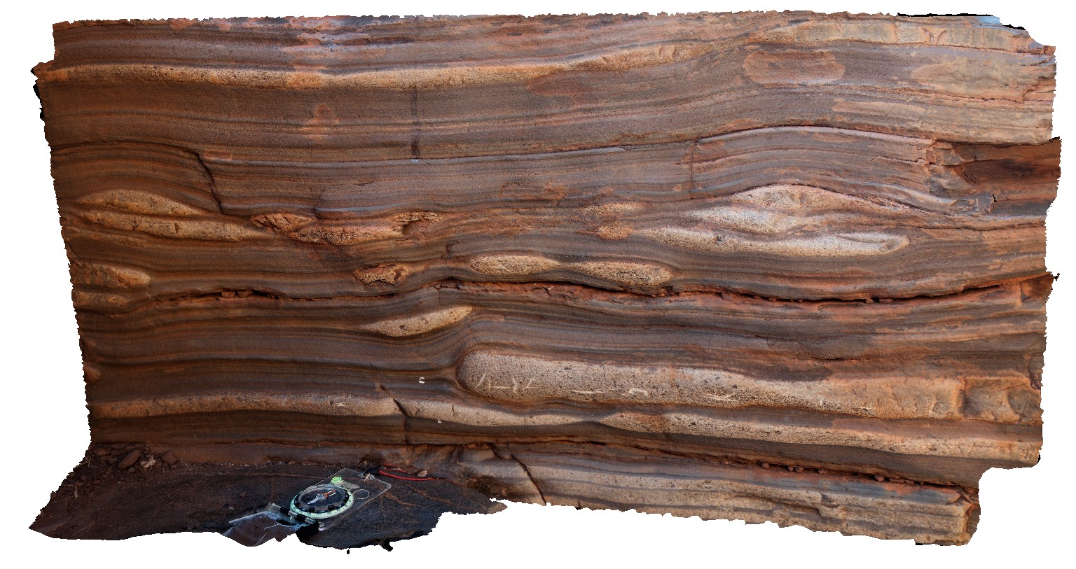 |
0 |
05/29/2016 noon |
3D |
sandstone lenses in the Brockman Iron Formation, Handcock Gorge. Karijini National Park. W.A. |
0.70 |
-22.35906000000 |
118.28644000000 |
-9999.000 |
Brockman Iron Formation, banded iron formation, sandstone lenses, sedimentology |
BIF |
Karijini9 Map
 |
0 |
05/29/2016 noon |
3D |
low amplitude open folds in banded iron formation. Handrail Pool, Weano Gorge, Karijini National Park. W.A. |
7.00 |
-22.35718000000 |
118.28704000000 |
-9999.000 |
open folds, fold, structure, banded iron formation |
BIF |