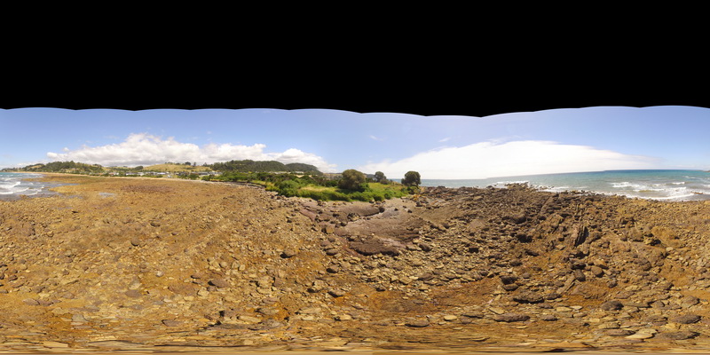
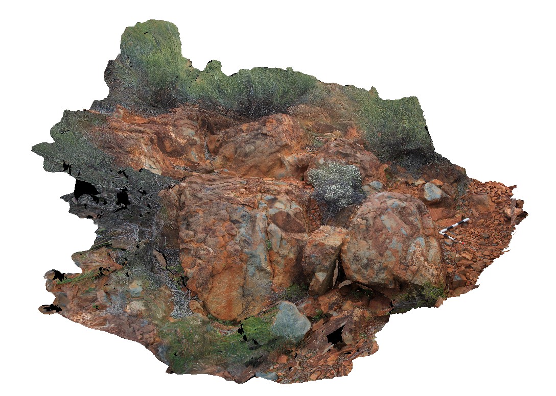
BluestoneFSP8 Map
 |
5 |
01/01/9999 midnight |
FSP |
View of granodiorite with xenoliths. Bluestone Bay, Freycinet. Tasmania. |
100.00 |
-42.10343200000 |
148.33744000000 |
2.000 |
xenolith, granodiorite |
granodiorite |
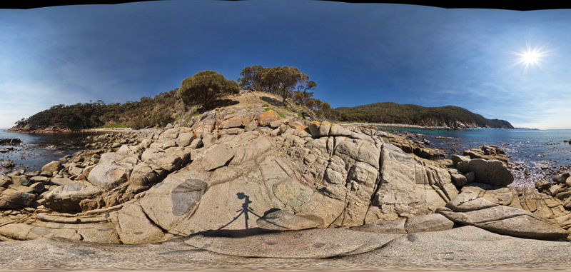
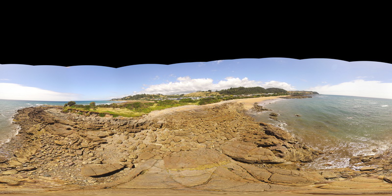
BluestoneFSP7 Map
 |
5 |
01/01/9999 midnight |
FSP |
View of granodiorite with cross-cutting aplite dykes. Bluestone Bay, Freycinet. Tasmania. |
500.00 |
-42.10540700000 |
148.33402300000 |
2.000 |
granodiorite, aplite |
granodiorite |
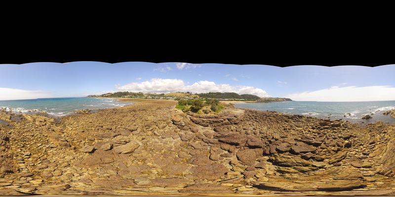
BluestoneFSP6 Map
 |
5 |
01/01/9999 midnight |
FSP |
View of granodiorite with xenoliths and cross-cutting aplite dykes. Bluestone Bay, Freycinet. Tasmania. |
500.00 |
-42.10531800000 |
148.33388800000 |
2.000 |
granodiorite, aplite dyke, xenolith |
granodiorite |
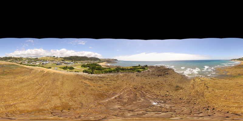
BluestoneFSP5 Map
 |
5 |
01/01/9999 midnight |
FSP |
View of granodiorite with abundant xenoliths. Bluestone Bay, Freycinet. Tasmania. |
500.00 |
-42.10553000000 |
148.33378800000 |
2.000 |
xenolith, granodiorite |
granodiorite |
BluestoneFSP4 Map
 |
5 |
01/01/9999 midnight |
FSP |
View of granodiorite with abundant xenoliths. Bluestone Bay, Freycinet. Tasmania. |
500.00 |
-42.10553000000 |
148.33378800000 |
2.000 |
xenolith, granodiorite, intrusive |
granodiorite |
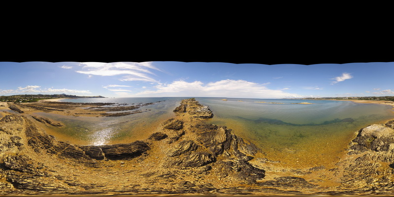
BluestoneFSP3 Map
 |
5 |
01/01/9999 midnight |
FSP |
View of disaggregated mafic dyke, Bluestone Bay, Freycinet. Tasmania. |
500.00 |
-42.10440800000 |
148.33218000000 |
2.000 |
dyke, granodiorite |
granodiorite, mafic |
BluestoneFSP3 Map
|
5 |
01/01/9999 midnight |
FSP |
View of disaggregated mafic dyke, Bluestone Bay, Freycinet. Tasmania. |
500.00 |
-42.10440800000 |
148.33218000000 |
2.000 |
dyke, granodiorite |
granodiorite, mafic |
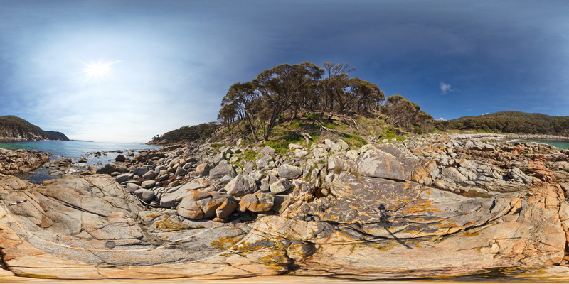
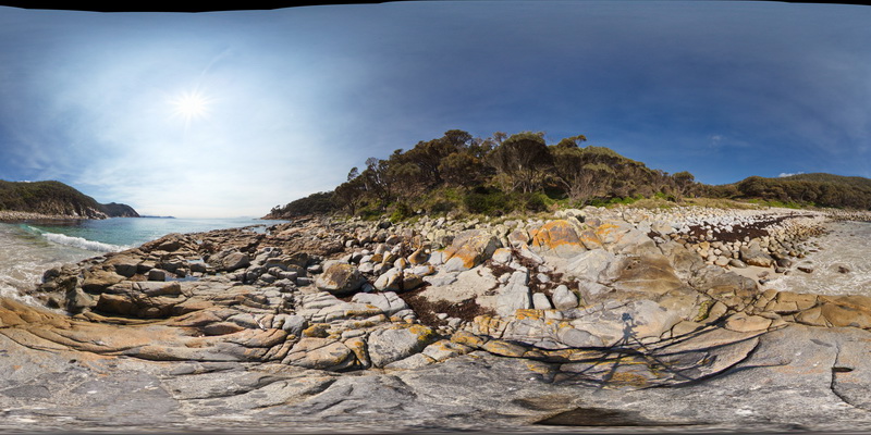
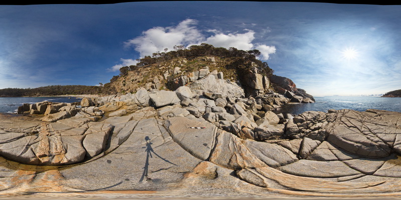
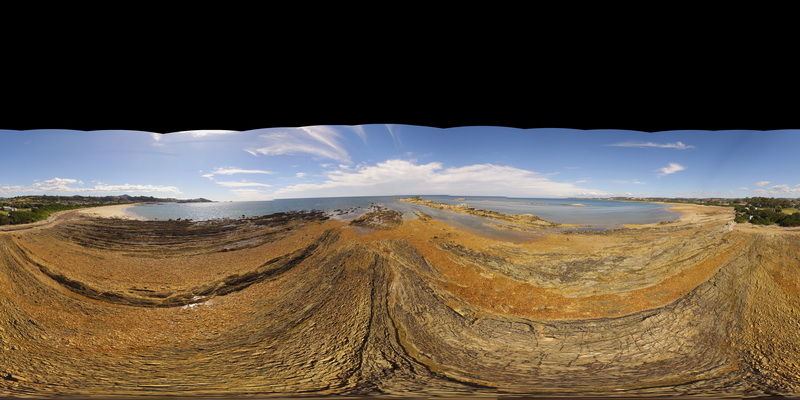
BluestoneFSP2 Map
 |
5 |
01/01/9999 midnight |
FSP |
360 degree view of grey granodiorite with intruding aplite dykes. Bluestone Bay. Tasmania. |
500.00 |
-42.10414300000 |
148.33217600000 |
2.000 |
granodiorite, aplite, dyke |
granodiorite, aplite |
BluestoneFSP2 Map
|
5 |
01/01/9999 midnight |
FSP |
360 degree view of grey granodiorite with intruding aplite dykes. Bluestone Bay. Tasmania. |
500.00 |
-42.10414300000 |
148.33217600000 |
2.000 |
granodiorite, aplite, dyke |
granodiorite, aplite |
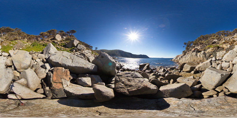
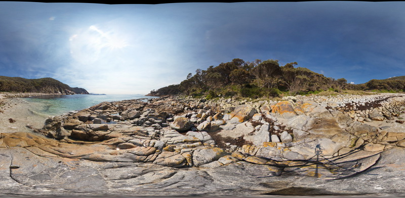
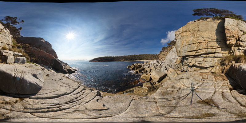
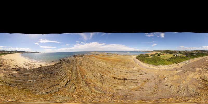
BluestoneFSP1 Map
 |
5 |
01/01/9999 midnight |
FSP |
360 degree view of grey granodiorite with intruding aplite dykes. Bluestone Bay. Tasmania. |
500.00 |
-42.10373900000 |
148.33212600000 |
2.000 |
granodiorite, aplite, dyke |
granodiorite, aplite |
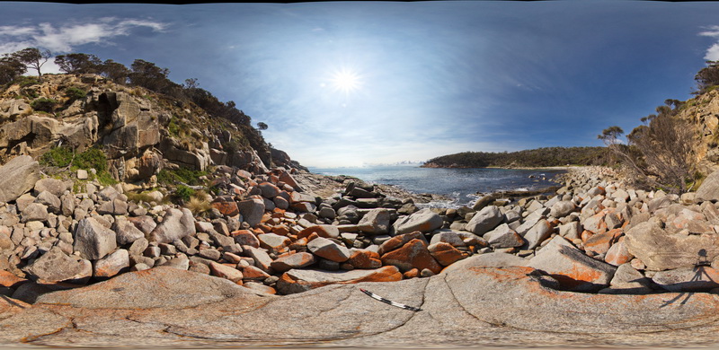
BluestoneFSP10 Map
 |
5 |
01/01/9999 midnight |
FSP |
View of granodiorite with xenoliths. Bluestone Bay, Freycinet. Tasmania. |
500.00 |
-42.10512000000 |
148.33464800000 |
2.000 |
granodiorite, xenolith |
granodiorite |
BluestoneFSP1 Map
|
5 |
01/01/9999 midnight |
FSP |
360 degree view of grey granodiorite with intruding aplite dykes. Bluestone Bay. Tasmania. |
500.00 |
-42.10373900000 |
148.33212600000 |
2.000 |
granodiorite, aplite, dyke |
granodiorite, aplite |
HallPointFSP4 Map
 |
20 |
01/01/9999 midnight |
FSP |
basal Ordovician unconformity with underlying folded Precambrian quartzite. Hall Point, Sulphur Creek. Tasmania. |
300.00 |
-41.09298700000 |
146.02833200000 |
1.000 |
unconformity, metasediments |
quartzite, conglomerate |
HallPointFSP4 Map
|
20 |
01/01/9999 midnight |
FSP |
basal Ordovician unconformity with underlying folded Precambrian quartzite. Hall Point, Sulphur Creek. Tasmania. |
300.00 |
-41.09298700000 |
146.02833200000 |
1.000 |
unconformity, metasediments |
quartzite, conglomerate |
HallPointFSP3 Map
 |
20 |
01/01/9999 midnight |
FSP |
basal Ordovician unconformity with underlying folded Precambrian quartzite. Hall Point, Sulphur Creek. Tasmania. |
500.00 |
-41.09298700000 |
146.02833200000 |
1.000 |
unconformity, metasediments |
quartzite, conglomerate |
HallPointFSP3 Map
|
20 |
01/01/9999 midnight |
FSP |
basal Ordovician unconformity with underlying folded Precambrian quartzite. Hall Point, Sulphur Creek. Tasmania. |
500.00 |
-41.09298700000 |
146.02833200000 |
1.000 |
unconformity, metasediments |
quartzite, conglomerate |
HallPointFSP2 Map
 |
20 |
01/01/9999 midnight |
FSP |
basal Ordovician unconformity with underlying folded Precambrian quartzite. Hall Point, Sulphur Creek. Tasmania. |
500.00 |
-41.09298700000 |
146.02833200000 |
1.000 |
unconformity |
quartzite, conglomerate |
HallPointFSP2 Map
|
20 |
01/01/9999 midnight |
FSP |
basal Ordovician unconformity with underlying folded Precambrian quartzite. Hall Point, Sulphur Creek. Tasmania. |
500.00 |
-41.09298700000 |
146.02833200000 |
1.000 |
unconformity |
quartzite, conglomerate |
HallPointFSP1 Map
 |
20 |
01/01/9999 midnight |
FSP |
basal Ordovician unconformity with underlying folded Precambrian quartzite. Hall Point, Sulphur Creek. Tasmania. |
500.00 |
-41.09298700000 |
146.02833200000 |
1.000 |
unconformity, fold, structure |
quartzite, conglomerate |
HallPointFSP1 Map
|
20 |
01/01/9999 midnight |
FSP |
basal Ordovician unconformity with underlying folded Precambrian quartzite. Hall Point, Sulphur Creek. Tasmania. |
500.00 |
-41.09298700000 |
146.02833200000 |
1.000 |
unconformity, fold, structure |
quartzite, conglomerate |
PicnicPtFSP3 Map
 |
5 |
01/01/9999 midnight |
FSP |
360 degree view of folding and faulting in pelite and psammite beds exposed at Picnic Point, Northern Tas. |
250.00 |
-41.14010200000 |
146.16233400000 |
1.000 |
kink band, fault, fold, structure, metasediment |
metasediment |
PicnicPtFSP2 Map
 |
5 |
01/01/9999 midnight |
FSP |
360 degree view of fault in pelite and psammite beds exposed at Picnic Point, Northern Tas. |
250.00 |
-41.14010200000 |
146.16233400000 |
1.000 |
fault, structure, metasediments |
metasediments |
PicnicPtFSP1 Map
 |
5 |
01/01/9999 midnight |
FSP |
360 degree view of folded pelite and psammite beds exposed at Picnic Point, Northern Tas. |
250.00 |
-41.14010200000 |
146.16233400000 |
1.000 |
metasediments, fold, structure |
metasediments |
Ninghan2 Map
 |
5 |
01/01/9999 midnight |
3D |
Archean meta-pillow basalts with interpillow quartz-cemented breccia. Thick unit located at the top of Mount Singleton, near Great Northern Highway, W.A. |
4.35 |
-29.37333320000 |
117.27916670000 |
650.000 |
Metabasalt, Pillow basalt, Interpillow breccia |
basalt |
MtGippsUAV3 Map
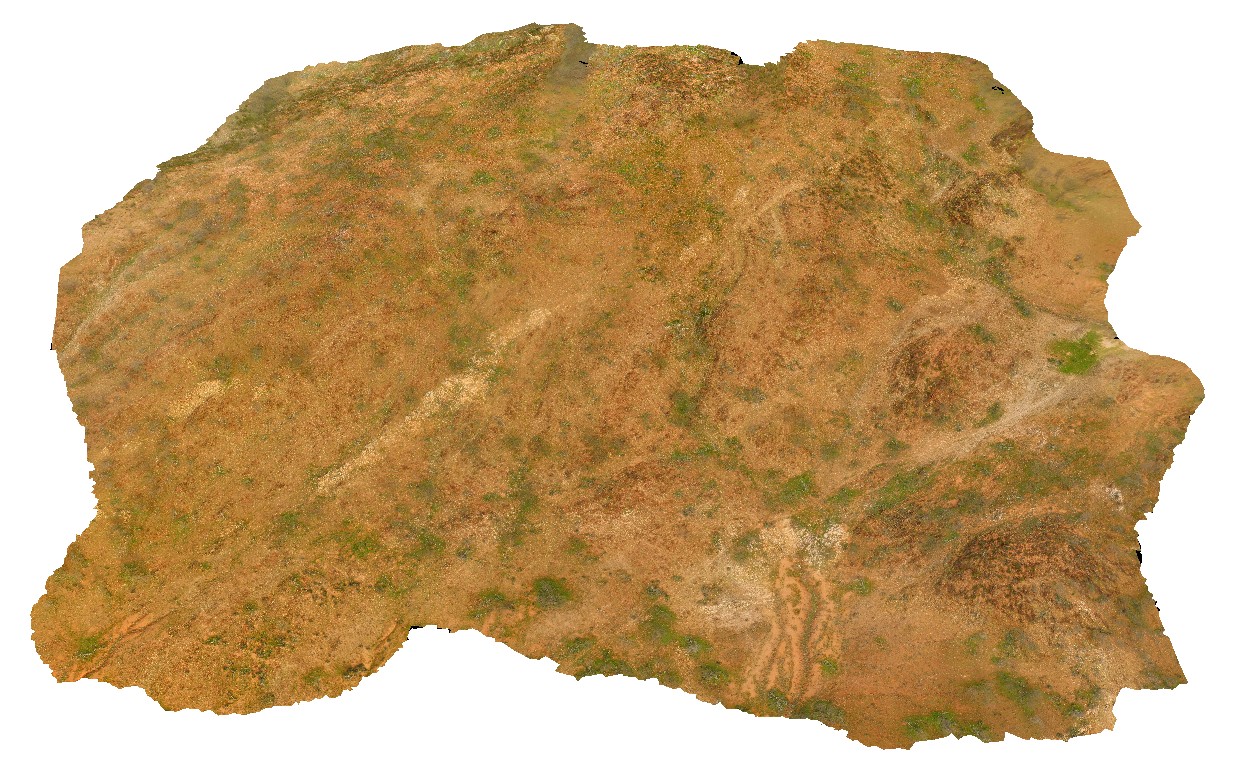 |
50 |
06/27/2016 noon |
UAV |
metasediments, Mount Gipps, N.S.W. |
420.00 |
-31.61280890000 |
141.49239520000 |
-9999.000 |
metasediments, metamorphic |
metasediments |