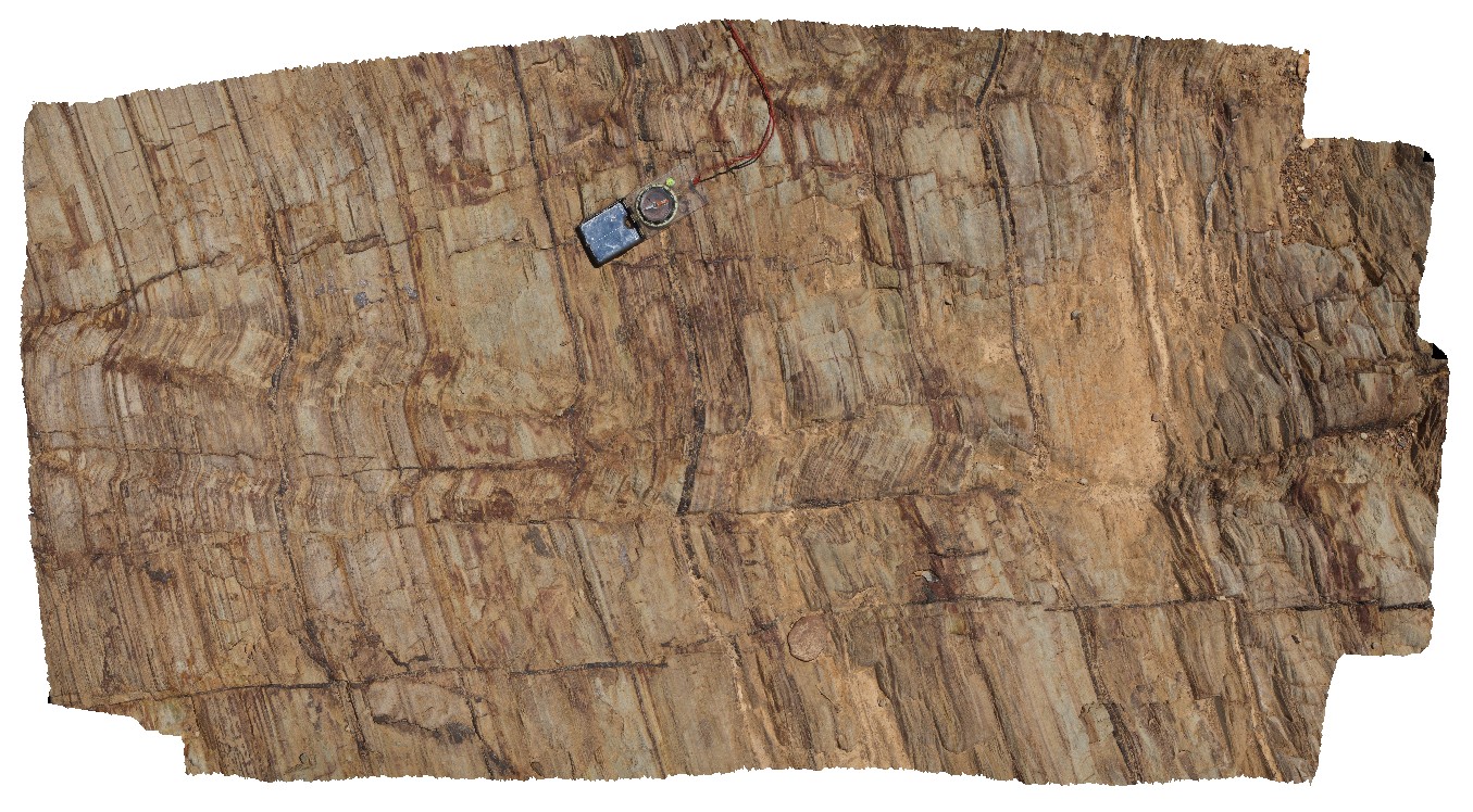
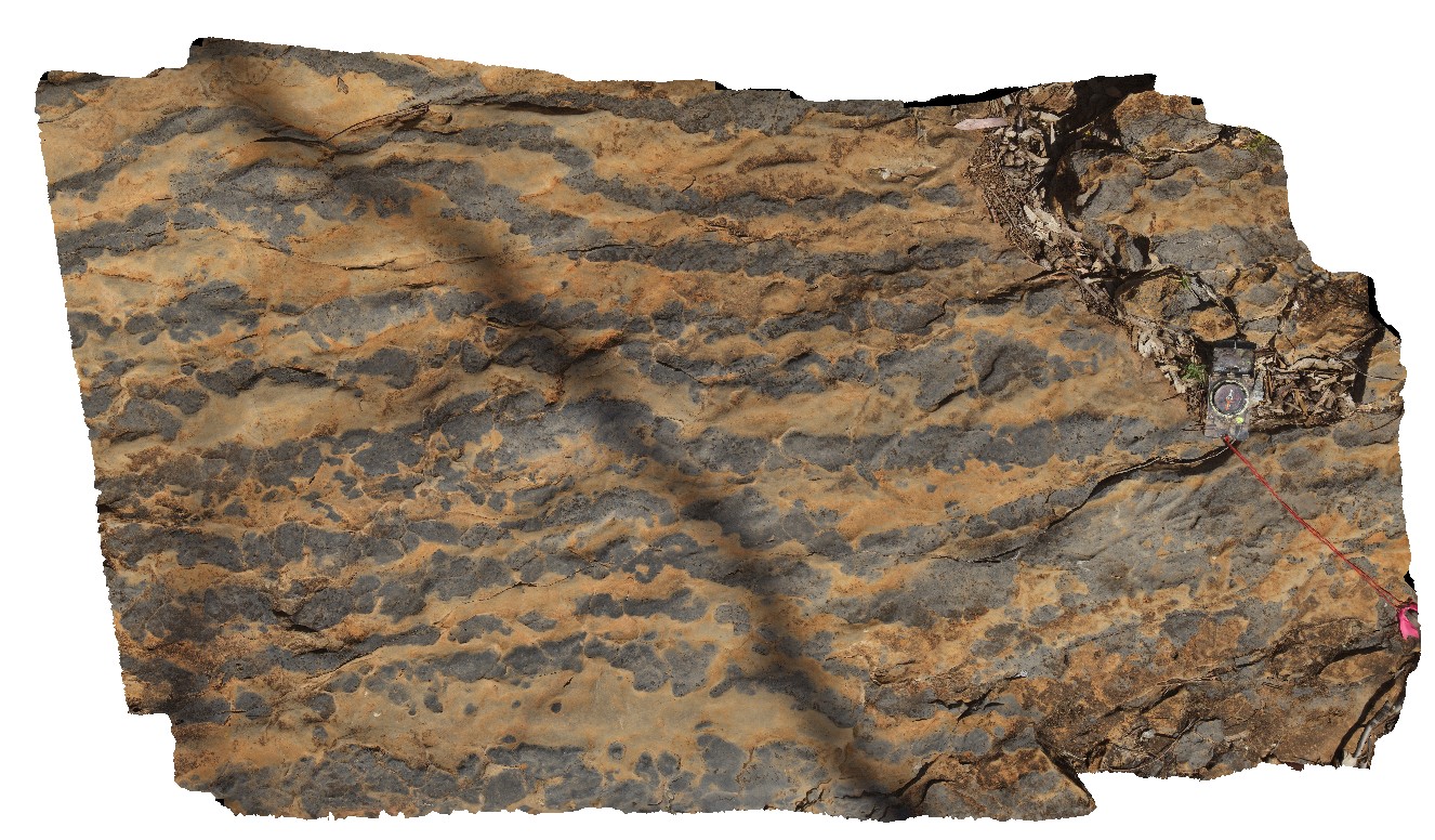
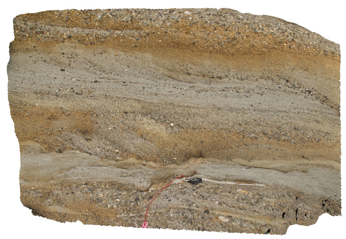
Copley4 Map
 |
5 |
01/01/9999 midnight |
3D |
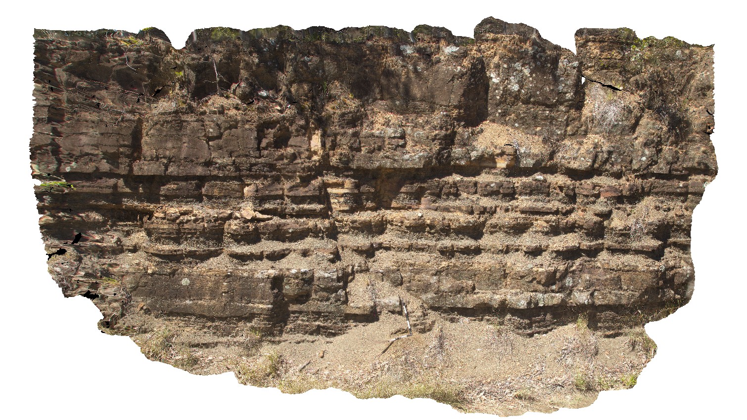
kink bands and folds in fine-grained sandstone and siltstones of Adelaidean metasediments. Iron oxide veins run parallel to and cross cut bedding. Copley, S.A. |
1.50 |
-30.52471000000 |
138.53619000000 |
-9999.000 |
folds, kink bands, fault, structure, sediments, Adelaidean |
metasediments |
Italowie1 Map
 |
5 |
01/01/9999 midnight |
3D |
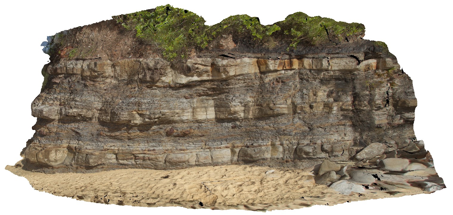
detail of carbonate layers with limestone and dolomite. Hematite psuedomorphs after pyrite in light coloured layers. Adelaidean domain, Italowie, S.A. |
1.30 |
-30.59696000000 |
139.05978000000 |
-9999.000 |
carbonate, dolomite, psuedomorph |
limestone |
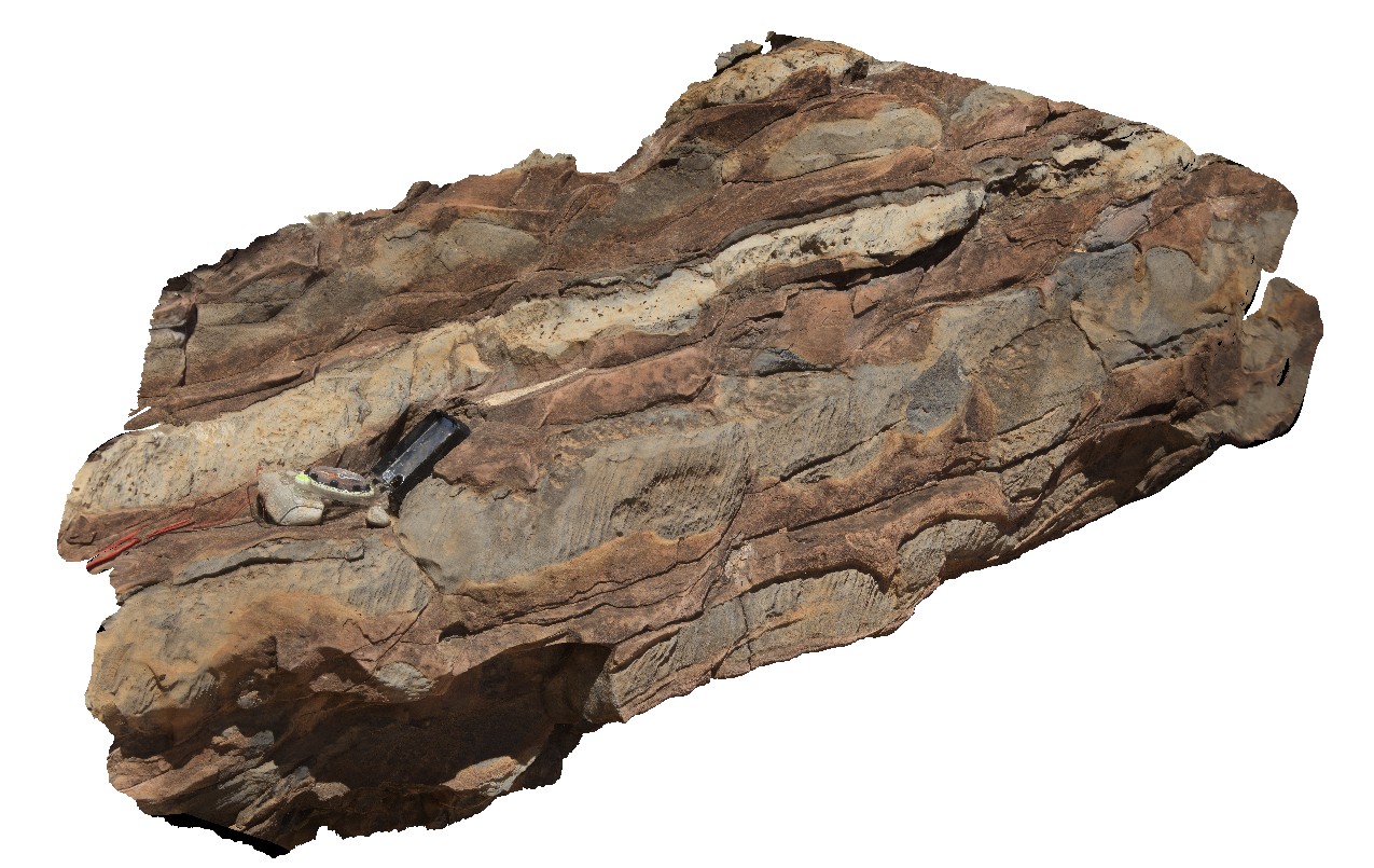
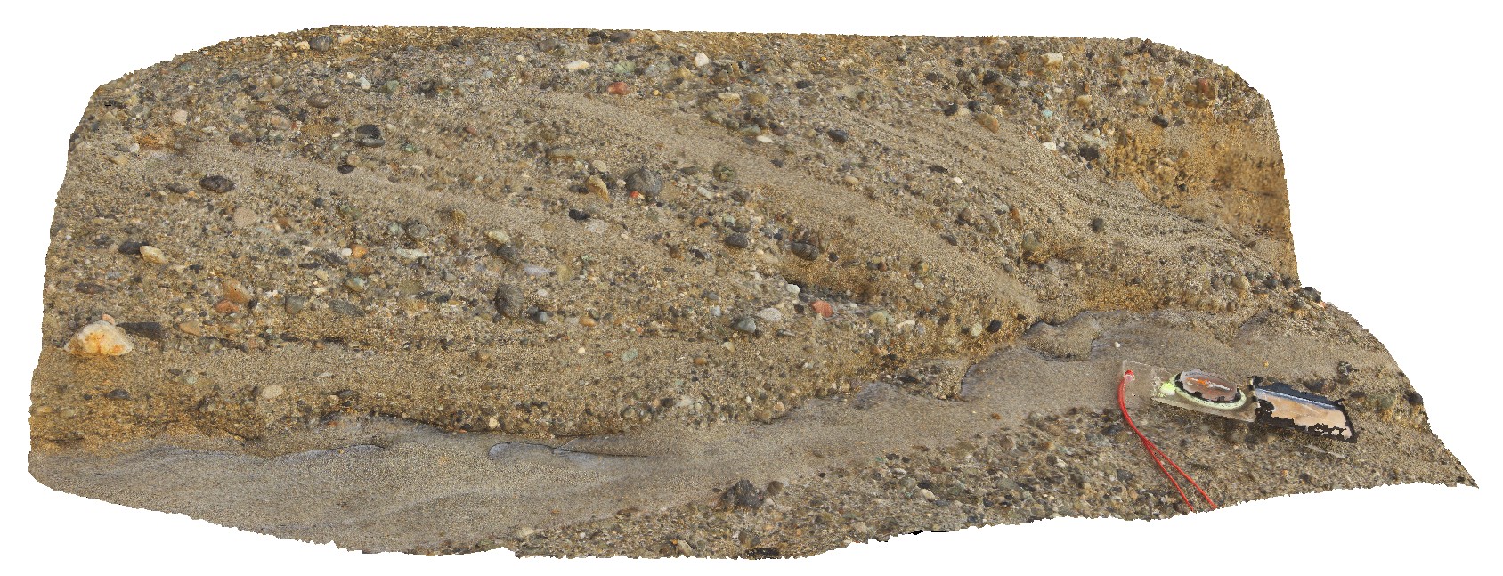
Italowie2 Map
 |
5 |
01/01/9999 midnight |
3D |
general view of layered and dipping carbonate sequence with thinly bedded limestone and dolomite. Adelaidean domain, Italowie, S.A. |
6.00 |
-30.59690000000 |
139.05988000000 |
-9999.000 |
carbonates, Adelaidean domain |
carbonate |
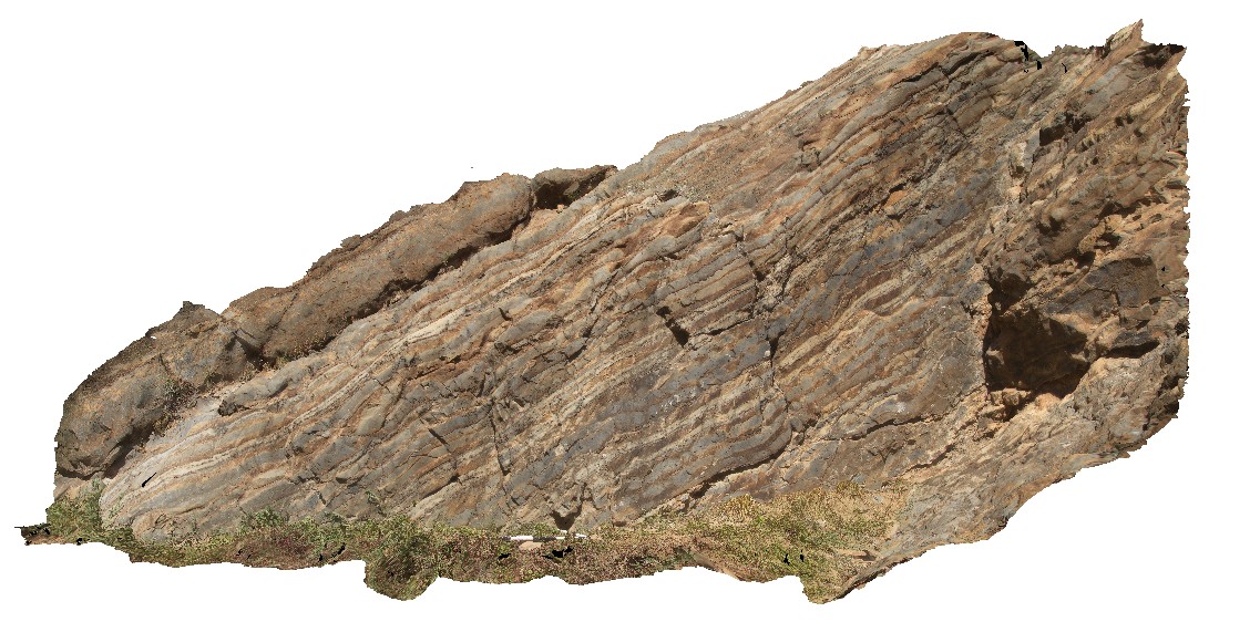
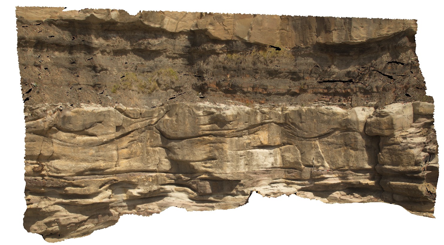
Italowie3 Map
 |
5 |
01/01/9999 midnight |
3D |
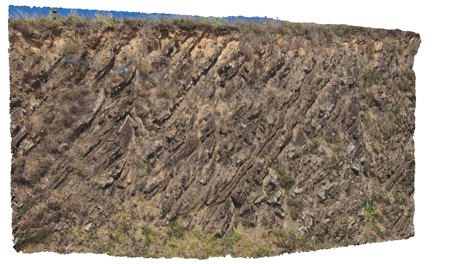
large-scale view of the carbonate outcrop, showing med-thickly bedded limestone and dolomite with open folding. Adelaidean domain, Italowie, S.A. |
20.00 |
-30.59710000000 |
139.05960000000 |
-9999.000 |
fold, structure, carbonates, open fold |
carbonate |
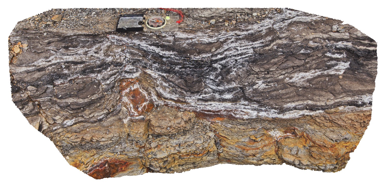
Italowie4 Map
 |
5 |
01/01/9999 midnight |
3D |
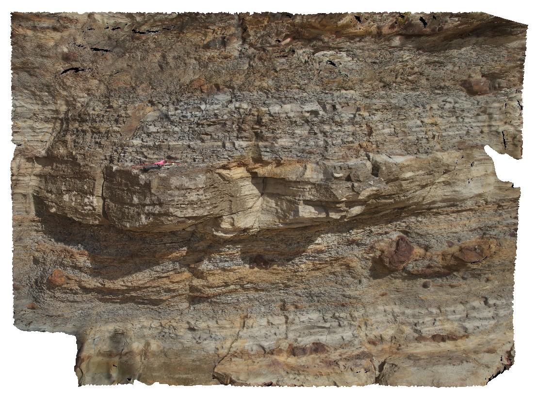
dolomite replacement textures in limestone. Adelaidean domain, Italowie, S.A. |
2.00 |
-30.59956000000 |
139.08430000000 |
-9999.000 |
dolomite, replacement textures, limestone, Adelaidean domain |
carbonate |
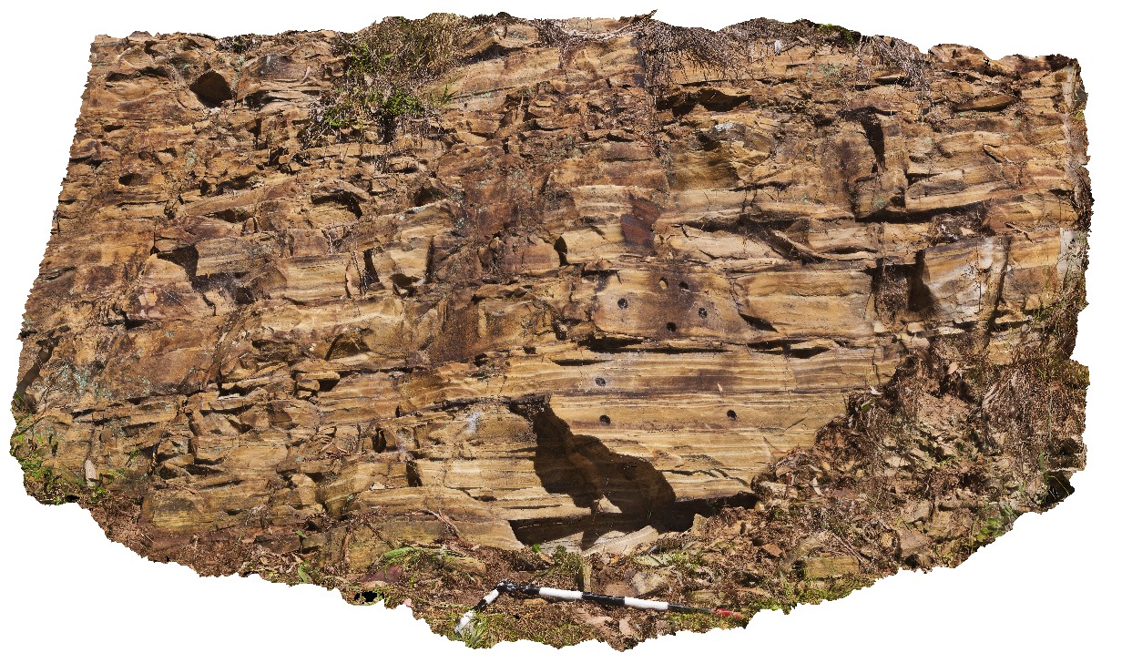
Seaham1 Map
 |
5 |
01/01/9999 midnight |
3D |
varved shales of the Seaham Formation with paleomag holes. Seaham, N.S.W. |
0.00 |
-32.66433000000 |
151.72768000000 |
-9999.000 |
varved, annual sediments, sedimentology, paleomagnetic dating |
shale |
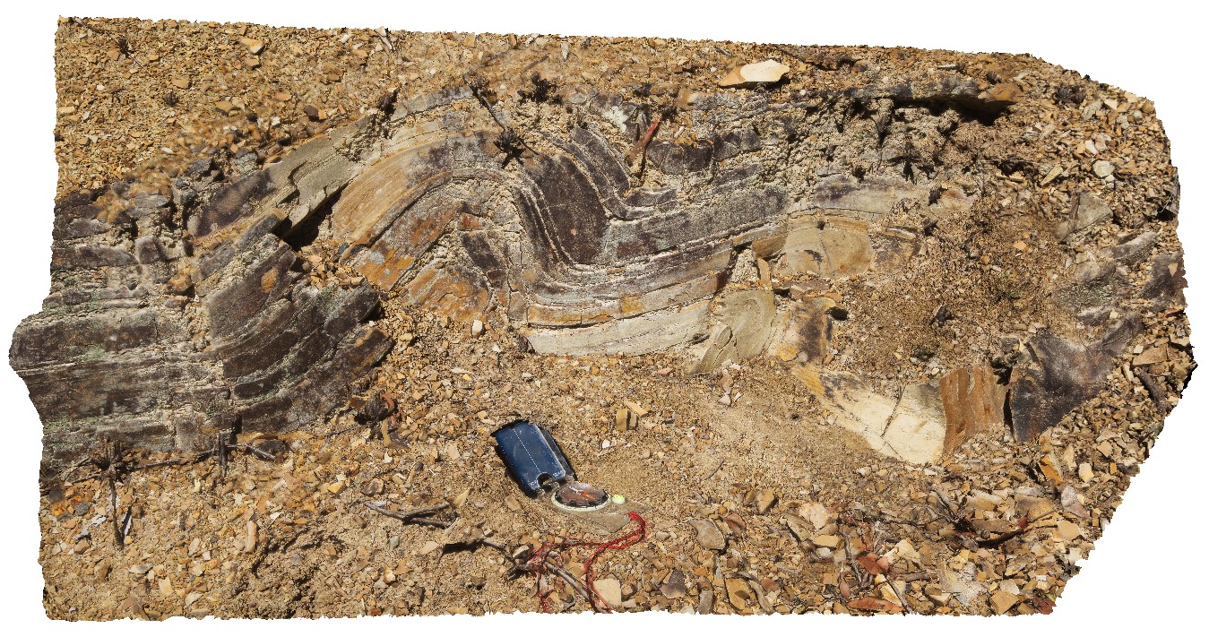
Seaham2 Map
 |
5 |
01/01/9999 midnight |
3D |
convoluted bedding in varved shales of the Seaham Formation. Seaham, N.S.W. |
0.00 |
-32.66301000000 |
151.72682000000 |
-9999.000 |
convoluted bedding, varved sediments, varved, annual, sedimentology |
shale |
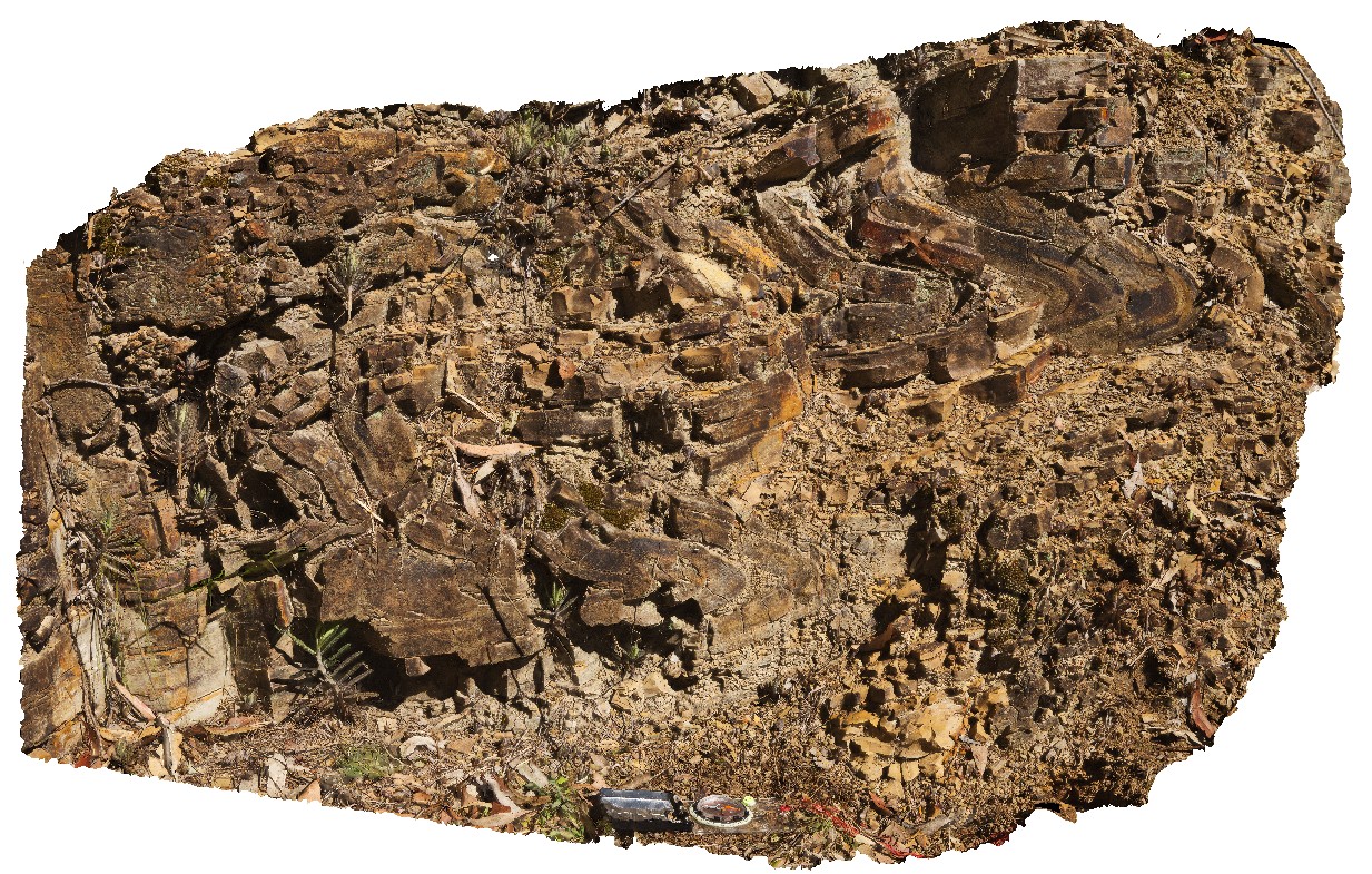
Seaham3 Map
 |
5 |
01/01/9999 midnight |
3D |
convoluted bedding in varved shales of the Seaham Formation. Seaham, N.S.W. |
0.00 |
-32.66299000000 |
151.72681000000 |
-9999.000 |
convoluted bedding, varved sediments, annual sediments, sedimentology |
shale |
Dungog1 Map
 |
5 |
01/01/9999 midnight |
3D |
flat-lying Carboniferous sandstone and shale, Chichester Dam Rd, near Mulconda. N.S.W. |
0.00 |
-32.28273000000 |
151.71133000000 |
-9999.000 |
Carboniferous, sediments, sedimentology |
sandstone |
Dungog2 Map
 |
5 |
01/01/9999 midnight |
3D |
moderately dipping, planar, Carboniferous sediments on Sailsbury Rd. Near Mulconda. N.S.W. |
0.00 |
-32.23988000000 |
151.58795000000 |
-9999.000 |
Carboniferous, sedimentology, planar sediments, dip |
sediments |
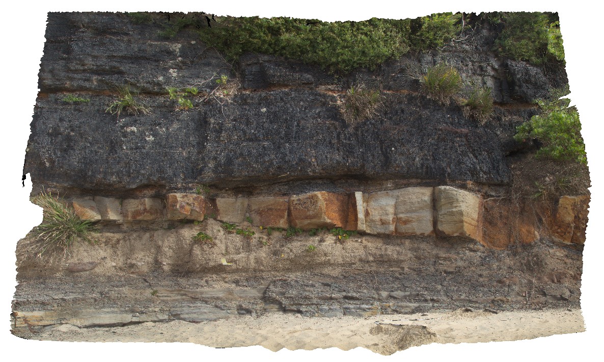
Dudley16 Map
 |
5 |
01/01/9999 midnight |
3D |
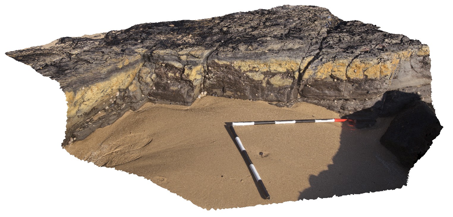
flat-lying floodplain sediments with channels and concretions. Dudley Beach, N.S.W. |
6.00 |
-32.96941000000 |
151.73492000000 |
-9999.000 |
floodplain sediments, channel deposits, concretions |
sediments |
Dudley17 Map
 |
5 |
01/01/9999 midnight |
3D |
detail of floodplain sediments from site Dudley16, showing thinly layered silt and sandstone layers with concretions. Dudley Beach, N.S.W. |
4.50 |
-32.96941000000 |
151.73492000000 |
-9999.000 |
floodplain sediments, concretions, sedimentology |
siltstone |
Dudley18 Map
 |
5 |
01/01/9999 midnight |
3D |
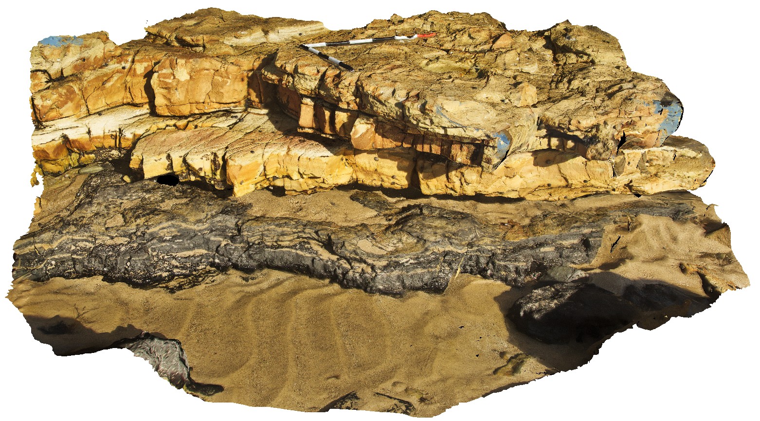
view showing the base of the 'Victoria Tunnel Seam' with floodplain sediments and channels. Dudley Beach, N.S.W. |
4.00 |
-32.97065000000 |
151.73265000000 |
-9999.000 |
Victoria Tunnel Coal Seam, floodplain sediments, channel, sedimentology |
coal |
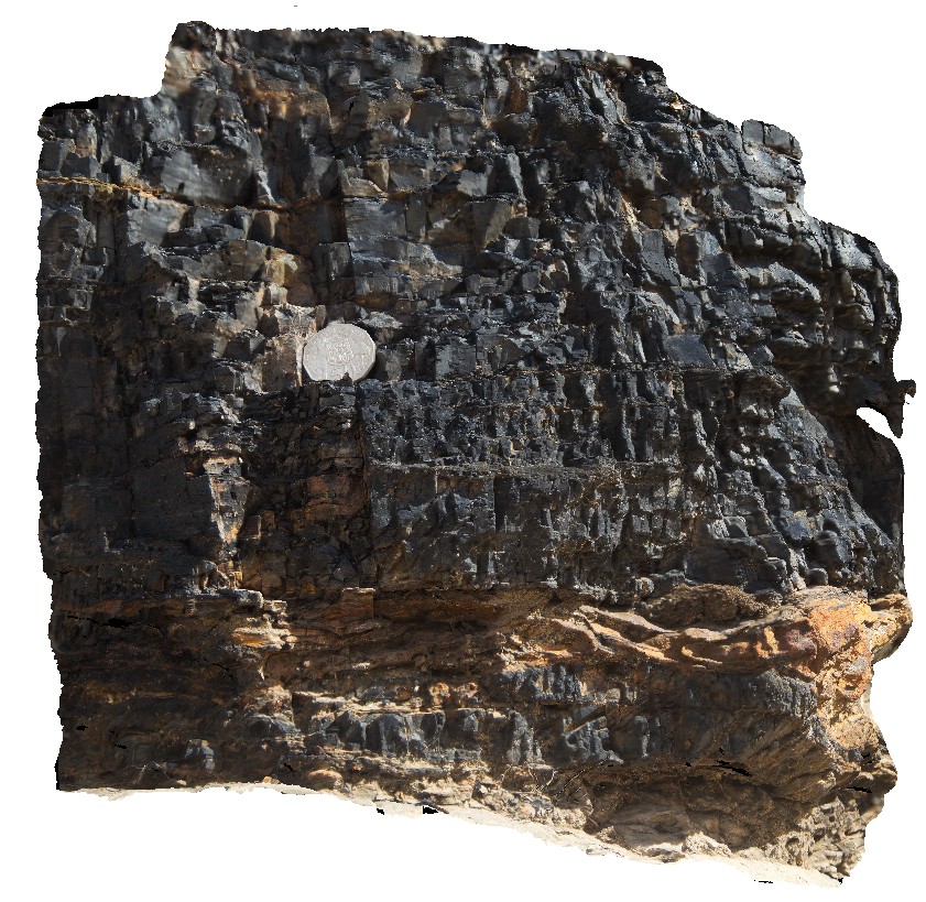
Dudley19 Map
 |
5 |
01/01/9999 midnight |
3D |
detail of the base of the Victoria Tunnel coal seam, showing clasts in coal and coal stringers below the seam. Dudley Beach, N.S.W. |
0.50 |
-32.97065000000 |
151.73265000000 |
-9999.000 |
coal seam, clast, sedimentology |
coal |
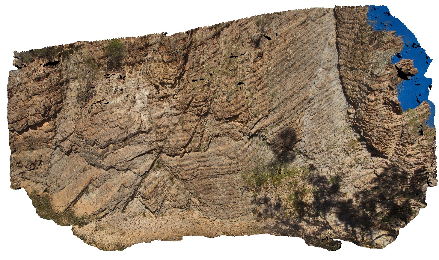
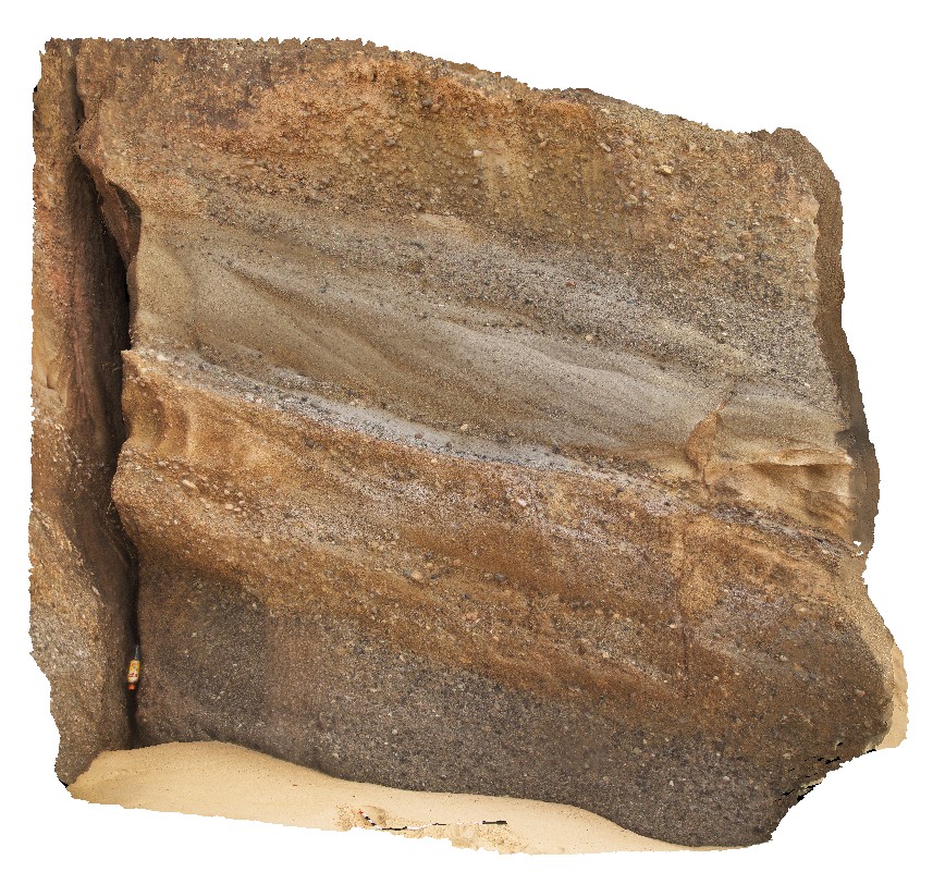
RHead1 Map
 |
5 |
01/01/9999 midnight |
3D |
high energy fluvial sediments of the Newcastle Coal Measures, showing cross bedding and varied grain size. Redhead, N.S.W. |
0.00 |
-33.01357000000 |
151.72153000000 |
-9999.000 |
high energy sediments, fluvial sediments |
sediments |
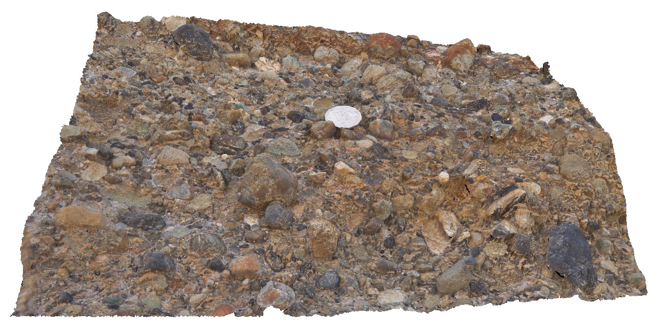
RHead2 Map
 |
5 |
01/01/9999 midnight |
3D |
detail of polymict, clast-supported conglomerate lense in Newcastle coal measures. Semi-rounded clasts. Redhead, N.S.W. |
0.00 |
-33.01356000000 |
151.72147000000 |
-9999.000 |
conglomerate, clast-supported, polymict, sedimentology |
conglomerate |
RHead3 Map
 |
5 |
01/01/9999 midnight |
3D |
sandy lenses in conglomerate with cross bedding and coaly fragments. Redhead, N.S.W. |
0.00 |
-33.01354000000 |
151.72142000000 |
-9999.000 |
conglomerate, cross bedding, coal, sedimentology |
conglomerate |
RHead4 Map
 |
5 |
01/01/9999 midnight |
3D |
conglomerate layer with sandy cross-beds and erosional lower contact. Redhead, N.S.W. |
0.00 |
-33.01352000000 |
151.72142000000 |
-9999.000 |
conglomerate, cross bedding, erosional contact, sedimentology, high-energy sediments |
sandstone |
RHead5 Map
 |
5 |
01/01/9999 midnight |
3D |
wavy bedforms in the Nobbys Tuff and overlying floodplain sediments. Redhead, N.S.W. |
15.00 |
-33.00492000000 |
151.73006000000 |
-9999.000 |
tuff, floodplain sediments, wavy bedforms, sedimentology |
tuff |
RHead6 Map
 |
5 |
01/01/9999 midnight |
3D |
detailed view of floodplain sediments below the Victoria's Tunnel Coal Seam, with coaly stringers and a concretion that disrupts bedding. Redhead, N.S.W. |
0.00 |
-33.00335000000 |
151.72969000000 |
-9999.000 |
floodplain sediments, concretion, disrupted bedding, Victoria's Tunnel Coal Seam, sedimentology |
mudstone |
RHead7 Map
 |
5 |
01/01/9999 midnight |
3D |
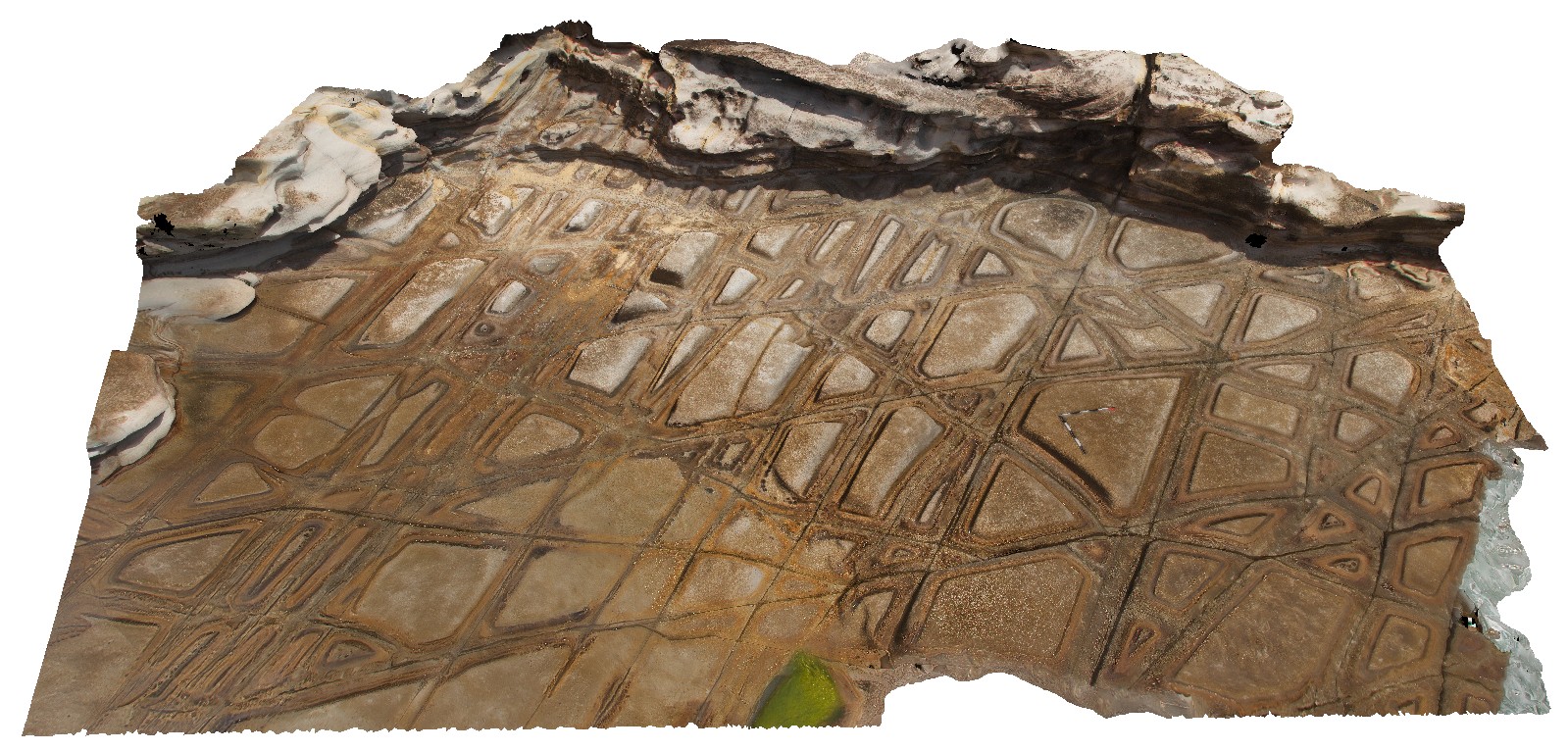
tessellated pavement in Nobbys Tuff, with concentric weathering along joints. Redhead, N.S.W. |
0.00 |
-33.00633000000 |
151.72972000000 |
-9999.000 |
joint, tessellated pavement, tuff |
tuff |
RHead8 Map
 |
5 |
01/01/9999 midnight |
3D |
detail of tessellated pavement in Nobbys Tuff. Redhead, N.S.W. |
0.00 |
-33.00633000000 |
151.72971000000 |
-9999.000 |
tessellated pavement, tuff, jointing |
tuff |
RHead9 Map
 |
5 |
01/01/9999 midnight |
3D |
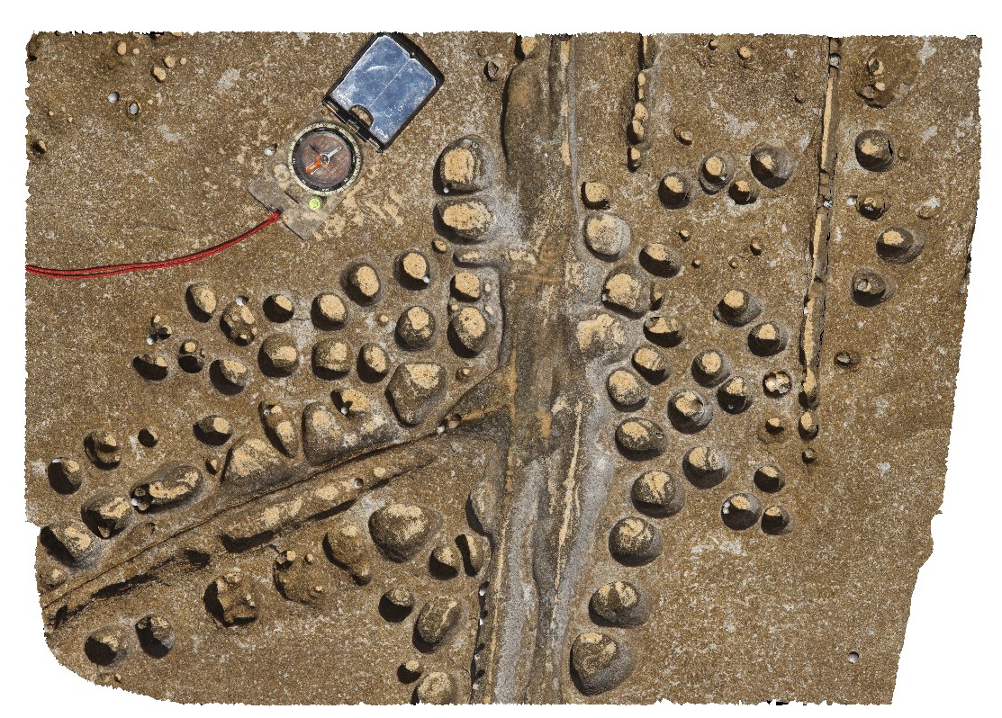
honeycomb weathering and jointing of Nobbys Tuff. Redhead, N.S.W. |
0.00 |
-33.00779000000 |
151.72920000000 |
-9999.000 |
honey comb weathering, weathering, jointing, tuff, Nobbys Tuff |
tuff |
Swansea12 Map
 |
5 |
01/01/9999 midnight |
3D |
view of part of the Lower Pilot coal seam. Swansea, N.S.W. |
0.00 |
-33.08762000000 |
151.66502000000 |
-9999.000 |
coal, sedimentology |
coal |
Swansea13 Map
 |
5 |
01/01/9999 midnight |
3D |
contact between the Lower Pilot Coal Seam and tuff, showing fine laminations in coal seam. Swansea, N.S.W. |
0.00 |
-33.08777000000 |
151.66492000000 |
-9999.000 |
coal seam, tuff, sedimentology |
coal |