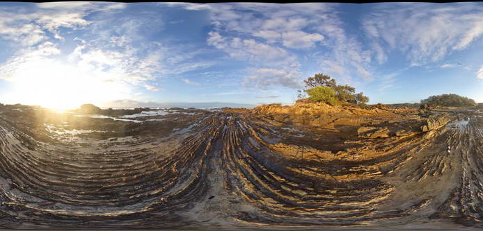
CapeArid12 Map
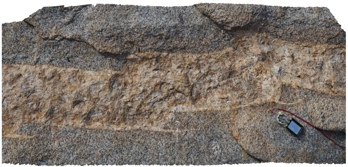 |
0 |
06/05/2016 10:36 a.m. |
3D |
view of small-scale step-overs / faults in pegmatite dyke, Cape Arid. W.A. |
1.60 |
-33.87414000000 |
123.00493000000 |
-9999.000 |
fault, pegmatite dyke |
pegmatite |
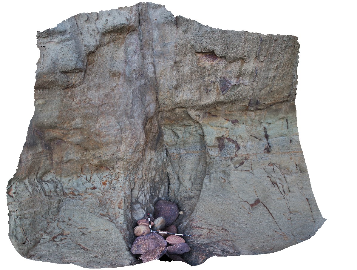
TheCrags1 Map
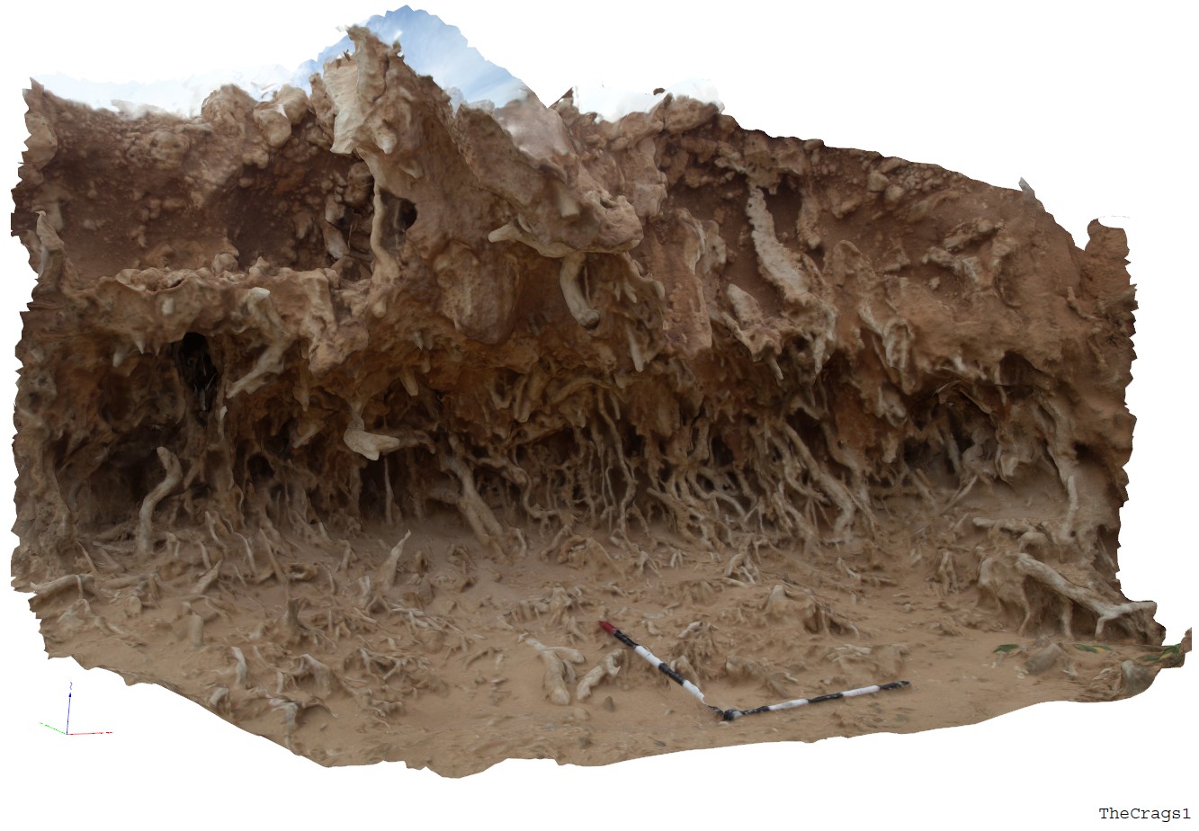 |
5 |
06/14/2016 11:45 a.m. |
3D |
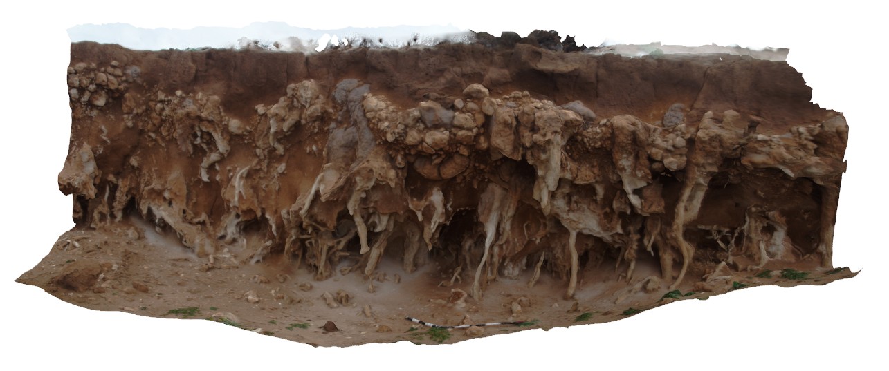
view of solution tubes and nodular carbonate in Pleistocene sediments. The Crags, Vic. |
3.00 |
-38.37184000000 |
142.11079000000 |
2.000 |
solution tubes, calcareous sediments |
carbonate |
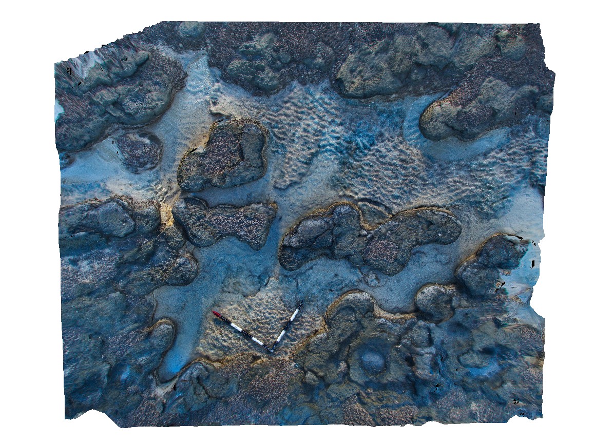
CapeBridgewater2 Map
 |
0 |
06/05/2016 10:38 a.m. |
3D |
view of solution tubes in aeolian sand. Cape Bridgewater, Vic. |
3.20 |
-38.38239000000 |
141.37033500000 |
-9999.000 |
solution tubes, aeolian sand |
aeolian sand |
CapeBridgewater3 Map
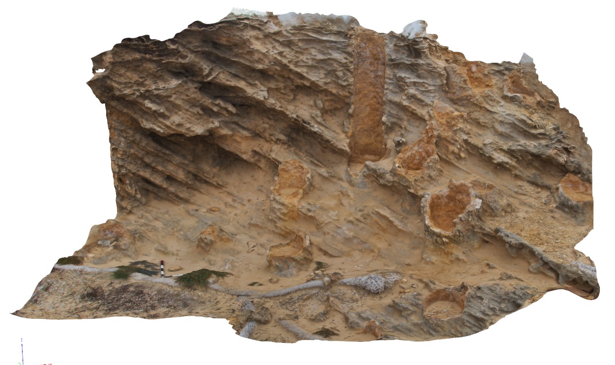 |
0 |
06/05/2016 10:38 a.m. |
3D |
view of solution tubes in cross bedded aeolian sand. Cape Bridgewater, Vic. |
4.20 |
-38.38137000000 |
141.36914000000 |
-9999.000 |
solution tubes, cross bedding, aeolian sandstone |
sandstone |
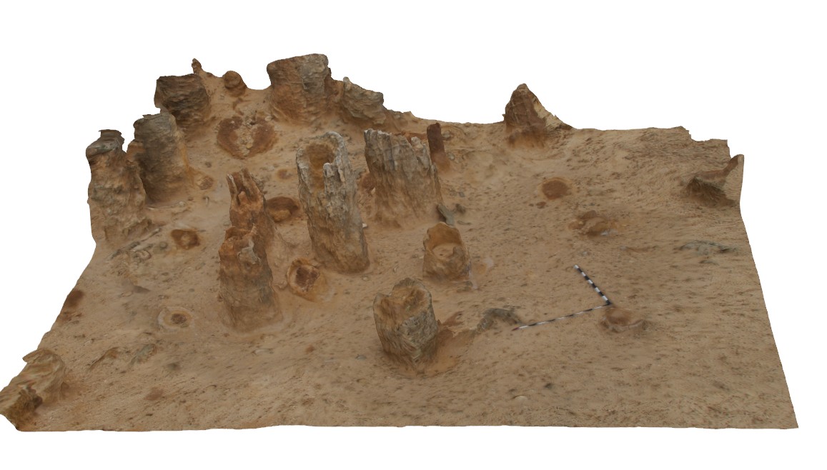
TheCrags2 Map
 |
5 |
06/14/2016 11:50 a.m. |
3D |
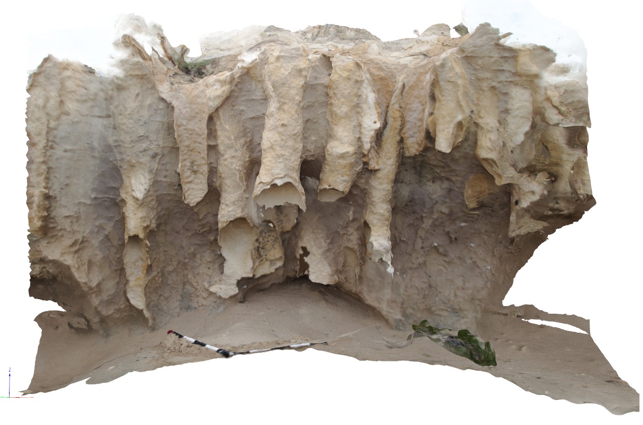
view of solution tubes in nodular carbonate, The Crags, Vic. |
4.00 |
-38.37184000000 |
142.11092000000 |
2.000 |
nodular carbonate, solution tubes |
carbonate |
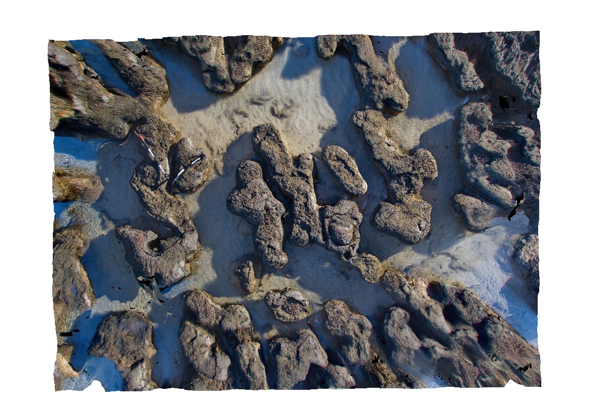
Esperance5 Map
 |
0 |
06/10/2016 2:19 p.m. |
3D |
view of solution tubes in Quaternary aeolian deposits. Esperance, W.A. |
2.50 |
-33.89637000000 |
121.77344000000 |
-9999.000 |
solution tubes, aeolian deposit |
calcareous sand |
BHill64 Map
 |
5 |
09/16/2015 8:12 a.m. |
3D |
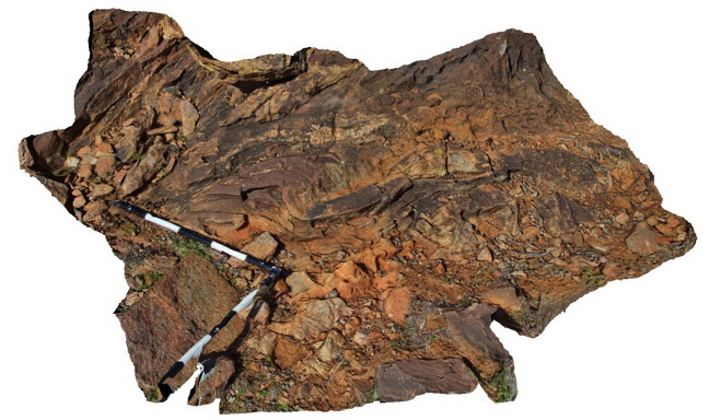
view of 'S' shape plunging folds in thinly banded psammopelitic metasediments near Allens Tank area, Broken Hill. N.S.W. |
2.00 |
-31.61792000000 |
141.48766000000 |
-9999.000 |
S fold, metasediments |
metasediments |
DixonRangeFSP1 Map
 |
0 |
06/14/2016 noon |
FSP |
view of steep faults in metasediments / fault block terrane. Road Dixon Range, W.A. |
2000.00 |
-17.17853000000 |
128.24756000000 |
-9999.000 |
fault terrane, steep fault, metasediment, structure |
metasediment |
YuraygirFSP1 Map
 |
5 |
06/16/2015 5:51 p.m. |
FSP |
View of steeply dipping metasedimentary units (sandstone and siltstone of the Carboniferous Coramba Beds. Yuraygir, N.S.W. |
50.00 |
-29.94940000000 |
153.25934000000 |
0.000 |
bedding |
sandstone, siltstone |
DarkBchFSP5 Map
 |
5 |
08/27/2015 2:20 p.m. |
FSP |
View of steeply dipping metasediments of the Cambro-Silurian Wagonga Group with flat-lying sandstone and breccia of the Permian Snapper Point Formation in the background. Dark Beach, N.S.W. |
50.00 |
-35.67946000000 |
150.29959900000 |
1.000 |
unconformity, structure, sedimentology |
sandstone, breccia |
DarkBchFSP4 Map
 |
5 |
08/27/2015 2:20 p.m. |
FSP |
View of steeply dipping metasediments of the Cambro-Silurian Wagonga Group with flat-lying sandstone and breccia of the Permian Snapper Point Formation in the background. Dark Beach, N.S.W. |
50.00 |
-35.67945000000 |
150.29971000000 |
0.000 |
unconformity, structure, sedimentology |
sandstone, breccia |
DarkBchFSP3 Map
 |
5 |
08/27/2015 2:20 p.m. |
FSP |
View of steeply dipping metasediments of the Cambro-Silurian Wagonga Group with flat-lying sandstone and breccia of the Permian Snapper Point Formation in the background. Unconformity is obscured by grass and talus. Dark Beach, N.S.W. |
50.00 |
-35.67817000000 |
150.30003000000 |
1.000 |
unconformity, sedimentology, structure |
breccia, sandstone |
DarkBchFSP2 Map
 |
5 |
08/27/2015 2:20 p.m. |
FSP |
View of steeply dipping metasediments of the Cambro-Silurian Wagonga Group with flat-lying sandstone and breccia of the Permian Snapper Point Formation in the background. Unconformity is obscured by grass and talus. Dark Beach, N.S.W. |
50.00 |
-35.67807000000 |
150.30016000000 |
0.000 |
unconformity, structure, sedimentology |
breccia, sandstone |
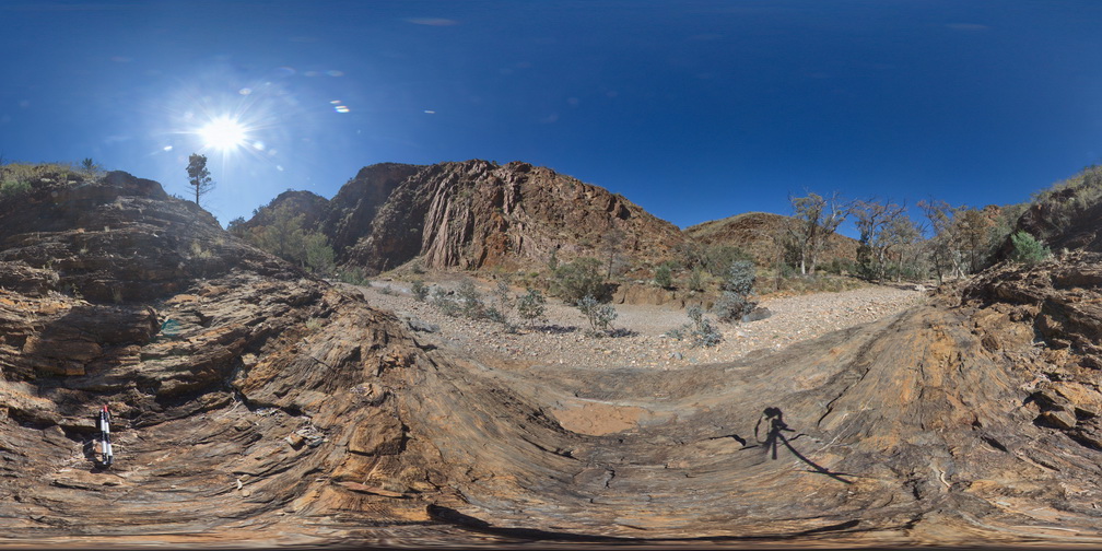
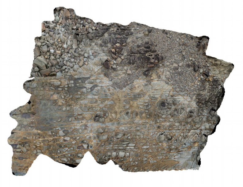
WeetootlaFSP12 Map
 |
0 |
09/27/2015 4:37 p.m. |
FSP |
View of steeply dipping sediments (hills) and creek exposure of diamictite. Balcanoona Creek. |
0.00 |
-30.48433000000 |
139.24013000000 |
-9999.000 |
diamictite, sediments |
diamictite, mudstone |
WeetootlaFSP4 Map
 |
0 |
09/27/2015 4:38 p.m. |
FSP |
view of steeply dipping stratigraphy, Weetootla Gorge. |
0.00 |
-30.48114000000 |
139.22690000000 |
-9999.000 |
structure |
mudstone |
Hamelin7 Map
 |
0 |
05/23/2016 noon |
3D |
view of submerged stromatolite colony and interspaced fine sediment. Hamelin Pool. Shark Bay, W.A. |
3.20 |
-24.40056000000 |
114.15903000000 |
-9999.000 |
tidal flat deposits, stromatolites |
tidal flat deposits |
Hamelin8 Map
 |
0 |
05/23/2016 noon |
3D |
view of submerged stromatolite colony and interspaced fine sediment. Hamelin Pool. Shark Bay, W.A. |
3.90 |
-24.40056000000 |
114.15903000000 |
-9999.000 |
tidal flat deposits, stromatolites |
tidal flat deposits |
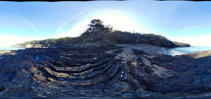
WreckBeach5 Map
 |
0 |
06/14/2016 2:25 p.m. |
3D |
view of sub-vertical? Fault cutting sandstone with fault breccia. Wreck Beach, Vic. |
3.00 |
-38.75634000000 |
143.21460000000 |
-9999.000 |
fault, fault breccia, structure, sandstone |
sandstone |
PCFSP1 Map
 |
0 |
07/20/2016 11:17 a.m. |
FSP |
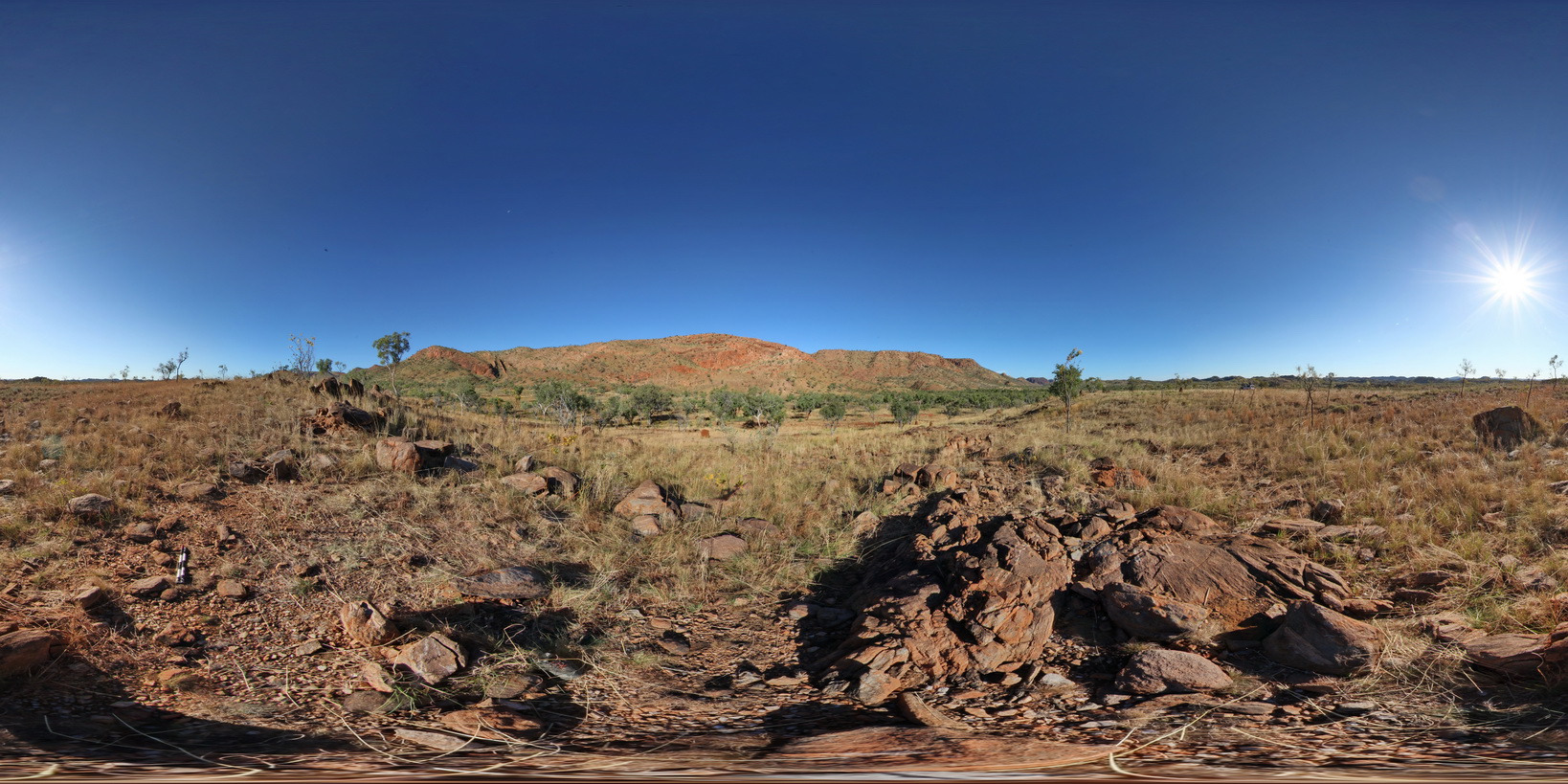
view of surrounding landscape of Pine Creek Orogen, North West corner. Grove Hill Road, Stuart Highway, N.T. |
0.00 |
-13.54029100000 |
131.53586900000 |
183.874 |
Pine Creek Orogeny |
metasediments |
BrachinaFSP11A Map
 |
5 |
11/27/2015 11:52 a.m. |
FSP |
View of surrounding Rawnsley Quartzite from hill above Brachina Gorge Road. S.A. |
2000.00 |
-31.34548600000 |
138.56320200000 |
-9999.000 |
sediments |
quartzite |
BrachinaUAV3 Map
 |
20 |
04/22/2016 11:02 a.m. |
FSP |
View of surrounding Rawnsley Quartzite from hill above Brachina Gorge Road. S.A. |
1000.00 |
-31.34426900000 |
138.55557900000 |
-9999.000 |
sedimentology |
quartzite |
KarijiniFSP6 Map
 |
0 |
05/29/2016 noon |
FSP |
view of terraced floor and sides of Dales Gorge, showing ripple marks in bedding surfaces, Karijini National Park, W.A. |
100.00 |
-22.47661000000 |
118.56281000000 |
-9999.000 |
ripple marks, terrace, banded iron formation |
BIF |
Fishery12 Map
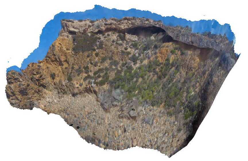 |
0 |
02/15/2016 11:34 a.m. |
3D |
View of Tertiary unconformity, showing weathered gneiss truncated and overlain by Tertiary deposits. Fishery Bay, S.A. |
8.00 |
-34.91291400000 |
135.69209100000 |
-9999.000 |
geological unconformity, metamorphics |
gneiss, sediment |
CrowdyPole1 Map
 |
5 |
06/16/2015 5:34 p.m. |
3D |
View of tessellated pavement generated by intersecting joints in sandstone of the Devonian Cowangara Formation. Crowdy Head Cliffs, N.S.W. |
12.00 |
-31.84576000000 |
152.75128000000 |
2.000 |
tessellated pavement, joints, structure |
sandstone |
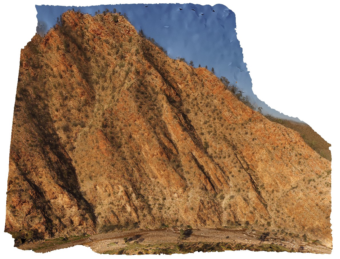
WindjanaUAV1 Map
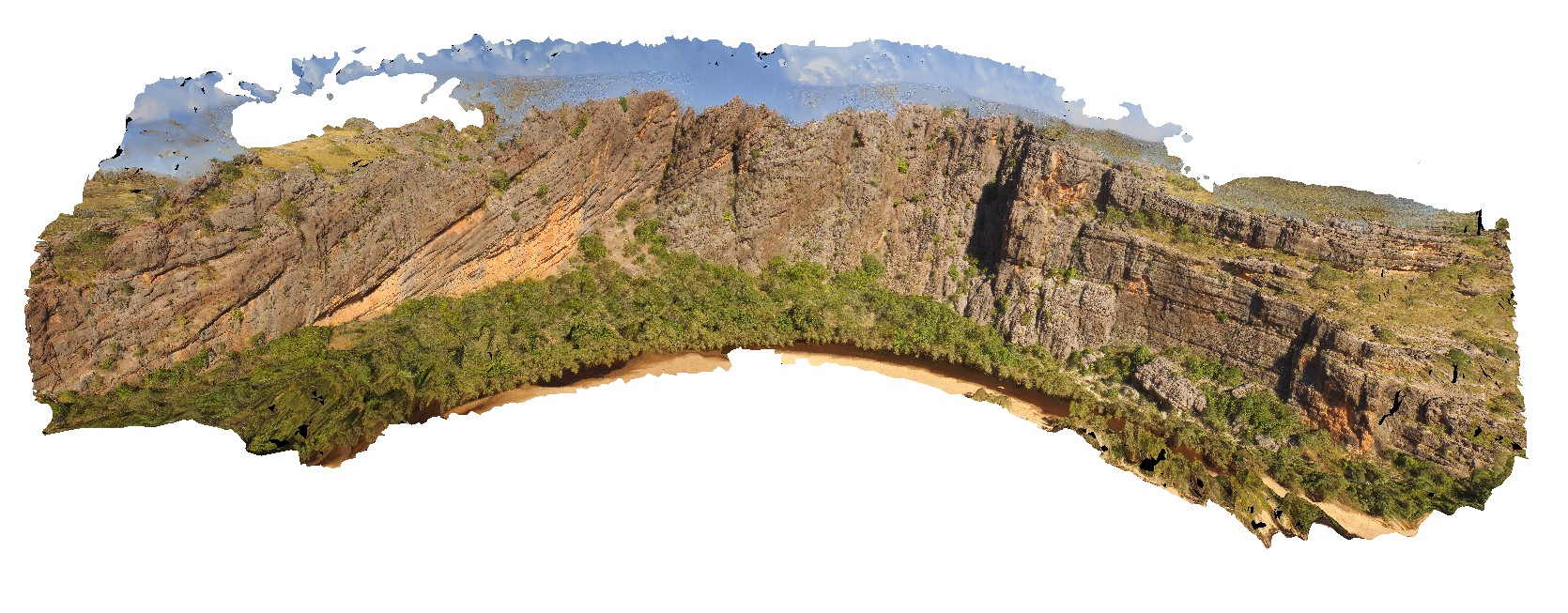 |
0 |
06/05/2016 noon |
UAV |
view of the ~400m 'Classic Face' of the reef facies at Windana Gorge, showing fore-reef, reefal-slope and platform facies and also, reef front and other reef facies. Windjana Gorge, W.A. |
400.00 |
-17.41218800000 |
124.96265530000 |
-9999.000 |
Reef facies, limestone, Windgana Gorge, sedimentology |
limestone, limestone |