Pennington4 Map
 |
0 |
10/20/2015 3:33 p.m. |
3D |
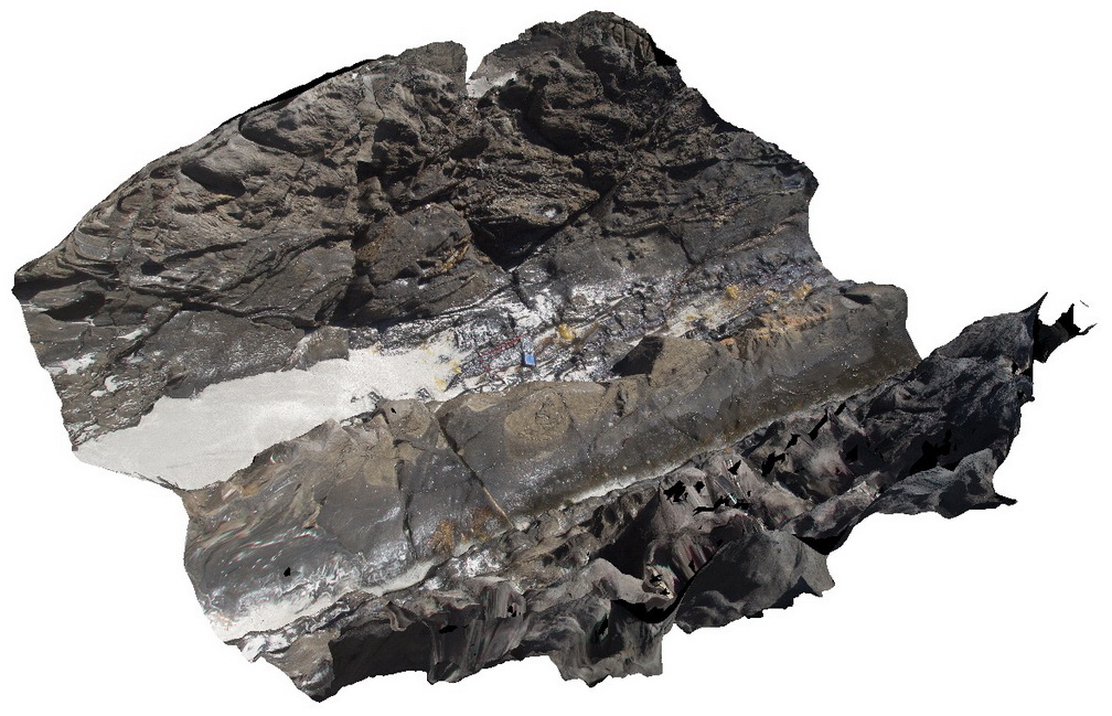
detail of Petrel Cove Formation meta-sediments, showing bedded, ripup clasts? And other sedimentary features. Pennington Bay, Kangaroo Island. |
1.50 |
-35.86062000000 |
137.73601000000 |
-9999.000 |
bedding, sedimentology |
sandstone |
Pennington5 Map
 |
0 |
10/20/2015 3:33 p.m. |
3D |
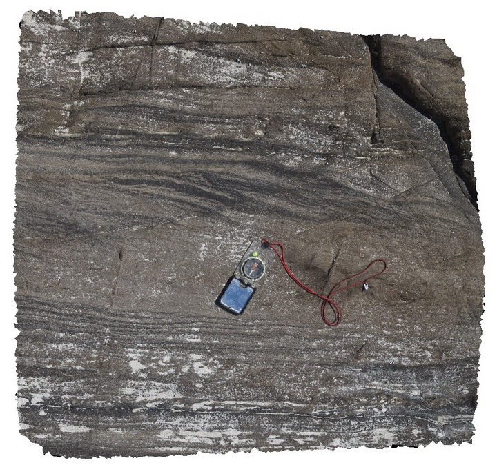
detail of planar and cross-laminations in Petrel Cove sandstone beds. Pennington Bay, Kangaroo Island. |
0.50 |
-35.85093000000 |
137.73552000000 |
-9999.000 |
cross-laminations, sandstone, laminations |
sandstone |
Pennington5 Map
|
0 |
10/20/2015 3:33 p.m. |
3D |
detail of planar and cross-laminations in Petrel Cove sandstone beds. Pennington Bay, Kangaroo Island. |
0.50 |
-35.85093000000 |
137.73552000000 |
-9999.000 |
cross-laminations, sandstone, laminations |
sandstone |
Pennington5 Map
|
0 |
10/20/2015 3:33 p.m. |
3D |
detail of planar and cross-laminations in Petrel Cove sandstone beds. Pennington Bay, Kangaroo Island. |
0.50 |
-35.85093000000 |
137.73552000000 |
-9999.000 |
cross-laminations, sandstone, laminations |
sandstone |
PenningtonFSP1 Map
 |
0 |
10/20/2015 3:33 p.m. |
FSP |
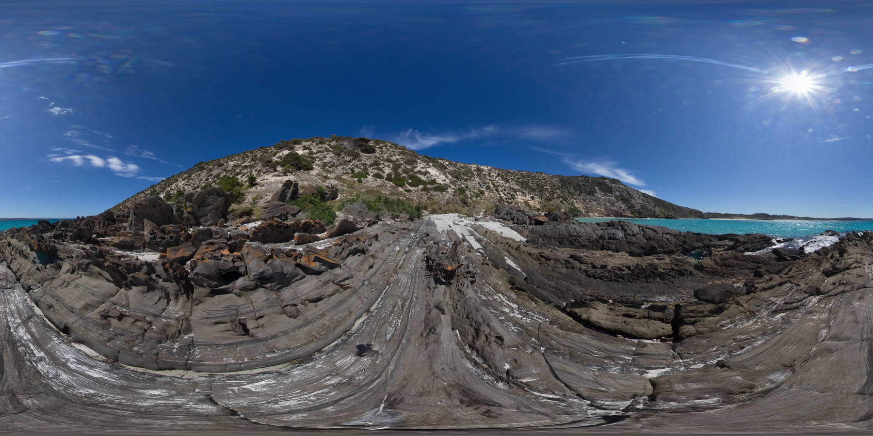
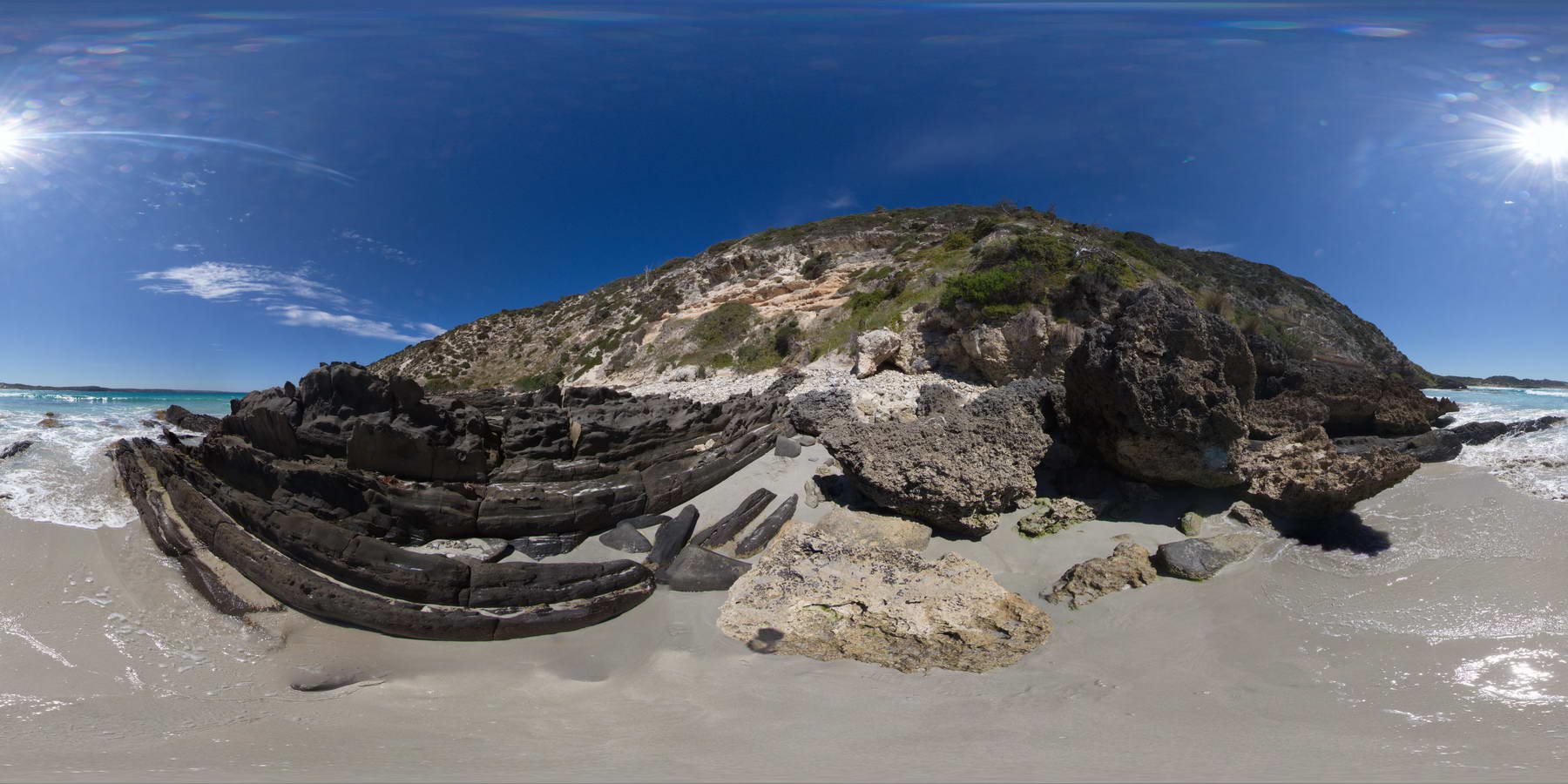
shore platform exposure of steeply dipping Petrel Cove Formation meta-sandstone, overlain by younger Bridgewater Formation calcareous sandstones. Pennington Bay, Kangaroo Island. |
1000.00 |
-35.86037000000 |
137.73471000000 |
-9999.000 |
metasandstone, unconformity, calcareous sandstone, sedimentology |
sandstone, sandstone |
PenningtonFSP1 Map
|
0 |
10/20/2015 3:33 p.m. |
FSP |
shore platform exposure of steeply dipping Petrel Cove Formation meta-sandstone, overlain by younger Bridgewater Formation calcareous sandstones. Pennington Bay, Kangaroo Island. |
1000.00 |
-35.86037000000 |
137.73471000000 |
-9999.000 |
metasandstone, unconformity, calcareous sandstone, sedimentology |
sandstone, sandstone |
PenningtonFSP2 Map
 |
0 |
10/20/2015 3:33 p.m. |
FSP |
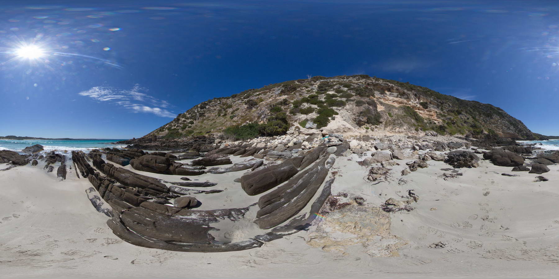
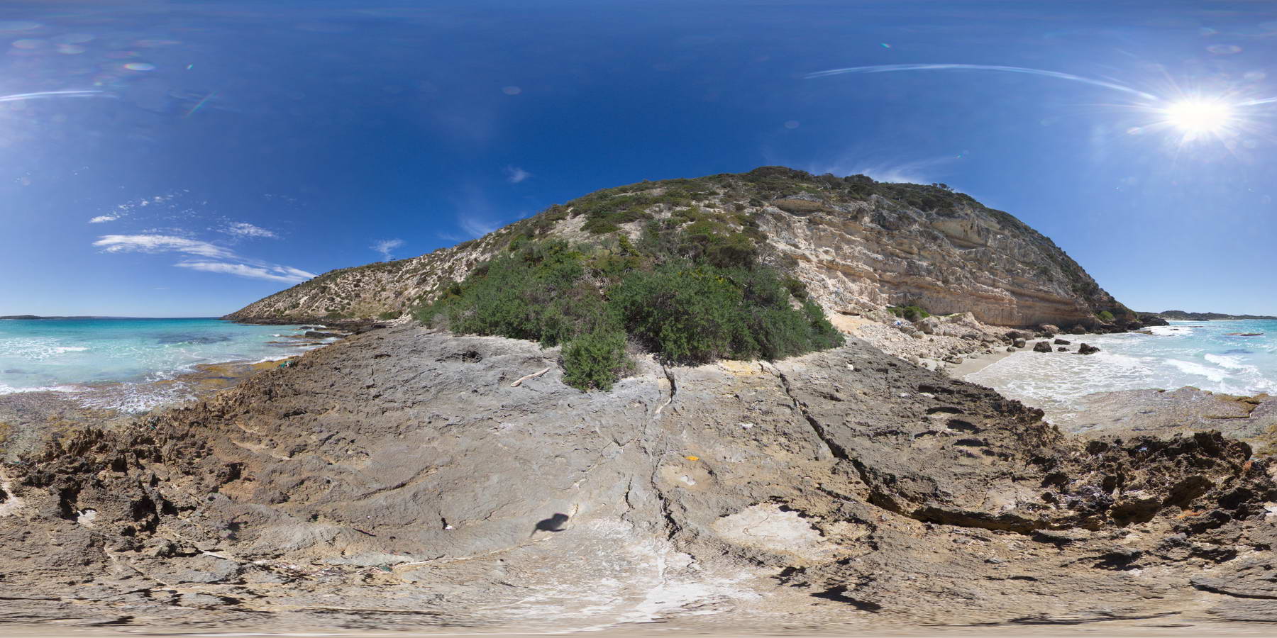
shoreline exposure showing steeply dipping Petrel Cove Sandstone, unconformably overlain by the Bridgewater Formation. Pennington Bay, Kangaroo Island. |
1000.00 |
-35.86018000000 |
137.73450000000 |
-9999.000 |
unconformity, meta-sandstone, calcareous sandstone, sedimentology |
sandstone, sandstone |
PenningtonFSP2 Map
|
0 |
10/20/2015 3:33 p.m. |
FSP |
shoreline exposure showing steeply dipping Petrel Cove Sandstone, unconformably overlain by the Bridgewater Formation. Pennington Bay, Kangaroo Island. |
1000.00 |
-35.86018000000 |
137.73450000000 |
-9999.000 |
unconformity, meta-sandstone, calcareous sandstone, sedimentology |
sandstone, sandstone |
PenningtonFSP3 Map
 |
0 |
10/20/2015 3:34 p.m. |
FSP |
shoreline exposure showing steeply dipping Petrel Cove Sandstone, unconformably overlain by the Bridgewater Formation. Pennington Bay, Kangaroo Island. |
1000.00 |
-35.85994000000 |
137.73450000000 |
-9999.000 |
meta-sandstone, calcareous sandstone, unconformity, sedimentology |
sandstone, sandstone |
PenningtonFSP3 Map
|
0 |
10/20/2015 3:34 p.m. |
FSP |
shoreline exposure showing steeply dipping Petrel Cove Sandstone, unconformably overlain by the Bridgewater Formation. Pennington Bay, Kangaroo Island. |
1000.00 |
-35.85994000000 |
137.73450000000 |
-9999.000 |
meta-sandstone, calcareous sandstone, unconformity, sedimentology |
sandstone, sandstone |
PenningtonFSP4 Map
 |
0 |
10/20/2015 3:34 p.m. |
FSP |
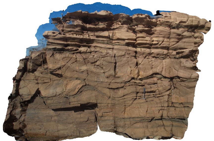
shore-platform and cliff exposures, showing flat-lying to gently dipping? Calcareous beds of the Bridgewater Formation. Pennington Bay, Kangaroo Island. |
1000.00 |
-35.85964000000 |
137.73453000000 |
-9999.000 |
calcareous sandstone, sedimentology |
sandstone |
PenningtonFSP4 Map
|
0 |
10/20/2015 3:34 p.m. |
FSP |
shore-platform and cliff exposures, showing flat-lying to gently dipping? Calcareous beds of the Bridgewater Formation. Pennington Bay, Kangaroo Island. |
1000.00 |
-35.85964000000 |
137.73453000000 |
-9999.000 |
calcareous sandstone, sedimentology |
sandstone |
Emu1 Map
 |
0 |
11/17/2015 10:35 a.m. |
3D |
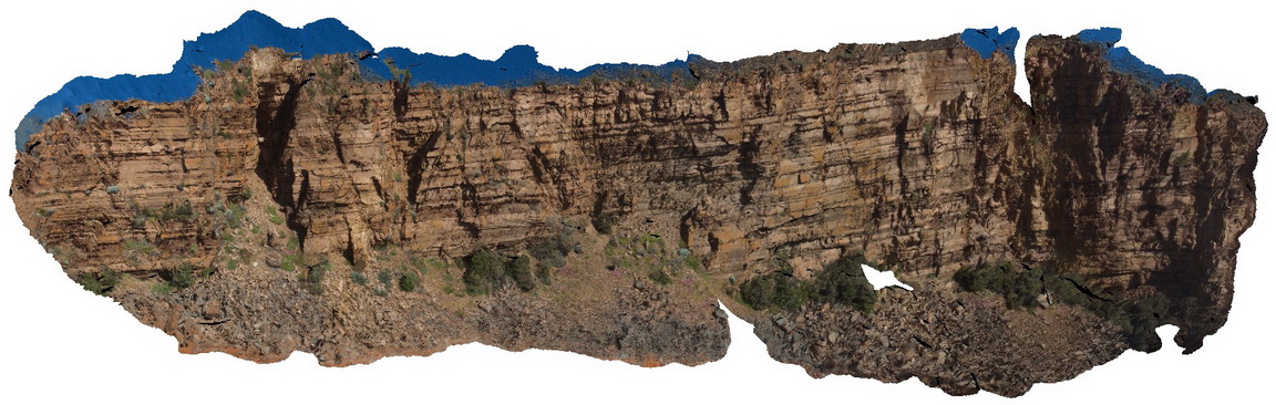
large cliff exposure, showing gently dipping and faulted beds of the Boxing Bay Formation, Emu Bay, Kangaroo Island. S.A. |
20.00 |
-35.56802000000 |
137.58672000000 |
-9999.000 |
sedimentology, fault, structure |
conglomerate |
Emu1 Map
|
0 |
11/17/2015 10:35 a.m. |
3D |
large cliff exposure, showing gently dipping and faulted beds of the Boxing Bay Formation, Emu Bay, Kangaroo Island. S.A. |
20.00 |
-35.56802000000 |
137.58672000000 |
-9999.000 |
sedimentology, fault, structure |
conglomerate |
Emu1 Map
|
0 |
11/17/2015 10:35 a.m. |
3D |
large cliff exposure, showing gently dipping and faulted beds of the Boxing Bay Formation, Emu Bay, Kangaroo Island. S.A. |
20.00 |
-35.56802000000 |
137.58672000000 |
-9999.000 |
sedimentology, fault, structure |
conglomerate |
Emu2 Map
 |
0 |
11/17/2015 10:37 a.m. |
3D |
soft sediment deformation in Boxing Bay Formation, Emu Bay, Kangaroo Island. S.A. |
4.00 |
-35.56952000000 |
137.57912000000 |
-9999.000 |
soft sediment deformation, sedimentology |
sandstone |
Emu2 Map
|
0 |
11/17/2015 10:37 a.m. |
3D |
soft sediment deformation in Boxing Bay Formation, Emu Bay, Kangaroo Island. S.A. |
4.00 |
-35.56952000000 |
137.57912000000 |
-9999.000 |
soft sediment deformation, sedimentology |
sandstone |
Emu3 Map
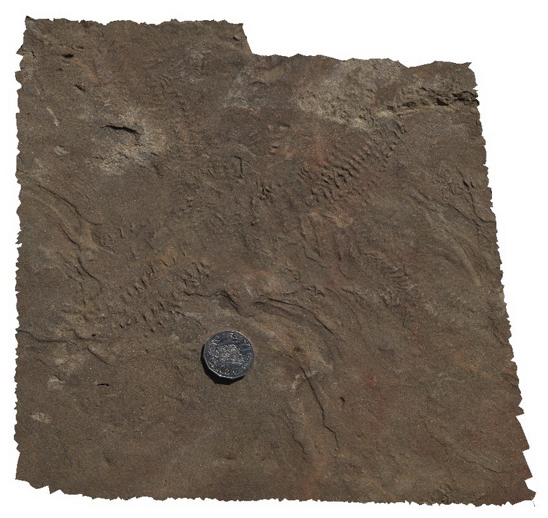 |
0 |
11/17/2015 10:37 a.m. |
3D |
trilobite feeding trackways in Emu Bay Shale, Emu Bay, Kangaroo Island. S.A. |
0.30 |
-35.57017000000 |
137.57787000000 |
-9999.000 |
trilobite, shale, feeding track, fossil, palaeontology |
shale |
Emu3 Map
|
0 |
11/17/2015 10:37 a.m. |
3D |
trilobite feeding trackways in Emu Bay Shale, Emu Bay, Kangaroo Island. S.A. |
0.30 |
-35.57017000000 |
137.57787000000 |
-9999.000 |
trilobite, shale, feeding track, fossil, palaeontology |
shale |