Litchfield4 Map
 |
0 |
06/23/2016 noon |
3D |
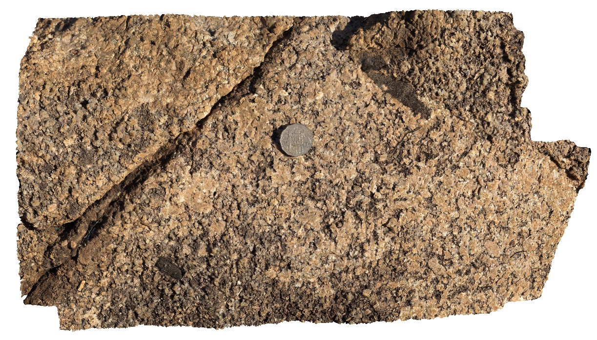
quartz-muscovite pegmatite float near Litchfield Park Road, Litchfield National Park. N.T. |
0.15 |
-13.06886000000 |
130.71255000000 |
-9999.000 |
quartz-muscovite pegmatite, igneous, two sisters granite |
pegmatite |
Kakadu7 Map
 |
0 |
06/25/2016 noon |
3D |
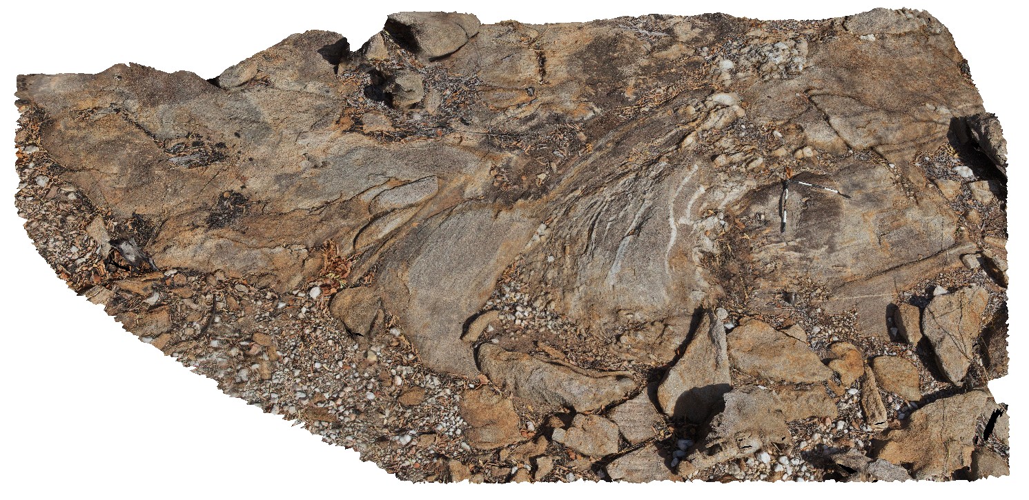
folds and axial planar cleavage in muscovite schist. Nourlangie Rock Art Site. Kakadu National Park, N.T. |
7.50 |
-12.97397000000 |
132.69547000000 |
-9999.000 |
muscovite schist, folds, axial planar cleavage |
schist |
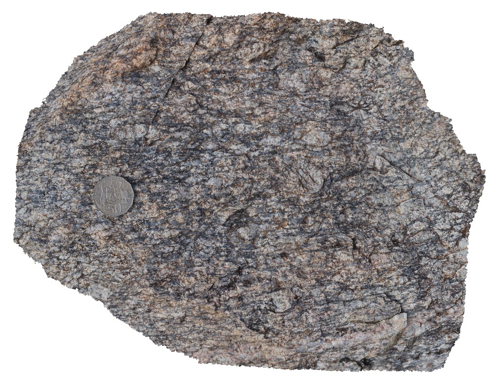
MaryRiver3 Map
 |
0 |
06/23/2016 noon |
3D |
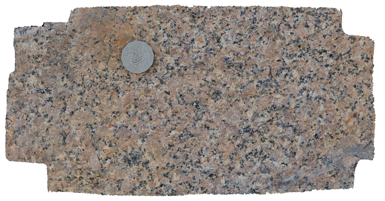
macro view of fresh surface of biotite granite. Next to Arnhem Highway, Mary River, N.T. |
0.35 |
-12.90025000000 |
131.62051000000 |
-9999.000 |
biotite granite, granite, coarse-grained |
granite |
MaryRiver2 Map
 |
0 |
06/23/2016 noon |
3D |
weathered granite with tabular xenoliths. Next to Arnhem Highway, Mary River, N.T. |
0.00 |
-12.90025000000 |
131.62051000000 |
-9999.000 |
granite, xenoliths, weathering |
granite |
MaryRiver1 Map
 |
0 |
06/23/2016 noon |
3D |
open fold in banded chert, with lenticular horizons. Hill above Mary River Wilderness Retreat. Mary River, N.T. |
1.70 |
-12.89174000000 |
131.63213000000 |
-9999.000 |
open fold, chert, structure, lenticular |
chert |
Kakadu5 Map
 |
0 |
06/25/2016 noon |
3D |
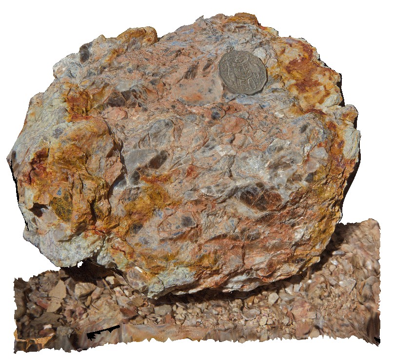
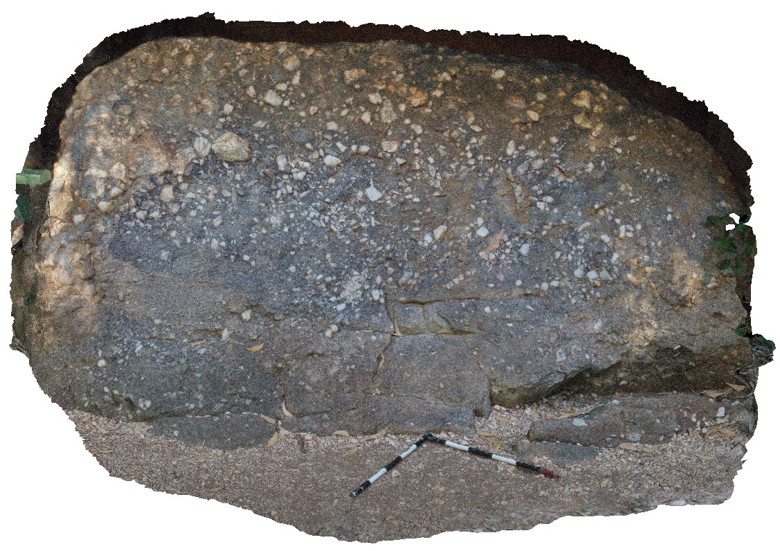
polymict conglomerate with weak graded bedding. Clast types include; vein-quartz, sandstone and granite. Nourlangie Rock Art Site. Kakadu National Park, N.T. |
2.80 |
-12.86548000000 |
132.81525000000 |
-9999.000 |
polymict conglomerate, poor grading, sedimentology |
conglomerate |
KakaduFSP7 Map
 |
0 |
06/25/2016 noon |
FSP |
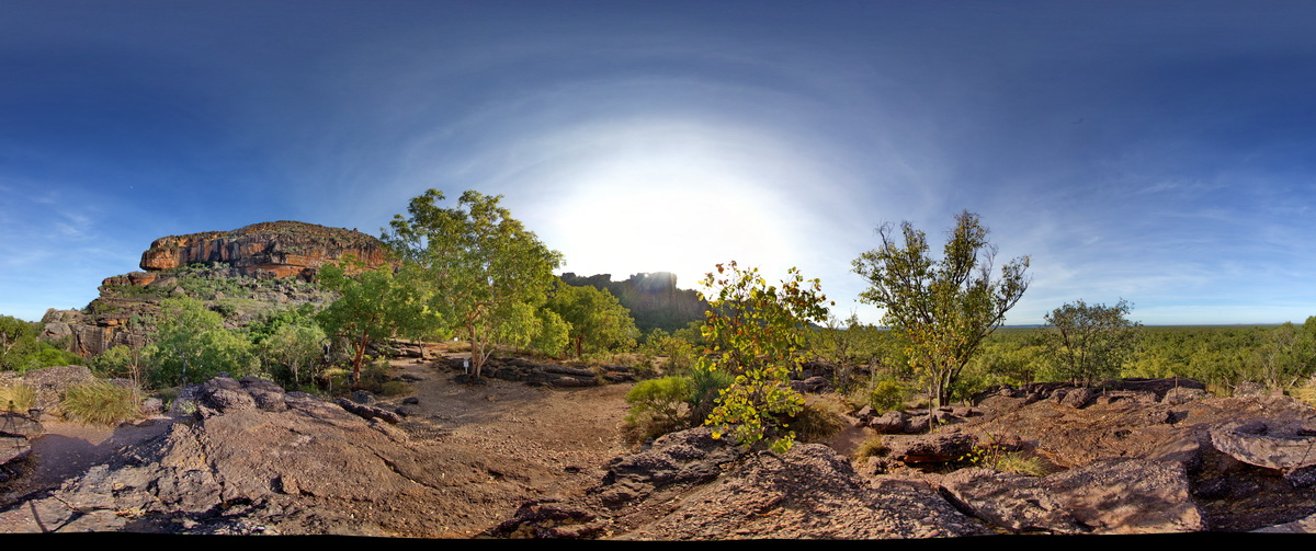
view of sandstone escarpment in background and conglomerate (as in site Kakadu5) in foreground. . Nourlangie Rock Art Site. Kakadu National Park, N.T. |
500.00 |
-12.86476000000 |
132.81610000000 |
-9999.000 |
conglomerate, sedimentology, sandstone |
sandstone |
KakaduFSP8 Map
 |
0 |
01/01/9999 midnight |
FSP |
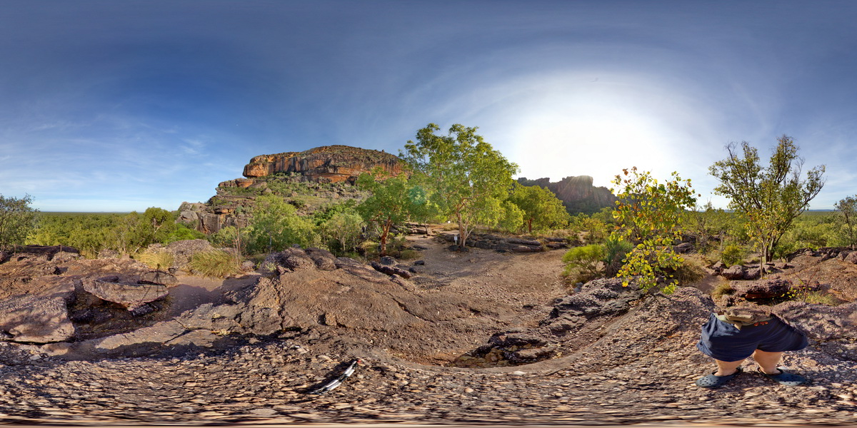
view of sandstone escarpment in background and conglomerate (as in site Kakadu5) in foreground. . Nourlangie Rock Art Site. Kakadu National Park, N.T. |
500.00 |
-12.86476000000 |
132.81590000000 |
-9999.000 |
sandstone, Kakadu National Park, escarpment, sedimentology |
sandstone |
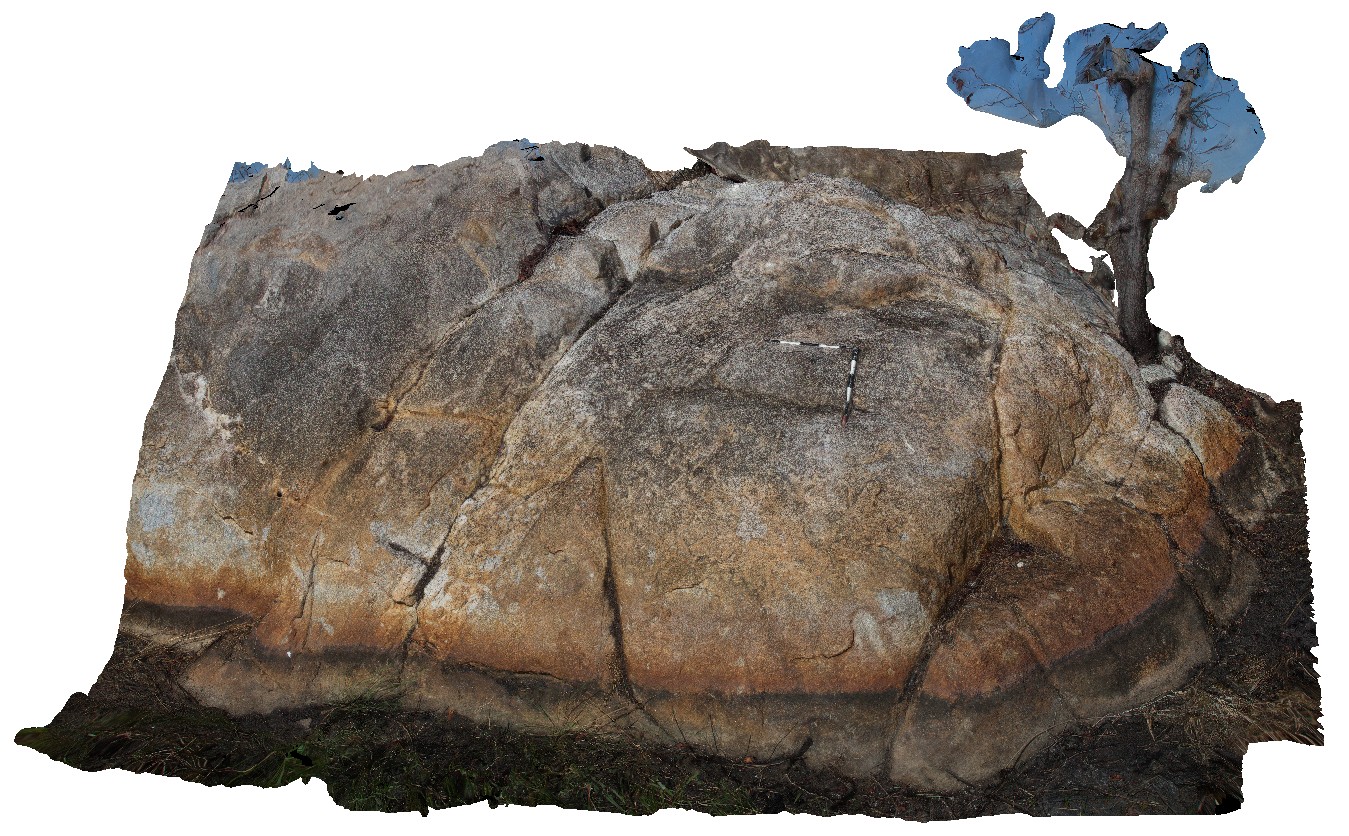
Kakadu6 Map
 |
0 |
06/25/2016 noon |
3D |
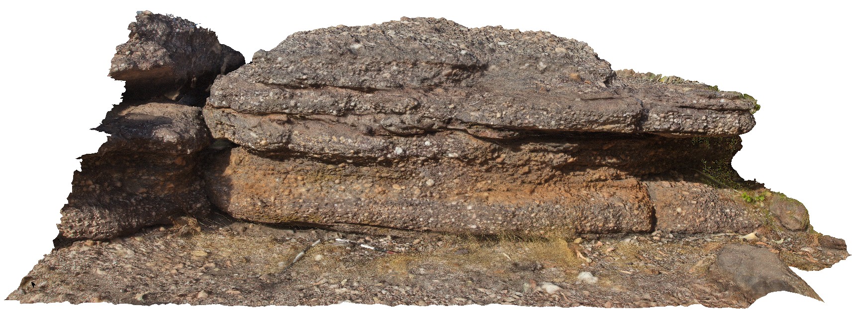
interbedded, polymict conglomerate and sandstone with weak to moderate imbrication in some of the conglomerate beds. Nourlangie Rock Art Site. Kakadu National Park, N.T. |
5.00 |
-12.86475000000 |
132.81610000000 |
-9999.000 |
polymict conglomerate, imbricated conglomerate |
conglomerate |
Kakadu1 Map
 |
0 |
06/25/2016 noon |
3D |
augen gneiss with K-feldspar-quartz pegmatite pod that is surrounded by biotite-feldspar halo. Gneiss crosscut by quartz veins. Gneissic basement, Arnhem Highway crossing of South Alligator River, N.T. |
5.30 |
-12.66160000000 |
132.51231000000 |
-9999.000 |
augen gneiss, pegmatite pod |
gneiss |
Kakadu2 Map
 |
0 |
06/25/2016 noon |
3D |
view of augen (up to 2.5cm wide) within augen gneiss basement. Arnhem Highway crossing of South Alligator River, N.T. |
0.30 |
-12.66160000000 |
132.51231000000 |
-9999.000 |
augen gneiss |
gneiss |
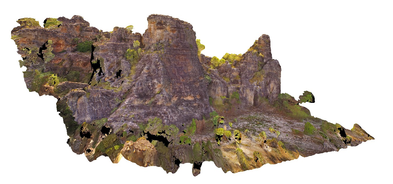
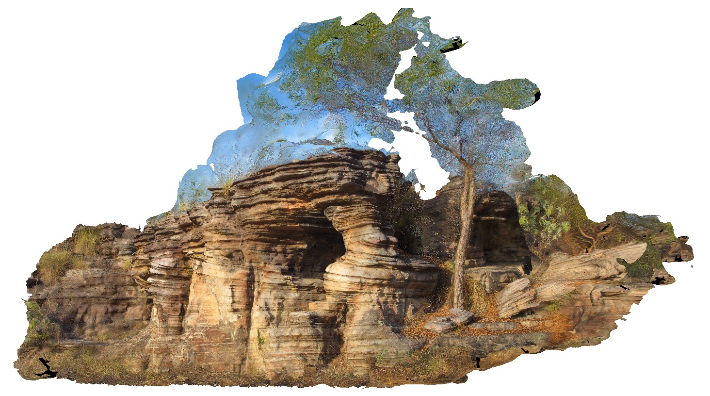
KakaduFPS4 Map
 |
0 |
06/25/2016 noon |
FSP |
towers of bedded sandstone with chert, cross bedding, caves and columns. Bardedjilidji Walk. Kakadu National Park, N.T. |
0.00 |
-12.43794000000 |
132.96854000000 |
-9999.000 |
cross bedding, sandstone, sedimentology, cave, Kakadu National Park |
sandstone |
KakaduUAV1 Map
 |
20 |
01/01/9999 midnight |
UAV |
270 degree view of tall (~30m) sandstone tower with shallowly dipping cross beds and planar beds. Bardedjilidji Walk. Kakadu National Park. N.T. |
40.00 |
-12.43749000000 |
132.96887000000 |
-9999.000 |
tower, sandstone, cross bedding, weathering feature |
sandstone |
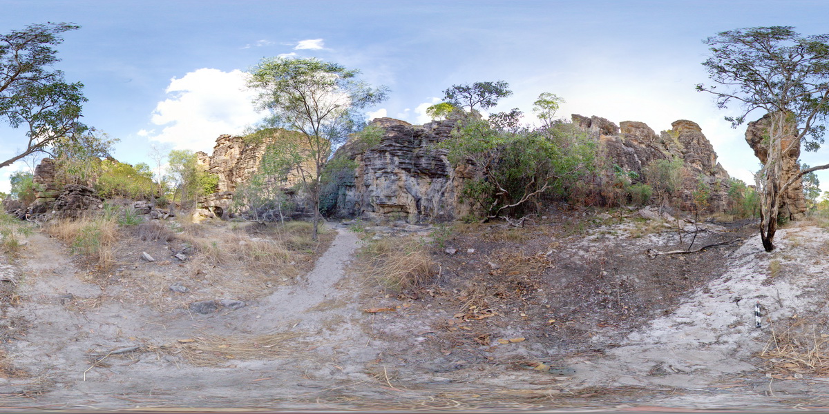
KakaduFSP5 Map
 |
0 |
06/25/2016 noon |
FSP |
panorama, featuring towers of cross bedded sandstone Bardedjilidji Walk. Kakadu National Park, N.T. |
100.00 |
-12.43749000000 |
132.96887000000 |
-9999.000 |
cross bedding, sandstone, sedimentology, Kakadu National Park |
sandstone |
Kakadu4 Map
 |
0 |
06/25/2016 noon |
3D |
cross bedding in sandstone cliff. Bardedjilidji Walk. Kakadu National Park, N.T. |
11.00 |
-12.43685000000 |
132.97076000000 |
-9999.000 |
cross bedding, sandstone |
sandstone |
KakaduUAV2 Map
 |
20 |
01/01/9999 midnight |
UAV |
aerial view of small cliff exposure, showing gently dipping cross beds, truncated by planar bedded sandstone. Bardedjilidji Walk. Kakadu National Park. N.T. |
10.00 |
-12.43685000000 |
132.97076000000 |
-9999.000 |
cross bedding, sandstone, sedimentology |
sandstone |
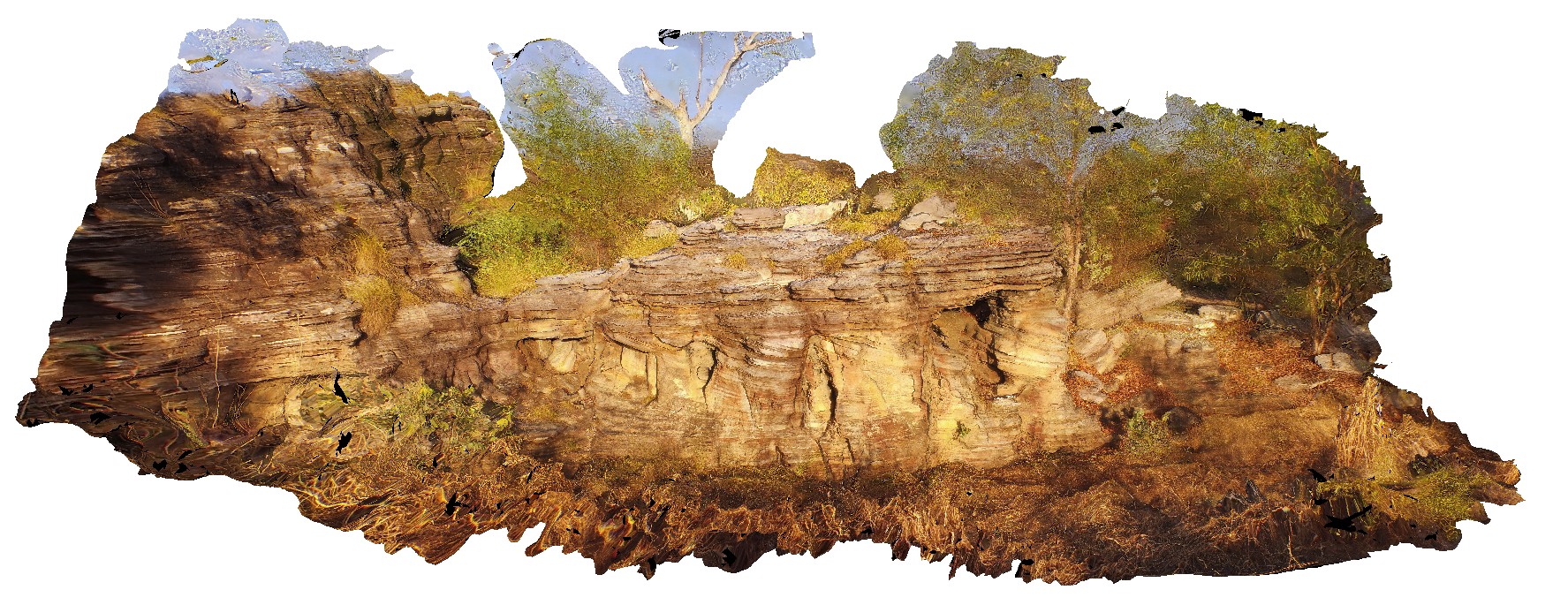
KakaduFPS6 Map
 |
0 |
06/25/2016 noon |
FSP |
view of sandstone escarpment and cross bedding in sandstone at Bardedjilidji Walk. Kakadu National Park, N.T. |
500.00 |
-12.43680000000 |
132.97054000000 |
-9999.000 |
sandstone, cross bedding, Kakadu National Park |
sandstone |
Kakadu3 Map
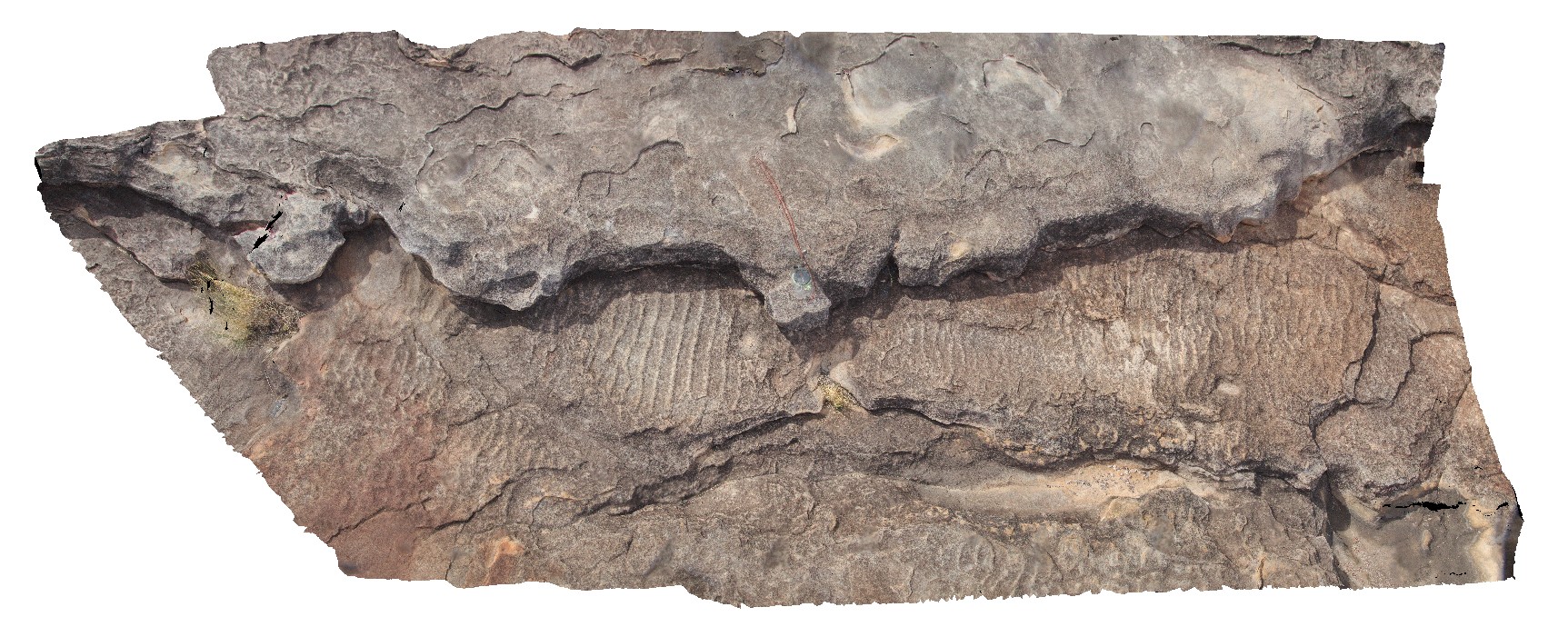 |
0 |
06/25/2016 noon |
3D |
ripple marks in weathered medium-to-coarse sandstone. Ubirr Art Site. Kakadu National Park, N.T. |
2.60 |
-12.40900000000 |
132.95412000000 |
-9999.000 |
ripple marks, sandstone, sedimentology |
sandstone |
KakaduFSP3 Map
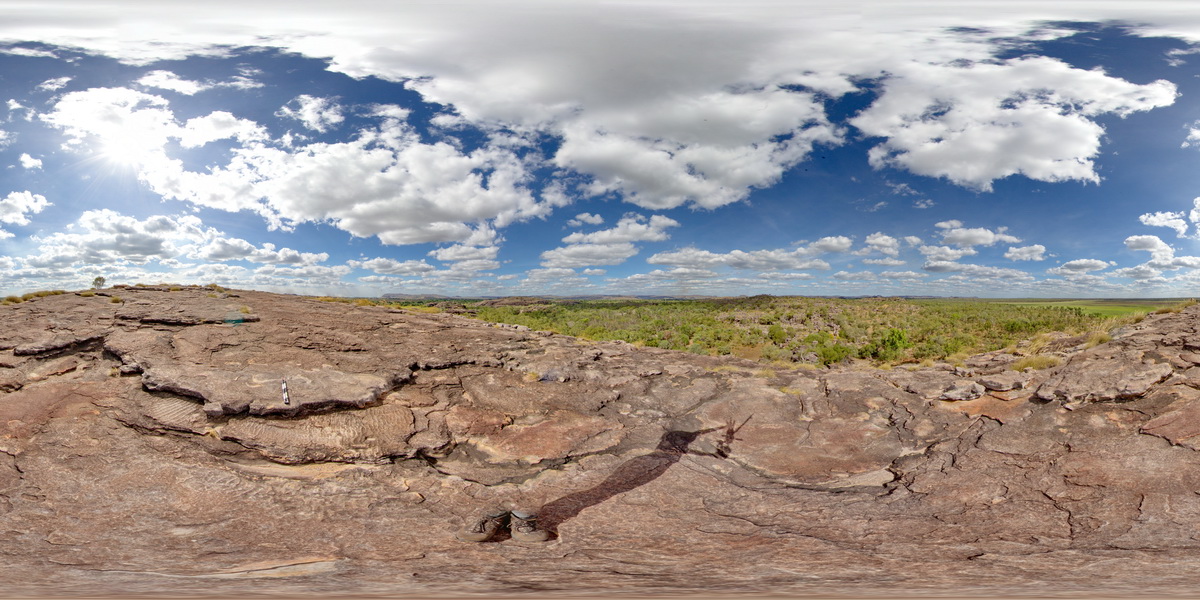 |
0 |
06/25/2016 noon |
FSP |
on top of Ubarr. Ripple marks in sandstone bedding top in foreground. Sandstone towers and escarpment in background. Ubirr Art Site. Kakadu National Park, N.T. |
2000.00 |
-12.40900000000 |
132.95412000000 |
-9999.000 |
ripple marks, bedding top, sedimentology, Kakadu National Park |
sandstone |
KakaduFPS2 Map
 |
0 |
06/25/2016 noon |
FSP |
foreground of pebbly sandstone with sandstone escarpment in the background. Ubirr Art Site. Kakadu National Park, N.T. |
2000.00 |
-12.40825000000 |
132.95457000000 |
-9999.000 |
sandstone, sedimentology, Kakadu National Park |
sandstone |
KakaduFSP1 Map
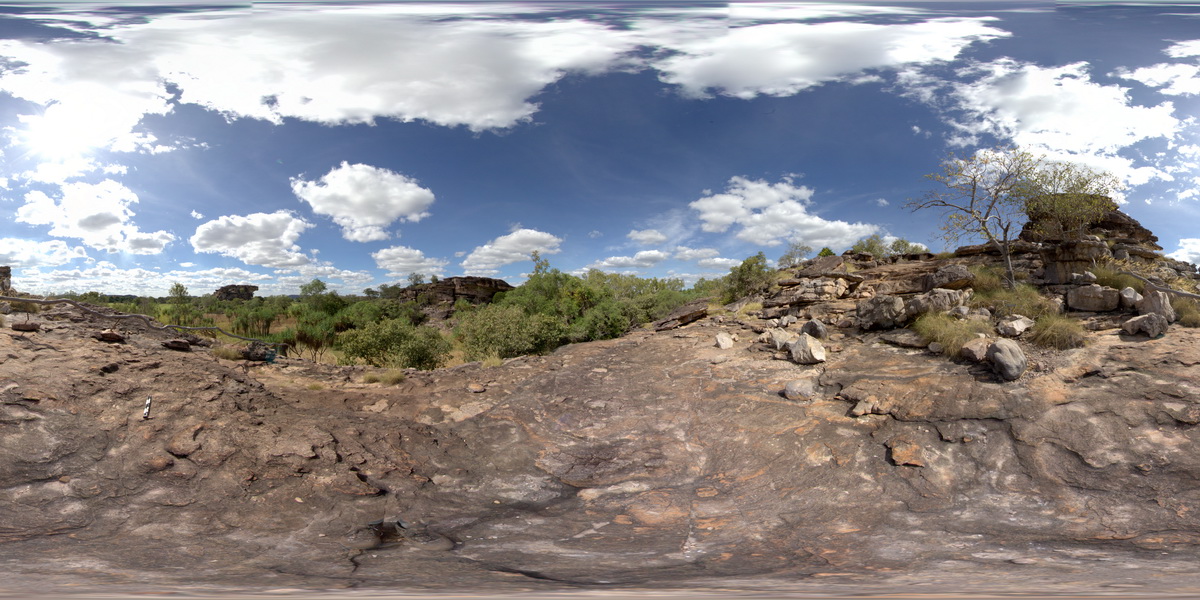 |
0 |
06/25/2016 noon |
FSP |
pebbly sandstone in the foreground, surrounded by stacks of shallow dipping sandstone (locally with rock art) in the background. Ubirr Art Site. Kakadu National Park, N.T. |
500.00 |
-12.40792000000 |
132.95520000000 |
-9999.000 |
sandstone, dip, sedimentology, Kakadu National Park |
sandstone |