Blinman13 Map
 |
0 |
11/12/2015 10:15 a.m. |
3D |
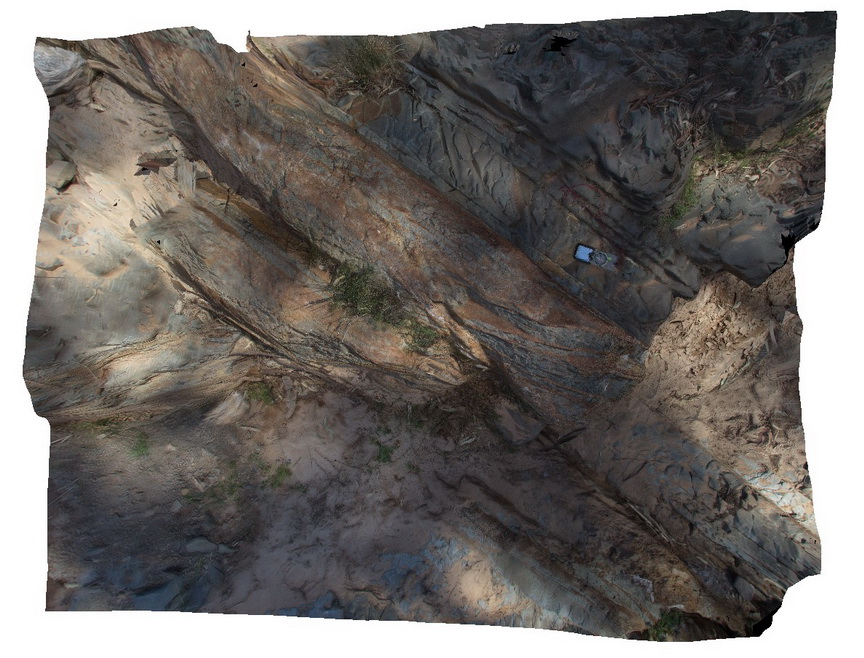
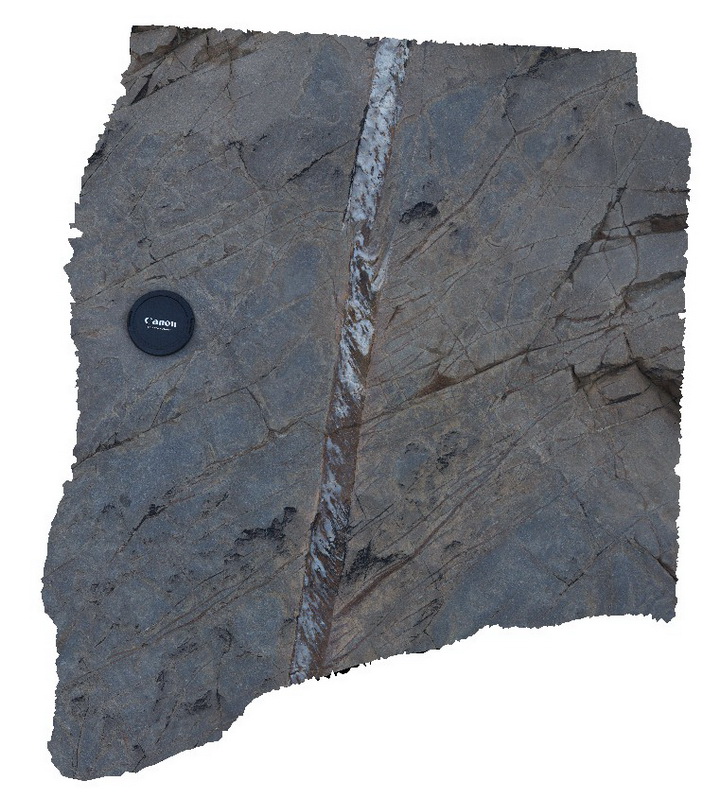
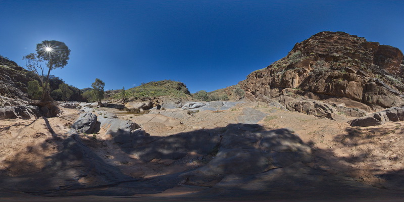
quartz veining in a fault zone cutting dipping fine sandstone and siltstone layers. Blinman pools walking trail. Blinman, S.A. |
2.00 |
-31.12766000000 |
138.56334000000 |
-9999.000 |
fault zone, structure |
siltstone |
Blinman16 Map
 |
0 |
11/12/2015 10:17 a.m. |
3D |
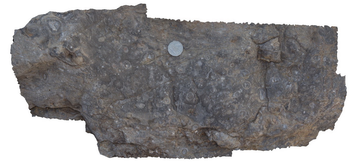
detail of cross-section and 3D view of stromatolites. Blinman pools walking trail. Blinman, S.A. |
0.00 |
-31.12896000000 |
138.57230000000 |
-9999.000 |
stromatolite, palaeontology |
carbonate |
Blinman17 Map
 |
0 |
11/16/2015 10:21 a.m. |
3D |
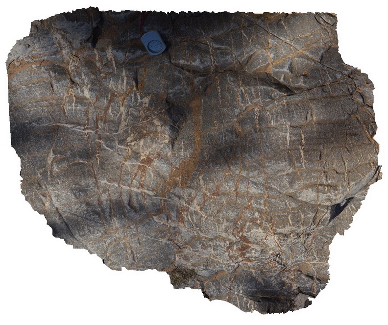
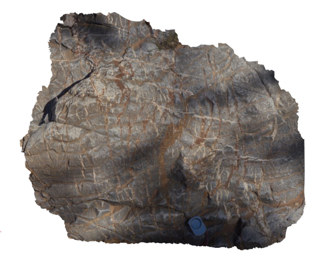
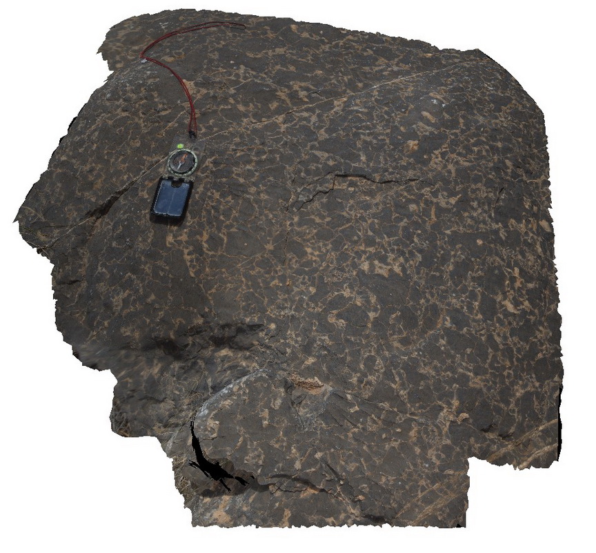
multiple vein sets cross cutting carbonate. Blinman pools walking trail. Blinman, S.A. |
1.00 |
-31.12693000000 |
138.57991000000 |
-9999.000 |
veining |
carbonate |
MtGipps41 Map
 |
0 |
06/30/2016 noon |
3D |
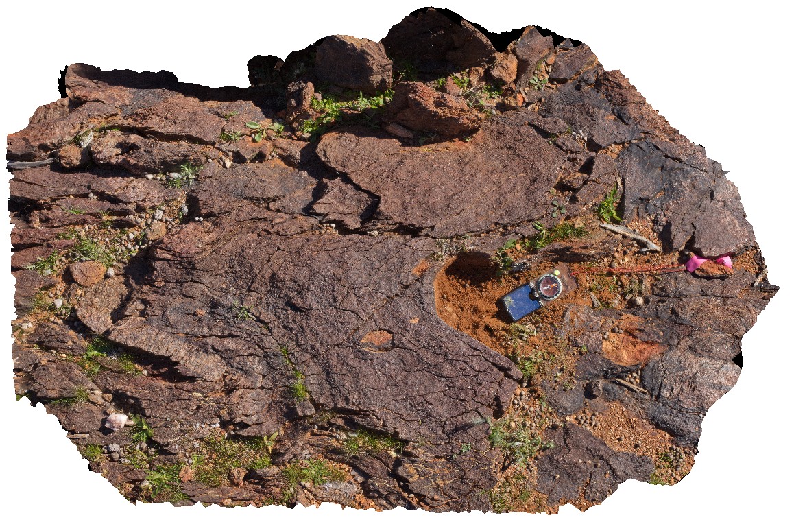
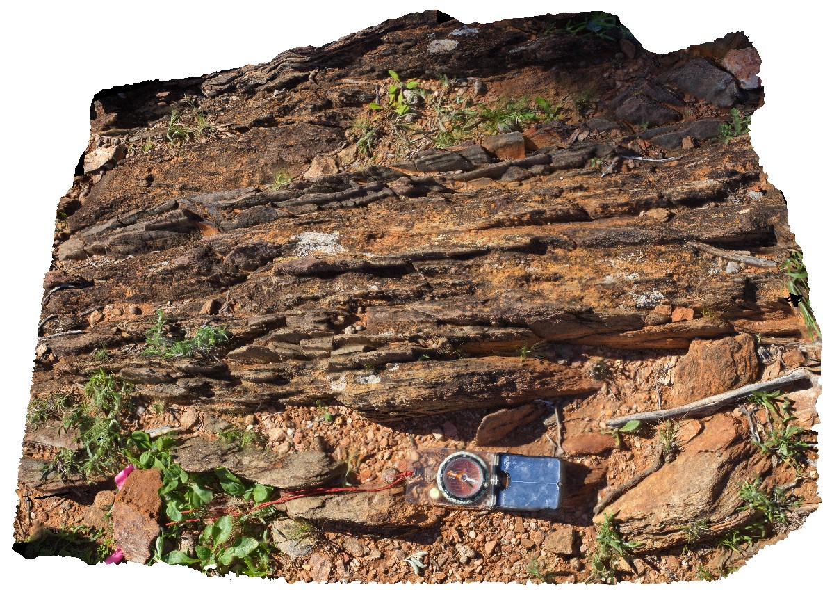
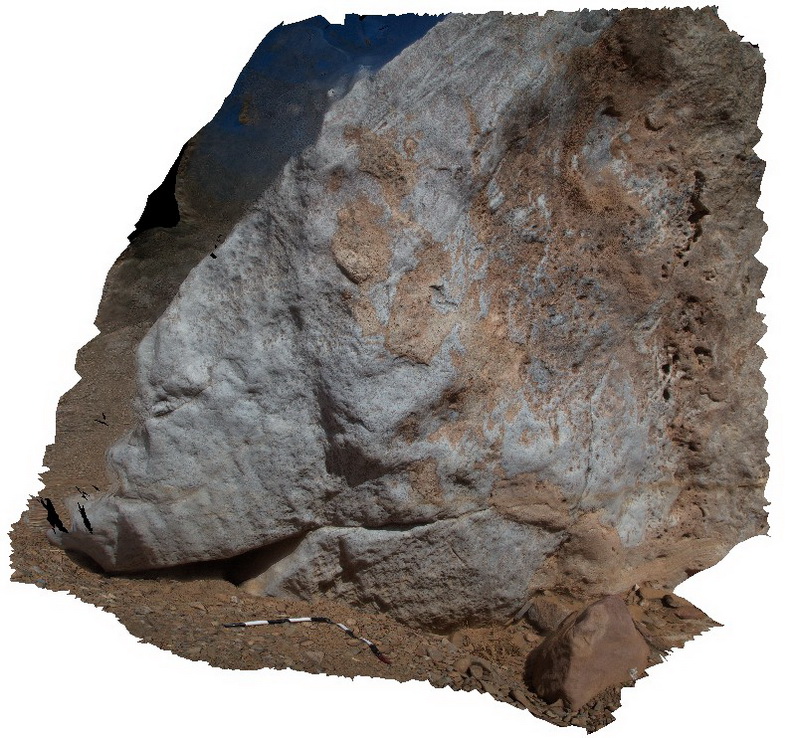
metasediments, Mount Gipps, N.S.W. |
1.80 |
-31.61732000000 |
141.50060000000 |
-9999.000 |
metasediments, structure |
metasediments |
Blinman19 Map
 |
0 |
11/12/2015 10:18 a.m. |
3D |
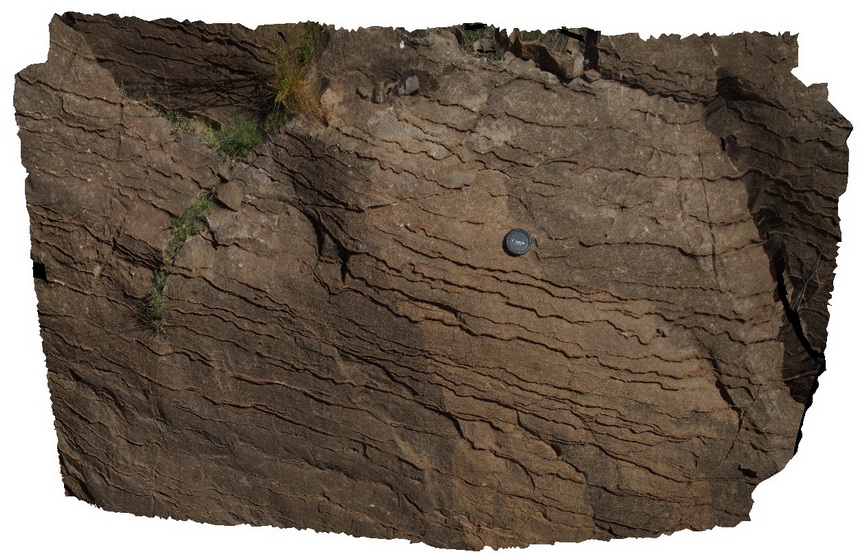
wavy laminations in carbonate sandstone / possible stylolites? Blinman, S.A. |
1.00 |
-31.12814000000 |
138.57985000000 |
-9999.000 |
laminations, sedimentology |
carbonate |
Blinman23 Map
 |
0 |
11/12/2015 10:19 a.m. |
3D |
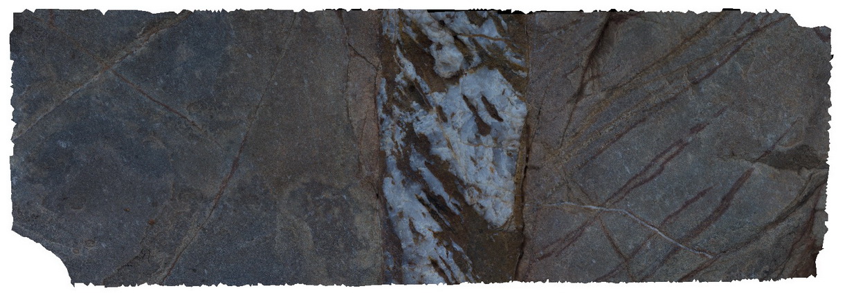
detail of quartz-carbonate fibrous vein texture, showing movement history as crystals have grown. Blinman Pools Walking Trail. Blinman, S.A. |
0.40 |
-31.12711000000 |
138.58350000000 |
-9999.000 |
vein minerals |
carbonate |
MtGipps38 Map
 |
0 |
06/30/2016 noon |
3D |
metasediments, Mount Gipps, N.S.W. |
0.80 |
-31.61696000000 |
141.50107000000 |
-9999.000 |
metasediment |
metasediment |
Blinman24 Map
 |
0 |
11/12/2015 10:20 a.m. |
3D |
detail of two-stage mineral growth in vein, showing displacement of mineral fibres as vein edges have moved. Blinman Pools walking trail. Blinman, S.A. |
0.20 |
-31.12711000000 |
138.58350000000 |
-9999.000 |
vein fibres |
carbonate |
BlinmanFSP1 Map
 |
0 |
11/27/2015 10:24 a.m. |
FSP |
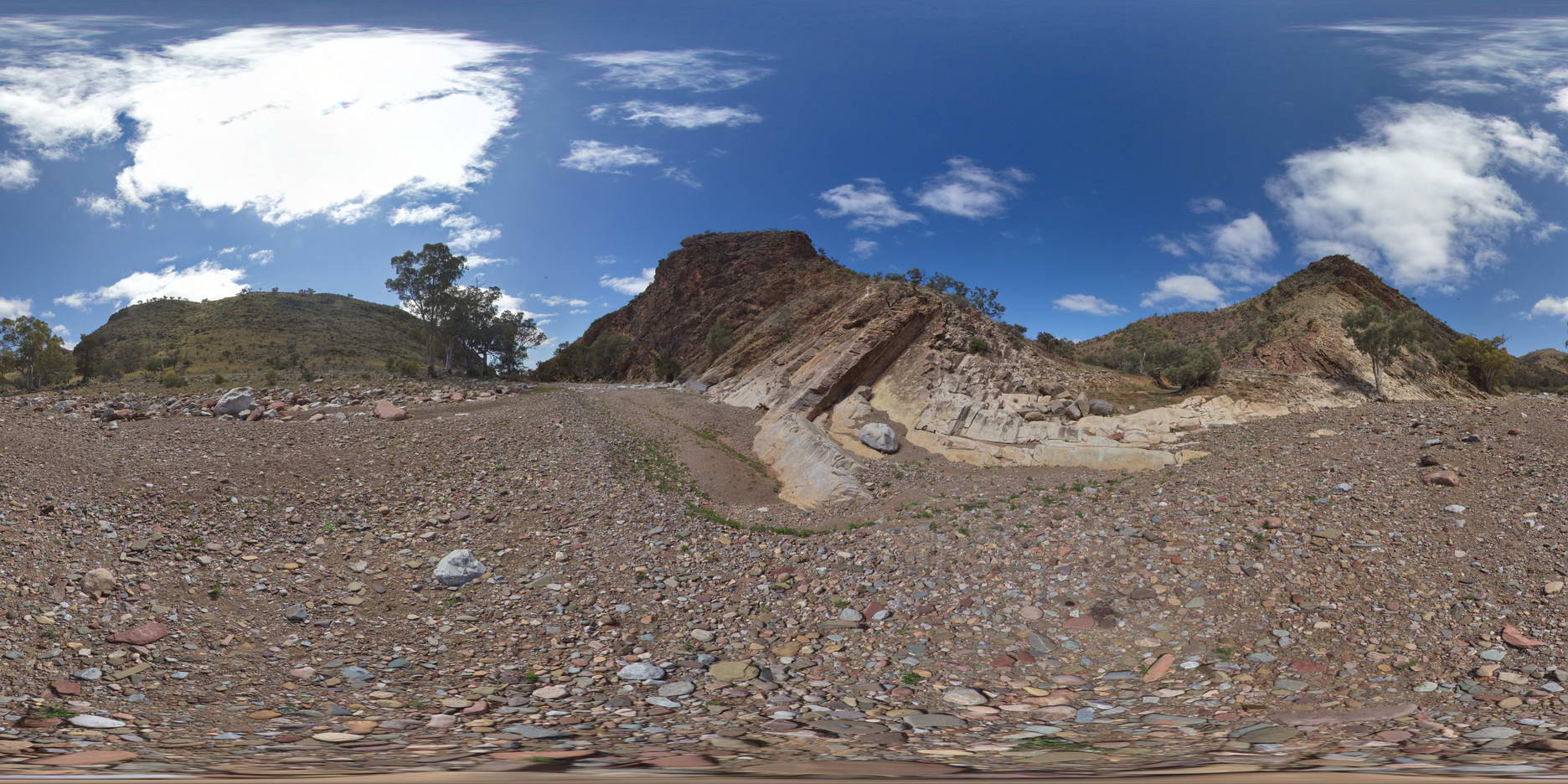
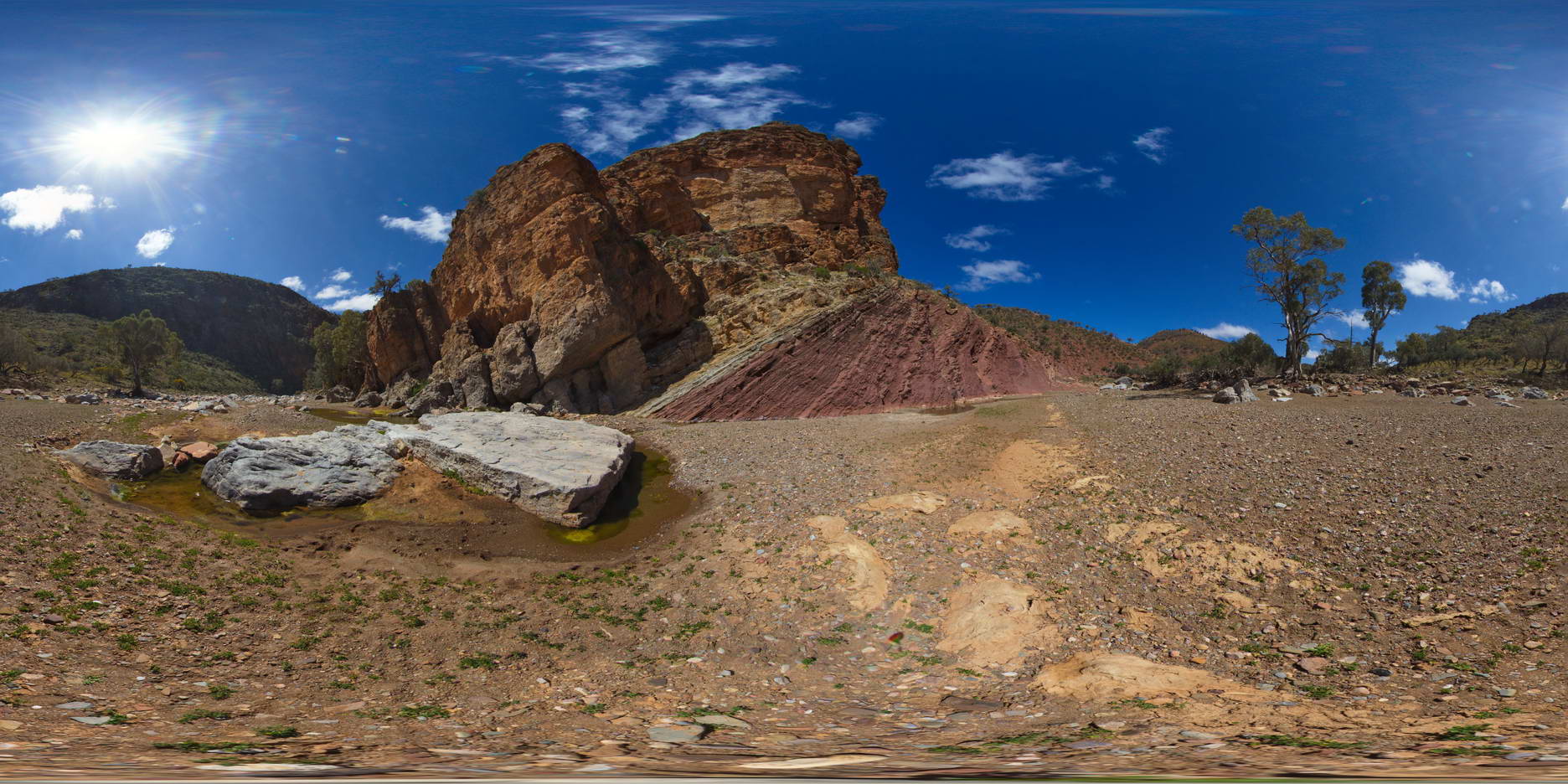
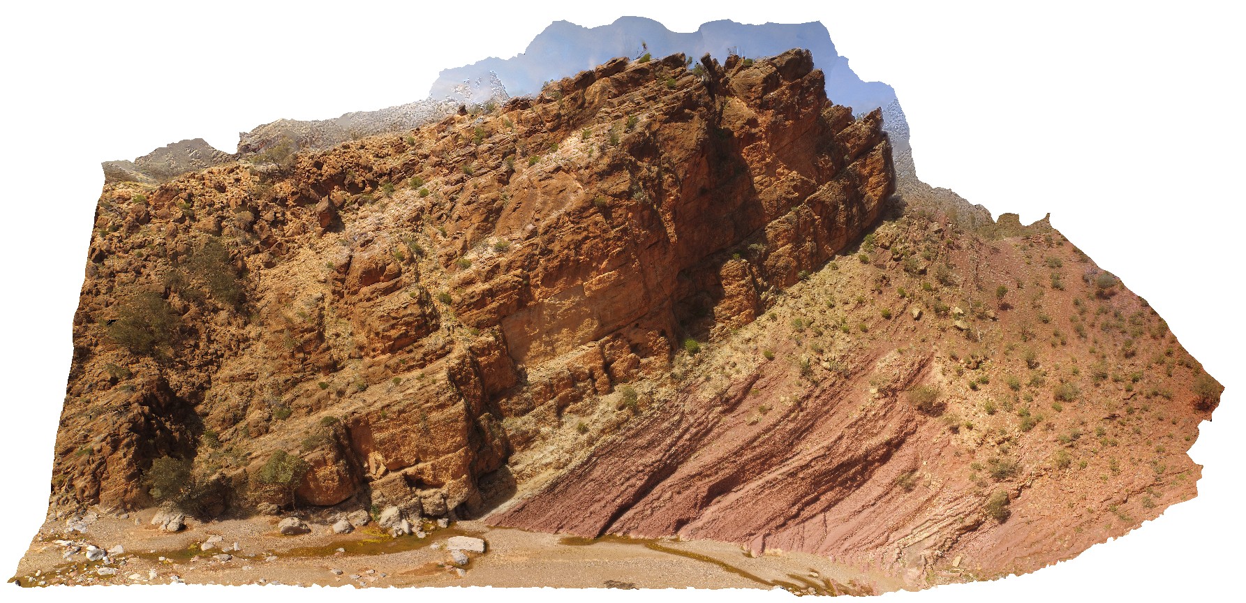
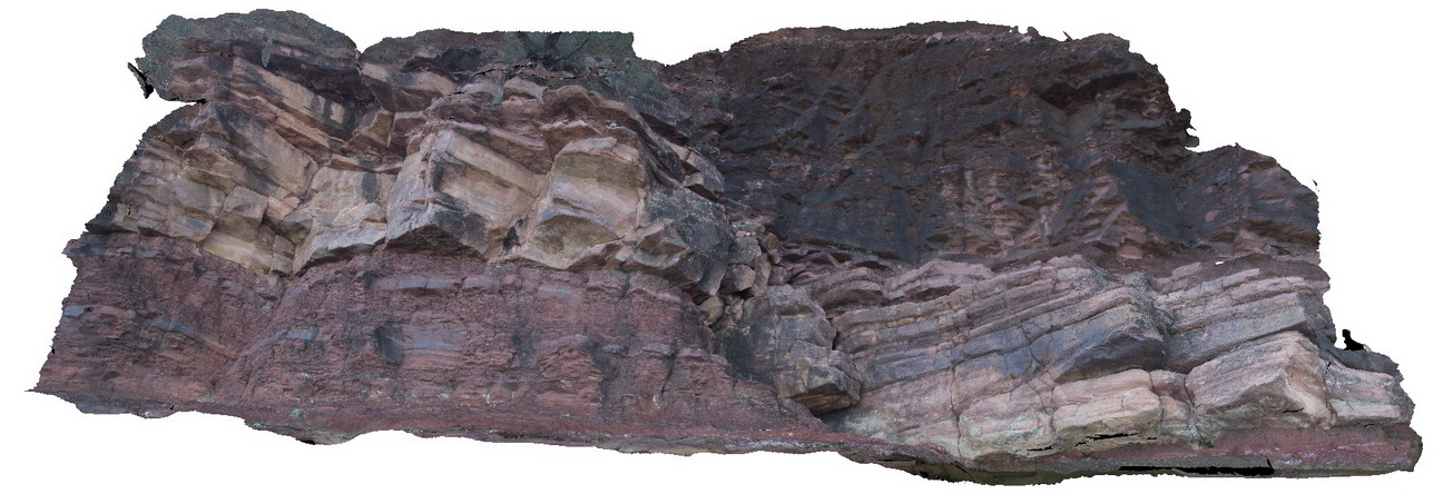
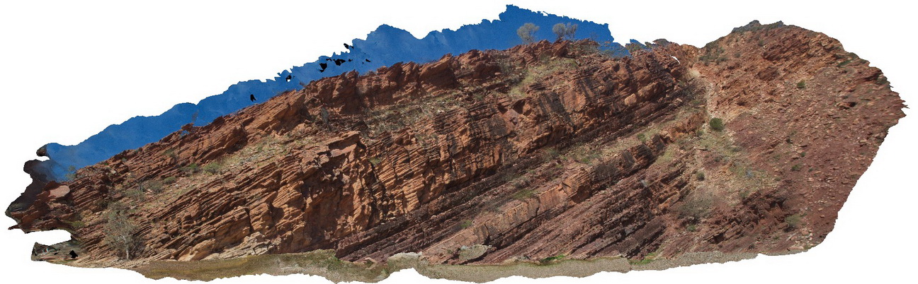
out crop and cliff exposure of gently - moderately dipping, bedded carbonates, Blinman Pools walking trail. Blinman, S.A. |
100.00 |
-31.12809000000 |
138.58003000000 |
-9999.000 |
carbonate |
carbonate |
WilkaFSP1 Map
 |
0 |
09/27/2015 5:20 p.m. |
FSP |
out crop of moderately dipping beds showing the contact between the Rownsley Quartzite and the Wilkawillina Limestone. Wilkawillina Trail, Flinders Ranges. |
1000.00 |
-31.30042000000 |
138.90196000000 |
-9999.000 |
geological contact |
sandstone, limestone |
WilkaFSP2 Map
 |
0 |
09/27/2015 5:20 p.m. |
FSP |
outcrop showing the geological contact between the Bonney Sandstone and the Wilkawillina Limestone, Wilkawillian Trail, Flinders Ranges. |
100.00 |
-31.29792000000 |
138.89125000000 |
-9999.000 |
geological contact |
sandstone, limestone |
WilkaUAV2 Map
 |
0 |
09/27/2015 5:21 p.m. |
UAV |
cliff outcrop showing the geological contact between the Bonney Sandstone and the Wilkawillina Limestone, Wilkawillian Trail, Flinders Ranges. |
100.00 |
-31.29782700000 |
138.89135100000 |
-9999.000 |
geological contact |
sandstone, limestone |
Wilka1 Map
 |
0 |
09/27/2015 5:06 p.m. |
3D |
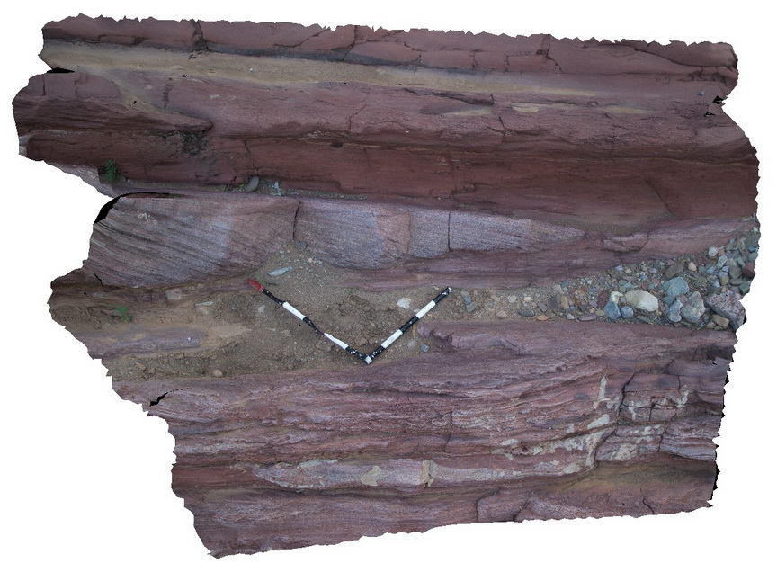
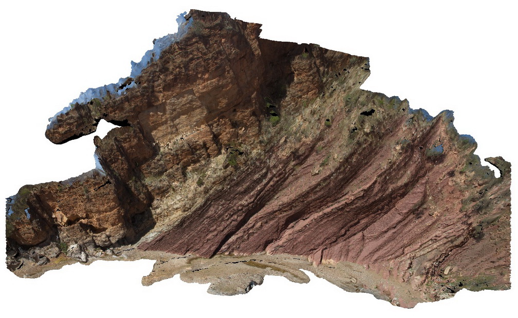
Clean, thickly bedded, cross bedded channel sandstone and red, thinly bedded sandstone and siltstone of the Bonney Sandstone. Cut by high angle fault. Wilkawillna Trail. Flinders Ranges. |
12.00 |
-31.29364000000 |
138.88297000000 |
-9999.000 |
bedding, fault, structure |
sandstone |
Wilka6 Map
 |
0 |
09/27/2015 5:16 p.m. |
3D |
Channel sediments with cross beds in fine ripple laminated silt and fine sandstone. Wilkawillina Trail. Flinders Ranges. |
3.00 |
-31.29641000000 |
138.88800000000 |
-9999.000 |
cross bedding, sedimentology |
sandstone |
Wilka7 Map
 |
0 |
09/27/2015 5:17 p.m. |
3D |
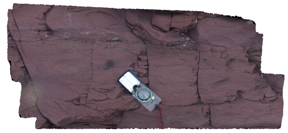
ripple and cross laminations in red silty fine grained sandstone. Bonney Sandstone, Wilkawillina Trail, Flinders Ranges. |
0.20 |
-31.29641000000 |
138.88800000000 |
-9999.000 |
cross beds |
sandstone |
Wilka9 Map
 |
0 |
09/27/2015 5:19 p.m. |
3D |
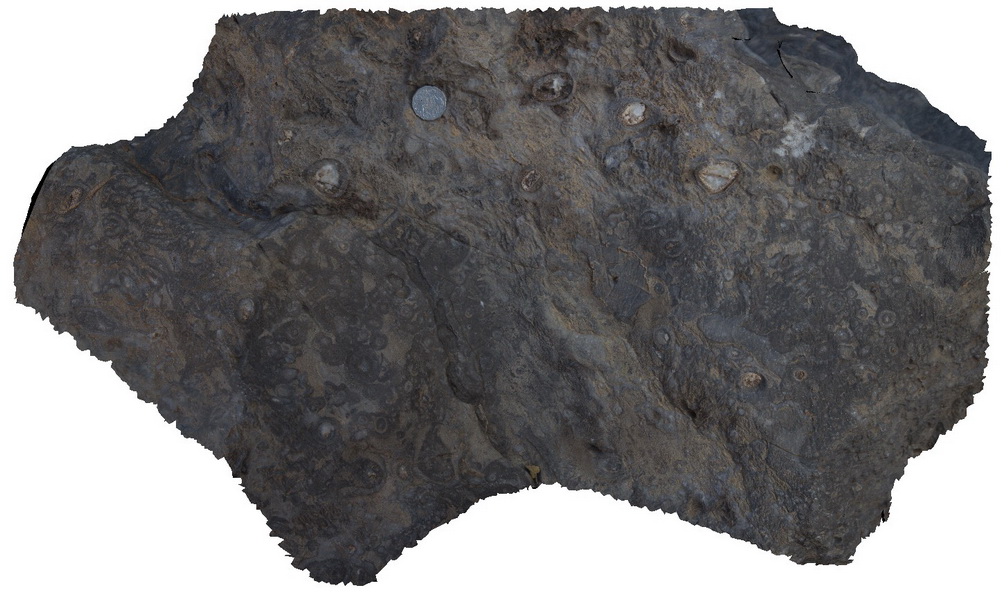
Out crop of archaeocyatha bearing carbonates, Wilkawillina Trail, Flinders Ranges. |
0.30 |
-31.29892000000 |
138.90530000000 |
-9999.000 |
Archaeocyatha |
limestone |
Wilka10 Map
 |
0 |
09/27/2015 5:07 p.m. |
3D |
detail of archaeocyatha bearing carbonates, Wilkawillina Trail, Flinders Ranges. |
0.20 |
-31.29892000000 |
138.90530000000 |
-9999.000 |
Archaeocyatha |
limestone |
Wilka13 Map
 |
0 |
09/27/2015 5:09 p.m. |
3D |
dolomitisation of limestone, Wilkawillina Trail, Flinders Ranges. |
5.00 |
-31.29876000000 |
138.90601000000 |
-9999.000 |
dolomitisation of limestone |
dolomite |
Wilka15 Map
 |
0 |
09/27/2015 5:10 p.m. |
3D |
brecciation in dolomitisation of Wilkawillina limestone. Wilkawillina Trail, Flinders Ranges. |
0.50 |
-31.29783000000 |
138.89418000000 |
-9999.000 |
breccia, dolomitisation of limestone |
limestone |
Wilka17 Map
 |
0 |
09/27/2015 5:11 p.m. |
3D |
view of cliff exposure showing moderately dipping beds and the geological contact between Bonney Sandstone and Wilkawillina limestone. Wilkawillina Trail, Flinders Ranges. |
100.00 |
-31.29806000000 |
138.89104000000 |
-9999.000 |
geological contact |
sandstone, limestone |
Wilka19 Map
 |
0 |
09/27/2015 5:12 p.m. |
3D |
outcrop of Bonney Sandstone, showing finely bedded red sandstone. Willkawillina Trail, Fraser Ranges. |
20.00 |
-31.29801000000 |
138.88535000000 |
-9999.000 |
bedded |
sandstone |
PtNeill5 Map
 |
0 |
10/20/2015 3:16 p.m. |
3D |
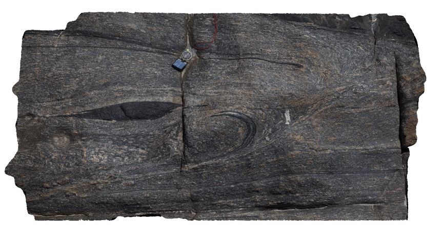
Image showing detail of texture in mylonite, from image PtNeill1. Pioneer Lookout, Point Neill. |
1.00 |
-34.10680000000 |
136.35030000000 |
-9999.000 |
mylonite, boudinage, tectonic |
mylonite |
PtNeill6 Map
 |
0 |
10/20/2015 3:17 p.m. |
3D |
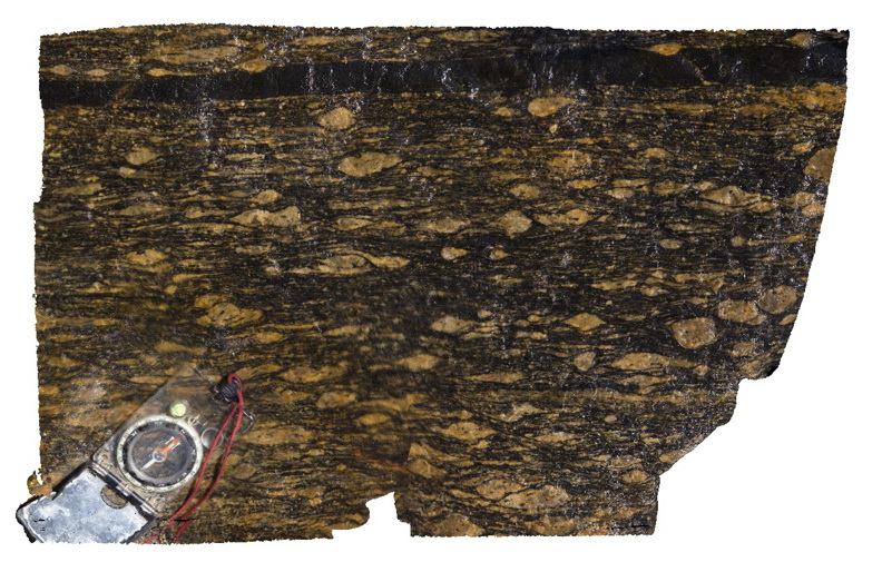
sheared augen in mylonite, showing well developed textures, Point Neill. |
0.20 |
-34.10682000000 |
136.35039000000 |
-9999.000 |
augen, mylonite |
mylonite |
PtNeill8 Map
 |
0 |
10/20/2015 3:19 p.m. |
3D |
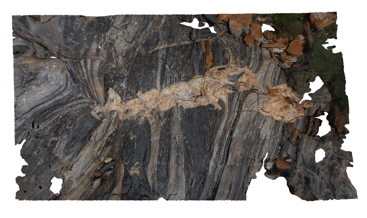
complex sheared banded mylonite, with partially sheared pegmatite. Point Neill. |
10.00 |
-34.10557000000 |
136.35065000000 |
-9999.000 |
pegmatite, mylonite, pegmatitic contact |
mylonite |
KirtonFSP5 Map
 |
0 |
10/20/2015 3:07 p.m. |
FSP |
shore line exposure, showing geological contact with amphibolite / mafic dyke and hosting granitic gneiss. Kirton Point, Port Lincoln. S.A. |
100.00 |
-34.72399000000 |
135.88403000000 |
-9999.000 |
geological contact, granitic gneiss, amphibolite |
granitic gneiss, amphibolite |